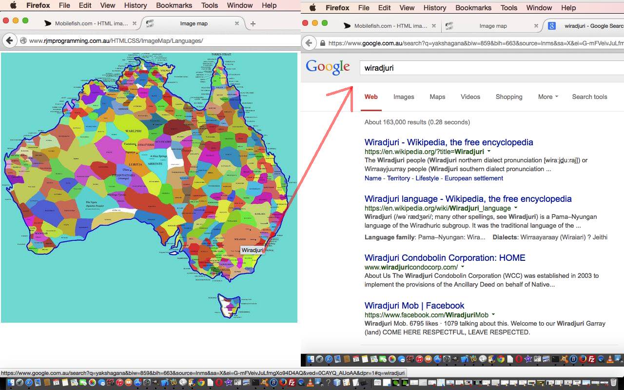
We want to show more ideas with Javascript DOM and the HTML map element over coming days.
The HTML map element is a very useful way to combine a graphical image with web functionality, by turning that image into a clickable, by region, entity.
For the theme of work over the next few days we combine history and geography. Remember at school that history and geography were choices at a certain stage of schooling, but today, we try to use geography to foster an interest in history … after all, where we live is really important to how history pans out for society.
Was inspired by a story of a several meter high atlas that is currently on display in our New South Wales library … and it takes two people to turn a page, else the weight of the page will tear it with only one person turning.
This thought of maps combined with me with a story about how diverse and interesting our Australian Indigenous Languages are here in Australia. There are hundreds of languages involved in Australia’s history, though we often only think of English … so take a look at today’s live run (HTML source code (you could call) aboriginal_language_regions.html) where we show …
- a brilliant piece of research from the University of Western Sydney and ending up on the TreatyRepublic.net website as a map image … thanks
- using the wonderful MobileFish image map (HTML element) creator helper … thanks
… to set up that initial additional “onclick” intelligence that takes you to some Google search engine opportunities to link a region of Australia with an indigenous tribe (and its language), as a first step in the functionality we develop over time.
If this was interesting you may be interested in this too.


11 Responses to Australian Indigenous Language Image Map Primer Tutorial