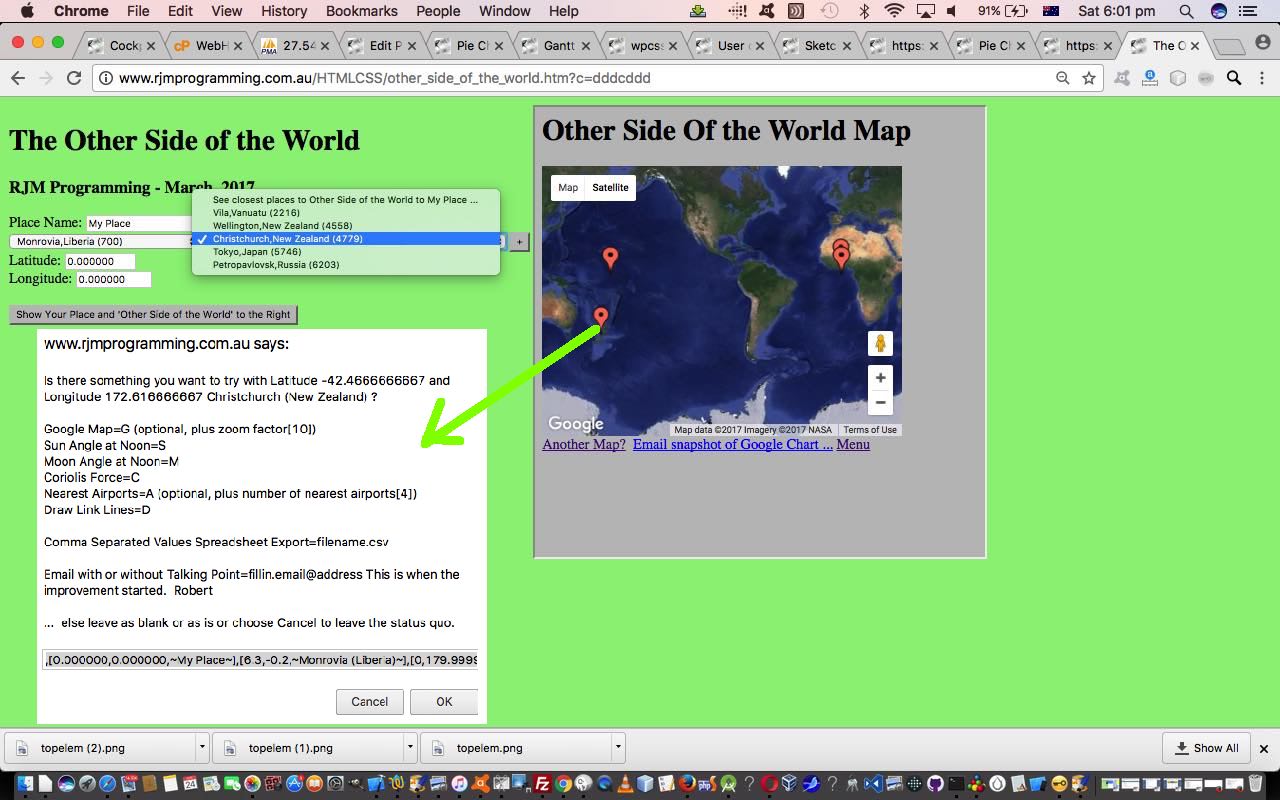
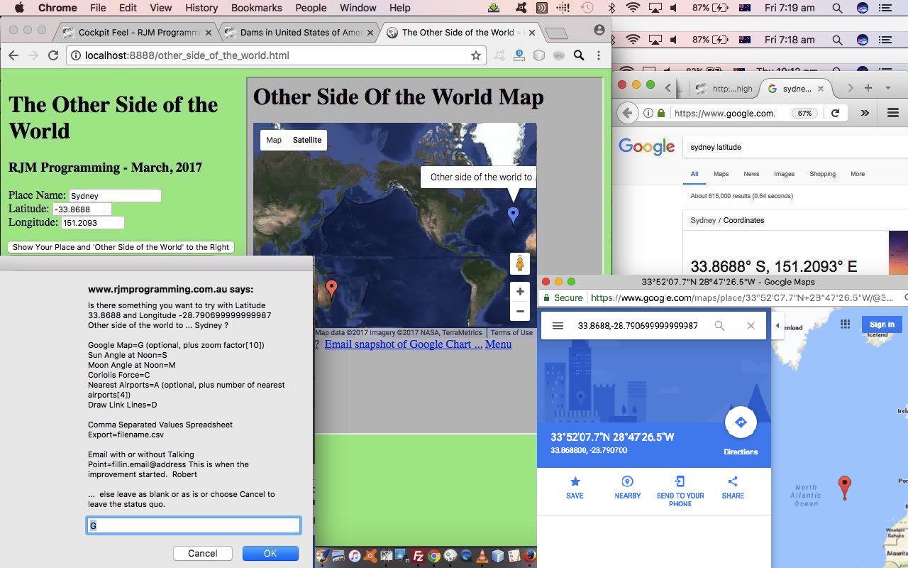
The last time we added a change to our Daylight Saving TimeZone Information web application was during our Other Side of the World Google Chart Tutorial work, and then, so many things were going on with interfacing and integration we didn’t really revisit the Daylight Saving TimeZone Information web application for itself, as it is so good to do every now and then to …
- incorporate new things you’ve learnt
- check on functionality that has fallen by the wayside (or, sin of all sins, never got to the wayside)
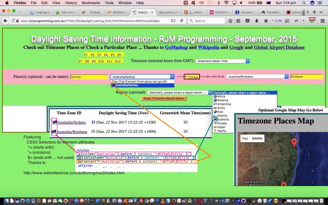
Our recent perusals around the “wooooooooorrrrllldd” of CSS3 reminded us of the power of CSS Selectors, especially the ones that came in with CSS3. The “two out of three” that we use today are described on today’s tutorial picture as well as we’d want to do here … so here goes …
Featuring
CSS3 Selectors for element attributes
^= (starts with)
*= (contains)
$= (ends with … not used)
Thanks to HTTP://www.webreference.com/authoring/css3/index.html (sadly no longer there … 24/3/2020)
When you try to memorize syntax do you look for “linkages”? Yes, you can find anything on the net. But seriously, this CSS syntax can be remembered because it uses the characters of a lot of RegEx wildcarding systems. Another kind of “linkage” we saw between this CSS(3) Selector functionality, and where it would be useful, was that we’d noted that TimeZone identifiers have a name, and generally they take a form …
Region/Placename
… and that Region (plus or minus the “/“) felt to us like a good candidate for functionality enhancement via the CSS(3) Selectors above. You can judge for yourself way below, or by clicking today’s tutorial picture.
Three other “popular” items around here, featuring, today, are …
- emojis (some of which were multiple and so we wish to rethank Iemoji (multiple HTML entity information) and FileFormat Information (normal HTML entity information) and Emojipedia (finding them) for these emoji lookups, as well as the CSS syntax help from this webpage (needed, because, unbelievable to us, we’d only ever done this with Javascript, in the past)), and their role to help internationalization of your web applications, and to add a bit of colour, and cuteness
- HTML element alt attribute when a data busy HTML select element option tag (the tag that we get most satisfaction from, making busy … it has to be said) is already using …
- title
- value
- text (or innerHTML)
… and you come along later not wanting to clobber any good logic looking for another “data place” to populate with your new “data item” (of interest) … well, that could be the “oft neglected except perhaps with the HTML img tag” alt attribute
- CSS selector :before
Apart from that alt logic above the changes we made to daylight_saving_time.html amounted to changes adding in new CSS(3) Selectors (that just happen … the joy of CSS, we guess) …
<style>

 a[title*="Africa/"]:before { content: '\01f30d' }

 a[title*="Europe/"]:before { content: '\01f4b6' }

 a[title*="America/"]:before { content: '\01f30e' }

 a[title*="Asia/"]:before { content: '\01f30f' }

 a[title*="Australia/"]:before { content: '\01f1e6\01f1fa' }

 a[title*="Indian/"]:before { content: '\01f1ee\01f1f3' }

 a[title*="Pacific/"]:before { content: '\01f3dd' }

 a[title*="Arctic/"]:before { content: '\01f1ec\01f1f1' }

 a[title*="Antarctica/"]:before { content: '\01f1e6\01f1f6' }

 a[title*="Atlantic/"]:before { content: '\01f30a' }

 option[value*="Africa"]:before { content: '\01f30d' }

 option[value*="Europe"]:before { content: '\01f4b6' }

 option[value*="America"]:before { content: '\01f30e' }

 option[value*="Asia"]:before { content: '\01f30f' }

 option[value*="Australia"]:before { content: '\01f1e6\01f1fa' }

 option[value*="Indian"]:before { content: '\01f1ee\01f1f3' }

 option[value*="Pacific"]:before { content: '\01f3dd' }

 option[value*="Arctic"]:before { content: '\01f1ec\01f1f1' }

 option[value*="Antarctica"]:before { content: '\01f1e6\01f1f6' }

 option[value*="Atlantic"]:before { content: '\01f30a' }

 option[alt^="Africa/"]:before { content: '\01f30d' }

 option[alt^="Europe/"]:before { content: '\01f4b6' }

 option[alt^="America/"]:before { content: '\01f30e' }

 option[alt^="Asia/"]:before { content: '\01f30f' }

 option[alt^="Australia/"]:before { content: '\01f1e6\01f1fa' }

 option[alt^="Indian/"]:before { content: '\01f1ee\01f1f3' }

 option[alt^="Pacific/"]:before { content: '\01f3dd' }

 option[alt^="Arctic/"]:before { content: '\01f1ec\01f1f1' }

 option[alt^="Antarctica/"]:before { content: '\01f1e6\01f1f6' }

 option[alt^="Atlantic/"]:before { content: '\01f30a' }

</style>
You can see these predominantly CSS styling changes for yourself at this live run link.
Previous relevant Other Side of the World Google Chart Tutorial is shown below.
Google Charts provides great chart tools for various purposes. We already use the Map Chart heavily with our “Other Side of the World” recent web application we last talked about below with Other Side of the World Continents and Countries Tutorial. This is no surprise given the geolocation and positioning and mapping aspects to the project. But also apt is the …
- Geo Chart which displays nominated countries and/or regions on a world map … and we also thought it would be good to call on a …
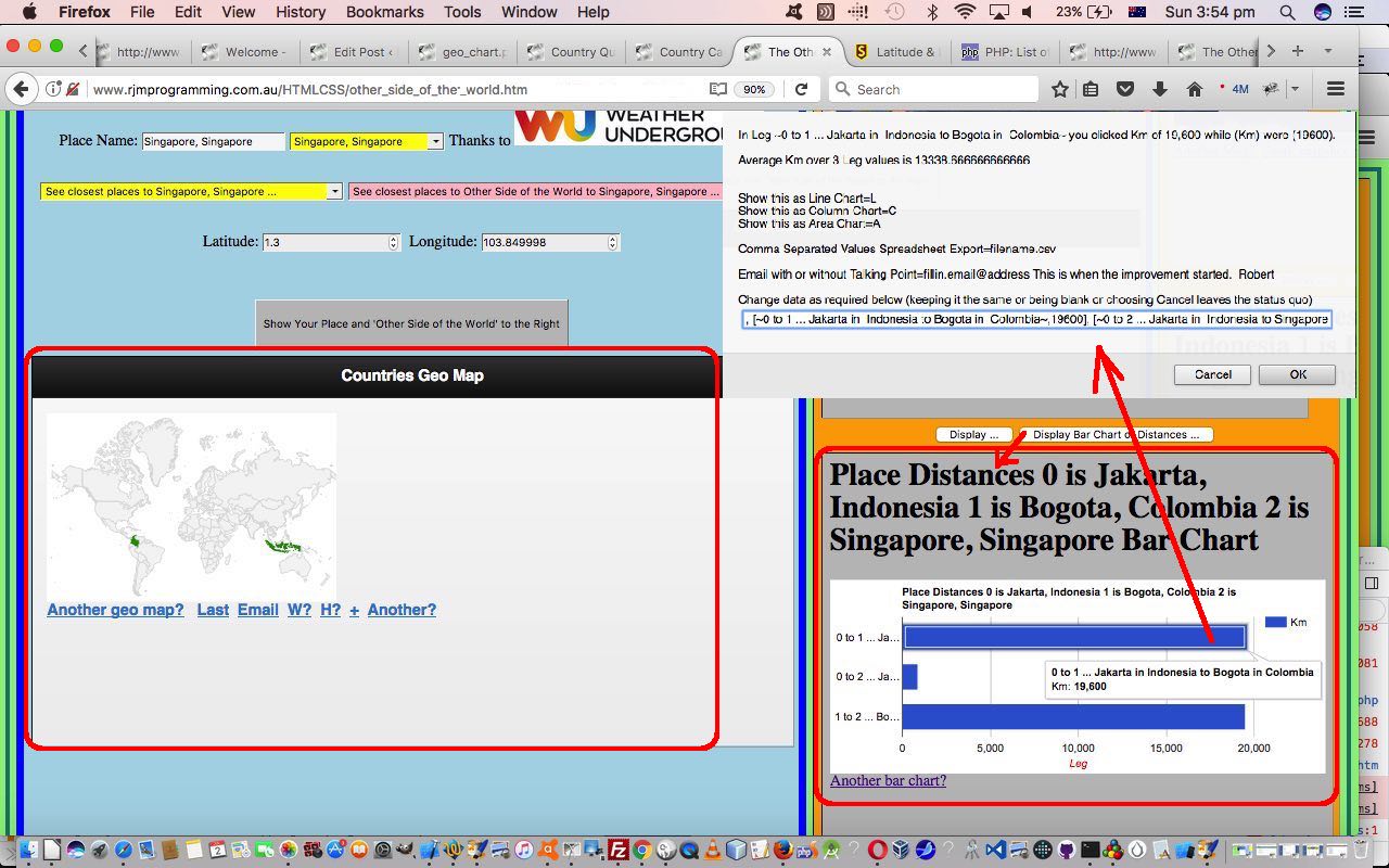
- Bar Chart can display Great Circle distances between places the user identifies during an execution of the “Other Side of the World” web application session
Over time you get a feeling for what Google Chart suits what scenario of data arrangements. Perhaps, here it would be instructional to read Google’s miscellaneous examples if you are wondering what is possible with this great software suite. We interface to many of these charts here at this blog and to read through these you could visit this link.
Today, as far as this “feel” goes, we’d like to admire how the Google Chart “way” of being housed in an HTML div element leads itself to scaling ready for smaller format devices, so long as you, the coder above, “play the game” so to speak, trying to specify percentage values for HTML element width properties where possible. This came to play with today’s Google Chart Bar Chart “fitting in” with right column table cell (td) widths with today’s “Other Side of the World” web application.
These two code files were involved in these changes …
- other_side_of_the_world.htm (changed in this way) … and you can try a live run or Seattle live run
- tz_places.php (changed this way)
As per usual, we encourage you to try the web application, and compare the goings on with code, and a good web inspector tool.
Previous relevant Other Side of the World Continents and Countries Tutorial is shown below.
Today, as with WordPress 4.1.1’s Other Side of the World Continents and Countries Tutorial, we came across a scenario where there was a tiny advantage being Australian, in that our “Continent Name” equals our “Country Name” … which I suppose you could argue for Antarctica, maybe?!
We were amused by this at school, and now have the first real world “application” of this in that today’s task, much harder than we thought it would be, was, with our “Other Side of the World” web application (we last talked about with Other Side of the World Timezone Tutorial as shown below) to link the two bigger data sets up the top of the list of three datasets going on with our application …
- Weather Underground database via its API … thanks
- PHP TimeZone functionality … why thank you, kind Open Sourcers (and the plates as well)
- the useful webpage … thank you again
The Weather Underground tends to talk about Placenames and their Country Names whereas the PHP TimeZones tend to link Placenames with Continent (or region) Names … and the missing link between these two talking to each other a good percentage of the time involves the PHP’s getLocation() functionality we’ve talked about before as a method for the DateTimeZone class, along with some 2 character ISO Country code information you can read more about at //stackoverflow.com/questions/17842003/php-intl-country-code-2-chars-to-country-name.
Making this link has lots of benefits …
- our “closest to” lists now have more data to call on (supplementing the last of those datasets above) … and …
- we can now allow for searches by Country on that top HTML select (dropdown) element …
- we can fill in more specified places now that we can add in a Country so often and often reach a point with the Weather Underground scrutiny where there is only one returned value, at which point, some days ago, we added logic to say just go and display this on the Map Chart and the rest straight away to save some time
- people tend to think of a Country when they think of a place, at least on dry land, that is.
An unusual code threesome were involved in these changes …
- other_side_of_the_world.htm (changed in this way) … and you can try a live run or Johannesburg live run
- daylight_saving_time.html (changed this way)
- tz_places.php (changed this way)
… that last one getting a new calling method just for this purpose of …
- take a placename
- take its inputted Continent (or region) Name … and …
- have the supervisory codes send to tz_places.php a $_GET[] call for the purpose of …
- using getLocation() functionality find a 2 character ISO Country Code … and …
- link this to a full Country Name via various arrays we have in the PHP … and finish off by …
- sign off the PHP (in an HTML iframe element) by changing relevant fields in top.document or parent.document DOM HTML elements via a simple HTML body onload event method of making those changes and exiting the called PHP … allowing for …
- supervisors pick up their usual logic flows once we have a Placename,CountryName textbox scenario going
Of course “Australia” the continent name being the same as “Australia” the country name saves so much time I’ll think I’ll have that cup of coffee now. See ya!
Previous relevant Other Side of the World Timezone Tutorial is shown below.
We’ve got a lot of “where” functionality mixed in with “when” functionality with our “Other Side of the World” web application. To us, the easiest way to link “where” and “when” in the world is the concept of Earth’s timezones. We spent a lot of time looking into this with the blog thread ending with TimeZone Country Places Data Tutorial and then it went through another makeover when we tackled its integration into the Weather Underground API inspired blog postings culminating in Weather API via Iframe jQuery Ajax AutoComplete Tutorial
Reading down that first blog posting thread to its “Primer Tutorial” …
Into the mix of the logic here, we need to venture into the world of two letter ISO Country Codes, and we work this with help from //php.net/manual/en/datetimezone.getlocation.php and //stackoverflow.com/questions/17842003/php-intl-country-code-2-chars-to-country-name and //php.net/manual/en/function.timezone-identifiers-list.php and //www.timezoneconverter.com/ to “hardcode” our HTML select “dropdown” elements we create in the process, and offer TimeZone information HTML select “dropdown” elements as well.
… you can see how good PHP is, natively, with timezones, and how approachable all this is for all PHP programmers … exciting stuff!
And there’s another series of blog postings culminating in HTML/PHP Timezone Feed Function Keys Tutorial involved in this same realm of thinking, that we use today (as with WordPress 4.1.1’s Other Side of the World Timezone Tutorial), along with the … you guessed it … Client Pre-emptive Iframe technique approaches to making use of what it helps with. Integrating “what it helps with” is quite interesting, and quite “Ajax”y in its ways. We call its supervisory web application into a new HTML iframe element of our “Other Side of the World” web application and pluck out only its initial “Digital Clock” HTML table display, and transfer that HTML table and its modified CSS styling over into a new HTML div element within the “Other Side of the World” web application, initially style “display:none;” but capable of being called into play via the user selecting an “Hour Time of the Day” value of interest, that causes the iframed daylight_saving_time.html (changed this way).
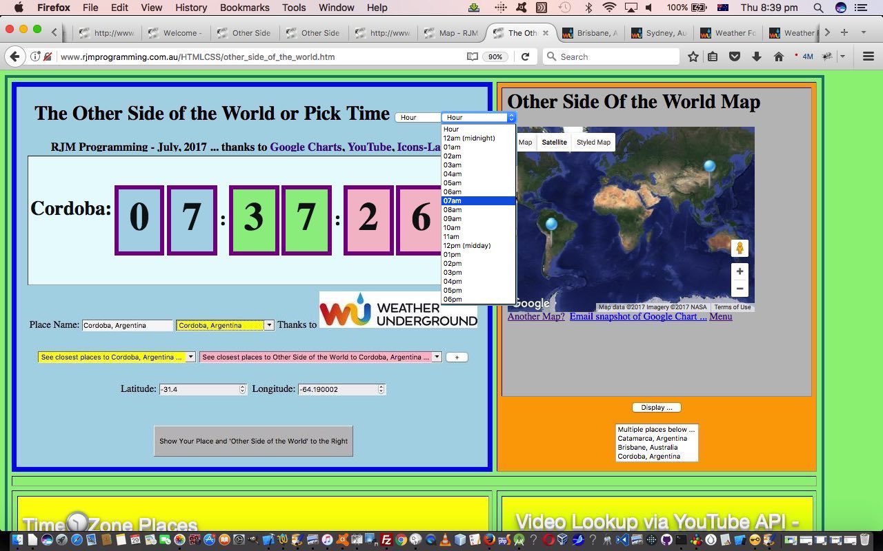
What the user sees/does to use this new functionality looks like …
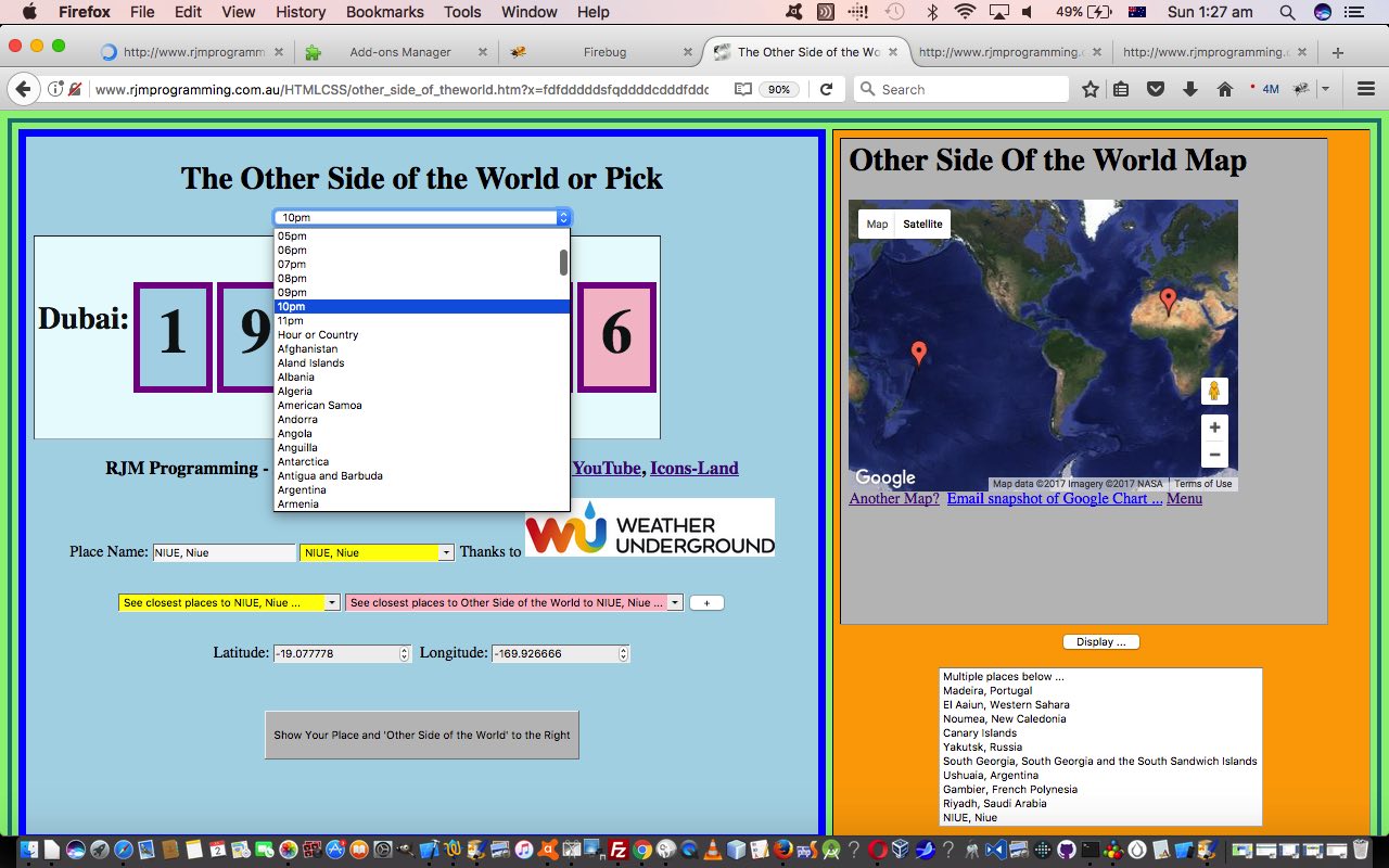
- they see the “Hour of the Day” dropdown
- they select an “Hour of the Day” value of interest … in today’s tutorial picture, here in AEST Australia (around about 8pm) we chose “07am”
- the “Digital Clock” flashes random current times of day from around the “TimeZone Places World” and when it lobs onto the first matching time between 07am and 08am (exclusive) …
- that matching “TimeZone Place” is copied into the “Other Side of the World” Place textbox … and …
- the “Weather Underground” (autocomplete) database is scrutinized for a match, and if so …
- the Map Chart shows the matched place as the base position along with its “Other Side of the World” counterpart, allowing for Google Chart click/touch (its “select”) event logic to allow for other functionalities that include a Weather link and TimeZone information (with a current time of day) … along with the …
- usual “packdrill” for TimeZone Places iframe table cell and YouTube API Embedded iframe table cell in the (now) bottom row of the “Other Side of the World” (big) table element
The code for these TimeZone integration changes, building on yesterday’s Other Side of the World Map Chart Styling Tutorial, remains as just HTML (apart from the supervised PHP for the Google Chart interface) that you could call other_side_of_the_world.htm (changed in this minor way for our HTML supervisor of additional TimeZone functionalities today) if you like, or want to try out (or try out for a specific (argument) location, such as Tokyo try out), again. The Client Pre-emptive Iframe reading and use of PHP continues today, making great use of its TimeZone code talents.
Previous relevant Other Side of the World Map Chart Styling Tutorial is shown below.
You’ll have noticed with our “Other Side of the World” web application of recent days … or maybe not, if you were dozing off … how much use we make of the Google Charts Map Chart functionality. Can’t do without it … thanks, Google.
Now if you go to read about the Google Chart Map Chart you may end up at this very interesting webpage, and even if it was some time back you were last there, it is always worth checking back in every now and then for information on changes, or to reread this functionality rich software suite documentation. We only touch the “tip of the iceberg” with the way we interface to Google Charts, but today we want to take some small steps to improving on that. Even taking small steps, when dealing with a third-party product so rich in possibilities, we try to be generic and be able to offer more to those adventurous users out there, both laptop and mobile (at least iPad only at this stage) users.
So we have set up a way for iPad users using the mobile app to be able to save their comma prefixed …
- localized Google Chart Map Chart styling ideas from here when they interactively enter Map Chart criteria … and for …
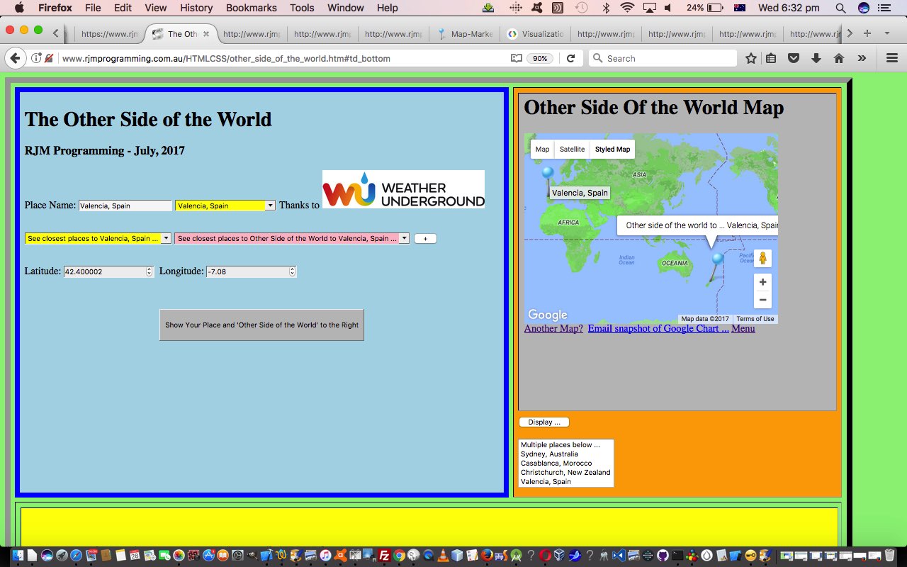
- all users of our “Other Side of the World” web application get an additional non-default Google Chart Map Chart “Styled Map” tab (in addition to their default “Map” and “Satellite” tabs), and some non-default Google Chart Map Chart icons … thanks to Icons-Land here
The new icons for that latter scenario also feature a different icon showing after a “pin” icon is selected (ie. the Google Chart click/touch “select” event is called into play).
The code for these Map Chart changes remains as just HTML (apart from the supervised PHP for the Google Chart interface) that you could call other_side_of_the_world.htm (changed in this minor way for our HTML supervisor of Google Chart Map Chart purposes today) if you like, or want to try out (or try out for a specific (argument) location, such as Beijing try out), again. The major changes related to in the Google Chart Map Chart web application PHP you could call map.php, and which changed in this way, starting down our long path towards more Map Chart styling possibilities.
Previous relevant Other Side of the World Iframe Tutorial is shown below.
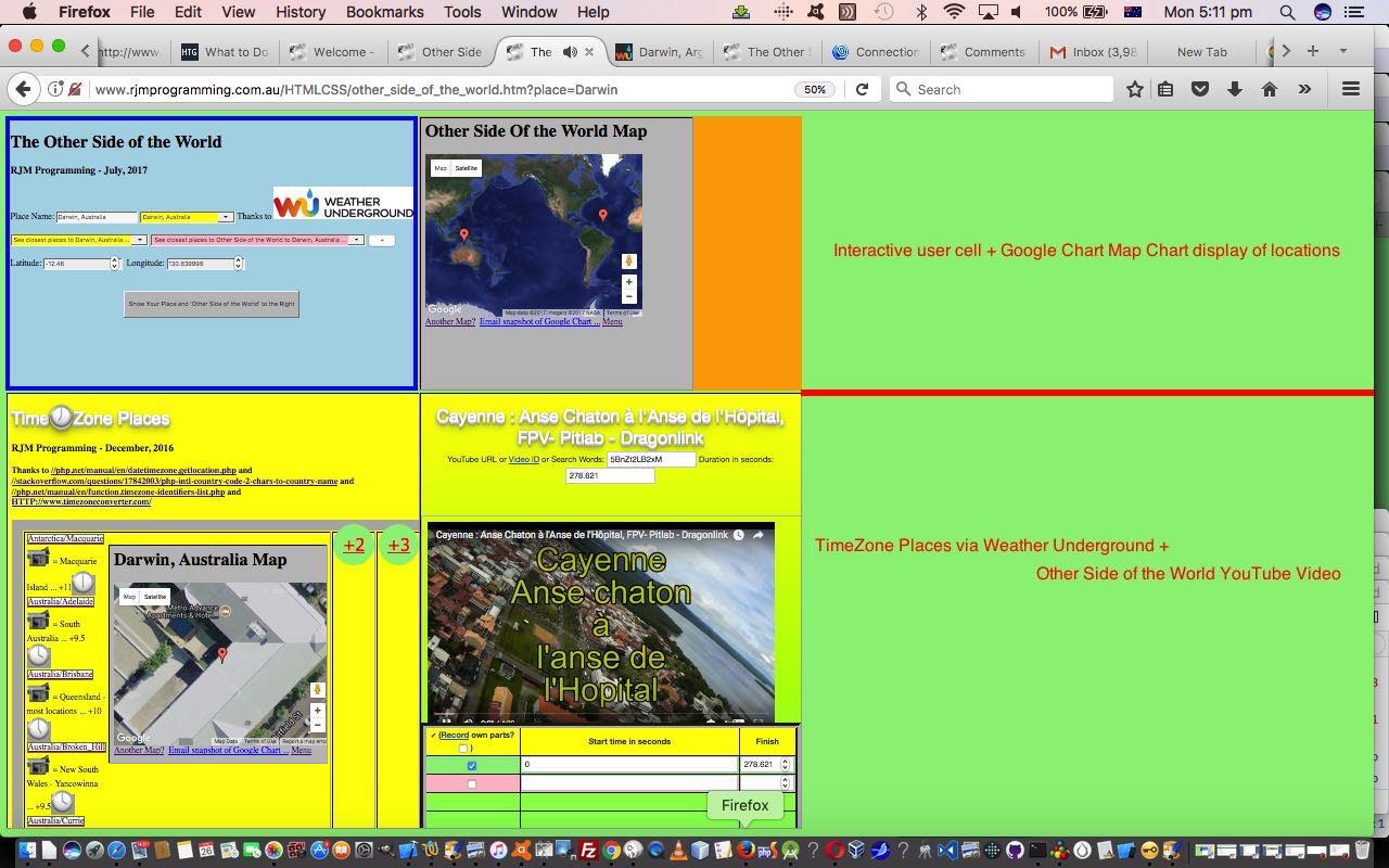
Our “Other Side of the World” web application we’ve been developing lately has made extensive use of the HTML iframe element, mainly as a “reader” of data in that Client Pre-emptive Iframe technique way. But the HTML iframe element is probably better known for its data integration and display talents, and it is these that we call upon today, to (software) integrate two other existing sources of data so that, display-wise we have four table (td) cells in play now those being the original …
- top left cell where the user interacts to show latitude and longitudes and placenames of interest
- top right cell showing these “latitude and longitudes and placenames of interest” paired with their “Other Side of the World” counterparts within a Google Charts Map Chart (software) integration … and, as of today we add into the equation …
- bottom left cell where depending on whether we’ve derived our “latitude and longitudes and placenames of interest” from …
- the Weather Underground HTML select (dropdown) element results in an HTML iframe element hosting a Weather API via Iframe jQuery Ajax Autocomplete Tutorial‘s TimeZone Places dataset … or …
- the useful webpage (thanks) HTML select (dropdown) element results in an HTML iframe element hosting a YouTube Embedded Video in Iframe API RegEx Tutorial ‘s YouTube (embedded) video integrator
- bottom right cell where the user’s “latitude and longitudes and placenames of interest”‘s “Other Side of the World” interfaces to the useful webpage (thanks) HTML select (dropdown) element results in an HTML iframe element hosting a YouTube Embedded Video in Iframe API RegEx Tutorial ‘s YouTube (embedded) video integrator
We now think the use of all this can have you hopping around the world discovering lots of geographical based, video based and timezone based information about lots of places around the world, lots of which you may never have known much about.
We’ve software integrated today, as well as integrated “where” web application thoughts with “when” web application thoughts.
Another feature of today’s changes involves the geolocation features of the Javascript …
navigator.geolocation.getCurrentPosition(success[, error[, options]])
… syntax method of allowing Location Services, if allowed by the user, return a latitude and longitude position of the user themselves, information used at the instigation of the web application, and which we also used with HTML/Javascript Where Does It Get Me To Primer Tutorial and Google Chart Map Chart Select Event Primer Tutorial in the past.
The code for this remains as just HTML (apart from the supervised PHP for the Google Chart interface) that you could call other_side_of_the_world.htm (changed in this way for our HTML iframe (software) integration purposes today) if you like, or want to try out (or try out for a specific (argument) location, such as Alice Springs try out), again. It also required small changes to …
- HTML of the YouTube embedded iframe video integrator’s supervisory karaoke_youtube_api.htm changed in this way and with this live run link
We hope you try it out and discover some new things!
Previous relevant Other Side of the World Onblur Tutorial is shown below.
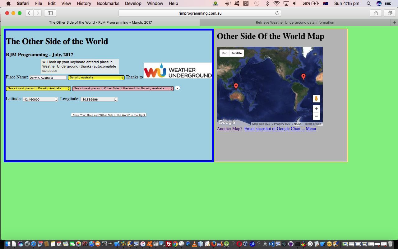
The onblur event in web programming is a very important event regarding interactive keyboard entries made by the user. We base new functionality, today, with our “Other Side of the World” web application, by allowing a user who enters in their own “place” information, can have that information filtered through the same “autocomplete” database provided by the wonderful Weather Underground and its great API service.
When we presented the last Weather Underground related blog posting we even used this functionality also interfacing to the onkeyup keyboard event, making it look up the database after just a few characters typed into the associated HTML input type=text text box, but today we lessen the interaction, presuming the user knows a location of interest and will only want information after tabbing out of this text box … hence the onblur event, only, logic interface to new functionality that creates an additional HTML select (dropdown) element of use to populate those same …
- placename
- country … linked to …
- latitude
- longitude
… fields as talked about yesterday when we presented Other Side of the World Places Tutorial as shown below.
So that’s the idea, but making it happen involved some tweaking of the parts to the Weather Underground blog posting Weather API via Iframe jQuery Ajax AutoComplete Tutorial from some time back, the changes for which we’ll explain later.
Again we call on Client Pre-emptive Iframe techniques for this, telling us that you can just keep on adding HTML iframe elements to make this technique happen for several different sources of information, as necessary.
The code for this is just HTML (apart from the supervised PHP for the Google Chart interface) that you could call other_side_of_the_world.htm (changed in this way for our onblur event purposes today) if you like, or want to try out (or try out for a specific (argument) location, such as Darwin try out), again. It also required small changes to …
- HTML of the “parent” you could call autocomplete.htm changed in this way and with this live run link (or specific place argument calls like the one here for live run for Darwin link) … and its …
- PHP autocomplete jQuery Ajax engined helper you could call using_key.php and tweaked in this way
Previous relevant Other Side of the World Places Tutorial is shown below.
A fair while ago now we were in the midst of writing a Geographicals Suite of web applications that, given Latitude and Longitude pairs you could calculate things like …
- Sun Angle at noon
- Moon Angle at noon
- Coriolis Effect
- Distance between Geographical Locations
- Weather at Geographical Location
… and that we eventually added some “placename” capabilities to all this, introduced with PHP/Javascript/HTML Sun Angle Tutorial, which harnessed all this useful goodwill of this useful webpage (thanks) publishing some placename geographicals data.
- placename
- country … linked to …
- latitude
- longitude
… and that we “channel” today, via our beloved Client Pre-emptive Iframe techniques, so that we reuse PHP, rather than having to create new PHP, as an aid to the modularization for added “placename” functionality to our “Other Side of the World” web application we started presenting yesterday with Other Side of the World Primer Tutorial as shown below.
Another thing we are trialling today is a concept (that admittedly seems to need more work in Firefox) of an HTML select (dropdown) element having an onclick event (after an onchange event that changes that select element value to a non-nothing value) having a logic whereby that select element value is used to repopulate the …
- placename (, country) (Great Circle Distance in km away)
- latitude
- longitude
… HTML input type=text and type=number fields automatically. In the normal case of events in non-Firefox web browsers an onchange event change of value to a non-nothing value just causes that select element value to be one of the places shown on the Google Charts Map Chart that we display.
The default is to show five of the nearest placenames in the derived list, but a “+” button can increase that number of “nearest”s as required.
The code for this is just HTML (apart from the supervised PHP for the Google Chart interface) that you could call other_side_of_the_world.htm (changed in this way for our purposes today) if you like, or want to try out, again perhaps?
Previous relevant Other Side of the World Primer Tutorial is shown below.
Today we’ve written a first draft of an “Other Side of the World” web application using a Google Chart Map Chart embedded into an HTML iframe element to show the user …
- the position of the place that they enter in for their latitude and longitude … as well as …
- “the other side of the world” to the position of the place that they enter in for their latitude and longitude, calculated by imagining you take a trip from your original location through the middle of the Earth and straight through onto the other location
Is this our “sister” location? Am not sure. But somebody was telling “Porkies” to me as a child where we were told “China” as being on the other side.
The code for this is just HTML (apart from the supervised PHP for the Google Chart interface) that you could call other_side_of_the_world.html if you like, or want to try out.
If this was interesting you may be interested in this too.
If this was interesting you may be interested in this too.
If this was interesting you may be interested in this too.
If this was interesting you may be interested in this too.
If this was interesting you may be interested in this too.
If this was interesting you may be interested in this too.
If this was interesting you may be interested in this too.
If this was interesting you may be interested in this too.
If this was interesting you may be interested in this too.
