Know your GeoJson! Yes, pretty obviously, any two GeoJson datasets might display the same in that “map plotting” sense, but one might have different and/or more “intelligence” than the other. Often, an XML has more “intelligence” than equivalent HTML (barring the use of global data attributes, that is), as today’s Corollacorollary.
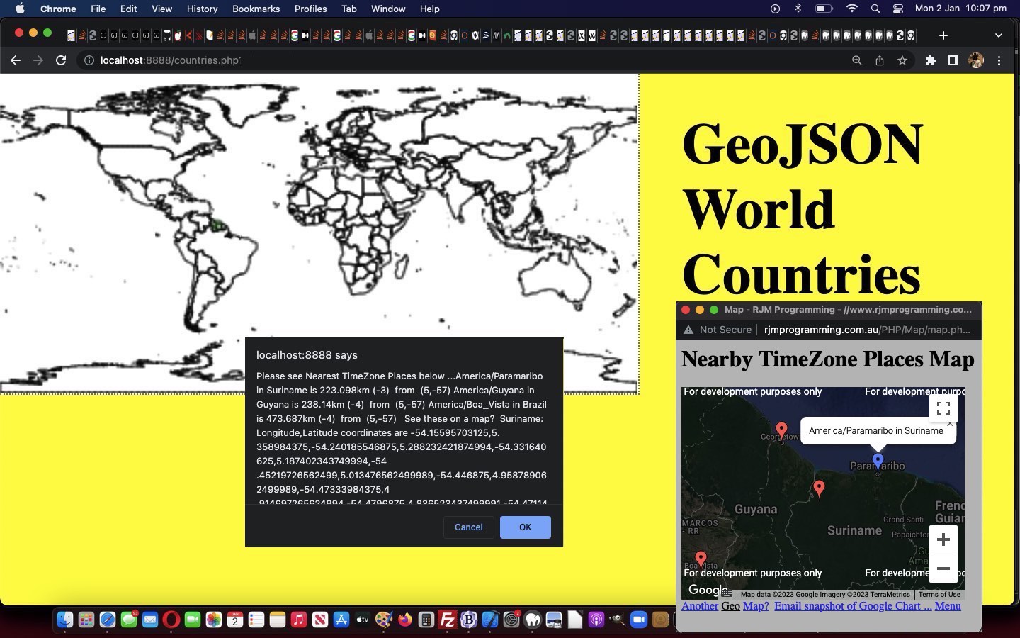
And so, moving on from yesterday’s GeoJson World Coastline TimeZone Tutorial, today, we present a new GeoJson admin 0 countries we download, and upload as “countries.geojson” data set, again via the excellent HTTP://geojson.xyz/ repository, thanks.
From it, we do get a different JSON additional “intelligence” …
{"type":"FeatureCollection","features":[{"type":"Feature","properties":{"scalerank":1,"labelrank":1,"sr_sov_a3":"ZWE","sr_adm0_a3":"ZWE","sr_gu_a3":"ZWE","sr_su_a3":"ZWE","sr_subunit":"Zimbabwe","featureclass":"Admin-0 scale ranks"},"geometry":{"type":"Polygon","coordinates":[[[31.287890625000017,-22.40205078125001],[31.197265625,-22.34492187500001],[31.07343750000001,-22.30781250000001],[30.916113281250006,-22.29072265625001],[30.71162109375001,-22.2978515625],[30.46015625000001,-22.32900390625001],[30.1904296875,-22.291113281250006],[29.90234375,-22.184179687500006],[29.6630859375,-22.146289062500003],[29.37744140625,-22.19277343750001],[29.36484375,-22.193945312500006],[29.315234375000017,-22.15771484375],[29.237207031250023,-22.07949218750001],[29.106835937500023,-22.065722656250003],[29.07148437500001,-22.047460937500006],[29.042382812500023,-22.018359375],[29.023339843750023,-21.98125],[29.01582031250001,-21.93994140625],[29.03730468750001,-21.811328125],[29.02558593750001,-21.796875],[28.99072265625,-21.78144531250001],[28.919335937500023,-21.766015625],[28.74775390625001,-21.707617187500006],[28.532031250000017,-21.65126953125001],[28.181640625,-21.58935546875],[28.04560546875001,-21.573046875],[28.014062500000023,-21.55419921875],[27.974609375,-21.50673828125001],[27.90742187500001,-21.35908203125001],[27.844140625000023,-21.261523437500003],[27.693457031250006,-21.11103515625001],[27.66943359375,-21.064257812500003],[27.67695312500001,-20.94482421875],[27.688085937500006,-20.84833984375001],[27.70429687500001,-20.76640625],[27.69697265625001,-20.689746093750003],[27.69482421875,-20.59453125],[27.699609375000023,-20.53066406250001],[27.679296875,-20.503027343750006],[27.624609375,-20.48359375000001],[27.46894531250001,-20.47480468750001],[27.28076171875,-20.47871093750001],[27.27460937500001,-20.3818359375],[27.256738281250023,-20.23203125],[27.221484375000017,-20.145800781250003],[27.17822265625,-20.10097656250001],[27.091796875,-20.05419921875],[26.91669921875001,-19.99013671875001],[26.67822265625,-19.89277343750001],[26.474609375,-19.748632812500006],[26.241015625000017,-19.5693359375],[26.168066406250006,-19.53828125000001],[26.081933593750023,-19.369921875],[25.95068359375,-19.08173828125001],[25.95917968750001,-18.985644531250003],[25.939355468750023,-18.93867187500001],[25.811914062500023,-18.79707031250001],[25.78369140625,-18.72353515625001],[25.76123046875,-18.64921875],[25.55830078125001,-18.441796875],[25.4892578125,-18.35126953125001],[25.43671875000001,-18.234960937500006],[25.384375,-18.14199218750001],[25.340234375000023,-18.1044921875],[25.28242187500001,-18.04121093750001],[25.242285156250006,-17.969042968750003],[25.224023437500023,-17.91523437500001],[25.239062500000017,-17.843066406250003],[25.2587890625,-17.793554687500006],[25.451757812500006,-17.84511718750001],[25.55712890625,-17.84951171875001],[25.6396484375,-17.82412109375001],[25.741601562500023,-17.858203125],[25.86328125,-17.951953125],[25.995898437500017,-17.969824218750006],[26.139550781250023,-17.91171875],[26.333398437500023,-17.929296875],[26.577539062500023,-18.022558593750006],[26.779882812500006,-18.04150390625],[27.020800781250017,-17.95839843750001],[27.235742187500023,-17.728320312500003],[27.437890625000023,-17.51191406250001],[27.63671875,-17.262109375],[27.75654296875001,-17.060351562500003],[27.932226562500006,-16.89619140625001],[28.16376953125001,-16.76972656250001],[28.399804687500023,-16.66279296875001],[28.760644531250023,-16.53193359375001],[28.760546875000017,-16.53212890625001],[28.83271484375001,-16.424121093750003],[28.856738281250017,-16.30615234375],[28.856738281250017,-16.14228515625001],[28.875585937500006,-16.0361328125],[28.9130859375,-15.98779296875],[28.973046875000023,-15.950097656250009],[29.050585937500017,-15.901171875],[29.287890625000017,-15.776464843750006],[29.4873046875,-15.69677734375],[29.729589843750006,-15.644628906250006],[29.994921875000017,-15.64404296875],[30.25068359375001,-15.643457031250009],[30.39609375,-15.64306640625],[30.39814453125001,-15.80078125],[30.409375,-15.978222656250011],[30.437792968750017,-15.995312500000011],[30.630175781250017,-15.999218750000011],[30.938769531250017,-16.01171875],[31.236230468750023,-16.02363281250001],[31.426171875000023,-16.15234375],[31.48984375,-16.1796875],[31.687597656250006,-16.214160156250003],[31.939843750000023,-16.428808593750006],[32.243261718750006,-16.44873046875],[32.45195312500002,-16.515722656250006],[32.635839843750006,-16.589453125],[32.741796875,-16.67763671875001],[32.81025390625001,-16.69765625],[32.902929687500006,-16.704199218750006],[32.94804687500002,-16.71230468750001],[32.93789062500002,-16.775976562500006],[32.87626953125002,-16.88359375],[32.884375,-17.03779296875001],[32.969335937500006,-17.2515625],[32.98076171875002,-17.4375],[32.9546875,-17.765429687500003],[32.95556640625,-18.08291015625001],[32.96464843750002,-18.1962890625],[32.978515625,-18.271484375],[32.99638671875002,-18.312597656250006],[32.99306640625002,-18.35957031250001],[32.942480468750006,-18.49267578125],[32.90166015625002,-18.632910156250006],[32.90029296875002,-18.6890625],[32.88457031250002,-18.728515625],[32.8544921875,-18.763671875],[32.72197265625002,-18.828417968750003],[32.69921875,-18.868457031250003],[32.69970703125,-18.94091796875],[32.71650390625001,-19.00185546875001],[32.766210937500006,-19.02431640625001],[32.826171875,-19.05878906250001],[32.84980468750001,-19.10439453125001],[32.85,-19.152441406250006],[32.83095703125002,-19.24140625000001],[32.77763671875002,-19.388769531250006],[32.83076171875001,-19.558203125],[32.89042968750002,-19.668066406250006],[32.97265625,-19.79541015625],[33.00673828125002,-19.873828125],[33.0048828125,-19.93017578125],[32.992773437500006,-19.98486328125],[32.86962890625,-20.2171875],[32.780859375,-20.36152343750001],[32.67255859375001,-20.51611328125],[32.529296875,-20.613085937500003],[32.49238281250001,-20.659765625],[32.477636718750006,-20.712988281250006],[32.48281250000002,-20.82890625],[32.476171875,-20.95009765625001],[32.353613281250006,-21.136523437500003],[32.429785156250006,-21.29707031250001],[32.41240234375002,-21.311816406250003],[32.37109375,-21.33486328125001],[32.19472656250002,-21.515429687500003],[32.01630859375001,-21.698046875],[31.88593750000001,-21.83154296875],[31.737695312500023,-21.9833984375],[31.57148437500001,-22.15351562500001],[31.429492187500017,-22.298828125],[31.287890625000017,-22.40205078125001]]]}}
… and “mapping look” because country borders are added in, and some JSON attributes we can call on to allow for …
- the similar Google Chart Map Chart maps introduced yesterday into the user interaction mix … as well as …
- Wikipedia, thanks, webpage lookup possibilities calling on those new GeoJson property attributes presented within the dataset above
We enable this, as we just add in some Javascript popup window type equals “prompt” to the existant “confirm” and “alert” logic of yesterday.
Feel free to try the how we got there regions.php GeoJson PHP World Countries web application in a new window, or below …
Previous relevant GeoJson World Coastline TimeZone Tutorial is shown below.
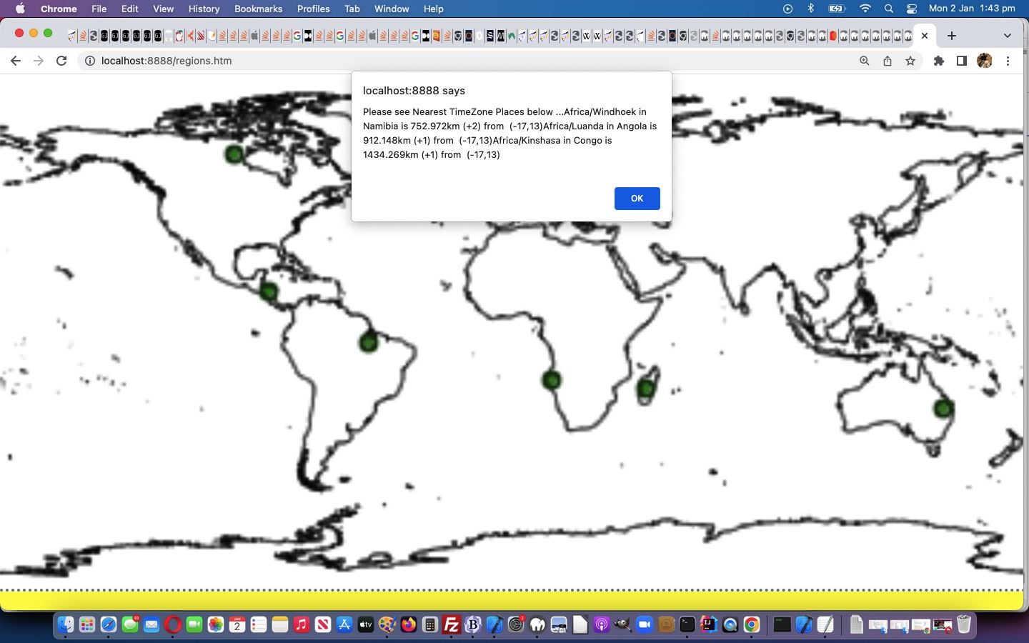
Luckily for programmers all over, the organization of TimeZones has had an International flavour in its development and maintenance. As such, given the “purely coastline” GeoJson data involved in our fledgling PHP web application of yesterday’s GeoJson World Coastline Primer Tutorial a useful arrangement for improvement involves …
- document.body onclick event co-ordinates … able to be converted to …
- longitude, latitude (easily, only because of our simplistic map projection, of course) … onfed to …
- our inhouse “TimeZone Places” web application PHP helper
… can have us helping out your curious web “clicking” user with the 3 nearest TimeZone places, as a reference as to where they are “clicking” in the world.
Feel free to try our improved regions.php GeoJson PHP web application in a new window, or below …
Stop Press
Our efforts in making our new tweaked regions.php GeoJson PHP web application more mobile platform user friendly reminds us about a salutary issue regarding touch gestures …
- in a discrete click methodology of interest, you could adopt a non-mobile “onmousedown” logic set that does not get interfered with by a mobile “ontouchdown” logic set (perhaps leaving “onclick” event, which both non-mobile and mobile both recognise, for another event logic role) … and …
- neither will interrupt the mobile gestures associated with swiping and pinching, which refer to the events “ontouchstart” and “ontouchend” at either end of their lifespan
Previous relevant GeoJson World Coastline Primer Tutorial is shown below.
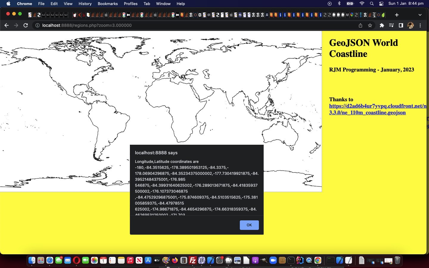
We’re keen to further explore the possibilities of GeoJson public data sets, further to yesterday’s Swift Playgrounds on macOS Map Emoji Tutorial.
And then we remembered some of the methodologies we used with Responsive Web Design Landing Page Image Map Tutorial, talking about image maps …
And so, we arrive at a long planned for tilt at Image Map functionality that we often turn to Mobilefish.Com and its excellent Image Map Creation to help us out … but not today?! Why not? We have a funny set of needs, they being …
- our Image Map’s image will have a variable set of width x height dimensions …
- our Image Map’s image will be transparent
- our Image Map needs to have a hole left aside inside it where the functionality that originally existed (and pointed to WordPress Blog content like you are reading), is still working
… the first two ideas of which, along with …
- canvas element where the …
- GeoJson coordinates … thanks to https://d2ad6b4ur7yvpq.cloudfront.net/naturalearth-3.3.0/ne_110m_coastline.geojson via HTTP://geojson.xyz/ …
- will be plotted … but the canvas element …
- has a z-index set below the image and image map above … meaning …
- we can add some region specific coding into the …
- image map area element (shape=poly) onclick logics
… in our “early days” “proof of concept” regions.php GeoJson PHP web application.
If this was interesting you may be interested in this too.
If this was interesting you may be interested in this too.
If this was interesting you may be interested in this too.


