Earth Scanner Legs Tutorial

Earth Scanner Legs Tutorial

Earth Scanner Legs Tutorial

Of course, yes, there’s a part of me that hoped today’s tutorial in its thread of related blog postings, would line up with the 11th draft of our Earth Scanner web application of yesterday’s Earth Scanner Hashtag Lists Tutorial, and then we could have made some lame joke about “Legs 11”, but we’ve grown up a lot since then, and even some reference to “Legs XI” can’t quite bring us around. Enjoy the sobriety (until the 11th draft, that is)?!

So, the “legs” we’re referring to today are like a …

Trip Leg

… a concept of interest to lots of people. Most of us make trips every day, and in our Earth Scanning web application we harness the great Google Directions link to make suggestions about how you might undertake your trip leg. It’s a simple case of replacing any commas in your (perhaps timezone) list with minus sign(s) to start seeing trip legs, such as …

#New York-Los Angeles

… either at the Javascript prompt window or with the address bar hashtag arrangements, which might end up calling …


function plotleg(thisleg, smlong, lglat, lglong, smlat) {
var brgtoset=0.0, disttoset=0.0, gbrgtoset=0.0, gdisttoset=0.0;
if (1 == 1) {
disttoset=Math.sqrt((eval(0 + eval(eval('' + plotlong[eval(thisleg.split('.')[0])]) - smlong) / eval(lglong - smlong) * eval(screenwidth)) - eval(0 + eval(eval('' + plotlong[eval(thisleg.split('.')[1])]) - smlong) / eval(lglong - smlong) * eval(screenwidth))) * (eval(0 + eval(eval('' + plotlong[eval(thisleg.split('.')[0])]) - smlong) / eval(lglong - smlong) * eval(screenwidth)) - eval(0 + eval(eval('' + plotlong[eval(thisleg.split('.')[1])]) - smlong) / eval(lglong - smlong) * eval(screenwidth))) + (eval(0 + eval(eval(lglat - eval('' + plotlat[eval(thisleg.split('.')[0])])) / eval(lglat - smlat) * eval(screenheight))) - eval(0 + eval(eval(lglat - eval('' + plotlat[eval(thisleg.split('.')[1])])) / eval(lglat - smlat) * eval(screenheight)))) * (eval(0 + eval(eval(lglat - eval('' + plotlat[eval(thisleg.split('.')[0])])) / eval(lglat - smlat) * eval(screenheight))) - eval(0 + eval(eval(lglat - eval('' + plotlat[eval(thisleg.split('.')[1])])) / eval(lglat - smlat) * eval(screenheight)))));
}
gdisttoset=great_circle_distance(plotlat[eval(thisleg.split('.')[0])], plotlong[eval(thisleg.split('.')[0])], plotlat[eval(thisleg.split('.')[1])], plotlong[eval(thisleg.split('.')[1])]);
var meanlong=eval(0 + eval(eval('' + plotlong[eval(thisleg.split('.')[0])]) - smlong) / eval(lglong - smlong) * eval(screenwidth));
var meanlat=eval(0 + eval(eval(lglat - eval('' + plotlat[eval(thisleg.split('.')[0])])) / eval(lglat - smlat) * eval(screenheight)));
brgtoset=Math.atan2(eval(0 + eval(eval(lglat - eval('' + plotlat[eval(thisleg.split('.')[1])])) / eval(lglat - smlat) * eval(screenheight))) - meanlat, eval(0 + eval(eval('' + plotlong[eval(thisleg.split('.')[1])]) - smlong) / eval(lglong - smlong) * eval(screenwidth)) - meanlong) * 180 / Math.PI;
meanlong+=eval(0 + eval(eval('' + plotlong[eval(thisleg.split('.')[1])]) - smlong) / eval(lglong - smlong) * eval(screenwidth))
meanlong/=2.0;
meanlat+=eval(0 + eval(eval(lglat - eval('' + plotlat[eval(thisleg.split('.')[1])])) / eval(lglat - smlat) * eval(screenheight)));
meanlat/=2.0;
console.log(thisleg + ' ' + brgtoset + ' ' + thisleg + ' ... ' + plotlat[eval(thisleg.split('.')[0])] + ',' + plotlong[eval(thisleg.split('.')[0])] + ' to ' + plotlat[eval(thisleg.split('.')[1])] + ',' + plotlong[eval(thisleg.split('.')[1])]);
bmeridian+='<hr onclick="event.stopPropagation(); canlooknow=false; clearwo(); wo=window.open(' + "'//www.google.com/maps/dir/" + encodeURIComponent(plotplace[eval(thisleg.split('.')[0])]) + '/' + encodeURIComponent(plotplace[eval(thisleg.split('.')[1])]) + "#In a minute we will start moving the map again','_blank','top=50,left=50,width=1000,height=900')" + '; canlooknow=true; " ondblclick="event.stopPropagation(); canlooknow=false; clearwo(); wo=window.open(' + "'//www.google.com/maps/dir/" + plotlat[eval(thisleg.split('.')[0])] + ',' + plotlong[eval(thisleg.split('.')[0])] + '/' + plotlat[eval(thisleg.split('.')[1])] + ',' + plotlong[eval(thisleg.split('.')[1])] + "#In a minute we will start moving the map again','_blank','top=50,left=50,width=1000,height=900')" + '; canlooknow=true; " title="' + plotplace[eval(thisleg.split('.')[0])] + ' to ' + plotplace[eval(thisleg.split('.')[1])] + ' has the crow flying (' + gbrgtoset + ' degrees setting off at versus on Mercator Projection ...) ' + eval(eval(brgtoset + 450) % 360) + ' degrees for ' + eval(gdisttoset / 1000.0) + ' kilometers. Click (for placename) or double click (for geographicals) to open a Google Directions window." class=leg style="transform:rotate(' + eval(eval('' + brgtoset) - 0) + 'deg);z-index:975;opacity:0.3;position:fixed;top:' +
meanlat +
'px;left:' +
eval(meanlong - disttoset / 2) +
'px;background-color:rgba(255,0,0,0.5);width:' + disttoset + 'px;height:6px;"></hr><span onclick="event.stopPropagation(); canlooknow=false; clearwo(); wo=window.open(' + "'//www.google.com/maps/dir/" + encodeURIComponent(plotplace[eval(thisleg.split('.')[0])]) + '/' + encodeURIComponent(plotplace[eval(thisleg.split('.')[1])]) + "#In a minute we will start moving the map again','_blank','top=50,left=50,width=1000,height=900')" + '; canlooknow=true; " ondblclick="event.stopPropagation(); canlooknow=false; clearwo(); wo=window.open(' + "'//www.google.com/maps/dir/" + plotlat[eval(thisleg.split('.')[0])] + ',' + plotlong[eval(thisleg.split('.')[0])] + '/' + plotlat[eval(thisleg.split('.')[1])] + ',' + plotlong[eval(thisleg.split('.')[1])] + "#In a minute we will start moving the map again','_blank','top=50,left=50,width=1000,height=900')" + '; canlooknow=true; " title="' + plotplace[eval(thisleg.split('.')[0])] + ' to ' + plotplace[eval(thisleg.split('.')[1])] + ' has the crow flying (' + gbrgtoset + ' degrees setting off at versus on Mercator Projection ...) ' + eval(eval(360 - brgtoset) % 360) + ' degrees for ' + eval(gdisttoset / 1000.0) + ' kilometers. Click (for placename) or double click (for geographicals) to open a Google Directions window." class=leg style="cursor:pointer;font-size:6px;z-index:976;margin-top:6px;margin-left:-6px;position:fixed;top:' + meanlat + 'px;left:' + meanlong + 'px;">&#129517;</span>';
if (ofive == fivethousand) {
fivethousand*=10;
setTimeout(callintoplay, 5000);
}

}

… and putting this into play we realized we should slow down animations to give users a chance to consider whether they want to “drill down” into finding out more about the “trip legs” as user defined.

This happens in our changed seventh (boo hoo) draft Earth Scanner web application.


Previous relevant Earth Scanner Hashtag Lists Tutorial is shown below.

Earth Scanner Hashtag Lists Tutorial

Earth Scanner Hashtag Lists Tutorial

Before yesterday’s Earth Scanner TimeZone Tutorial, when we presented Earth Scanner Places Tutorial we intimated with …

… and into the future we have another idea regarding how this operates.

… that we might offer another way for the driver of our latest Earth Scanner web application …

  • not only depend on a webpage click event Javascript prompt window means by which to control proceedings, including newly coded for comma separated list logic support … but, also, as of today, after proving it could work (because we can’t remember ever depending this much on a “hashtag on the address bar” arrangement, in the past, before)
  • but also allow similar functionality using hashtags on the address bar of the web browser, and able to be changed dynamically (ie. in real time) by the user, as required …

    if (prevhash != decodeURIComponent(('' + location.hash).replace(/^null$/g,'').replace(/^undefined$/g,'').replace(/^\#/g,''))) {
    thishash=decodeURIComponent(('' + location.hash).replace(/^null$/g,'').replace(/^undefined$/g,'').replace(/^\#/g,'')); //.trim();
    for (var iop=0; iop<plotplace.length; iop++) {
    thishash=thishash.replace(plotplace[iop], '');
    }
    var thishs=thishash.replace(/\ to\ /g,',').trim().split(',');
    if (thishs[0].trim() != '') {
    for (var ipo=0; ipo<thishs.length; ipo++) {
    if (newlist == '') {
    nlist=thishs[ipo].replace(/\+/g,'').trim(); //.trim();
    newlist=thishs[ipo].replace(/\+/g,''); //.trim();
    prefnew=thishs[ipo].replace(/\+/g,' ').split(nlist)[0];
    if (eval(1 + ipo) == eval('' + thishs.length) && thishs[ipo].replace(/\+/g,' ') != (prefnew + newlist)) {
    //alert(98);
    suffnew=thishs[ipo].replace(/\+/g,' ').split(newlist)[1];
    }
    } else {
    nlist=thishs[ipo].replace(/\+/g,'').trim(); //.trim();
    newlist+=',' + nlist; //.trim();
    if (eval(1 + ipo) == eval('' + thishs.length) && thishs[ipo].replace(/\+/g,' ') != nlist) {
    suffnew=thishs[ipo].replace(/\+/g,' ').split(nlist)[1];
    }
    }
    }
    }
    prevhash=decodeURIComponent(('' + location.hash).replace(/^null$/g,'').replace(/^undefined$/g,'').replace(/^\#/g,'')); //.trim();
    if (newlist != '') {
    //alert('newlist=' + newlist + '|');
    gdefv=prefnew + newlist + suffnew;
    //alert(gdefv + '!');
    if (1 == 1) {
    askfor=gdefv;
    if (1 == 7 && ('' + askfor).replace('(','').replace(')','').replace('[','').replace(']','').indexOf(',') != -1) {
    ameridian='';
    acircleoflatitude='';
    enforcedlong=false;
    enforcedxp=-999;
    }
    document.getElementById('myimg').click();
    gdefv='';
    setTimeout(scmove, fivethousand);
    return null;
    } else {
    ourprompt(null,'Earth Scanner - RJM Programming - February, 2024 ... ' + String.fromCharCode(10) + 'Thanks to https://github.com/nvkelso/natural-earth-raster/blob/master/50m_rasters/HYP_50M_SR_W/HYP_50M_SR_W.README.html ... ' + String.fromCharCode(10) + 'Currently top left of screen is (Longitude,Latitude) ' + '(' + eval(-180 + xp * 360 / 100) + ',' + eval(90 - yp * 180 / 100) + ') and bottom right is (' + eval(-180 + screenlong + xp * 360 / 100) + ',' + eval(90 - screenlat - yp * 180 / 100) + ') and around the middle is (' + eval(-180 + eval(screenlong / 2) + xp * 360 / 100) + ',' + eval(90 - eval(screenlat / 2) - yp * 180 / 100) + ').' + String.fromCharCode(10) + 'Where do you want middle of screen to be in terms of Longitude,Latitude? Suffix with space to show meridians and/or prefix with space to not show meridians.', newlist);
    }
    }
    }

And we did find this an easy way to build up a sizeable number of plotted places, in quick time, entered as …

  • the “P” and “N’ and “A” and “C” shortcuts (near to where the user clicked) ways
  • timezone place name(s)
  • country name(s)
  • country code(s)
  • [longitude,latitude,placename]
  • [longitude,latitude]
  • longitude,latitude,placename
  • longitude,latitude (with some form of mantissa)

… methodologies to end up with at least a pin (📍) emoji plotted, as well as the “longitude,latitude (with no form of mantissa)” way to just move the map to that position with no plotting taking place.

But now that we have a few “data players” in the mix, there’ll be users out there that do not want to see it all, perhaps … and so, now “the blurb” goes, for user entries, in either of these modes of use …

… at prompt ++ can make delay between snapshots slower and — can make delay between snapshots faster
… at prompt > can hide any time related information else < reveals it again
… comma lists of TimeZone places and/or Country Codes (2 letter) and/or Country Names can be plotted via click or via hashtag usage up at address bar
… suffix with space to show meridians and/or prefix with space to not show meridians

… in our changed sixth draft Earth Scanner web application.


Previous relevant Earth Scanner TimeZone Tutorial is shown below.

Earth Scanner TimeZone Tutorial

Earth Scanner TimeZone Tutorial

Take a look at the word …

TimeZone

… as a concept newly introduced into the Earth Scanner web application workings, as explained in yesterday’s Earth Scanner Places Tutorial.

It’s got a “where” word part “Zone” fitting in with our “where of life” ideas up to now, but it also has got “Time” as a new “when of life” word part of the whole idea of TimeZones we’d like to start exploring today. Yes, TimeZones are very useful to have “where” meet “when” … the Opera Bar would be nice, we think.

We now have


function ourprompt(e, blurb, defv) {
var locans=null, ijk=0, extras='',thatplace='', utzdate, tzDate, xdate1, xextratztime, xextraemj, xdiff;
if (eval(uc_iso_country_codes.length) == 0) {
for (ijk=0; ijk<iso_country_codes.length; ijk++) {
uc_iso_country_codes.push(iso_country_codes[ijk].toUpperCase());
}
}
e = e || window.event;
e.preventDefault();
if (e.touches) {
if (e.touches[0].pageX) {
xinxy.push(eval(e.touches[0].pageX + document.body.scrollLeft * 0) * 1);
yinxy.push(eval(e.touches[0].pageY + document.body.scrollTop * 0) * 1);
} else {
xinxy.push(eval(e.touches[0].clientX + document.body.scrollLeft * 0) * 1);
yinxy.push(eval(e.touches[0].clientY + document.body.scrollTop * 0) * 1);
}
} else if (e.clientX || e.clientY) {
xinxy.push(e.clientX + document.body.scrollLeft * 0);
yinxy.push(e.clientY + document.body.scrollTop * 0);
} else {
xinxy.push(e.pageX + document.body.scrollLeft * 0);
yinxy.push(e.pageY + document.body.scrollTop * 0);
}
var llsa=blurb.split(') (')[1];
//alert(blurb + ' ... ' + llsa);
tllg=eval(llsa.split(',')[0]);
tlla=eval(llsa.split(',')[1].split(')')[0]);
brlg=eval(llsa.split('(')[1].split(',')[0]);
brla=eval(llsa.split('(')[1].split(',')[1].split(')')[0]);
thislong=eval(tllg + eval(eval(xinxy[eval(-1 + xinxy.length)] / screenwidth) * eval(screenlong)));
thislat=eval(tlla - eval(eval(yinxy[eval(-1 + yinxy.length)] / screenheight) * eval(screenlat)));
var nearbyfour=retnearest(thislong, thislat);
var aatm='youllneverfindthis';
var bbtm=String.fromCharCode(9);
if (blurb.indexOf('Thanks to ') != -1) {
if (blurb.split('Thanks to ')[1].indexOf(' ...') != -1) {
bbtm='Thanks to ' + blurb.split('Thanks to ')[1].split(' ...')[0] + ' ...';
}
}
if (blurb.indexOf(' and around the middle ') != -1) {
aatm=' and around the middle ' + blurb.split(' and around the middle ')[1].split(')')[0] + ')';
}
var ourblurb=(blurb.replace(bbtm,'').replace('Currently top ','Top ').replace(' in terms of ',' as ').replace(aatm, '').replace(/\ and\ /g,' & ').replace('? ', '? ' + ' Nearest timezone place (via N) is ' + nearbyfour.split('|')[3] + ' at [' + nearbyfour.split('|')[0] + ',' + nearbyfour.split('|')[1] + '] to your clicked (via C) [' + thislong + ',' + thislat + '] ') + bbtm.replace(String.fromCharCode(9),'')).replace(String.fromCharCode(10),' ').replace(String.fromCharCode(10),' ').replace(String.fromCharCode(10),' ').replace(String.fromCharCode(10),' ');
if (prevf.indexOf(',') != -1) {
if (Math.abs(eval(prevf.split(',')[0]) - tllg) <= 0.5) {
prevf='' + prevone + ',' + prevtwo + ',' + prevthree + ',' + prevfour;
}
if (Math.abs(eval(prevf.split(',')[0]) - tllg) > 0.5) {
tllg=eval(prevf.split(',')[0]);
tlla=eval(prevf.split(',')[1]);
brlg=eval(prevf.split(',')[2]);
brla=eval(prevf.split(',')[3]);
var sthislong=eval(tllg + eval(eval(xinxy[eval(-1 + xinxy.length)] / screenwidth) * eval(screenlong)));
var sthislat=eval(tlla - eval(eval(yinxy[eval(-1 + yinxy.length)] / screenheight) * eval(screenlat)));
var snearbyfour=retnearest(sthislong, sthislat);
//alert(ourblurb + ' ' + prevf + ' vs ' + tllg + ' ... ' + Math.abs(eval(prevf.split(',')[0]) - tllg));
ourblurb=ourblurb.replace('? ', '? ' + ' Nearest timezone place (via P) is ' + snearbyfour.split('|')[3] + ' at [' + snearbyfour.split('|')[0] + ',' + snearbyfour.split('|')[1] + '] to your clicked (via A) [' + sthislong + ',' + sthislat + '] ');
}
locans=prompt(ourblurb, defv);
}
if (locans != null) {
if (locans.toUpperCase().trim() == 'N') {
locans=locans.toUpperCase().replace('N', '[' + nearbyfour.split('|')[0] + ',' + nearbyfour.split('|')[1] + ']');
plotplace.push(nearbyfour.split('|')[3]);
plotcc.push(nearbyfour.split('|')[2]);
plotlong.push(nearbyfour.split('|')[0]);
plotlat.push(nearbyfour.split('|')[1]);
if (eval('' + nearbyfour.length) > 4) {

plottz.push(nearbyfour.split('|')[4]);
plotct.push(nearbyfour.split('|')[5]);
plotemj.push(nearbyfour.split('|')[6]);

} else {
plottz.push('');
plotct.push('');
plotemj.push('');
}

} else if (locans.toUpperCase().trim() == 'C') {
thisplace=' ';
locans=locans.toUpperCase().replace('C', '[' + thislong + ',' + thislat + ']');
plotplace.push('');
plotcc.push(nearbyfour.split('|')[2]);
plotlong.push(thislong);
plotlat.push(thislat);
plotct.push('');
plotemj.push('');
plottz.push('');

} else if (locans.toUpperCase().trim() == 'P') {
locans=locans.toUpperCase().replace('P', '[' + snearbyfour.split('|')[0] + ',' + snearbyfour.split('|')[1] + ']');
plotplace.push(snearbyfour.split('|')[3]);
plotcc.push(snearbyfour.split('|')[2]);
plotlong.push(snearbyfour.split('|')[0]);
plotlat.push(snearbyfour.split('|')[1]);
if (eval('' + nearbyfour.length) > 4) {

plottz.push(nearbyfour.split('|')[4]);
plotct.push(nearbyfour.split('|')[5]);
plotemj.push(nearbyfour.split('|')[6]);

} else {
plottz.push('');
plotct.push('');
plotemj.push('');
}

} else if (locans.toUpperCase().trim() == 'A') {
thisplace=' ';
locans=locans.toUpperCase().replace('A', '[' + sthislong + ',' + sthislat + ']');
plotplace.push('');
plotcc.push(snearbyfour.split('|')[2]);
plotlong.push(sthislong);
plotlat.push(sthislat);
plotct.push('');
plotemj.push('');
plottz.push('');

} else if (eval('' + ('' + locans.trim()).length) >= 3 && ('' + locans).indexOf(',') == -1 && yourtzlist.indexOf('/' + ('' + locans.trim()).replace(/\ /g,'_') + '<') != -1) {
thisplace=yourtzlist.split('/' + ('' + locans.trim()).replace(/\ /g,'_') + '<')[0].split(' data-geo="')[eval(-1 + yourtzlist.split('/' + ('' + locans.trim()).replace(/\ /g,'_') + '<')[0].split(' data-geo="').length)];
//alert(thisplace);

udate=new Date();
utcDate = new Date(udate.toLocaleString('en-US', { timeZone: 'UTC' }));

thatplace=thisplace.split('>')[1].split('<')[0].replace('GMT','UTC') + '/' + locans;
//alert(thatplace);
utzdate=new Date();
tzDate = new Date(utzdate.toLocaleString('en-US', { timeZone: thatplace.replace('GMT','UTC').replace(/\ /g,'_') }));
extratz=',' + thatplace; //.split('/')[eval(-1 + iplacesarr[jk].split('>')[1].split('<')[0].replace('GMT','Europe/London').split('/').length)].replace(/\_/g,' ');
xdate1=new Date().toLocaleString("en-US", { timeZone: thatplace.replace('GMT','UTC').replace(/\ /g,'_') });
xextratztime=(',' + xdate1);
plottz.push(thatplace);
thatplace=thatplace.replace('GMT','Europe/London').split('/')[eval(-1 + thatplace.replace('GMT','Europe/London').split('/').length)].replace(/\_/g,' ');
xdiff = Math.abs(tzDate.getTime() - utcDate.getTime()) / 3600000;
xextraemj=',' + clockit('' + xdiff);
plotct.push('' + xdate1);
plotemj.push(clockit('' + xdiff));

plotplace.push(yourtzlist.split(thisplace.split('>')[0] + '>')[1].split('<')[0].replace('GMT','Europe/London').split('/')[eval(-1 + yourtzlist.split(thisplace.split('>')[0] + '>')[1].split('<')[0].replace('GMT','Europe/London').split('/').length)].replace(/\_/g,' '));
plotlong.push((thisplace.split(',')[1]));
plotlat.push((thisplace.split(',')[0]));
plotcc.push(thisplace.split(',')[3]);
if (thisplace.split(',')[3] != '') {
for (ijk=0; ijk<iso_country_codes.length; ijk+=2) {
if (iso_country_codes[ijk].toUpperCase() == thisplace.split(',')[3].toUpperCase()) {
extras=', ' + iso_country_codes[eval(1 + ijk)];
plotplace[eval(-1 + plotplace.length)]+=extras;
extras='';
}
}
}
//alert(extras + ' ... ' + locans);
locans=locans.replace(locans.trim(), '[' + thisplace.split(',')[1] + ',' + thisplace.split(',')[0] + ',' + plotplace[eval(-1 + plotplace.length)] + extras + ']');
//alert(locans);
thisplace=' ';
} else if (eval('' + ('' + locans.trim()).length) >= 3 && ('' + locans).indexOf(',') == -1 && yourtzlist.toUpperCase().indexOf('/' + ('' + locans.trim()).toUpperCase().replace(/\ /g,'_') + '<') != -1) {
thisplace=yourtzlist.toUpperCase().split('/' + ('' + locans.trim()).toUpperCase().replace(/\ /g,'_') + '<')[0].split(' DATA-GEO="')[eval(-1 + yourtzlist.toUpperCase().split('/' + ('' + locans.trim()).toUpperCase().replace(/\ /g,'_') + '<')[0].split(' DATA-GEO="').length)];
//alert(thisplace);
udate=new Date();
utcDate = new Date(udate.toLocaleString('en-US', { timeZone: 'UTC' }));

thatplace=thisplace.split('>')[1].split('<')[0].replace('GMT','UTC') + '/' + locans;
utzdate=new Date();
tzDate = new Date(utzdate.toLocaleString('en-US', { timeZone: thatplace.replace('GMT','UTC').replace(/\ /g,'_') }));
extratz=',' + thatplace; //.split('/')[eval(-1 + iplacesarr[jk].split('>')[1].split('<')[0].replace('GMT','Europe/London').split('/').length)].replace(/\_/g,' ');
xdate1=new Date().toLocaleString("en-US", { timeZone: thatplace.replace('GMT','UTC') });
xextratztime=(',' + xdate1);
plottz.push(thatplace);
thatplace=thatplace.replace('GMT','Europe/London').split('/')[eval(-1 + thatplace.replace('GMT','Europe/London').split('/').length)].replace(/\_/g,' ');
xdiff = Math.abs(tzDate.getTime() - utcDate.getTime()) / 3600000;
xextraemj=',' + clockit('' + xdiff);
plotct.push('' + xdate1);
plotemj.push(clockit('' + xdiff));

plotplace.push(yourtzlist.split(thisplace.split('>')[0] + '>')[1].split('<')[0].replace('GMT','Europe/London').split('/')[eval(-1 + yourtzlist.split(thisplace.split('>')[0] + '>')[1].split('<')[0].replace('GMT','Europe/London').split('/').length)].replace(/\_/g,' '));
plotlong.push((thisplace.split(',')[1]));
plotlat.push((thisplace.split(',')[0]));
plotcc.push(thisplace.split(',')[3]);
if (thisplace.split(',')[3] != '') {
for (ijk=0; ijk<iso_country_codes.length; ijk+=2) {
if (iso_country_codes[ijk].toUpperCase() == thisplace.split(',')[3].toUpperCase()) {
extras=', ' + iso_country_codes[eval(1 + ijk)];
plotplace[eval(-1 + plotplace.length)]+=extras;
extras='';
}
}
}
//alert(extras + ' ... ' + locans);
locans=locans.replace(locans.trim(), '[' + thisplace.split(',')[1] + ',' + thisplace.split(',')[0] + ',' + plotplace[eval(-1 + plotplace.length)] + extras + ']');
//alert(locans);
thisplace=' ';
} else if (eval('' + ('' + locans.trim()).length) == 2 && ('' + locans).indexOf(',') == -1 && yourtzlist.indexOf(',' + ('' + locans.trim()).toUpperCase() + ',') != -1) {
thisplace=yourtzlist.split(',' + ('' + locans.trim()).toUpperCase() + ',')[0].split(' data-geo="')[eval(-1 + yourtzlist.split(',' + ('' + locans.trim()).toUpperCase() + ',')[0].split(' data-geo="').length)];

thatplace=yourtzlist.split(',' + ('' + locans.trim()).toUpperCase() + ',')[1].split('>')[1].split('<')[0].replace('GMT','UTC');
utzdate=new Date();
tzDate = new Date(utzdate.toLocaleString('en-US', { timeZone: thatplace.replace('GMT','UTC').replace(/\ /g,'_') }));
extratz=',' + thatplace; //.split('/')[eval(-1 + iplacesarr[jk].split('>')[1].split('<')[0].replace('GMT','Europe/London').split('/').length)].replace(/\_/g,' ');
xdate1=new Date().toLocaleString("en-US", { timeZone: thatplace.replace('GMT','UTC').replace(/\ /g,'_') });
xextratztime=(',' + xdate1);
plottz.push(thatplace);
thatplace=thatplace.replace('GMT','Europe/London').split('/')[eval(-1 + thatplace.replace('GMT','Europe/London').split('/').length)].replace(/\_/g,' ');
xdiff = Math.abs(tzDate.getTime() - utzdate.getTime()) / 3600000;
xextraemj=',' + clockit('' + xdiff);
plotct.push('' + xdate1);
plotemj.push(clockit('' + xdiff));

plotplace.push(yourtzlist.split(',' + ('' + locans.trim()).toUpperCase() + ',')[1].split('>')[1].split('<')[0].replace('GMT','Europe/London').split('/')[eval(-1 + yourtzlist.split(',' + ('' + locans.trim()).toUpperCase() + ',')[1].split('>')[1].split('<')[0].replace('GMT','Europe/London').split('/').length)].replace(/\_/g,' '));
plotlong.push((thisplace.split(',')[1]));
plotlat.push((thisplace.split(',')[0]));
plotcc.push(locans.trim());
if (locans != '') {
for (ijk=0; ijk<iso_country_codes.length; ijk+=2) {
if (iso_country_codes[ijk].toUpperCase() == locans.trim().toUpperCase()) {
extras=', ' + iso_country_codes[eval(1 + ijk)];
plotplace[eval(-1 + plotplace.length)]+=extras;
extras='';
}
}
}
locans=locans.replace(locans.trim(), '[' + thisplace.split(',')[1] + ',' + thisplace.split(',')[0] + ',' + plotplace[eval(-1 + plotplace.length)] + extras + ']');
thisplace=' ';
} else if (eval('' + ('' + locans.trim()).length) >= 3 && ('' + locans).indexOf(',') == -1 && iso_country_codes.indexOf(locans.trim()) != -1) {
//alert(iso_country_codes[eval(-1 + eval('' + iso_country_codes.indexOf(locans.trim())))].toUpperCase());
if (yourtzlist.indexOf(',' + ('' + iso_country_codes[eval(-1 + eval('' + iso_country_codes.indexOf(locans.trim())))].toUpperCase()) + ',') != -1) {
locans=locans.replace(locans.trim(), '' + iso_country_codes[eval(-1 + eval('' + iso_country_codes.indexOf(locans.trim())))]);
thisplace=yourtzlist.split(',' + ('' + locans.trim()).toUpperCase() + ',')[0].split(' data-geo="')[eval(-1 + yourtzlist.split(',' + ('' + locans.trim()).toUpperCase() + ',')[0].split(' data-geo="').length)];

//alert('thisplace=' + thisplace + ' and thatplace=' + thatplace);
thatplace=yourtzlist.split(thisplace)[1].split('>')[1].split('<')[0].replace('GMT','UTC');
//alert('thisplace=' + thisplace + ' and thatplace=' + thatplace);
utzdate=new Date();
tzDate = new Date(utzdate.toLocaleString('en-US', { timeZone: thatplace.replace('GMT','UTC').replace(/\ /g,'_') }));
extratz=',' + thatplace; //.split('/')[eval(-1 + iplacesarr[jk].split('>')[1].split('<')[0].replace('GMT','Europe/London').split('/').length)].replace(/\_/g,' ');
xdate1=new Date().toLocaleString("en-US", { timeZone: thatplace.replace('GMT','UTC').replace(/\ /g,'_') });
xextratztime=(',' + xdate1);
plottz.push(thatplace);
thatplace=thatplace.replace('GMT','Europe/London').split('/')[eval(-1 + thatplace.replace('GMT','Europe/London').split('/').length)].replace(/\_/g,' ');
xdiff = Math.abs(tzDate.getTime() - utzdate.getTime()) / 3600000;
xextraemj=',' + clockit('' + xdiff);
plotct.push('' + xdate1);
plotemj.push(clockit('' + xdiff));

plotplace.push(yourtzlist.split(',' + ('' + locans.trim()).toUpperCase() + ',')[1].split('>')[1].split('<')[0].replace('GMT','Europe/London').split('/')[eval(-1 + yourtzlist.split(',' + ('' + locans.trim()).toUpperCase() + ',')[1].split('>')[1].split('<')[0].replace('GMT','Europe/London').split('/').length)].replace(/\_/g,' '));
plotlong.push((thisplace.split(',')[1]));
plotlat.push((thisplace.split(',')[0]));
plotcc.push(locans.trim());
if (locans != '') {
for (ijk=0; ijk<iso_country_codes.length; ijk+=2) {
if (iso_country_codes[ijk].toUpperCase() == locans.trim().toUpperCase()) {
extras=', ' + iso_country_codes[eval(1 + ijk)];
plotplace[eval(-1 + plotplace.length)]+=extras;
extras='';
}
}
}
locans=locans.replace(locans.trim(), '[' + thisplace.split(',')[1] + ',' + thisplace.split(',')[0] + ',' + plotplace[eval(-1 + plotplace.length)] + extras + ']');
thisplace=' ';
} else if (locans.trim() != '' && locans.trim() != locans) {
locans=locans.replace(locans.trim(), '');
} else {
locans=null;
}
} else if (eval('' + ('' + locans.trim()).length) >= 3 && ('' + locans).indexOf(',') == -1 && uc_iso_country_codes.indexOf(locans.trim().toUpperCase()) != -1) {
//alert(iso_country_codes[eval(-1 + eval('' + uc_iso_country_codes.indexOf(locans.trim())))].toUpperCase());
if (yourtzlist.indexOf(',' + iso_country_codes[eval(-1 + uc_iso_country_codes.indexOf(locans.trim().toUpperCase()))].toUpperCase() + ',') != -1) {
locans=locans.replace(locans.trim(), '' + iso_country_codes[eval(-1 + eval('' + uc_iso_country_codes.indexOf(locans.trim().toUpperCase())))]);
thisplace=yourtzlist.split(',' + ('' + locans.trim()).toUpperCase() + ',')[0].split(' data-geo="')[eval(-1 + yourtzlist.split(',' + ('' + locans.trim()).toUpperCase() + ',')[0].split(' data-geo="').length)];

thatplace=thisplace.split('>')[1].split('<')[0].replace('GMT','UTC');
utzdate=new Date();
tzDate = new Date(utzdate.toLocaleString('en-US', { timeZone: thatplace.replace('GMT','UTC').replace(/\ /g,'_') }));
extratz=',' + thatplace; //.split('/')[eval(-1 + iplacesarr[jk].split('>')[1].split('<')[0].replace('GMT','Europe/London').split('/').length)].replace(/\_/g,' ');
xdate1=new Date().toLocaleString("en-US", { timeZone: thatplace.replace('GMT','UTC').replace(/\ /g,'_') });
xextratztime=(',' + xdate1);
plottz.push(thatplace);
thatplace=thatplace.replace('GMT','Europe/London').split('/')[eval(-1 + thatplace.replace('GMT','Europe/London').split('/').length)].replace(/\_/g,' ');
xdiff = Math.abs(tzDate.getTime() - utzdate.getTime()) / 3600000;
xextraemj=',' + clockit('' + xdiff);
plotct.push('' + xdate1);
plotemj.push(clockit('' + xdiff));

plotplace.push(yourtzlist.split(',' + ('' + locans.trim()).toUpperCase() + ',')[1].split('>')[1].split('<')[0].replace('GMT','Europe/London').split('/')[eval(-1 + yourtzlist.split(',' + ('' + locans.trim()).toUpperCase() + ',')[1].split('>')[1].split('<')[0].replace('GMT','Europe/London').split('/').length)].replace(/\_/g,' '));
plotlong.push((thisplace.split(',')[1]));
plotlat.push((thisplace.split(',')[0]));
plotcc.push(locans.trim());
if (locans != '') {
for (ijk=0; ijk<iso_country_codes.length; ijk+=2) {
if (iso_country_codes[ijk].toUpperCase() == locans.trim().toUpperCase()) {
extras=', ' + iso_country_codes[eval(1 + ijk)];
plotplace[eval(-1 + plotplace.length)]+=extras;
extras='';
}
}
}
locans=locans.replace(locans.trim(), '[' + thisplace.split(',')[1] + ',' + thisplace.split(',')[0] + ',' + plotplace[eval(-1 + plotplace.length)] + extras + ']');
thisplace=' ';
} else if (locans.trim() != '' && locans.trim() != locans) {
locans=locans.replace(locans.trim(), '');
} else {
locans=null;
}
} else if (('' + locans).indexOf(',') != -1 && ('' + locans).indexOf('[') != -1) {
thisplace=' ';
if (eval('' + locans.replace('(','').replace(')','').replace('[','').replace(']','').split(',').length) > 2) {
plotplace.push(locans.replace(locans.split(',')[0] + ',' + locans.split(',')[1] + ',', '').replace('(','').replace(')','').replace('[','').replace(']',''));
thisplace=locans.replace(locans.split(',')[0] + ',' + locans.split(',')[1] + ',', '').replace('(','').replace(')','').replace('[','').replace(']','') + ' ';
} else {
plotplace.push('');
}
plotcc.push('');
plotlong.push(locans.replace('(','').replace(')','').replace('[','').replace(']','').split(',')[0]);
plotlat.push(locans.replace('(','').replace(')','').replace('[','').replace(']','').split(',')[1]);
plotct.push('');
plotemj.push('');
plottz.push('');

} else if (('' + locans).indexOf(',') != -1 && ('' + locans).indexOf('.') != -1) {
thisplace=' ';
if (eval('' + locans.replace('(','').replace(')','').replace('[','').replace(']','').split(',').length) > 2) {
plotplace.push(locans.replace(locans.split(',')[0] + ',' + locans.split(',')[1] + ',', '').replace('(','').replace(')','').replace('[','').replace(']',''));
thisplace=locans.replace(locans.split(',')[0] + ',' + locans.split(',')[1] + ',', '').replace('(','').replace(')','').replace('[','').replace(']','') + ' ';
} else {
plotplace.push('');
}
plotcc.push('');
plotlong.push(locans.replace('(','').replace(')','').replace('[','').replace(']','').split(',')[0]);
plotlat.push(locans.replace('(','').replace(')','').replace('[','').replace(']','').split(',')[1]);
plotct.push('');
plotemj.push('');
plottz.push('');

} else if (locans.trim() != '' && locans.trim() != locans) {
locans=locans.replace(locans.trim(), '');
} else {
locans=null;
}
}

movesallowed=true;
return locans;
}

function orflag(thiscc) {
var ccchar='', ccsuff='';
var lri='ABCDEFGHIJKLMNOPQRSTUVWXYZ';
var dri=['127462','127463','127464','127465','127466','127467','127468','127469','127470','127471','127472','127473','127474','127475','127476','127477','127478','127479','127480','127481','127482','127483','127484','127485','127486','127487'];
for (var iccsuff=0; iccsuff<thiscc.length; iccsuff++) {
ccchar=thiscc.substring(iccsuff, eval(1 + eval('' + iccsuff))).toUpperCase();
ccsuff+=String.fromCodePoint(eval('' + dri[eval('' + lri.indexOf(ccchar))])); //'&#' + dri[eval('' + lri.indexOf(ccchar))] + ';';
}
return ccsuff;
}

… referencing three new when “collectables” …

  1. var plottz=[]; // contains a TimeZone name
  2. var plotct=[]; // contains a current datetime timestamp
  3. var plotemj=[]; // contains a current datetime clockemoji of nearest relevance

now used in an amended plotting span element innerHTML (used to be plotplace[iplot]) “wrapper” (now using doplotplace(iplot)) …


function doplotplace(ipl) {
if (plotcc[ipl].trim() && plottz[ipl].trim() != '') {
return plotplace[ipl] + ' ' + orflag(plotcc[ipl]) + '
' + plotct[ipl] + '
' + plotemj[ipl];
}

return plotplace[ipl];
}

… in our changed fifth draft Earth Scanner web application.


Previous relevant Earth Scanner Places Tutorial is shown below.

Earth Scanner Places Tutorial

Earth Scanner Places Tutorial

So far, with our Earth Scanner web application from the day before yesterday’s Earth Scanner Lines Tutorial, it had a pretty passive modus operandi. On a plane or on television or some other “just watching” scenario that suits, but we’d like to offer more regarding value adding …

  • new Place plotting functionality that the user has real-time control over via onclick logic reaching a …
  • Javascript prompt window

… and into the future we have another idea regarding how this operates.

So today, though, we change how that Javascript prompt window’s “blurb” is constructed, and how the user answer is analyzed, because, today, we’ve added in …


PHP inspired TimeZone place lookup logic within the Javascript code

Of course not all places are TimeZone places, and we’ll see how that goes into the future?!

We funnelled the Javascript prompt window logic into a new “wrapper style” Javascript inhouse function …


function ourprompt(e, blurb, defv) {
var locans=null, ijk=0, extras='';
if (eval(uc_iso_country_codes.length) == 0) {
for (ijk=0; ijk<iso_country_codes.length; ijk++) {
uc_iso_country_codes.push(iso_country_codes[ijk].toUpperCase());
}
}
e = e || window.event;
e.preventDefault();
if (e.touches) {
if (e.touches[0].pageX) {
xinxy.push(eval(e.touches[0].pageX + document.body.scrollLeft * 0) * 1);
yinxy.push(eval(e.touches[0].pageY + document.body.scrollTop * 0) * 1);
} else {
xinxy.push(eval(e.touches[0].clientX + document.body.scrollLeft * 0) * 1);
yinxy.push(eval(e.touches[0].clientY + document.body.scrollTop * 0) * 1);
}
} else if (e.clientX || e.clientY) {
xinxy.push(e.clientX + document.body.scrollLeft * 0);
yinxy.push(e.clientY + document.body.scrollTop * 0);
} else {
xinxy.push(e.pageX + document.body.scrollLeft * 0);
yinxy.push(e.pageY + document.body.scrollTop * 0);
}
var llsa=blurb.split(') (')[1];
//alert(blurb + ' ... ' + llsa);
tllg=eval(llsa.split(',')[0]);
tlla=eval(llsa.split(',')[1].split(')')[0]);
brlg=eval(llsa.split('(')[1].split(',')[0]);
brla=eval(llsa.split('(')[1].split(',')[1].split(')')[0]);
thislong=eval(tllg + eval(eval(xinxy[eval(-1 + xinxy.length)] / screenwidth) * eval(screenlong)));
thislat=eval(tlla - eval(eval(yinxy[eval(-1 + yinxy.length)] / screenheight) * eval(screenlat)));
var nearbyfour=retnearest(thislong, thislat);
var aatm='youllneverfindthis';
var bbtm=String.fromCharCode(9);
if (blurb.indexOf('Thanks to ') != -1) {
if (blurb.split('Thanks to ')[1].indexOf(' ...') != -1) {
bbtm='Thanks to ' + blurb.split('Thanks to ')[1].split(' ...')[0] + ' ...';
}
}
if (blurb.indexOf(' and around the middle ') != -1) {
aatm=' and around the middle ' + blurb.split(' and around the middle ')[1].split(')')[0] + ')';
}
var ourblurb=(blurb.replace(bbtm,'').replace('Currently top ','Top ').replace(' in terms of ',' as ').replace(aatm, '').replace(/\ and\ /g,' & ').replace('? ', '? ' + ' Nearest timezone place (via N) is ' + nearbyfour.split('|')[3] + ' at [' + nearbyfour.split('|')[0] + ',' + nearbyfour.split('|')[1] + '] to your clicked (via C) [' + thislong + ',' + thislat + '] ') + bbtm.replace(String.fromCharCode(9),'')).replace(String.fromCharCode(10),' ').replace(String.fromCharCode(10),' ').replace(String.fromCharCode(10),' ').replace(String.fromCharCode(10),' ');
if (prevf.indexOf(',') != -1) {
if (Math.abs(eval(prevf.split(',')[0]) - tllg) <= 0.5) {
prevf='' + prevone + ',' + prevtwo + ',' + prevthree + ',' + prevfour;
}
if (Math.abs(eval(prevf.split(',')[0]) - tllg) > 0.5) {
tllg=eval(prevf.split(',')[0]);
tlla=eval(prevf.split(',')[1]);
brlg=eval(prevf.split(',')[2]);
brla=eval(prevf.split(',')[3]);
var sthislong=eval(tllg + eval(eval(xinxy[eval(-1 + xinxy.length)] / screenwidth) * eval(screenlong)));
var sthislat=eval(tlla - eval(eval(yinxy[eval(-1 + yinxy.length)] / screenheight) * eval(screenlat)));
var snearbyfour=retnearest(sthislong, sthislat);
//alert(ourblurb + ' ' + prevf + ' vs ' + tllg + ' ... ' + Math.abs(eval(prevf.split(',')[0]) - tllg));
ourblurb=ourblurb.replace('? ', '? ' + ' Nearest timezone place (via P) is ' + snearbyfour.split('|')[3] + ' at [' + snearbyfour.split('|')[0] + ',' + snearbyfour.split('|')[1] + '] to your clicked (via A) [' + sthislong + ',' + sthislat + '] ');
}
locans=prompt(ourblurb, defv);
}
if (locans != null) {
if (locans.toUpperCase().trim() == 'N') {
locans=locans.toUpperCase().replace('N', '[' + nearbyfour.split('|')[0] + ',' + nearbyfour.split('|')[1] + ']');
plotplace.push(nearbyfour.split('|')[3]);
plotcc.push(nearbyfour.split('|')[2]);
plotlong.push(nearbyfour.split('|')[0]);
plotlat.push(nearbyfour.split('|')[1]);
} else if (locans.toUpperCase().trim() == 'C') {
thisplace=' ';
locans=locans.toUpperCase().replace('C', '[' + thislong + ',' + thislat + ']');
plotplace.push('');
plotcc.push(nearbyfour.split('|')[2]);
plotlong.push(thislong);
plotlat.push(thislat);
} else if (locans.toUpperCase().trim() == 'P') {
locans=locans.toUpperCase().replace('P', '[' + snearbyfour.split('|')[0] + ',' + snearbyfour.split('|')[1] + ']');
plotplace.push(snearbyfour.split('|')[3]);
plotcc.push(snearbyfour.split('|')[2]);
plotlong.push(snearbyfour.split('|')[0]);
plotlat.push(snearbyfour.split('|')[1]);
} else if (locans.toUpperCase().trim() == 'A') {
thisplace=' ';
locans=locans.toUpperCase().replace('A', '[' + sthislong + ',' + sthislat + ']');
plotplace.push('');
plotcc.push(snearbyfour.split('|')[2]);
plotlong.push(sthislong);
plotlat.push(sthislat);
} else if (eval('' + ('' + locans.trim()).length) >= 3 && ('' + locans).indexOf(',') == -1 && yourtzlist.toUpperCase().indexOf('/' + ('' + locans.trim()).toUpperCase().replace(/\ /g,'_') + '<') != -1) {
thisplace=yourtzlist.toUpperCase().split('/' + ('' + locans.trim()).toUpperCase().replace(/\ /g,'_') + '<')[0].split(' DATA-GEO="')[eval(-1 + yourtzlist.toUpperCase().split('/' + ('' + locans.trim()).toUpperCase().replace(/\ /g,'_') + '<')[0].split(' DATA-GEO="').length)];
//alert(thisplace);
plotplace.push(yourtzlist.split(thisplace.split('>')[0] + '>')[1].split('<')[0].replace('GMT','Europe/London').split('/')[eval(-1 + yourtzlist.split(thisplace.split('>')[0] + '>')[1].split('<')[0].replace('GMT','Europe/London').split('/').length)].replace(/\_/g,' '));
plotlong.push((thisplace.split(',')[1]));
plotlat.push((thisplace.split(',')[0]));
plotcc.push(thisplace.split(',')[3]);
if (thisplace.split(',')[3] != '') {
for (ijk=0; ijk<iso_country_codes.length; ijk+=2) {
if (iso_country_codes[ijk].toUpperCase() == thisplace.split(',')[3].toUpperCase()) {
extras=', ' + iso_country_codes[eval(1 + ijk)];
plotplace[eval(-1 + plotplace.length)]+=extras;
extras='';
}
}
}
//alert(extras + ' ... ' + locans);
locans=locans.replace(locans.trim(), '[' + thisplace.split(',')[1] + ',' + thisplace.split(',')[0] + ',' + plotplace[eval(-1 + plotplace.length)] + extras + ']');
//alert(locans);
thisplace=' ';
} else if (eval('' + ('' + locans.trim()).length) == 2 && ('' + locans).indexOf(',') == -1 && yourtzlist.indexOf(',' + ('' + locans.trim()).toUpperCase() + ',') != -1) {
thisplace=yourtzlist.split(',' + ('' + locans.trim()).toUpperCase() + ',')[0].split(' data-geo="')[eval(-1 + yourtzlist.split(',' + ('' + locans.trim()).toUpperCase() + ',')[0].split(' data-geo="').length)];
plotplace.push(yourtzlist.split(',' + ('' + locans.trim()).toUpperCase() + ',')[1].split('>')[1].split('<')[0].replace('GMT','Europe/London').split('/')[eval(-1 + yourtzlist.split(',' + ('' + locans.trim()).toUpperCase() + ',')[1].split('>')[1].split('<')[0].replace('GMT','Europe/London').split('/').length)].replace(/\_/g,' '));
plotlong.push((thisplace.split(',')[1]));
plotlat.push((thisplace.split(',')[0]));
plotcc.push(locans.trim());
if (locans != '') {
for (ijk=0; ijk<iso_country_codes.length; ijk+=2) {
if (iso_country_codes[ijk].toUpperCase() == locans.trim().toUpperCase()) {
extras=', ' + iso_country_codes[eval(1 + ijk)];
plotplace[eval(-1 + plotplace.length)]+=extras;
extras='';
}
}
}
locans=locans.replace(locans.trim(), '[' + thisplace.split(',')[1] + ',' + thisplace.split(',')[0] + ',' + plotplace[eval(-1 + plotplace.length)] + extras + ']');
thisplace=' ';
} else if (eval('' + ('' + locans.trim()).length) >= 3 && ('' + locans).indexOf(',') == -1 && iso_country_codes.indexOf(locans.trim()) != -1) {
//alert(iso_country_codes[eval(-1 + eval('' + iso_country_codes.indexOf(locans.trim())))].toUpperCase());
if (yourtzlist.indexOf(',' + ('' + iso_country_codes[eval(-1 + eval('' + iso_country_codes.indexOf(locans.trim())))].toUpperCase()) + ',') != -1) {
locans=locans.replace(locans.trim(), '' + iso_country_codes[eval(-1 + eval('' + iso_country_codes.indexOf(locans.trim())))]);
thisplace=yourtzlist.split(',' + ('' + locans.trim()).toUpperCase() + ',')[0].split(' data-geo="')[eval(-1 + yourtzlist.split(',' + ('' + locans.trim()).toUpperCase() + ',')[0].split(' data-geo="').length)];
plotplace.push(yourtzlist.split(',' + ('' + locans.trim()).toUpperCase() + ',')[1].split('>')[1].split('<')[0].replace('GMT','Europe/London').split('/')[eval(-1 + yourtzlist.split(',' + ('' + locans.trim()).toUpperCase() + ',')[1].split('>')[1].split('<')[0].replace('GMT','Europe/London').split('/').length)].replace(/\_/g,' '));
plotlong.push((thisplace.split(',')[1]));
plotlat.push((thisplace.split(',')[0]));
plotcc.push(locans.trim());
if (locans != '') {
for (ijk=0; ijk<iso_country_codes.length; ijk+=2) {
if (iso_country_codes[ijk].toUpperCase() == locans.trim().toUpperCase()) {
extras=', ' + iso_country_codes[eval(1 + ijk)];
plotplace[eval(-1 + plotplace.length)]+=extras;
extras='';
}
}
}
locans=locans.replace(locans.trim(), '[' + thisplace.split(',')[1] + ',' + thisplace.split(',')[0] + ',' + plotplace[eval(-1 + plotplace.length)] + extras + ']');
thisplace=' ';
} else if (locans.trim() != '' && locans.trim() != locans) {
locans=locans.replace(locans.trim(), '');
} else {
locans=null;
}
} else if (eval('' + ('' + locans.trim()).length) >= 3 && ('' + locans).indexOf(',') == -1 && uc_iso_country_codes.indexOf(locans.trim().toUpperCase()) != -1) {
//alert(iso_country_codes[eval(-1 + eval('' + uc_iso_country_codes.indexOf(locans.trim())))].toUpperCase());
if (yourtzlist.indexOf(',' + iso_country_codes[eval(-1 + uc_iso_country_codes.indexOf(locans.trim().toUpperCase()))].toUpperCase() + ',') != -1) {
locans=locans.replace(locans.trim(), '' + iso_country_codes[eval(-1 + eval('' + uc_iso_country_codes.indexOf(locans.trim().toUpperCase())))]);
thisplace=yourtzlist.split(',' + ('' + locans.trim()).toUpperCase() + ',')[0].split(' data-geo="')[eval(-1 + yourtzlist.split(',' + ('' + locans.trim()).toUpperCase() + ',')[0].split(' data-geo="').length)];
plotplace.push(yourtzlist.split(',' + ('' + locans.trim()).toUpperCase() + ',')[1].split('>')[1].split('<')[0].replace('GMT','Europe/London').split('/')[eval(-1 + yourtzlist.split(',' + ('' + locans.trim()).toUpperCase() + ',')[1].split('>')[1].split('<')[0].replace('GMT','Europe/London').split('/').length)].replace(/\_/g,' '));
plotlong.push((thisplace.split(',')[1]));
plotlat.push((thisplace.split(',')[0]));
plotcc.push(locans.trim());
if (locans != '') {
for (ijk=0; ijk<iso_country_codes.length; ijk+=2) {
if (iso_country_codes[ijk].toUpperCase() == locans.trim().toUpperCase()) {
extras=', ' + iso_country_codes[eval(1 + ijk)];
plotplace[eval(-1 + plotplace.length)]+=extras;
extras='';
}
}
}
locans=locans.replace(locans.trim(), '[' + thisplace.split(',')[1] + ',' + thisplace.split(',')[0] + ',' + plotplace[eval(-1 + plotplace.length)] + extras + ']');
thisplace=' ';
} else if (locans.trim() != '' && locans.trim() != locans) {
locans=locans.replace(locans.trim(), '');
} else {
locans=null;
}
} else if (('' + locans).indexOf(',') != -1 && ('' + locans).indexOf('[') != -1) {
thisplace=' ';
if (eval('' + locans.replace('(','').replace(')','').replace('[','').replace(']','').split(',').length) > 2) {
plotplace.push(locans.replace(locans.split(',')[0] + ',' + locans.split(',')[1] + ',', '').replace('(','').replace(')','').replace('[','').replace(']',''));
thisplace=locans.replace(locans.split(',')[0] + ',' + locans.split(',')[1] + ',', '').replace('(','').replace(')','').replace('[','').replace(']','') + ' ';
} else {
plotplace.push('');
}
plotcc.push('');
plotlong.push(locans.replace('(','').replace(')','').replace('[','').replace(']','').split(',')[0]);
plotlat.push(locans.replace('(','').replace(')','').replace('[','').replace(']','').split(',')[1]);
} else if (('' + locans).indexOf(',') != -1 && ('' + locans).indexOf('.') != -1) {
thisplace=' ';
if (eval('' + locans.replace('(','').replace(')','').replace('[','').replace(']','').split(',').length) > 2) {
plotplace.push(locans.replace(locans.split(',')[0] + ',' + locans.split(',')[1] + ',', '').replace('(','').replace(')','').replace('[','').replace(']',''));
thisplace=locans.replace(locans.split(',')[0] + ',' + locans.split(',')[1] + ',', '').replace('(','').replace(')','').replace('[','').replace(']','') + ' ';
} else {
plotplace.push('');
}
plotcc.push('');
plotlong.push(locans.replace('(','').replace(')','').replace('[','').replace(']','').split(',')[0]);
plotlat.push(locans.replace('(','').replace(')','').replace('[','').replace(']','').split(',')[1]);
} else if (locans.trim() != '' && locans.trim() != locans) {
locans=locans.replace(locans.trim(), '');
} else {
locans=null;
}
}


movesallowed=true;
return locans;
}

… as the best way to get into how this happens in Earth Scanner Primer Tutorial, in our changed fourth draft Earth Scanner web application.


Previous relevant Earth Scanner Lines Tutorial is shown below.

Earth Scanner Lines Tutorial

Earth Scanner Lines Tutorial

Not everybody is a geography buff. But I’d say more people attended primary school than are geography buffs. And those people may have seen World Maps on the wall, and they were often Mercator Projection maps featuring the usual country and sea boundaries, as well as useful reference lines …

  • lines of latitude, including, in between top “North Pole” 90° N and “South Pole” 90° S bottom …
    1. Arctic Circle 66° 34′ N
    2. Tropic of Cancer 23° 26′ N
    3. Equator 0°
    4. Tropic of Capricorn 23° 26′ S
    5. Antarctic Circle 66° 34′ S
  • meridians of longitude (only the Equator above, is as long as … and in the “Go Figure, Mercator” realms, the North Pole and South Pole are each of zero length, in “non-projection land”), including …
    1. Greenwich Meridian 0°
    2. International Date Line 180° (but in practice, broken up so as not to confuse regarding timezones for some Pacific island countries)

… that become useful as you scan your way around Earth, further to yesterday’s Earth Scanner Primer Tutorial, in our changed second draft Earth Scanner web application.

Stop Press

Couple of points to note …

  1. the linework is just hr (Horizontal rule) elements, which are not the challenge either horizontally or vertically, regarding linework, that any diagonality brings …

  2. the matter of screen width and screen height, which we need to know precisely for the work above, can be more involved to calculate on mobile platforms … we ended up, with great help from this useful link, with this Javascript code …

    var screenwidth=screen.width, screenheight=screen.height;

    var wasthisso='';
    if (navigator.userAgent.match(/Android|BlackBerry|iPhone|iPad|iPod|Opera Mini|IEMobile/i)) {
    try {
    wasthisso=('' + window.orientation).replace(/^0$/g, 'portrait'); //"portrait";
    } catch (ehgfg) {
    wasthisso='';
    }
    if (wasthisso == '') {
    try {
    wasthisso='' + screen.orientation.type; //"portrait";
    } catch (hgfg) {
    wasthisso=('' + window.orientation).replace(/^0$/g, 'portrait'); //"portrait";
    }
    }
    //alert(wasthisso);
    var hdone=false;
    if (wasthisso.indexOf('ortrait') != -1) { // thanks to https://stackoverflow.com/questions/50690191/window-innerheight-returning-wrong-value-in-ios-11
    if (eval('0' + document.documentElement.clientWidth) >= eval('0' + window.innerWidth)) {
    screenwidth=eval('' + document.documentElement.clientWidth);
    screenheight=eval('' + document.documentElement.clientHeight);
    hdone=true;
    } else {
    screenwidth=window.innerWidth;
    }
    if (!hdone) {
    if (eval('0' + document.documentElement.clientHeight) > eval('0' + window.innerHeight)) {
    screenheight=eval('' + document.documentElement.clientHeight);
    } else {
    screenheight=window.innerHeight;
    }
    }
    } else {
    if (eval('0' + document.documentElement.clientWidth) >= eval('0' + window.innerHeight)) {
    screenwidth=eval('' + document.documentElement.clientWidth);
    screenheight=eval('' + document.documentElement.clientHeight);
    hdone=true;
    } else {
    screenwidth=window.innerHeight;
    }
    if (!hdone) {
    if (eval('0' + document.documentElement.clientHeight) > eval('0' + window.innerWidth)) {
    screenheight=eval('' + document.documentElement.clientHeight);
    } else {
    screenheight=window.innerWidth;
    }
    }
    }
    // alert(wasthisso + ' ' + screenwidth + 'x' + screenheight);
    if (1 == 6) {
    documentURL=documentURL + '&nolines=y';
    if (documentURL.indexOf('.html') != -1) {
    location.href=document.URL.replace('.html','.htm');
    }
    }
    }

    … in Earth Scanner Primer Tutorial, in our changed third draft Earth Scanner web application


Previous relevant Earth Scanner Primer Tutorial is shown below.

Earth Scanner Primer Tutorial

Earth Scanner Primer Tutorial

Today we’ve got for you a tutorial that takes bits and pieces from …

… so as to create a new “Earth Scanner” web application in what we like to think of as “the where of life” realms.

In essence this Earth Scanner is pretty simple, so below you can see a first draft, “holus bolus” …


<html>
<head>
<title>Earth Scanner - RJM Programming - February, 2024 ... Thanks to https://github.com/nvkelso/natural-earth-raster/blob/master/50m_rasters/HYP_50M_SR_W/HYP_50M_SR_W.README.html</title>
<style>
#myimg {
clip-path: circle(2% at 800px 700px);
animation:mymove 5s infinite;
-webkit-animation:mymove 5s infinite; /* Safari and Chrome */
}

@keyframes mymove
{
0% { clip-path: circle(2% at 0px 0px) }
100% { clip-path: circle(16% at 140px 140px) }
}

@-webkit-keyframes mymove /* Safari and Chrome */
{
0% { clip-path: circle(2% at 0px 0px) }
100% { clip-path: circle(16% at 140px 140px) }
}
</style>
<script type=text/javascript>
// Deemed unnecessary is ...
// 7% { clip-path: circle(3% at 10px 10px) }
// 14% { clip-path: circle(4% at 20px 20px) }
// 21% { clip-path: circle(5% at 30px 30px) }
// 28% { clip-path: circle(6% at 40px 40px) }
// 35% { clip-path: circle(7% at 50px 50px) }
// 42% { clip-path: circle(8% at 60px 60px) }
// 50% { clip-path: circle(9% at 70px 70px) }
// 57% { clip-path: circle(10% at 80px 80px) }
// 64% { clip-path: circle(11% at 90px 90px) }
// 71% { clip-path: circle(12% at 100px 100px) }
// 78% { clip-path: circle(13% at 110px 110px) }
// 85% { clip-path: circle(14% at 120px 120px) }
// 93% { clip-path: circle(15% at 130px 130px) }

var xp=0, yp=0, num=0;
var fixkeys='<style> #myimg { animation:mymove 5s infinite; -webkit-animation:mymove 5s infinite; } @keyframes mymove' + document.head.innerHTML.split('@keyframes mymove')[1].split('</style>')[0] + ' </style>';
var screenlong=-9, screenlat=-9, askfor=null, enforcedlong=false, enforcedxp=-999;

function scmove() {
var longforce='-999', latforce='-999';
if (screenlong < 0) {
screenlong=eval(360 * screen.width / document.getElementById('myimg').width);
screenlat=eval(180 * screen.height / document.getElementById('myimg').height);
document.getElementById('myimg').onclick=function() { askfor=prompt('Earth Scanner - RJM Programming - February, 2024 ... ' + String.fromCharCode(10) + 'Thanks to https://github.com/nvkelso/natural-earth-raster/blob/master/50m_rasters/HYP_50M_SR_W/HYP_50M_SR_W.README.html ... ' + String.fromCharCode(10) + 'Currently top left of screen is (Longitude,Latitude) ' + '(' + eval(-180 + xp * 360 / 100) + ',' + eval(90 - yp * 180 / 100) + ') and bottom right is (' + eval(-180 + screenlong + xp * 360 / 100) + ',' + eval(90 - screenlat - yp * 180 / 100) + ') and in the middle is (' + eval(-180 + eval(screenlong / 2) + xp * 360 / 100) + ',' + eval(90 - eval(screenlat / 2) - yp * 180 / 100) + ').' + String.fromCharCode(10) + 'Where do you want middle of screen to be in terms of Longitude,Latitude?', ''); };
}
//document.title="window.scrollTo(" + eval(xp * eval('' + document.getElementById('myimg').width) / 100) + "," + eval(yp * eval('' + document.getElementById('myimg').height) / 100) + ")";
if (askfor != null) {
if (askfor.replace('(','').replace(')','').indexOf(',') != -1) {
longforce=askfor.replace('(','').replace(')','').split(',')[0];
latforce=askfor.replace('(','').replace(')','').split(',')[1];
} else if (askfor.replace('(','').replace(')','').indexOf(' ') != -1) {
longforce=askfor.replace('(','').replace(')','').split(' ')[0];
latforce=askfor.replace('(','').replace(')','').split(' ')[1];
}
//xp = eval(((eval(eval('' + longforce) + 180) / 360) * eval('' + document.getElementById('myimg').width) / 100) - 0 * eval(eval(screenlong / 720) * eval('' + document.getElementById('myimg').width) / 100));
//yp = eval(((eval(90 - eval('' + latforce)) / 180) * eval('' + document.getElementById('myimg').height) / 100) + 0 * eval(eval(screenlat / 360) * eval('' + document.getElementById('myimg').height) / 100));
xp = eval(eval(eval('' + longforce) - screenlong / 2 + 180) / 3.60); // * eval('' + document.getElementById('myimg').width) / 100) - 0 * eval(eval(screenlong / 720) * eval('' + document.getElementById('myimg').width) / 100));
yp = eval(eval(90 - eval('' + latforce) - screenlat / 2) / 1.80); // * eval('' + document.getElementById('myimg').height) / 100) + 0 * eval(eval(screenlat / 360) * eval('' + document.getElementById('myimg').height) / 100));
//alert('' + xp + ',' + yp + ' ... ' + "window.scrollTo(" + eval(xp * eval('' + document.getElementById('myimg').width) / 100) + "," + eval(yp * eval('' + document.getElementById('myimg').height) / 100) + ")");
askfor=null;
if (enforcedlong) {
enforcedlong=false;
enforcedxp=xp;
//alert(xp + ' or ' + enforcedxp);
}
}
eval("window.scrollTo(" + eval((enforcedxp > -990 ? enforcedxp : xp) * eval('' + document.getElementById('myimg').width) / 100) + "," + eval(yp * eval('' + document.getElementById('myimg').height) / 100) + ")");
document.getElementById('myimg').title='Earth Scanner - RJM Programming - February, 2024 ... ' + 'Thanks to https://github.com/nvkelso/natural-earth-raster/blob/master/50m_rasters/HYP_50M_SR_W/HYP_50M_SR_W.README.html ... ' + String.fromCharCode(10) + String.fromCharCode(10) + 'Top left of screen is (Longitude,Latitude) ' + '(' + eval(-180 + (enforcedxp > -990 ? enforcedxp : xp) * 360 / 100) + ',' + eval(90 - yp * 180 / 100) + ') and bottom right is (' + eval(-180 + screenlong + (enforcedxp > -990 ? enforcedxp : xp) * 360 / 100) + ',' + eval(90 - screenlat - yp * 180 / 100) + ') and in the middle is (' + eval(-180 + eval(screenlong / 2) + (enforcedxp > -990 ? enforcedxp : xp) * 360 / 100) + ',' + eval(90 - eval(screenlat / 2) - yp * 180 / 100) + ')';
document.title=document.getElementById('myimg').title; //'Top left of screen is (Longitude,Latitude) ' + '(' + eval(-180 + xp * 360 / 100) + ',' + eval(90 - yp * 180 / 100) + ') and bottom right is (' + eval(-180 + screenlong + (enforcedxp > -990 ? enforcedxp : xp) * 360 / 100) + ',' + eval(90 - screenlat - yp * 180 / 100) + ') and in the middle is (' + eval(-180 + eval(screenlong / 2) + (enforcedxp > -990 ? enforcedxp : xp) * 360 / 100) + ',' + eval(90 - eval(screenlat / 2) - yp * 180 / 100) + ')';
if (xp < 95) {
xp+=5;
} else if (yp >= 95 && xp >= 95) {
enforcedxp=-999;
xp=0;
yp=0;
} else {
yp+=5;
xp=0;
}
var xdiff=eval((enforcedxp > -990 ? enforcedxp : xp) * eval('' + document.getElementById('myimg').width) / 100);
var ydiff=eval(yp * eval('' + document.getElementById('myimg').height) / 100);
var startkeys=fixkeys;
var coords=fixkeys.split('px');
for (var ic=0; ic<coords.length; ic+=2) {
if (coords[ic].split(' ')[eval(-1 + coords[ic].split(' ').length)].indexOf('<') == -1) {
//alert('' + xdiff + ',' + ydiff+ ',' + coords[ic].split(' ')[eval(-1 + coords[ic].split(' ').length)]);
startkeys=startkeys.replace(' ' + coords[ic].split(' ')[eval(-1 + coords[ic].split(' ').length)] + 'px', ' ' + eval(xdiff + eval('' + coords[ic].split(' ')[eval(-1 + coords[ic].split(' ').length)])) + 'px');
startkeys=startkeys.replace(' ' + coords[eval(1 + ic)].split(' ')[eval(-1 + coords[eval(1 + ic)].split(' ').length)] + 'px', ' ' + eval(ydiff + eval('' + coords[eval(1 + ic)].split(' ')[eval(-1 + coords[eval(1 + ic)].split(' ').length)])) + 'px');
}
}
//alert(startkeys);
document.getElementById('dstyle').innerHTML=startkeys; //.replace(/mymove/g, 'mymove' + num);
num++;
}

setInterval(scmove, 5000);
document.write("<img src='/HTMLCSS/HYP_50M_SR_W.jpg' id=myimg></img><div id=dstyle></div>");
var latis=location.search.split('latitude=')[1] ? decodeURIComponent(location.search.split('latitude=')[1].split('&')[0]) : '';
var longis=location.search.split('longitude=')[1] ? decodeURIComponent(location.search.split('longitude=')[1].split('&')[0]) : '';
if (latis != '' && longis != '') {
askfor='' + longis + ',' + latis;
} else if (latis != '') {
askfor='-168,' + latis;
} else if (longis != '') {
enforcedlong=true;
askfor='' + longis + ',70';
}
</script>
</head>
<body>
</body>
</html>

… with great thanks to this great resource as the crucial image in our first draft Earth Scanner web application.

Please note using it, it does have onclick logic to specify …

Posted in eLearning, Event-Driven Programming, Trips, Tutorials | Tagged , , , , , , , , , , , , , , , , , , , , , , , , , , , , , , , , , , , , , , , , , , , , , , , , , , , , , , , , , , , , , , , , , , , , , , , | Leave a comment

Earth Scanner Hashtag Lists Tutorial

Earth Scanner Hashtag Lists Tutorial

Earth Scanner Hashtag Lists Tutorial

Before yesterday’s Earth Scanner TimeZone Tutorial, when we presented Earth Scanner Places Tutorial we intimated with …

… and into the future we have another idea regarding how this operates.

… that we might offer another way for the driver of our latest Earth Scanner web application …

  • not only depend on a webpage click event Javascript prompt window means by which to control proceedings, including newly coded for comma separated list logic support … but, also, as of today, after proving it could work (because we can’t remember ever depending this much on a “hashtag on the address bar” arrangement, in the past, before)
  • but also allow similar functionality using hashtags on the address bar of the web browser, and able to be changed dynamically (ie. in real time) by the user, as required …

    if (prevhash != decodeURIComponent(('' + location.hash).replace(/^null$/g,'').replace(/^undefined$/g,'').replace(/^\#/g,''))) {
    thishash=decodeURIComponent(('' + location.hash).replace(/^null$/g,'').replace(/^undefined$/g,'').replace(/^\#/g,'')); //.trim();
    for (var iop=0; iop<plotplace.length; iop++) {
    thishash=thishash.replace(plotplace[iop], '');
    }
    var thishs=thishash.replace(/\ to\ /g,',').trim().split(',');
    if (thishs[0].trim() != '') {
    for (var ipo=0; ipo<thishs.length; ipo++) {
    if (newlist == '') {
    nlist=thishs[ipo].replace(/\+/g,'').trim(); //.trim();
    newlist=thishs[ipo].replace(/\+/g,''); //.trim();
    prefnew=thishs[ipo].replace(/\+/g,' ').split(nlist)[0];
    if (eval(1 + ipo) == eval('' + thishs.length) && thishs[ipo].replace(/\+/g,' ') != (prefnew + newlist)) {
    //alert(98);
    suffnew=thishs[ipo].replace(/\+/g,' ').split(newlist)[1];
    }
    } else {
    nlist=thishs[ipo].replace(/\+/g,'').trim(); //.trim();
    newlist+=',' + nlist; //.trim();
    if (eval(1 + ipo) == eval('' + thishs.length) && thishs[ipo].replace(/\+/g,' ') != nlist) {
    suffnew=thishs[ipo].replace(/\+/g,' ').split(nlist)[1];
    }
    }
    }
    }
    prevhash=decodeURIComponent(('' + location.hash).replace(/^null$/g,'').replace(/^undefined$/g,'').replace(/^\#/g,'')); //.trim();
    if (newlist != '') {
    //alert('newlist=' + newlist + '|');
    gdefv=prefnew + newlist + suffnew;
    //alert(gdefv + '!');
    if (1 == 1) {
    askfor=gdefv;
    if (1 == 7 && ('' + askfor).replace('(','').replace(')','').replace('[','').replace(']','').indexOf(',') != -1) {
    ameridian='';
    acircleoflatitude='';
    enforcedlong=false;
    enforcedxp=-999;
    }
    document.getElementById('myimg').click();
    gdefv='';
    setTimeout(scmove, fivethousand);
    return null;
    } else {
    ourprompt(null,'Earth Scanner - RJM Programming - February, 2024 ... ' + String.fromCharCode(10) + 'Thanks to https://github.com/nvkelso/natural-earth-raster/blob/master/50m_rasters/HYP_50M_SR_W/HYP_50M_SR_W.README.html ... ' + String.fromCharCode(10) + 'Currently top left of screen is (Longitude,Latitude) ' + '(' + eval(-180 + xp * 360 / 100) + ',' + eval(90 - yp * 180 / 100) + ') and bottom right is (' + eval(-180 + screenlong + xp * 360 / 100) + ',' + eval(90 - screenlat - yp * 180 / 100) + ') and around the middle is (' + eval(-180 + eval(screenlong / 2) + xp * 360 / 100) + ',' + eval(90 - eval(screenlat / 2) - yp * 180 / 100) + ').' + String.fromCharCode(10) + 'Where do you want middle of screen to be in terms of Longitude,Latitude? Suffix with space to show meridians and/or prefix with space to not show meridians.', newlist);
    }
    }
    }

And we did find this an easy way to build up a sizeable number of plotted places, in quick time, entered as …

  • the “P” and “N’ and “A” and “C” shortcuts (near to where the user clicked) ways
  • timezone place name(s)
  • country name(s)
  • country code(s)
  • [longitude,latitude,placename]
  • [longitude,latitude]
  • longitude,latitude,placename
  • longitude,latitude (with some form of mantissa)

… methodologies to end up with at least a pin (📍) emoji plotted, as well as the “longitude,latitude (with no form of mantissa)” way to just move the map to that position with no plotting taking place.

But now that we have a few “data players” in the mix, there’ll be users out there that do not want to see it all, perhaps … and so, now “the blurb” goes, for user entries, in either of these modes of use …

… at prompt ++ can make delay between snapshots slower and — can make delay between snapshots faster
… at prompt > can hide any time related information else < reveals it again
… comma lists of TimeZone places and/or Country Codes (2 letter) and/or Country Names can be plotted via click or via hashtag usage up at address bar
… suffix with space to show meridians and/or prefix with space to not show meridians

… in our changed sixth draft Earth Scanner web application.


Previous relevant Earth Scanner TimeZone Tutorial is shown below.

Earth Scanner TimeZone Tutorial

Earth Scanner TimeZone Tutorial

Take a look at the word …

TimeZone

… as a concept newly introduced into the Earth Scanner web application workings, as explained in yesterday’s Earth Scanner Places Tutorial.

It’s got a “where” word part “Zone” fitting in with our “where of life” ideas up to now, but it also has got “Time” as a new “when of life” word part of the whole idea of TimeZones we’d like to start exploring today. Yes, TimeZones are very useful to have “where” meet “when” … the Opera Bar would be nice, we think.

We now have


function ourprompt(e, blurb, defv) {
var locans=null, ijk=0, extras='',thatplace='', utzdate, tzDate, xdate1, xextratztime, xextraemj, xdiff;
if (eval(uc_iso_country_codes.length) == 0) {
for (ijk=0; ijk<iso_country_codes.length; ijk++) {
uc_iso_country_codes.push(iso_country_codes[ijk].toUpperCase());
}
}
e = e || window.event;
e.preventDefault();
if (e.touches) {
if (e.touches[0].pageX) {
xinxy.push(eval(e.touches[0].pageX + document.body.scrollLeft * 0) * 1);
yinxy.push(eval(e.touches[0].pageY + document.body.scrollTop * 0) * 1);
} else {
xinxy.push(eval(e.touches[0].clientX + document.body.scrollLeft * 0) * 1);
yinxy.push(eval(e.touches[0].clientY + document.body.scrollTop * 0) * 1);
}
} else if (e.clientX || e.clientY) {
xinxy.push(e.clientX + document.body.scrollLeft * 0);
yinxy.push(e.clientY + document.body.scrollTop * 0);
} else {
xinxy.push(e.pageX + document.body.scrollLeft * 0);
yinxy.push(e.pageY + document.body.scrollTop * 0);
}
var llsa=blurb.split(') (')[1];
//alert(blurb + ' ... ' + llsa);
tllg=eval(llsa.split(',')[0]);
tlla=eval(llsa.split(',')[1].split(')')[0]);
brlg=eval(llsa.split('(')[1].split(',')[0]);
brla=eval(llsa.split('(')[1].split(',')[1].split(')')[0]);
thislong=eval(tllg + eval(eval(xinxy[eval(-1 + xinxy.length)] / screenwidth) * eval(screenlong)));
thislat=eval(tlla - eval(eval(yinxy[eval(-1 + yinxy.length)] / screenheight) * eval(screenlat)));
var nearbyfour=retnearest(thislong, thislat);
var aatm='youllneverfindthis';
var bbtm=String.fromCharCode(9);
if (blurb.indexOf('Thanks to ') != -1) {
if (blurb.split('Thanks to ')[1].indexOf(' ...') != -1) {
bbtm='Thanks to ' + blurb.split('Thanks to ')[1].split(' ...')[0] + ' ...';
}
}
if (blurb.indexOf(' and around the middle ') != -1) {
aatm=' and around the middle ' + blurb.split(' and around the middle ')[1].split(')')[0] + ')';
}
var ourblurb=(blurb.replace(bbtm,'').replace('Currently top ','Top ').replace(' in terms of ',' as ').replace(aatm, '').replace(/\ and\ /g,' & ').replace('? ', '? ' + ' Nearest timezone place (via N) is ' + nearbyfour.split('|')[3] + ' at [' + nearbyfour.split('|')[0] + ',' + nearbyfour.split('|')[1] + '] to your clicked (via C) [' + thislong + ',' + thislat + '] ') + bbtm.replace(String.fromCharCode(9),'')).replace(String.fromCharCode(10),' ').replace(String.fromCharCode(10),' ').replace(String.fromCharCode(10),' ').replace(String.fromCharCode(10),' ');
if (prevf.indexOf(',') != -1) {
if (Math.abs(eval(prevf.split(',')[0]) - tllg) <= 0.5) {
prevf='' + prevone + ',' + prevtwo + ',' + prevthree + ',' + prevfour;
}
if (Math.abs(eval(prevf.split(',')[0]) - tllg) > 0.5) {
tllg=eval(prevf.split(',')[0]);
tlla=eval(prevf.split(',')[1]);
brlg=eval(prevf.split(',')[2]);
brla=eval(prevf.split(',')[3]);
var sthislong=eval(tllg + eval(eval(xinxy[eval(-1 + xinxy.length)] / screenwidth) * eval(screenlong)));
var sthislat=eval(tlla - eval(eval(yinxy[eval(-1 + yinxy.length)] / screenheight) * eval(screenlat)));
var snearbyfour=retnearest(sthislong, sthislat);
//alert(ourblurb + ' ' + prevf + ' vs ' + tllg + ' ... ' + Math.abs(eval(prevf.split(',')[0]) - tllg));
ourblurb=ourblurb.replace('? ', '? ' + ' Nearest timezone place (via P) is ' + snearbyfour.split('|')[3] + ' at [' + snearbyfour.split('|')[0] + ',' + snearbyfour.split('|')[1] + '] to your clicked (via A) [' + sthislong + ',' + sthislat + '] ');
}
locans=prompt(ourblurb, defv);
}
if (locans != null) {
if (locans.toUpperCase().trim() == 'N') {
locans=locans.toUpperCase().replace('N', '[' + nearbyfour.split('|')[0] + ',' + nearbyfour.split('|')[1] + ']');
plotplace.push(nearbyfour.split('|')[3]);
plotcc.push(nearbyfour.split('|')[2]);
plotlong.push(nearbyfour.split('|')[0]);
plotlat.push(nearbyfour.split('|')[1]);
if (eval('' + nearbyfour.length) > 4) {

plottz.push(nearbyfour.split('|')[4]);
plotct.push(nearbyfour.split('|')[5]);
plotemj.push(nearbyfour.split('|')[6]);

} else {
plottz.push('');
plotct.push('');
plotemj.push('');
}

} else if (locans.toUpperCase().trim() == 'C') {
thisplace=' ';
locans=locans.toUpperCase().replace('C', '[' + thislong + ',' + thislat + ']');
plotplace.push('');
plotcc.push(nearbyfour.split('|')[2]);
plotlong.push(thislong);
plotlat.push(thislat);
plotct.push('');
plotemj.push('');
plottz.push('');

} else if (locans.toUpperCase().trim() == 'P') {
locans=locans.toUpperCase().replace('P', '[' + snearbyfour.split('|')[0] + ',' + snearbyfour.split('|')[1] + ']');
plotplace.push(snearbyfour.split('|')[3]);
plotcc.push(snearbyfour.split('|')[2]);
plotlong.push(snearbyfour.split('|')[0]);
plotlat.push(snearbyfour.split('|')[1]);
if (eval('' + nearbyfour.length) > 4) {

plottz.push(nearbyfour.split('|')[4]);
plotct.push(nearbyfour.split('|')[5]);
plotemj.push(nearbyfour.split('|')[6]);

} else {
plottz.push('');
plotct.push('');
plotemj.push('');
}

} else if (locans.toUpperCase().trim() == 'A') {
thisplace=' ';
locans=locans.toUpperCase().replace('A', '[' + sthislong + ',' + sthislat + ']');
plotplace.push('');
plotcc.push(snearbyfour.split('|')[2]);
plotlong.push(sthislong);
plotlat.push(sthislat);
plotct.push('');
plotemj.push('');
plottz.push('');

} else if (eval('' + ('' + locans.trim()).length) >= 3 && ('' + locans).indexOf(',') == -1 && yourtzlist.indexOf('/' + ('' + locans.trim()).replace(/\ /g,'_') + '<') != -1) {
thisplace=yourtzlist.split('/' + ('' + locans.trim()).replace(/\ /g,'_') + '<')[0].split(' data-geo="')[eval(-1 + yourtzlist.split('/' + ('' + locans.trim()).replace(/\ /g,'_') + '<')[0].split(' data-geo="').length)];
//alert(thisplace);

udate=new Date();
utcDate = new Date(udate.toLocaleString('en-US', { timeZone: 'UTC' }));

thatplace=thisplace.split('>')[1].split('<')[0].replace('GMT','UTC') + '/' + locans;
//alert(thatplace);
utzdate=new Date();
tzDate = new Date(utzdate.toLocaleString('en-US', { timeZone: thatplace.replace('GMT','UTC').replace(/\ /g,'_') }));
extratz=',' + thatplace; //.split('/')[eval(-1 + iplacesarr[jk].split('>')[1].split('<')[0].replace('GMT','Europe/London').split('/').length)].replace(/\_/g,' ');
xdate1=new Date().toLocaleString("en-US", { timeZone: thatplace.replace('GMT','UTC').replace(/\ /g,'_') });
xextratztime=(',' + xdate1);
plottz.push(thatplace);
thatplace=thatplace.replace('GMT','Europe/London').split('/')[eval(-1 + thatplace.replace('GMT','Europe/London').split('/').length)].replace(/\_/g,' ');
xdiff = Math.abs(tzDate.getTime() - utcDate.getTime()) / 3600000;
xextraemj=',' + clockit('' + xdiff);
plotct.push('' + xdate1);
plotemj.push(clockit('' + xdiff));

plotplace.push(yourtzlist.split(thisplace.split('>')[0] + '>')[1].split('<')[0].replace('GMT','Europe/London').split('/')[eval(-1 + yourtzlist.split(thisplace.split('>')[0] + '>')[1].split('<')[0].replace('GMT','Europe/London').split('/').length)].replace(/\_/g,' '));
plotlong.push((thisplace.split(',')[1]));
plotlat.push((thisplace.split(',')[0]));
plotcc.push(thisplace.split(',')[3]);
if (thisplace.split(',')[3] != '') {
for (ijk=0; ijk<iso_country_codes.length; ijk+=2) {
if (iso_country_codes[ijk].toUpperCase() == thisplace.split(',')[3].toUpperCase()) {
extras=', ' + iso_country_codes[eval(1 + ijk)];
plotplace[eval(-1 + plotplace.length)]+=extras;
extras='';
}
}
}
//alert(extras + ' ... ' + locans);
locans=locans.replace(locans.trim(), '[' + thisplace.split(',')[1] + ',' + thisplace.split(',')[0] + ',' + plotplace[eval(-1 + plotplace.length)] + extras + ']');
//alert(locans);
thisplace=' ';
} else if (eval('' + ('' + locans.trim()).length) >= 3 && ('' + locans).indexOf(',') == -1 && yourtzlist.toUpperCase().indexOf('/' + ('' + locans.trim()).toUpperCase().replace(/\ /g,'_') + '<') != -1) {
thisplace=yourtzlist.toUpperCase().split('/' + ('' + locans.trim()).toUpperCase().replace(/\ /g,'_') + '<')[0].split(' DATA-GEO="')[eval(-1 + yourtzlist.toUpperCase().split('/' + ('' + locans.trim()).toUpperCase().replace(/\ /g,'_') + '<')[0].split(' DATA-GEO="').length)];
//alert(thisplace);
udate=new Date();
utcDate = new Date(udate.toLocaleString('en-US', { timeZone: 'UTC' }));

thatplace=thisplace.split('>')[1].split('<')[0].replace('GMT','UTC') + '/' + locans;
utzdate=new Date();
tzDate = new Date(utzdate.toLocaleString('en-US', { timeZone: thatplace.replace('GMT','UTC').replace(/\ /g,'_') }));
extratz=',' + thatplace; //.split('/')[eval(-1 + iplacesarr[jk].split('>')[1].split('<')[0].replace('GMT','Europe/London').split('/').length)].replace(/\_/g,' ');
xdate1=new Date().toLocaleString("en-US", { timeZone: thatplace.replace('GMT','UTC') });
xextratztime=(',' + xdate1);
plottz.push(thatplace);
thatplace=thatplace.replace('GMT','Europe/London').split('/')[eval(-1 + thatplace.replace('GMT','Europe/London').split('/').length)].replace(/\_/g,' ');
xdiff = Math.abs(tzDate.getTime() - utcDate.getTime()) / 3600000;
xextraemj=',' + clockit('' + xdiff);
plotct.push('' + xdate1);
plotemj.push(clockit('' + xdiff));

plotplace.push(yourtzlist.split(thisplace.split('>')[0] + '>')[1].split('<')[0].replace('GMT','Europe/London').split('/')[eval(-1 + yourtzlist.split(thisplace.split('>')[0] + '>')[1].split('<')[0].replace('GMT','Europe/London').split('/').length)].replace(/\_/g,' '));
plotlong.push((thisplace.split(',')[1]));
plotlat.push((thisplace.split(',')[0]));
plotcc.push(thisplace.split(',')[3]);
if (thisplace.split(',')[3] != '') {
for (ijk=0; ijk<iso_country_codes.length; ijk+=2) {
if (iso_country_codes[ijk].toUpperCase() == thisplace.split(',')[3].toUpperCase()) {
extras=', ' + iso_country_codes[eval(1 + ijk)];
plotplace[eval(-1 + plotplace.length)]+=extras;
extras='';
}
}
}
//alert(extras + ' ... ' + locans);
locans=locans.replace(locans.trim(), '[' + thisplace.split(',')[1] + ',' + thisplace.split(',')[0] + ',' + plotplace[eval(-1 + plotplace.length)] + extras + ']');
//alert(locans);
thisplace=' ';
} else if (eval('' + ('' + locans.trim()).length) == 2 && ('' + locans).indexOf(',') == -1 && yourtzlist.indexOf(',' + ('' + locans.trim()).toUpperCase() + ',') != -1) {
thisplace=yourtzlist.split(',' + ('' + locans.trim()).toUpperCase() + ',')[0].split(' data-geo="')[eval(-1 + yourtzlist.split(',' + ('' + locans.trim()).toUpperCase() + ',')[0].split(' data-geo="').length)];

thatplace=yourtzlist.split(',' + ('' + locans.trim()).toUpperCase() + ',')[1].split('>')[1].split('<')[0].replace('GMT','UTC');
utzdate=new Date();
tzDate = new Date(utzdate.toLocaleString('en-US', { timeZone: thatplace.replace('GMT','UTC').replace(/\ /g,'_') }));
extratz=',' + thatplace; //.split('/')[eval(-1 + iplacesarr[jk].split('>')[1].split('<')[0].replace('GMT','Europe/London').split('/').length)].replace(/\_/g,' ');
xdate1=new Date().toLocaleString("en-US", { timeZone: thatplace.replace('GMT','UTC').replace(/\ /g,'_') });
xextratztime=(',' + xdate1);
plottz.push(thatplace);
thatplace=thatplace.replace('GMT','Europe/London').split('/')[eval(-1 + thatplace.replace('GMT','Europe/London').split('/').length)].replace(/\_/g,' ');
xdiff = Math.abs(tzDate.getTime() - utzdate.getTime()) / 3600000;
xextraemj=',' + clockit('' + xdiff);
plotct.push('' + xdate1);
plotemj.push(clockit('' + xdiff));

plotplace.push(yourtzlist.split(',' + ('' + locans.trim()).toUpperCase() + ',')[1].split('>')[1].split('<')[0].replace('GMT','Europe/London').split('/')[eval(-1 + yourtzlist.split(',' + ('' + locans.trim()).toUpperCase() + ',')[1].split('>')[1].split('<')[0].replace('GMT','Europe/London').split('/').length)].replace(/\_/g,' '));
plotlong.push((thisplace.split(',')[1]));
plotlat.push((thisplace.split(',')[0]));
plotcc.push(locans.trim());
if (locans != '') {
for (ijk=0; ijk<iso_country_codes.length; ijk+=2) {
if (iso_country_codes[ijk].toUpperCase() == locans.trim().toUpperCase()) {
extras=', ' + iso_country_codes[eval(1 + ijk)];
plotplace[eval(-1 + plotplace.length)]+=extras;
extras='';
}
}
}
locans=locans.replace(locans.trim(), '[' + thisplace.split(',')[1] + ',' + thisplace.split(',')[0] + ',' + plotplace[eval(-1 + plotplace.length)] + extras + ']');
thisplace=' ';
} else if (eval('' + ('' + locans.trim()).length) >= 3 && ('' + locans).indexOf(',') == -1 && iso_country_codes.indexOf(locans.trim()) != -1) {
//alert(iso_country_codes[eval(-1 + eval('' + iso_country_codes.indexOf(locans.trim())))].toUpperCase());
if (yourtzlist.indexOf(',' + ('' + iso_country_codes[eval(-1 + eval('' + iso_country_codes.indexOf(locans.trim())))].toUpperCase()) + ',') != -1) {
locans=locans.replace(locans.trim(), '' + iso_country_codes[eval(-1 + eval('' + iso_country_codes.indexOf(locans.trim())))]);
thisplace=yourtzlist.split(',' + ('' + locans.trim()).toUpperCase() + ',')[0].split(' data-geo="')[eval(-1 + yourtzlist.split(',' + ('' + locans.trim()).toUpperCase() + ',')[0].split(' data-geo="').length)];

//alert('thisplace=' + thisplace + ' and thatplace=' + thatplace);
thatplace=yourtzlist.split(thisplace)[1].split('>')[1].split('<')[0].replace('GMT','UTC');
//alert('thisplace=' + thisplace + ' and thatplace=' + thatplace);
utzdate=new Date();
tzDate = new Date(utzdate.toLocaleString('en-US', { timeZone: thatplace.replace('GMT','UTC').replace(/\ /g,'_') }));
extratz=',' + thatplace; //.split('/')[eval(-1 + iplacesarr[jk].split('>')[1].split('<')[0].replace('GMT','Europe/London').split('/').length)].replace(/\_/g,' ');
xdate1=new Date().toLocaleString("en-US", { timeZone: thatplace.replace('GMT','UTC').replace(/\ /g,'_') });
xextratztime=(',' + xdate1);
plottz.push(thatplace);
thatplace=thatplace.replace('GMT','Europe/London').split('/')[eval(-1 + thatplace.replace('GMT','Europe/London').split('/').length)].replace(/\_/g,' ');
xdiff = Math.abs(tzDate.getTime() - utzdate.getTime()) / 3600000;
xextraemj=',' + clockit('' + xdiff);
plotct.push('' + xdate1);
plotemj.push(clockit('' + xdiff));

plotplace.push(yourtzlist.split(',' + ('' + locans.trim()).toUpperCase() + ',')[1].split('>')[1].split('<')[0].replace('GMT','Europe/London').split('/')[eval(-1 + yourtzlist.split(',' + ('' + locans.trim()).toUpperCase() + ',')[1].split('>')[1].split('<')[0].replace('GMT','Europe/London').split('/').length)].replace(/\_/g,' '));
plotlong.push((thisplace.split(',')[1]));
plotlat.push((thisplace.split(',')[0]));
plotcc.push(locans.trim());
if (locans != '') {
for (ijk=0; ijk<iso_country_codes.length; ijk+=2) {
if (iso_country_codes[ijk].toUpperCase() == locans.trim().toUpperCase()) {
extras=', ' + iso_country_codes[eval(1 + ijk)];
plotplace[eval(-1 + plotplace.length)]+=extras;
extras='';
}
}
}
locans=locans.replace(locans.trim(), '[' + thisplace.split(',')[1] + ',' + thisplace.split(',')[0] + ',' + plotplace[eval(-1 + plotplace.length)] + extras + ']');
thisplace=' ';
} else if (locans.trim() != '' && locans.trim() != locans) {
locans=locans.replace(locans.trim(), '');
} else {
locans=null;
}
} else if (eval('' + ('' + locans.trim()).length) >= 3 && ('' + locans).indexOf(',') == -1 && uc_iso_country_codes.indexOf(locans.trim().toUpperCase()) != -1) {
//alert(iso_country_codes[eval(-1 + eval('' + uc_iso_country_codes.indexOf(locans.trim())))].toUpperCase());
if (yourtzlist.indexOf(',' + iso_country_codes[eval(-1 + uc_iso_country_codes.indexOf(locans.trim().toUpperCase()))].toUpperCase() + ',') != -1) {
locans=locans.replace(locans.trim(), '' + iso_country_codes[eval(-1 + eval('' + uc_iso_country_codes.indexOf(locans.trim().toUpperCase())))]);
thisplace=yourtzlist.split(',' + ('' + locans.trim()).toUpperCase() + ',')[0].split(' data-geo="')[eval(-1 + yourtzlist.split(',' + ('' + locans.trim()).toUpperCase() + ',')[0].split(' data-geo="').length)];

thatplace=thisplace.split('>')[1].split('<')[0].replace('GMT','UTC');
utzdate=new Date();
tzDate = new Date(utzdate.toLocaleString('en-US', { timeZone: thatplace.replace('GMT','UTC').replace(/\ /g,'_') }));
extratz=',' + thatplace; //.split('/')[eval(-1 + iplacesarr[jk].split('>')[1].split('<')[0].replace('GMT','Europe/London').split('/').length)].replace(/\_/g,' ');
xdate1=new Date().toLocaleString("en-US", { timeZone: thatplace.replace('GMT','UTC').replace(/\ /g,'_') });
xextratztime=(',' + xdate1);
plottz.push(thatplace);
thatplace=thatplace.replace('GMT','Europe/London').split('/')[eval(-1 + thatplace.replace('GMT','Europe/London').split('/').length)].replace(/\_/g,' ');
xdiff = Math.abs(tzDate.getTime() - utzdate.getTime()) / 3600000;
xextraemj=',' + clockit('' + xdiff);
plotct.push('' + xdate1);
plotemj.push(clockit('' + xdiff));

plotplace.push(yourtzlist.split(',' + ('' + locans.trim()).toUpperCase() + ',')[1].split('>')[1].split('<')[0].replace('GMT','Europe/London').split('/')[eval(-1 + yourtzlist.split(',' + ('' + locans.trim()).toUpperCase() + ',')[1].split('>')[1].split('<')[0].replace('GMT','Europe/London').split('/').length)].replace(/\_/g,' '));
plotlong.push((thisplace.split(',')[1]));
plotlat.push((thisplace.split(',')[0]));
plotcc.push(locans.trim());
if (locans != '') {
for (ijk=0; ijk<iso_country_codes.length; ijk+=2) {
if (iso_country_codes[ijk].toUpperCase() == locans.trim().toUpperCase()) {
extras=', ' + iso_country_codes[eval(1 + ijk)];
plotplace[eval(-1 + plotplace.length)]+=extras;
extras='';
}
}
}
locans=locans.replace(locans.trim(), '[' + thisplace.split(',')[1] + ',' + thisplace.split(',')[0] + ',' + plotplace[eval(-1 + plotplace.length)] + extras + ']');
thisplace=' ';
} else if (locans.trim() != '' && locans.trim() != locans) {
locans=locans.replace(locans.trim(), '');
} else {
locans=null;
}
} else if (('' + locans).indexOf(',') != -1 && ('' + locans).indexOf('[') != -1) {
thisplace=' ';
if (eval('' + locans.replace('(','').replace(')','').replace('[','').replace(']','').split(',').length) > 2) {
plotplace.push(locans.replace(locans.split(',')[0] + ',' + locans.split(',')[1] + ',', '').replace('(','').replace(')','').replace('[','').replace(']',''));
thisplace=locans.replace(locans.split(',')[0] + ',' + locans.split(',')[1] + ',', '').replace('(','').replace(')','').replace('[','').replace(']','') + ' ';
} else {
plotplace.push('');
}
plotcc.push('');
plotlong.push(locans.replace('(','').replace(')','').replace('[','').replace(']','').split(',')[0]);
plotlat.push(locans.replace('(','').replace(')','').replace('[','').replace(']','').split(',')[1]);
plotct.push('');
plotemj.push('');
plottz.push('');

} else if (('' + locans).indexOf(',') != -1 && ('' + locans).indexOf('.') != -1) {
thisplace=' ';
if (eval('' + locans.replace('(','').replace(')','').replace('[','').replace(']','').split(',').length) > 2) {
plotplace.push(locans.replace(locans.split(',')[0] + ',' + locans.split(',')[1] + ',', '').replace('(','').replace(')','').replace('[','').replace(']',''));
thisplace=locans.replace(locans.split(',')[0] + ',' + locans.split(',')[1] + ',', '').replace('(','').replace(')','').replace('[','').replace(']','') + ' ';
} else {
plotplace.push('');
}
plotcc.push('');
plotlong.push(locans.replace('(','').replace(')','').replace('[','').replace(']','').split(',')[0]);
plotlat.push(locans.replace('(','').replace(')','').replace('[','').replace(']','').split(',')[1]);
plotct.push('');
plotemj.push('');
plottz.push('');

} else if (locans.trim() != '' && locans.trim() != locans) {
locans=locans.replace(locans.trim(), '');
} else {
locans=null;
}
}

movesallowed=true;
return locans;
}

function orflag(thiscc) {
var ccchar='', ccsuff='';
var lri='ABCDEFGHIJKLMNOPQRSTUVWXYZ';
var dri=['127462','127463','127464','127465','127466','127467','127468','127469','127470','127471','127472','127473','127474','127475','127476','127477','127478','127479','127480','127481','127482','127483','127484','127485','127486','127487'];
for (var iccsuff=0; iccsuff<thiscc.length; iccsuff++) {
ccchar=thiscc.substring(iccsuff, eval(1 + eval('' + iccsuff))).toUpperCase();
ccsuff+=String.fromCodePoint(eval('' + dri[eval('' + lri.indexOf(ccchar))])); //'&#' + dri[eval('' + lri.indexOf(ccchar))] + ';';
}
return ccsuff;
}

… referencing three new when “collectables” …

  1. var plottz=[]; // contains a TimeZone name
  2. var plotct=[]; // contains a current datetime timestamp
  3. var plotemj=[]; // contains a current datetime clockemoji of nearest relevance

now used in an amended plotting span element innerHTML (used to be plotplace[iplot]) “wrapper” (now using doplotplace(iplot)) …


function doplotplace(ipl) {
if (plotcc[ipl].trim() && plottz[ipl].trim() != '') {
return plotplace[ipl] + ' ' + orflag(plotcc[ipl]) + '
' + plotct[ipl] + '
' + plotemj[ipl];
}

return plotplace[ipl];
}

… in our changed fifth draft Earth Scanner web application.


Previous relevant Earth Scanner Places Tutorial is shown below.

Earth Scanner Places Tutorial

Earth Scanner Places Tutorial

So far, with our Earth Scanner web application from the day before yesterday’s Earth Scanner Lines Tutorial, it had a pretty passive modus operandi. On a plane or on television or some other “just watching” scenario that suits, but we’d like to offer more regarding value adding …

  • new Place plotting functionality that the user has real-time control over via onclick logic reaching a …
  • Javascript prompt window

… and into the future we have another idea regarding how this operates.

So today, though, we change how that Javascript prompt window’s “blurb” is constructed, and how the user answer is analyzed, because, today, we’ve added in …


PHP inspired TimeZone place lookup logic within the Javascript code

Of course not all places are TimeZone places, and we’ll see how that goes into the future?!

We funnelled the Javascript prompt window logic into a new “wrapper style” Javascript inhouse function …


function ourprompt(e, blurb, defv) {
var locans=null, ijk=0, extras='';
if (eval(uc_iso_country_codes.length) == 0) {
for (ijk=0; ijk<iso_country_codes.length; ijk++) {
uc_iso_country_codes.push(iso_country_codes[ijk].toUpperCase());
}
}
e = e || window.event;
e.preventDefault();
if (e.touches) {
if (e.touches[0].pageX) {
xinxy.push(eval(e.touches[0].pageX + document.body.scrollLeft * 0) * 1);
yinxy.push(eval(e.touches[0].pageY + document.body.scrollTop * 0) * 1);
} else {
xinxy.push(eval(e.touches[0].clientX + document.body.scrollLeft * 0) * 1);
yinxy.push(eval(e.touches[0].clientY + document.body.scrollTop * 0) * 1);
}
} else if (e.clientX || e.clientY) {
xinxy.push(e.clientX + document.body.scrollLeft * 0);
yinxy.push(e.clientY + document.body.scrollTop * 0);
} else {
xinxy.push(e.pageX + document.body.scrollLeft * 0);
yinxy.push(e.pageY + document.body.scrollTop * 0);
}
var llsa=blurb.split(') (')[1];
//alert(blurb + ' ... ' + llsa);
tllg=eval(llsa.split(',')[0]);
tlla=eval(llsa.split(',')[1].split(')')[0]);
brlg=eval(llsa.split('(')[1].split(',')[0]);
brla=eval(llsa.split('(')[1].split(',')[1].split(')')[0]);
thislong=eval(tllg + eval(eval(xinxy[eval(-1 + xinxy.length)] / screenwidth) * eval(screenlong)));
thislat=eval(tlla - eval(eval(yinxy[eval(-1 + yinxy.length)] / screenheight) * eval(screenlat)));
var nearbyfour=retnearest(thislong, thislat);
var aatm='youllneverfindthis';
var bbtm=String.fromCharCode(9);
if (blurb.indexOf('Thanks to ') != -1) {
if (blurb.split('Thanks to ')[1].indexOf(' ...') != -1) {
bbtm='Thanks to ' + blurb.split('Thanks to ')[1].split(' ...')[0] + ' ...';
}
}
if (blurb.indexOf(' and around the middle ') != -1) {
aatm=' and around the middle ' + blurb.split(' and around the middle ')[1].split(')')[0] + ')';
}
var ourblurb=(blurb.replace(bbtm,'').replace('Currently top ','Top ').replace(' in terms of ',' as ').replace(aatm, '').replace(/\ and\ /g,' & ').replace('? ', '? ' + ' Nearest timezone place (via N) is ' + nearbyfour.split('|')[3] + ' at [' + nearbyfour.split('|')[0] + ',' + nearbyfour.split('|')[1] + '] to your clicked (via C) [' + thislong + ',' + thislat + '] ') + bbtm.replace(String.fromCharCode(9),'')).replace(String.fromCharCode(10),' ').replace(String.fromCharCode(10),' ').replace(String.fromCharCode(10),' ').replace(String.fromCharCode(10),' ');
if (prevf.indexOf(',') != -1) {
if (Math.abs(eval(prevf.split(',')[0]) - tllg) <= 0.5) {
prevf='' + prevone + ',' + prevtwo + ',' + prevthree + ',' + prevfour;
}
if (Math.abs(eval(prevf.split(',')[0]) - tllg) > 0.5) {
tllg=eval(prevf.split(',')[0]);
tlla=eval(prevf.split(',')[1]);
brlg=eval(prevf.split(',')[2]);
brla=eval(prevf.split(',')[3]);
var sthislong=eval(tllg + eval(eval(xinxy[eval(-1 + xinxy.length)] / screenwidth) * eval(screenlong)));
var sthislat=eval(tlla - eval(eval(yinxy[eval(-1 + yinxy.length)] / screenheight) * eval(screenlat)));
var snearbyfour=retnearest(sthislong, sthislat);
//alert(ourblurb + ' ' + prevf + ' vs ' + tllg + ' ... ' + Math.abs(eval(prevf.split(',')[0]) - tllg));
ourblurb=ourblurb.replace('? ', '? ' + ' Nearest timezone place (via P) is ' + snearbyfour.split('|')[3] + ' at [' + snearbyfour.split('|')[0] + ',' + snearbyfour.split('|')[1] + '] to your clicked (via A) [' + sthislong + ',' + sthislat + '] ');
}
locans=prompt(ourblurb, defv);
}
if (locans != null) {
if (locans.toUpperCase().trim() == 'N') {
locans=locans.toUpperCase().replace('N', '[' + nearbyfour.split('|')[0] + ',' + nearbyfour.split('|')[1] + ']');
plotplace.push(nearbyfour.split('|')[3]);
plotcc.push(nearbyfour.split('|')[2]);
plotlong.push(nearbyfour.split('|')[0]);
plotlat.push(nearbyfour.split('|')[1]);
} else if (locans.toUpperCase().trim() == 'C') {
thisplace=' ';
locans=locans.toUpperCase().replace('C', '[' + thislong + ',' + thislat + ']');
plotplace.push('');
plotcc.push(nearbyfour.split('|')[2]);
plotlong.push(thislong);
plotlat.push(thislat);
} else if (locans.toUpperCase().trim() == 'P') {
locans=locans.toUpperCase().replace('P', '[' + snearbyfour.split('|')[0] + ',' + snearbyfour.split('|')[1] + ']');
plotplace.push(snearbyfour.split('|')[3]);
plotcc.push(snearbyfour.split('|')[2]);
plotlong.push(snearbyfour.split('|')[0]);
plotlat.push(snearbyfour.split('|')[1]);
} else if (locans.toUpperCase().trim() == 'A') {
thisplace=' ';
locans=locans.toUpperCase().replace('A', '[' + sthislong + ',' + sthislat + ']');
plotplace.push('');
plotcc.push(snearbyfour.split('|')[2]);
plotlong.push(sthislong);
plotlat.push(sthislat);
} else if (eval('' + ('' + locans.trim()).length) >= 3 && ('' + locans).indexOf(',') == -1 && yourtzlist.toUpperCase().indexOf('/' + ('' + locans.trim()).toUpperCase().replace(/\ /g,'_') + '<') != -1) {
thisplace=yourtzlist.toUpperCase().split('/' + ('' + locans.trim()).toUpperCase().replace(/\ /g,'_') + '<')[0].split(' DATA-GEO="')[eval(-1 + yourtzlist.toUpperCase().split('/' + ('' + locans.trim()).toUpperCase().replace(/\ /g,'_') + '<')[0].split(' DATA-GEO="').length)];
//alert(thisplace);
plotplace.push(yourtzlist.split(thisplace.split('>')[0] + '>')[1].split('<')[0].replace('GMT','Europe/London').split('/')[eval(-1 + yourtzlist.split(thisplace.split('>')[0] + '>')[1].split('<')[0].replace('GMT','Europe/London').split('/').length)].replace(/\_/g,' '));
plotlong.push((thisplace.split(',')[1]));
plotlat.push((thisplace.split(',')[0]));
plotcc.push(thisplace.split(',')[3]);
if (thisplace.split(',')[3] != '') {
for (ijk=0; ijk<iso_country_codes.length; ijk+=2) {
if (iso_country_codes[ijk].toUpperCase() == thisplace.split(',')[3].toUpperCase()) {
extras=', ' + iso_country_codes[eval(1 + ijk)];
plotplace[eval(-1 + plotplace.length)]+=extras;
extras='';
}
}
}
//alert(extras + ' ... ' + locans);
locans=locans.replace(locans.trim(), '[' + thisplace.split(',')[1] + ',' + thisplace.split(',')[0] + ',' + plotplace[eval(-1 + plotplace.length)] + extras + ']');
//alert(locans);
thisplace=' ';
} else if (eval('' + ('' + locans.trim()).length) == 2 && ('' + locans).indexOf(',') == -1 && yourtzlist.indexOf(',' + ('' + locans.trim()).toUpperCase() + ',') != -1) {
thisplace=yourtzlist.split(',' + ('' + locans.trim()).toUpperCase() + ',')[0].split(' data-geo="')[eval(-1 + yourtzlist.split(',' + ('' + locans.trim()).toUpperCase() + ',')[0].split(' data-geo="').length)];
plotplace.push(yourtzlist.split(',' + ('' + locans.trim()).toUpperCase() + ',')[1].split('>')[1].split('<')[0].replace('GMT','Europe/London').split('/')[eval(-1 + yourtzlist.split(',' + ('' + locans.trim()).toUpperCase() + ',')[1].split('>')[1].split('<')[0].replace('GMT','Europe/London').split('/').length)].replace(/\_/g,' '));
plotlong.push((thisplace.split(',')[1]));
plotlat.push((thisplace.split(',')[0]));
plotcc.push(locans.trim());
if (locans != '') {
for (ijk=0; ijk<iso_country_codes.length; ijk+=2) {
if (iso_country_codes[ijk].toUpperCase() == locans.trim().toUpperCase()) {
extras=', ' + iso_country_codes[eval(1 + ijk)];
plotplace[eval(-1 + plotplace.length)]+=extras;
extras='';
}
}
}
locans=locans.replace(locans.trim(), '[' + thisplace.split(',')[1] + ',' + thisplace.split(',')[0] + ',' + plotplace[eval(-1 + plotplace.length)] + extras + ']');
thisplace=' ';
} else if (eval('' + ('' + locans.trim()).length) >= 3 && ('' + locans).indexOf(',') == -1 && iso_country_codes.indexOf(locans.trim()) != -1) {
//alert(iso_country_codes[eval(-1 + eval('' + iso_country_codes.indexOf(locans.trim())))].toUpperCase());
if (yourtzlist.indexOf(',' + ('' + iso_country_codes[eval(-1 + eval('' + iso_country_codes.indexOf(locans.trim())))].toUpperCase()) + ',') != -1) {
locans=locans.replace(locans.trim(), '' + iso_country_codes[eval(-1 + eval('' + iso_country_codes.indexOf(locans.trim())))]);
thisplace=yourtzlist.split(',' + ('' + locans.trim()).toUpperCase() + ',')[0].split(' data-geo="')[eval(-1 + yourtzlist.split(',' + ('' + locans.trim()).toUpperCase() + ',')[0].split(' data-geo="').length)];
plotplace.push(yourtzlist.split(',' + ('' + locans.trim()).toUpperCase() + ',')[1].split('>')[1].split('<')[0].replace('GMT','Europe/London').split('/')[eval(-1 + yourtzlist.split(',' + ('' + locans.trim()).toUpperCase() + ',')[1].split('>')[1].split('<')[0].replace('GMT','Europe/London').split('/').length)].replace(/\_/g,' '));
plotlong.push((thisplace.split(',')[1]));
plotlat.push((thisplace.split(',')[0]));
plotcc.push(locans.trim());
if (locans != '') {
for (ijk=0; ijk<iso_country_codes.length; ijk+=2) {
if (iso_country_codes[ijk].toUpperCase() == locans.trim().toUpperCase()) {
extras=', ' + iso_country_codes[eval(1 + ijk)];
plotplace[eval(-1 + plotplace.length)]+=extras;
extras='';
}
}
}
locans=locans.replace(locans.trim(), '[' + thisplace.split(',')[1] + ',' + thisplace.split(',')[0] + ',' + plotplace[eval(-1 + plotplace.length)] + extras + ']');
thisplace=' ';
} else if (locans.trim() != '' && locans.trim() != locans) {
locans=locans.replace(locans.trim(), '');
} else {
locans=null;
}
} else if (eval('' + ('' + locans.trim()).length) >= 3 && ('' + locans).indexOf(',') == -1 && uc_iso_country_codes.indexOf(locans.trim().toUpperCase()) != -1) {
//alert(iso_country_codes[eval(-1 + eval('' + uc_iso_country_codes.indexOf(locans.trim())))].toUpperCase());
if (yourtzlist.indexOf(',' + iso_country_codes[eval(-1 + uc_iso_country_codes.indexOf(locans.trim().toUpperCase()))].toUpperCase() + ',') != -1) {
locans=locans.replace(locans.trim(), '' + iso_country_codes[eval(-1 + eval('' + uc_iso_country_codes.indexOf(locans.trim().toUpperCase())))]);
thisplace=yourtzlist.split(',' + ('' + locans.trim()).toUpperCase() + ',')[0].split(' data-geo="')[eval(-1 + yourtzlist.split(',' + ('' + locans.trim()).toUpperCase() + ',')[0].split(' data-geo="').length)];
plotplace.push(yourtzlist.split(',' + ('' + locans.trim()).toUpperCase() + ',')[1].split('>')[1].split('<')[0].replace('GMT','Europe/London').split('/')[eval(-1 + yourtzlist.split(',' + ('' + locans.trim()).toUpperCase() + ',')[1].split('>')[1].split('<')[0].replace('GMT','Europe/London').split('/').length)].replace(/\_/g,' '));
plotlong.push((thisplace.split(',')[1]));
plotlat.push((thisplace.split(',')[0]));
plotcc.push(locans.trim());
if (locans != '') {
for (ijk=0; ijk<iso_country_codes.length; ijk+=2) {
if (iso_country_codes[ijk].toUpperCase() == locans.trim().toUpperCase()) {
extras=', ' + iso_country_codes[eval(1 + ijk)];
plotplace[eval(-1 + plotplace.length)]+=extras;
extras='';
}
}
}
locans=locans.replace(locans.trim(), '[' + thisplace.split(',')[1] + ',' + thisplace.split(',')[0] + ',' + plotplace[eval(-1 + plotplace.length)] + extras + ']');
thisplace=' ';
} else if (locans.trim() != '' && locans.trim() != locans) {
locans=locans.replace(locans.trim(), '');
} else {
locans=null;
}
} else if (('' + locans).indexOf(',') != -1 && ('' + locans).indexOf('[') != -1) {
thisplace=' ';
if (eval('' + locans.replace('(','').replace(')','').replace('[','').replace(']','').split(',').length) > 2) {
plotplace.push(locans.replace(locans.split(',')[0] + ',' + locans.split(',')[1] + ',', '').replace('(','').replace(')','').replace('[','').replace(']',''));
thisplace=locans.replace(locans.split(',')[0] + ',' + locans.split(',')[1] + ',', '').replace('(','').replace(')','').replace('[','').replace(']','') + ' ';
} else {
plotplace.push('');
}
plotcc.push('');
plotlong.push(locans.replace('(','').replace(')','').replace('[','').replace(']','').split(',')[0]);
plotlat.push(locans.replace('(','').replace(')','').replace('[','').replace(']','').split(',')[1]);
} else if (('' + locans).indexOf(',') != -1 && ('' + locans).indexOf('.') != -1) {
thisplace=' ';
if (eval('' + locans.replace('(','').replace(')','').replace('[','').replace(']','').split(',').length) > 2) {
plotplace.push(locans.replace(locans.split(',')[0] + ',' + locans.split(',')[1] + ',', '').replace('(','').replace(')','').replace('[','').replace(']',''));
thisplace=locans.replace(locans.split(',')[0] + ',' + locans.split(',')[1] + ',', '').replace('(','').replace(')','').replace('[','').replace(']','') + ' ';
} else {
plotplace.push('');
}
plotcc.push('');
plotlong.push(locans.replace('(','').replace(')','').replace('[','').replace(']','').split(',')[0]);
plotlat.push(locans.replace('(','').replace(')','').replace('[','').replace(']','').split(',')[1]);
} else if (locans.trim() != '' && locans.trim() != locans) {
locans=locans.replace(locans.trim(), '');
} else {
locans=null;
}
}


movesallowed=true;
return locans;
}

… as the best way to get into how this happens in Earth Scanner Primer Tutorial, in our changed fourth draft Earth Scanner web application.


Previous relevant Earth Scanner Lines Tutorial is shown below.

Earth Scanner Lines Tutorial

Earth Scanner Lines Tutorial

Not everybody is a geography buff. But I’d say more people attended primary school than are geography buffs. And those people may have seen World Maps on the wall, and they were often Mercator Projection maps featuring the usual country and sea boundaries, as well as useful reference lines …

  • lines of latitude, including, in between top “North Pole” 90° N and “South Pole” 90° S bottom …
    1. Arctic Circle 66° 34′ N
    2. Tropic of Cancer 23° 26′ N
    3. Equator 0°
    4. Tropic of Capricorn 23° 26′ S
    5. Antarctic Circle 66° 34′ S
  • meridians of longitude (only the Equator above, is as long as … and in the “Go Figure, Mercator” realms, the North Pole and South Pole are each of zero length, in “non-projection land”), including …
    1. Greenwich Meridian 0°
    2. International Date Line 180° (but in practice, broken up so as not to confuse regarding timezones for some Pacific island countries)

… that become useful as you scan your way around Earth, further to yesterday’s Earth Scanner Primer Tutorial, in our changed second draft Earth Scanner web application.

Stop Press

Couple of points to note …

  1. the linework is just hr (Horizontal rule) elements, which are not the challenge either horizontally or vertically, regarding linework, that any diagonality brings …

  2. the matter of screen width and screen height, which we need to know precisely for the work above, can be more involved to calculate on mobile platforms … we ended up, with great help from this useful link, with this Javascript code …

    var screenwidth=screen.width, screenheight=screen.height;

    var wasthisso='';
    if (navigator.userAgent.match(/Android|BlackBerry|iPhone|iPad|iPod|Opera Mini|IEMobile/i)) {
    try {
    wasthisso=('' + window.orientation).replace(/^0$/g, 'portrait'); //"portrait";
    } catch (ehgfg) {
    wasthisso='';
    }
    if (wasthisso == '') {
    try {
    wasthisso='' + screen.orientation.type; //"portrait";
    } catch (hgfg) {
    wasthisso=('' + window.orientation).replace(/^0$/g, 'portrait'); //"portrait";
    }
    }
    //alert(wasthisso);
    var hdone=false;
    if (wasthisso.indexOf('ortrait') != -1) { // thanks to https://stackoverflow.com/questions/50690191/window-innerheight-returning-wrong-value-in-ios-11
    if (eval('0' + document.documentElement.clientWidth) >= eval('0' + window.innerWidth)) {
    screenwidth=eval('' + document.documentElement.clientWidth);
    screenheight=eval('' + document.documentElement.clientHeight);
    hdone=true;
    } else {
    screenwidth=window.innerWidth;
    }
    if (!hdone) {
    if (eval('0' + document.documentElement.clientHeight) > eval('0' + window.innerHeight)) {
    screenheight=eval('' + document.documentElement.clientHeight);
    } else {
    screenheight=window.innerHeight;
    }
    }
    } else {
    if (eval('0' + document.documentElement.clientWidth) >= eval('0' + window.innerHeight)) {
    screenwidth=eval('' + document.documentElement.clientWidth);
    screenheight=eval('' + document.documentElement.clientHeight);
    hdone=true;
    } else {
    screenwidth=window.innerHeight;
    }
    if (!hdone) {
    if (eval('0' + document.documentElement.clientHeight) > eval('0' + window.innerWidth)) {
    screenheight=eval('' + document.documentElement.clientHeight);
    } else {
    screenheight=window.innerWidth;
    }
    }
    }
    // alert(wasthisso + ' ' + screenwidth + 'x' + screenheight);
    if (1 == 6) {
    documentURL=documentURL + '&nolines=y';
    if (documentURL.indexOf('.html') != -1) {
    location.href=document.URL.replace('.html','.htm');
    }
    }
    }

    … in Earth Scanner Primer Tutorial, in our changed third draft Earth Scanner web application


Previous relevant Earth Scanner Primer Tutorial is shown below.

Earth Scanner Primer Tutorial

Earth Scanner Primer Tutorial

Today we’ve got for you a tutorial that takes bits and pieces from …

… so as to create a new “Earth Scanner” web application in what we like to think of as “the where of life” realms.

In essence this Earth Scanner is pretty simple, so below you can see a first draft, “holus bolus” …


<html>
<head>
<title>Earth Scanner - RJM Programming - February, 2024 ... Thanks to https://github.com/nvkelso/natural-earth-raster/blob/master/50m_rasters/HYP_50M_SR_W/HYP_50M_SR_W.README.html</title>
<style>
#myimg {
clip-path: circle(2% at 800px 700px);
animation:mymove 5s infinite;
-webkit-animation:mymove 5s infinite; /* Safari and Chrome */
}

@keyframes mymove
{
0% { clip-path: circle(2% at 0px 0px) }
100% { clip-path: circle(16% at 140px 140px) }
}

@-webkit-keyframes mymove /* Safari and Chrome */
{
0% { clip-path: circle(2% at 0px 0px) }
100% { clip-path: circle(16% at 140px 140px) }
}
</style>
<script type=text/javascript>
// Deemed unnecessary is ...
// 7% { clip-path: circle(3% at 10px 10px) }
// 14% { clip-path: circle(4% at 20px 20px) }
// 21% { clip-path: circle(5% at 30px 30px) }
// 28% { clip-path: circle(6% at 40px 40px) }
// 35% { clip-path: circle(7% at 50px 50px) }
// 42% { clip-path: circle(8% at 60px 60px) }
// 50% { clip-path: circle(9% at 70px 70px) }
// 57% { clip-path: circle(10% at 80px 80px) }
// 64% { clip-path: circle(11% at 90px 90px) }
// 71% { clip-path: circle(12% at 100px 100px) }
// 78% { clip-path: circle(13% at 110px 110px) }
// 85% { clip-path: circle(14% at 120px 120px) }
// 93% { clip-path: circle(15% at 130px 130px) }

var xp=0, yp=0, num=0;
var fixkeys='<style> #myimg { animation:mymove 5s infinite; -webkit-animation:mymove 5s infinite; } @keyframes mymove' + document.head.innerHTML.split('@keyframes mymove')[1].split('</style>')[0] + ' </style>';
var screenlong=-9, screenlat=-9, askfor=null, enforcedlong=false, enforcedxp=-999;

function scmove() {
var longforce='-999', latforce='-999';
if (screenlong < 0) {
screenlong=eval(360 * screen.width / document.getElementById('myimg').width);
screenlat=eval(180 * screen.height / document.getElementById('myimg').height);
document.getElementById('myimg').onclick=function() { askfor=prompt('Earth Scanner - RJM Programming - February, 2024 ... ' + String.fromCharCode(10) + 'Thanks to https://github.com/nvkelso/natural-earth-raster/blob/master/50m_rasters/HYP_50M_SR_W/HYP_50M_SR_W.README.html ... ' + String.fromCharCode(10) + 'Currently top left of screen is (Longitude,Latitude) ' + '(' + eval(-180 + xp * 360 / 100) + ',' + eval(90 - yp * 180 / 100) + ') and bottom right is (' + eval(-180 + screenlong + xp * 360 / 100) + ',' + eval(90 - screenlat - yp * 180 / 100) + ') and in the middle is (' + eval(-180 + eval(screenlong / 2) + xp * 360 / 100) + ',' + eval(90 - eval(screenlat / 2) - yp * 180 / 100) + ').' + String.fromCharCode(10) + 'Where do you want middle of screen to be in terms of Longitude,Latitude?', ''); };
}
//document.title="window.scrollTo(" + eval(xp * eval('' + document.getElementById('myimg').width) / 100) + "," + eval(yp * eval('' + document.getElementById('myimg').height) / 100) + ")";
if (askfor != null) {
if (askfor.replace('(','').replace(')','').indexOf(',') != -1) {
longforce=askfor.replace('(','').replace(')','').split(',')[0];
latforce=askfor.replace('(','').replace(')','').split(',')[1];
} else if (askfor.replace('(','').replace(')','').indexOf(' ') != -1) {
longforce=askfor.replace('(','').replace(')','').split(' ')[0];
latforce=askfor.replace('(','').replace(')','').split(' ')[1];
}
//xp = eval(((eval(eval('' + longforce) + 180) / 360) * eval('' + document.getElementById('myimg').width) / 100) - 0 * eval(eval(screenlong / 720) * eval('' + document.getElementById('myimg').width) / 100));
//yp = eval(((eval(90 - eval('' + latforce)) / 180) * eval('' + document.getElementById('myimg').height) / 100) + 0 * eval(eval(screenlat / 360) * eval('' + document.getElementById('myimg').height) / 100));
xp = eval(eval(eval('' + longforce) - screenlong / 2 + 180) / 3.60); // * eval('' + document.getElementById('myimg').width) / 100) - 0 * eval(eval(screenlong / 720) * eval('' + document.getElementById('myimg').width) / 100));
yp = eval(eval(90 - eval('' + latforce) - screenlat / 2) / 1.80); // * eval('' + document.getElementById('myimg').height) / 100) + 0 * eval(eval(screenlat / 360) * eval('' + document.getElementById('myimg').height) / 100));
//alert('' + xp + ',' + yp + ' ... ' + "window.scrollTo(" + eval(xp * eval('' + document.getElementById('myimg').width) / 100) + "," + eval(yp * eval('' + document.getElementById('myimg').height) / 100) + ")");
askfor=null;
if (enforcedlong) {
enforcedlong=false;
enforcedxp=xp;
//alert(xp + ' or ' + enforcedxp);
}
}
eval("window.scrollTo(" + eval((enforcedxp > -990 ? enforcedxp : xp) * eval('' + document.getElementById('myimg').width) / 100) + "," + eval(yp * eval('' + document.getElementById('myimg').height) / 100) + ")");
document.getElementById('myimg').title='Earth Scanner - RJM Programming - February, 2024 ... ' + 'Thanks to https://github.com/nvkelso/natural-earth-raster/blob/master/50m_rasters/HYP_50M_SR_W/HYP_50M_SR_W.README.html ... ' + String.fromCharCode(10) + String.fromCharCode(10) + 'Top left of screen is (Longitude,Latitude) ' + '(' + eval(-180 + (enforcedxp > -990 ? enforcedxp : xp) * 360 / 100) + ',' + eval(90 - yp * 180 / 100) + ') and bottom right is (' + eval(-180 + screenlong + (enforcedxp > -990 ? enforcedxp : xp) * 360 / 100) + ',' + eval(90 - screenlat - yp * 180 / 100) + ') and in the middle is (' + eval(-180 + eval(screenlong / 2) + (enforcedxp > -990 ? enforcedxp : xp) * 360 / 100) + ',' + eval(90 - eval(screenlat / 2) - yp * 180 / 100) + ')';
document.title=document.getElementById('myimg').title; //'Top left of screen is (Longitude,Latitude) ' + '(' + eval(-180 + xp * 360 / 100) + ',' + eval(90 - yp * 180 / 100) + ') and bottom right is (' + eval(-180 + screenlong + (enforcedxp > -990 ? enforcedxp : xp) * 360 / 100) + ',' + eval(90 - screenlat - yp * 180 / 100) + ') and in the middle is (' + eval(-180 + eval(screenlong / 2) + (enforcedxp > -990 ? enforcedxp : xp) * 360 / 100) + ',' + eval(90 - eval(screenlat / 2) - yp * 180 / 100) + ')';
if (xp < 95) {
xp+=5;
} else if (yp >= 95 && xp >= 95) {
enforcedxp=-999;
xp=0;
yp=0;
} else {
yp+=5;
xp=0;
}
var xdiff=eval((enforcedxp > -990 ? enforcedxp : xp) * eval('' + document.getElementById('myimg').width) / 100);
var ydiff=eval(yp * eval('' + document.getElementById('myimg').height) / 100);
var startkeys=fixkeys;
var coords=fixkeys.split('px');
for (var ic=0; ic<coords.length; ic+=2) {
if (coords[ic].split(' ')[eval(-1 + coords[ic].split(' ').length)].indexOf('<') == -1) {
//alert('' + xdiff + ',' + ydiff+ ',' + coords[ic].split(' ')[eval(-1 + coords[ic].split(' ').length)]);
startkeys=startkeys.replace(' ' + coords[ic].split(' ')[eval(-1 + coords[ic].split(' ').length)] + 'px', ' ' + eval(xdiff + eval('' + coords[ic].split(' ')[eval(-1 + coords[ic].split(' ').length)])) + 'px');
startkeys=startkeys.replace(' ' + coords[eval(1 + ic)].split(' ')[eval(-1 + coords[eval(1 + ic)].split(' ').length)] + 'px', ' ' + eval(ydiff + eval('' + coords[eval(1 + ic)].split(' ')[eval(-1 + coords[eval(1 + ic)].split(' ').length)])) + 'px');
}
}
//alert(startkeys);
document.getElementById('dstyle').innerHTML=startkeys; //.replace(/mymove/g, 'mymove' + num);
num++;
}

setInterval(scmove, 5000);
document.write("<img src='/HTMLCSS/HYP_50M_SR_W.jpg' id=myimg></img><div id=dstyle></div>");
var latis=location.search.split('latitude=')[1] ? decodeURIComponent(location.search.split('latitude=')[1].split('&')[0]) : '';
var longis=location.search.split('longitude=')[1] ? decodeURIComponent(location.search.split('longitude=')[1].split('&')[0]) : '';
if (latis != '' && longis != '') {
askfor='' + longis + ',' + latis;
} else if (latis != '') {
askfor='-168,' + latis;
} else if (longis != '') {
enforcedlong=true;
askfor='' + longis + ',70';
}
</script>
</head>
<body>
</body>
</html>

… with great thanks to this great resource as the crucial image in our first draft Earth Scanner web application.

Please note using it, it does have onclick logic to specify …

Posted in eLearning, Event-Driven Programming, Tutorials | Tagged , , , , , , , , , , , , , , , , , , , , , , , , , , , , , , , , , , , , , , , , , , , , , , , , , , , , , , , , , , , , , , , , , , | Leave a comment

Earth Scanner TimeZone Tutorial

Earth Scanner TimeZone Tutorial

Earth Scanner TimeZone Tutorial

Take a look at the word …

TimeZone

… as a concept newly introduced into the Earth Scanner web application workings, as explained in yesterday’s Earth Scanner Places Tutorial.

It’s got a “where” word part “Zone” fitting in with our “where of life” ideas up to now, but it also has got “Time” as a new “when of life” word part of the whole idea of TimeZones we’d like to start exploring today. Yes, TimeZones are very useful to have “where” meet “when” … the Opera Bar would be nice, we think.

We now have


function ourprompt(e, blurb, defv) {
var locans=null, ijk=0, extras='',thatplace='', utzdate, tzDate, xdate1, xextratztime, xextraemj, xdiff;
if (eval(uc_iso_country_codes.length) == 0) {
for (ijk=0; ijk<iso_country_codes.length; ijk++) {
uc_iso_country_codes.push(iso_country_codes[ijk].toUpperCase());
}
}
e = e || window.event;
e.preventDefault();
if (e.touches) {
if (e.touches[0].pageX) {
xinxy.push(eval(e.touches[0].pageX + document.body.scrollLeft * 0) * 1);
yinxy.push(eval(e.touches[0].pageY + document.body.scrollTop * 0) * 1);
} else {
xinxy.push(eval(e.touches[0].clientX + document.body.scrollLeft * 0) * 1);
yinxy.push(eval(e.touches[0].clientY + document.body.scrollTop * 0) * 1);
}
} else if (e.clientX || e.clientY) {
xinxy.push(e.clientX + document.body.scrollLeft * 0);
yinxy.push(e.clientY + document.body.scrollTop * 0);
} else {
xinxy.push(e.pageX + document.body.scrollLeft * 0);
yinxy.push(e.pageY + document.body.scrollTop * 0);
}
var llsa=blurb.split(') (')[1];
//alert(blurb + ' ... ' + llsa);
tllg=eval(llsa.split(',')[0]);
tlla=eval(llsa.split(',')[1].split(')')[0]);
brlg=eval(llsa.split('(')[1].split(',')[0]);
brla=eval(llsa.split('(')[1].split(',')[1].split(')')[0]);
thislong=eval(tllg + eval(eval(xinxy[eval(-1 + xinxy.length)] / screenwidth) * eval(screenlong)));
thislat=eval(tlla - eval(eval(yinxy[eval(-1 + yinxy.length)] / screenheight) * eval(screenlat)));
var nearbyfour=retnearest(thislong, thislat);
var aatm='youllneverfindthis';
var bbtm=String.fromCharCode(9);
if (blurb.indexOf('Thanks to ') != -1) {
if (blurb.split('Thanks to ')[1].indexOf(' ...') != -1) {
bbtm='Thanks to ' + blurb.split('Thanks to ')[1].split(' ...')[0] + ' ...';
}
}
if (blurb.indexOf(' and around the middle ') != -1) {
aatm=' and around the middle ' + blurb.split(' and around the middle ')[1].split(')')[0] + ')';
}
var ourblurb=(blurb.replace(bbtm,'').replace('Currently top ','Top ').replace(' in terms of ',' as ').replace(aatm, '').replace(/\ and\ /g,' & ').replace('? ', '? ' + ' Nearest timezone place (via N) is ' + nearbyfour.split('|')[3] + ' at [' + nearbyfour.split('|')[0] + ',' + nearbyfour.split('|')[1] + '] to your clicked (via C) [' + thislong + ',' + thislat + '] ') + bbtm.replace(String.fromCharCode(9),'')).replace(String.fromCharCode(10),' ').replace(String.fromCharCode(10),' ').replace(String.fromCharCode(10),' ').replace(String.fromCharCode(10),' ');
if (prevf.indexOf(',') != -1) {
if (Math.abs(eval(prevf.split(',')[0]) - tllg) <= 0.5) {
prevf='' + prevone + ',' + prevtwo + ',' + prevthree + ',' + prevfour;
}
if (Math.abs(eval(prevf.split(',')[0]) - tllg) > 0.5) {
tllg=eval(prevf.split(',')[0]);
tlla=eval(prevf.split(',')[1]);
brlg=eval(prevf.split(',')[2]);
brla=eval(prevf.split(',')[3]);
var sthislong=eval(tllg + eval(eval(xinxy[eval(-1 + xinxy.length)] / screenwidth) * eval(screenlong)));
var sthislat=eval(tlla - eval(eval(yinxy[eval(-1 + yinxy.length)] / screenheight) * eval(screenlat)));
var snearbyfour=retnearest(sthislong, sthislat);
//alert(ourblurb + ' ' + prevf + ' vs ' + tllg + ' ... ' + Math.abs(eval(prevf.split(',')[0]) - tllg));
ourblurb=ourblurb.replace('? ', '? ' + ' Nearest timezone place (via P) is ' + snearbyfour.split('|')[3] + ' at [' + snearbyfour.split('|')[0] + ',' + snearbyfour.split('|')[1] + '] to your clicked (via A) [' + sthislong + ',' + sthislat + '] ');
}
locans=prompt(ourblurb, defv);
}
if (locans != null) {
if (locans.toUpperCase().trim() == 'N') {
locans=locans.toUpperCase().replace('N', '[' + nearbyfour.split('|')[0] + ',' + nearbyfour.split('|')[1] + ']');
plotplace.push(nearbyfour.split('|')[3]);
plotcc.push(nearbyfour.split('|')[2]);
plotlong.push(nearbyfour.split('|')[0]);
plotlat.push(nearbyfour.split('|')[1]);
if (eval('' + nearbyfour.length) > 4) {

plottz.push(nearbyfour.split('|')[4]);
plotct.push(nearbyfour.split('|')[5]);
plotemj.push(nearbyfour.split('|')[6]);

} else {
plottz.push('');
plotct.push('');
plotemj.push('');
}

} else if (locans.toUpperCase().trim() == 'C') {
thisplace=' ';
locans=locans.toUpperCase().replace('C', '[' + thislong + ',' + thislat + ']');
plotplace.push('');
plotcc.push(nearbyfour.split('|')[2]);
plotlong.push(thislong);
plotlat.push(thislat);
plotct.push('');
plotemj.push('');
plottz.push('');

} else if (locans.toUpperCase().trim() == 'P') {
locans=locans.toUpperCase().replace('P', '[' + snearbyfour.split('|')[0] + ',' + snearbyfour.split('|')[1] + ']');
plotplace.push(snearbyfour.split('|')[3]);
plotcc.push(snearbyfour.split('|')[2]);
plotlong.push(snearbyfour.split('|')[0]);
plotlat.push(snearbyfour.split('|')[1]);
if (eval('' + nearbyfour.length) > 4) {

plottz.push(nearbyfour.split('|')[4]);
plotct.push(nearbyfour.split('|')[5]);
plotemj.push(nearbyfour.split('|')[6]);

} else {
plottz.push('');
plotct.push('');
plotemj.push('');
}

} else if (locans.toUpperCase().trim() == 'A') {
thisplace=' ';
locans=locans.toUpperCase().replace('A', '[' + sthislong + ',' + sthislat + ']');
plotplace.push('');
plotcc.push(snearbyfour.split('|')[2]);
plotlong.push(sthislong);
plotlat.push(sthislat);
plotct.push('');
plotemj.push('');
plottz.push('');

} else if (eval('' + ('' + locans.trim()).length) >= 3 && ('' + locans).indexOf(',') == -1 && yourtzlist.indexOf('/' + ('' + locans.trim()).replace(/\ /g,'_') + '<') != -1) {
thisplace=yourtzlist.split('/' + ('' + locans.trim()).replace(/\ /g,'_') + '<')[0].split(' data-geo="')[eval(-1 + yourtzlist.split('/' + ('' + locans.trim()).replace(/\ /g,'_') + '<')[0].split(' data-geo="').length)];
//alert(thisplace);

udate=new Date();
utcDate = new Date(udate.toLocaleString('en-US', { timeZone: 'UTC' }));

thatplace=thisplace.split('>')[1].split('<')[0].replace('GMT','UTC') + '/' + locans;
//alert(thatplace);
utzdate=new Date();
tzDate = new Date(utzdate.toLocaleString('en-US', { timeZone: thatplace.replace('GMT','UTC').replace(/\ /g,'_') }));
extratz=',' + thatplace; //.split('/')[eval(-1 + iplacesarr[jk].split('>')[1].split('<')[0].replace('GMT','Europe/London').split('/').length)].replace(/\_/g,' ');
xdate1=new Date().toLocaleString("en-US", { timeZone: thatplace.replace('GMT','UTC').replace(/\ /g,'_') });
xextratztime=(',' + xdate1);
plottz.push(thatplace);
thatplace=thatplace.replace('GMT','Europe/London').split('/')[eval(-1 + thatplace.replace('GMT','Europe/London').split('/').length)].replace(/\_/g,' ');
xdiff = Math.abs(tzDate.getTime() - utcDate.getTime()) / 3600000;
xextraemj=',' + clockit('' + xdiff);
plotct.push('' + xdate1);
plotemj.push(clockit('' + xdiff));

plotplace.push(yourtzlist.split(thisplace.split('>')[0] + '>')[1].split('<')[0].replace('GMT','Europe/London').split('/')[eval(-1 + yourtzlist.split(thisplace.split('>')[0] + '>')[1].split('<')[0].replace('GMT','Europe/London').split('/').length)].replace(/\_/g,' '));
plotlong.push((thisplace.split(',')[1]));
plotlat.push((thisplace.split(',')[0]));
plotcc.push(thisplace.split(',')[3]);
if (thisplace.split(',')[3] != '') {
for (ijk=0; ijk<iso_country_codes.length; ijk+=2) {
if (iso_country_codes[ijk].toUpperCase() == thisplace.split(',')[3].toUpperCase()) {
extras=', ' + iso_country_codes[eval(1 + ijk)];
plotplace[eval(-1 + plotplace.length)]+=extras;
extras='';
}
}
}
//alert(extras + ' ... ' + locans);
locans=locans.replace(locans.trim(), '[' + thisplace.split(',')[1] + ',' + thisplace.split(',')[0] + ',' + plotplace[eval(-1 + plotplace.length)] + extras + ']');
//alert(locans);
thisplace=' ';
} else if (eval('' + ('' + locans.trim()).length) >= 3 && ('' + locans).indexOf(',') == -1 && yourtzlist.toUpperCase().indexOf('/' + ('' + locans.trim()).toUpperCase().replace(/\ /g,'_') + '<') != -1) {
thisplace=yourtzlist.toUpperCase().split('/' + ('' + locans.trim()).toUpperCase().replace(/\ /g,'_') + '<')[0].split(' DATA-GEO="')[eval(-1 + yourtzlist.toUpperCase().split('/' + ('' + locans.trim()).toUpperCase().replace(/\ /g,'_') + '<')[0].split(' DATA-GEO="').length)];
//alert(thisplace);
udate=new Date();
utcDate = new Date(udate.toLocaleString('en-US', { timeZone: 'UTC' }));

thatplace=thisplace.split('>')[1].split('<')[0].replace('GMT','UTC') + '/' + locans;
utzdate=new Date();
tzDate = new Date(utzdate.toLocaleString('en-US', { timeZone: thatplace.replace('GMT','UTC').replace(/\ /g,'_') }));
extratz=',' + thatplace; //.split('/')[eval(-1 + iplacesarr[jk].split('>')[1].split('<')[0].replace('GMT','Europe/London').split('/').length)].replace(/\_/g,' ');
xdate1=new Date().toLocaleString("en-US", { timeZone: thatplace.replace('GMT','UTC') });
xextratztime=(',' + xdate1);
plottz.push(thatplace);
thatplace=thatplace.replace('GMT','Europe/London').split('/')[eval(-1 + thatplace.replace('GMT','Europe/London').split('/').length)].replace(/\_/g,' ');
xdiff = Math.abs(tzDate.getTime() - utcDate.getTime()) / 3600000;
xextraemj=',' + clockit('' + xdiff);
plotct.push('' + xdate1);
plotemj.push(clockit('' + xdiff));

plotplace.push(yourtzlist.split(thisplace.split('>')[0] + '>')[1].split('<')[0].replace('GMT','Europe/London').split('/')[eval(-1 + yourtzlist.split(thisplace.split('>')[0] + '>')[1].split('<')[0].replace('GMT','Europe/London').split('/').length)].replace(/\_/g,' '));
plotlong.push((thisplace.split(',')[1]));
plotlat.push((thisplace.split(',')[0]));
plotcc.push(thisplace.split(',')[3]);
if (thisplace.split(',')[3] != '') {
for (ijk=0; ijk<iso_country_codes.length; ijk+=2) {
if (iso_country_codes[ijk].toUpperCase() == thisplace.split(',')[3].toUpperCase()) {
extras=', ' + iso_country_codes[eval(1 + ijk)];
plotplace[eval(-1 + plotplace.length)]+=extras;
extras='';
}
}
}
//alert(extras + ' ... ' + locans);
locans=locans.replace(locans.trim(), '[' + thisplace.split(',')[1] + ',' + thisplace.split(',')[0] + ',' + plotplace[eval(-1 + plotplace.length)] + extras + ']');
//alert(locans);
thisplace=' ';
} else if (eval('' + ('' + locans.trim()).length) == 2 && ('' + locans).indexOf(',') == -1 && yourtzlist.indexOf(',' + ('' + locans.trim()).toUpperCase() + ',') != -1) {
thisplace=yourtzlist.split(',' + ('' + locans.trim()).toUpperCase() + ',')[0].split(' data-geo="')[eval(-1 + yourtzlist.split(',' + ('' + locans.trim()).toUpperCase() + ',')[0].split(' data-geo="').length)];

thatplace=yourtzlist.split(',' + ('' + locans.trim()).toUpperCase() + ',')[1].split('>')[1].split('<')[0].replace('GMT','UTC');
utzdate=new Date();
tzDate = new Date(utzdate.toLocaleString('en-US', { timeZone: thatplace.replace('GMT','UTC').replace(/\ /g,'_') }));
extratz=',' + thatplace; //.split('/')[eval(-1 + iplacesarr[jk].split('>')[1].split('<')[0].replace('GMT','Europe/London').split('/').length)].replace(/\_/g,' ');
xdate1=new Date().toLocaleString("en-US", { timeZone: thatplace.replace('GMT','UTC').replace(/\ /g,'_') });
xextratztime=(',' + xdate1);
plottz.push(thatplace);
thatplace=thatplace.replace('GMT','Europe/London').split('/')[eval(-1 + thatplace.replace('GMT','Europe/London').split('/').length)].replace(/\_/g,' ');
xdiff = Math.abs(tzDate.getTime() - utzdate.getTime()) / 3600000;
xextraemj=',' + clockit('' + xdiff);
plotct.push('' + xdate1);
plotemj.push(clockit('' + xdiff));

plotplace.push(yourtzlist.split(',' + ('' + locans.trim()).toUpperCase() + ',')[1].split('>')[1].split('<')[0].replace('GMT','Europe/London').split('/')[eval(-1 + yourtzlist.split(',' + ('' + locans.trim()).toUpperCase() + ',')[1].split('>')[1].split('<')[0].replace('GMT','Europe/London').split('/').length)].replace(/\_/g,' '));
plotlong.push((thisplace.split(',')[1]));
plotlat.push((thisplace.split(',')[0]));
plotcc.push(locans.trim());
if (locans != '') {
for (ijk=0; ijk<iso_country_codes.length; ijk+=2) {
if (iso_country_codes[ijk].toUpperCase() == locans.trim().toUpperCase()) {
extras=', ' + iso_country_codes[eval(1 + ijk)];
plotplace[eval(-1 + plotplace.length)]+=extras;
extras='';
}
}
}
locans=locans.replace(locans.trim(), '[' + thisplace.split(',')[1] + ',' + thisplace.split(',')[0] + ',' + plotplace[eval(-1 + plotplace.length)] + extras + ']');
thisplace=' ';
} else if (eval('' + ('' + locans.trim()).length) >= 3 && ('' + locans).indexOf(',') == -1 && iso_country_codes.indexOf(locans.trim()) != -1) {
//alert(iso_country_codes[eval(-1 + eval('' + iso_country_codes.indexOf(locans.trim())))].toUpperCase());
if (yourtzlist.indexOf(',' + ('' + iso_country_codes[eval(-1 + eval('' + iso_country_codes.indexOf(locans.trim())))].toUpperCase()) + ',') != -1) {
locans=locans.replace(locans.trim(), '' + iso_country_codes[eval(-1 + eval('' + iso_country_codes.indexOf(locans.trim())))]);
thisplace=yourtzlist.split(',' + ('' + locans.trim()).toUpperCase() + ',')[0].split(' data-geo="')[eval(-1 + yourtzlist.split(',' + ('' + locans.trim()).toUpperCase() + ',')[0].split(' data-geo="').length)];

//alert('thisplace=' + thisplace + ' and thatplace=' + thatplace);
thatplace=yourtzlist.split(thisplace)[1].split('>')[1].split('<')[0].replace('GMT','UTC');
//alert('thisplace=' + thisplace + ' and thatplace=' + thatplace);
utzdate=new Date();
tzDate = new Date(utzdate.toLocaleString('en-US', { timeZone: thatplace.replace('GMT','UTC').replace(/\ /g,'_') }));
extratz=',' + thatplace; //.split('/')[eval(-1 + iplacesarr[jk].split('>')[1].split('<')[0].replace('GMT','Europe/London').split('/').length)].replace(/\_/g,' ');
xdate1=new Date().toLocaleString("en-US", { timeZone: thatplace.replace('GMT','UTC').replace(/\ /g,'_') });
xextratztime=(',' + xdate1);
plottz.push(thatplace);
thatplace=thatplace.replace('GMT','Europe/London').split('/')[eval(-1 + thatplace.replace('GMT','Europe/London').split('/').length)].replace(/\_/g,' ');
xdiff = Math.abs(tzDate.getTime() - utzdate.getTime()) / 3600000;
xextraemj=',' + clockit('' + xdiff);
plotct.push('' + xdate1);
plotemj.push(clockit('' + xdiff));

plotplace.push(yourtzlist.split(',' + ('' + locans.trim()).toUpperCase() + ',')[1].split('>')[1].split('<')[0].replace('GMT','Europe/London').split('/')[eval(-1 + yourtzlist.split(',' + ('' + locans.trim()).toUpperCase() + ',')[1].split('>')[1].split('<')[0].replace('GMT','Europe/London').split('/').length)].replace(/\_/g,' '));
plotlong.push((thisplace.split(',')[1]));
plotlat.push((thisplace.split(',')[0]));
plotcc.push(locans.trim());
if (locans != '') {
for (ijk=0; ijk<iso_country_codes.length; ijk+=2) {
if (iso_country_codes[ijk].toUpperCase() == locans.trim().toUpperCase()) {
extras=', ' + iso_country_codes[eval(1 + ijk)];
plotplace[eval(-1 + plotplace.length)]+=extras;
extras='';
}
}
}
locans=locans.replace(locans.trim(), '[' + thisplace.split(',')[1] + ',' + thisplace.split(',')[0] + ',' + plotplace[eval(-1 + plotplace.length)] + extras + ']');
thisplace=' ';
} else if (locans.trim() != '' && locans.trim() != locans) {
locans=locans.replace(locans.trim(), '');
} else {
locans=null;
}
} else if (eval('' + ('' + locans.trim()).length) >= 3 && ('' + locans).indexOf(',') == -1 && uc_iso_country_codes.indexOf(locans.trim().toUpperCase()) != -1) {
//alert(iso_country_codes[eval(-1 + eval('' + uc_iso_country_codes.indexOf(locans.trim())))].toUpperCase());
if (yourtzlist.indexOf(',' + iso_country_codes[eval(-1 + uc_iso_country_codes.indexOf(locans.trim().toUpperCase()))].toUpperCase() + ',') != -1) {
locans=locans.replace(locans.trim(), '' + iso_country_codes[eval(-1 + eval('' + uc_iso_country_codes.indexOf(locans.trim().toUpperCase())))]);
thisplace=yourtzlist.split(',' + ('' + locans.trim()).toUpperCase() + ',')[0].split(' data-geo="')[eval(-1 + yourtzlist.split(',' + ('' + locans.trim()).toUpperCase() + ',')[0].split(' data-geo="').length)];

thatplace=thisplace.split('>')[1].split('<')[0].replace('GMT','UTC');
utzdate=new Date();
tzDate = new Date(utzdate.toLocaleString('en-US', { timeZone: thatplace.replace('GMT','UTC').replace(/\ /g,'_') }));
extratz=',' + thatplace; //.split('/')[eval(-1 + iplacesarr[jk].split('>')[1].split('<')[0].replace('GMT','Europe/London').split('/').length)].replace(/\_/g,' ');
xdate1=new Date().toLocaleString("en-US", { timeZone: thatplace.replace('GMT','UTC').replace(/\ /g,'_') });
xextratztime=(',' + xdate1);
plottz.push(thatplace);
thatplace=thatplace.replace('GMT','Europe/London').split('/')[eval(-1 + thatplace.replace('GMT','Europe/London').split('/').length)].replace(/\_/g,' ');
xdiff = Math.abs(tzDate.getTime() - utzdate.getTime()) / 3600000;
xextraemj=',' + clockit('' + xdiff);
plotct.push('' + xdate1);
plotemj.push(clockit('' + xdiff));

plotplace.push(yourtzlist.split(',' + ('' + locans.trim()).toUpperCase() + ',')[1].split('>')[1].split('<')[0].replace('GMT','Europe/London').split('/')[eval(-1 + yourtzlist.split(',' + ('' + locans.trim()).toUpperCase() + ',')[1].split('>')[1].split('<')[0].replace('GMT','Europe/London').split('/').length)].replace(/\_/g,' '));
plotlong.push((thisplace.split(',')[1]));
plotlat.push((thisplace.split(',')[0]));
plotcc.push(locans.trim());
if (locans != '') {
for (ijk=0; ijk<iso_country_codes.length; ijk+=2) {
if (iso_country_codes[ijk].toUpperCase() == locans.trim().toUpperCase()) {
extras=', ' + iso_country_codes[eval(1 + ijk)];
plotplace[eval(-1 + plotplace.length)]+=extras;
extras='';
}
}
}
locans=locans.replace(locans.trim(), '[' + thisplace.split(',')[1] + ',' + thisplace.split(',')[0] + ',' + plotplace[eval(-1 + plotplace.length)] + extras + ']');
thisplace=' ';
} else if (locans.trim() != '' && locans.trim() != locans) {
locans=locans.replace(locans.trim(), '');
} else {
locans=null;
}
} else if (('' + locans).indexOf(',') != -1 && ('' + locans).indexOf('[') != -1) {
thisplace=' ';
if (eval('' + locans.replace('(','').replace(')','').replace('[','').replace(']','').split(',').length) > 2) {
plotplace.push(locans.replace(locans.split(',')[0] + ',' + locans.split(',')[1] + ',', '').replace('(','').replace(')','').replace('[','').replace(']',''));
thisplace=locans.replace(locans.split(',')[0] + ',' + locans.split(',')[1] + ',', '').replace('(','').replace(')','').replace('[','').replace(']','') + ' ';
} else {
plotplace.push('');
}
plotcc.push('');
plotlong.push(locans.replace('(','').replace(')','').replace('[','').replace(']','').split(',')[0]);
plotlat.push(locans.replace('(','').replace(')','').replace('[','').replace(']','').split(',')[1]);
plotct.push('');
plotemj.push('');
plottz.push('');

} else if (('' + locans).indexOf(',') != -1 && ('' + locans).indexOf('.') != -1) {
thisplace=' ';
if (eval('' + locans.replace('(','').replace(')','').replace('[','').replace(']','').split(',').length) > 2) {
plotplace.push(locans.replace(locans.split(',')[0] + ',' + locans.split(',')[1] + ',', '').replace('(','').replace(')','').replace('[','').replace(']',''));
thisplace=locans.replace(locans.split(',')[0] + ',' + locans.split(',')[1] + ',', '').replace('(','').replace(')','').replace('[','').replace(']','') + ' ';
} else {
plotplace.push('');
}
plotcc.push('');
plotlong.push(locans.replace('(','').replace(')','').replace('[','').replace(']','').split(',')[0]);
plotlat.push(locans.replace('(','').replace(')','').replace('[','').replace(']','').split(',')[1]);
plotct.push('');
plotemj.push('');
plottz.push('');

} else if (locans.trim() != '' && locans.trim() != locans) {
locans=locans.replace(locans.trim(), '');
} else {
locans=null;
}
}

movesallowed=true;
return locans;
}

function orflag(thiscc) {
var ccchar='', ccsuff='';
var lri='ABCDEFGHIJKLMNOPQRSTUVWXYZ';
var dri=['127462','127463','127464','127465','127466','127467','127468','127469','127470','127471','127472','127473','127474','127475','127476','127477','127478','127479','127480','127481','127482','127483','127484','127485','127486','127487'];
for (var iccsuff=0; iccsuff<thiscc.length; iccsuff++) {
ccchar=thiscc.substring(iccsuff, eval(1 + eval('' + iccsuff))).toUpperCase();
ccsuff+=String.fromCodePoint(eval('' + dri[eval('' + lri.indexOf(ccchar))])); //'&#' + dri[eval('' + lri.indexOf(ccchar))] + ';';
}
return ccsuff;
}

… referencing three new when “collectables” …

  1. var plottz=[]; // contains a TimeZone name
  2. var plotct=[]; // contains a current datetime timestamp
  3. var plotemj=[]; // contains a current datetime clockemoji of nearest relevance

now used in an amended plotting span element innerHTML (used to be plotplace[iplot]) “wrapper” (now using doplotplace(iplot)) …


function doplotplace(ipl) {
if (plotcc[ipl].trim() && plottz[ipl].trim() != '') {
return plotplace[ipl] + ' ' + orflag(plotcc[ipl]) + '
' + plotct[ipl] + '
' + plotemj[ipl];
}

return plotplace[ipl];
}

… in our changed fifth draft Earth Scanner web application.


Previous relevant Earth Scanner Places Tutorial is shown below.

Earth Scanner Places Tutorial

Earth Scanner Places Tutorial

So far, with our Earth Scanner web application from the day before yesterday’s Earth Scanner Lines Tutorial, it had a pretty passive modus operandi. On a plane or on television or some other “just watching” scenario that suits, but we’d like to offer more regarding value adding …

  • new Place plotting functionality that the user has real-time control over via onclick logic reaching a …
  • Javascript prompt window

… and into the future we have another idea regarding how this operates.

So today, though, we change how that Javascript prompt window’s “blurb” is constructed, and how the user answer is analyzed, because, today, we’ve added in …


PHP inspired TimeZone place lookup logic within the Javascript code

Of course not all places are TimeZone places, and we’ll see how that goes into the future?!

We funnelled the Javascript prompt window logic into a new “wrapper style” Javascript inhouse function …


function ourprompt(e, blurb, defv) {
var locans=null, ijk=0, extras='';
if (eval(uc_iso_country_codes.length) == 0) {
for (ijk=0; ijk<iso_country_codes.length; ijk++) {
uc_iso_country_codes.push(iso_country_codes[ijk].toUpperCase());
}
}
e = e || window.event;
e.preventDefault();
if (e.touches) {
if (e.touches[0].pageX) {
xinxy.push(eval(e.touches[0].pageX + document.body.scrollLeft * 0) * 1);
yinxy.push(eval(e.touches[0].pageY + document.body.scrollTop * 0) * 1);
} else {
xinxy.push(eval(e.touches[0].clientX + document.body.scrollLeft * 0) * 1);
yinxy.push(eval(e.touches[0].clientY + document.body.scrollTop * 0) * 1);
}
} else if (e.clientX || e.clientY) {
xinxy.push(e.clientX + document.body.scrollLeft * 0);
yinxy.push(e.clientY + document.body.scrollTop * 0);
} else {
xinxy.push(e.pageX + document.body.scrollLeft * 0);
yinxy.push(e.pageY + document.body.scrollTop * 0);
}
var llsa=blurb.split(') (')[1];
//alert(blurb + ' ... ' + llsa);
tllg=eval(llsa.split(',')[0]);
tlla=eval(llsa.split(',')[1].split(')')[0]);
brlg=eval(llsa.split('(')[1].split(',')[0]);
brla=eval(llsa.split('(')[1].split(',')[1].split(')')[0]);
thislong=eval(tllg + eval(eval(xinxy[eval(-1 + xinxy.length)] / screenwidth) * eval(screenlong)));
thislat=eval(tlla - eval(eval(yinxy[eval(-1 + yinxy.length)] / screenheight) * eval(screenlat)));
var nearbyfour=retnearest(thislong, thislat);
var aatm='youllneverfindthis';
var bbtm=String.fromCharCode(9);
if (blurb.indexOf('Thanks to ') != -1) {
if (blurb.split('Thanks to ')[1].indexOf(' ...') != -1) {
bbtm='Thanks to ' + blurb.split('Thanks to ')[1].split(' ...')[0] + ' ...';
}
}
if (blurb.indexOf(' and around the middle ') != -1) {
aatm=' and around the middle ' + blurb.split(' and around the middle ')[1].split(')')[0] + ')';
}
var ourblurb=(blurb.replace(bbtm,'').replace('Currently top ','Top ').replace(' in terms of ',' as ').replace(aatm, '').replace(/\ and\ /g,' & ').replace('? ', '? ' + ' Nearest timezone place (via N) is ' + nearbyfour.split('|')[3] + ' at [' + nearbyfour.split('|')[0] + ',' + nearbyfour.split('|')[1] + '] to your clicked (via C) [' + thislong + ',' + thislat + '] ') + bbtm.replace(String.fromCharCode(9),'')).replace(String.fromCharCode(10),' ').replace(String.fromCharCode(10),' ').replace(String.fromCharCode(10),' ').replace(String.fromCharCode(10),' ');
if (prevf.indexOf(',') != -1) {
if (Math.abs(eval(prevf.split(',')[0]) - tllg) <= 0.5) {
prevf='' + prevone + ',' + prevtwo + ',' + prevthree + ',' + prevfour;
}
if (Math.abs(eval(prevf.split(',')[0]) - tllg) > 0.5) {
tllg=eval(prevf.split(',')[0]);
tlla=eval(prevf.split(',')[1]);
brlg=eval(prevf.split(',')[2]);
brla=eval(prevf.split(',')[3]);
var sthislong=eval(tllg + eval(eval(xinxy[eval(-1 + xinxy.length)] / screenwidth) * eval(screenlong)));
var sthislat=eval(tlla - eval(eval(yinxy[eval(-1 + yinxy.length)] / screenheight) * eval(screenlat)));
var snearbyfour=retnearest(sthislong, sthislat);
//alert(ourblurb + ' ' + prevf + ' vs ' + tllg + ' ... ' + Math.abs(eval(prevf.split(',')[0]) - tllg));
ourblurb=ourblurb.replace('? ', '? ' + ' Nearest timezone place (via P) is ' + snearbyfour.split('|')[3] + ' at [' + snearbyfour.split('|')[0] + ',' + snearbyfour.split('|')[1] + '] to your clicked (via A) [' + sthislong + ',' + sthislat + '] ');
}
locans=prompt(ourblurb, defv);
}
if (locans != null) {
if (locans.toUpperCase().trim() == 'N') {
locans=locans.toUpperCase().replace('N', '[' + nearbyfour.split('|')[0] + ',' + nearbyfour.split('|')[1] + ']');
plotplace.push(nearbyfour.split('|')[3]);
plotcc.push(nearbyfour.split('|')[2]);
plotlong.push(nearbyfour.split('|')[0]);
plotlat.push(nearbyfour.split('|')[1]);
} else if (locans.toUpperCase().trim() == 'C') {
thisplace=' ';
locans=locans.toUpperCase().replace('C', '[' + thislong + ',' + thislat + ']');
plotplace.push('');
plotcc.push(nearbyfour.split('|')[2]);
plotlong.push(thislong);
plotlat.push(thislat);
} else if (locans.toUpperCase().trim() == 'P') {
locans=locans.toUpperCase().replace('P', '[' + snearbyfour.split('|')[0] + ',' + snearbyfour.split('|')[1] + ']');
plotplace.push(snearbyfour.split('|')[3]);
plotcc.push(snearbyfour.split('|')[2]);
plotlong.push(snearbyfour.split('|')[0]);
plotlat.push(snearbyfour.split('|')[1]);
} else if (locans.toUpperCase().trim() == 'A') {
thisplace=' ';
locans=locans.toUpperCase().replace('A', '[' + sthislong + ',' + sthislat + ']');
plotplace.push('');
plotcc.push(snearbyfour.split('|')[2]);
plotlong.push(sthislong);
plotlat.push(sthislat);
} else if (eval('' + ('' + locans.trim()).length) >= 3 && ('' + locans).indexOf(',') == -1 && yourtzlist.toUpperCase().indexOf('/' + ('' + locans.trim()).toUpperCase().replace(/\ /g,'_') + '<') != -1) {
thisplace=yourtzlist.toUpperCase().split('/' + ('' + locans.trim()).toUpperCase().replace(/\ /g,'_') + '<')[0].split(' DATA-GEO="')[eval(-1 + yourtzlist.toUpperCase().split('/' + ('' + locans.trim()).toUpperCase().replace(/\ /g,'_') + '<')[0].split(' DATA-GEO="').length)];
//alert(thisplace);
plotplace.push(yourtzlist.split(thisplace.split('>')[0] + '>')[1].split('<')[0].replace('GMT','Europe/London').split('/')[eval(-1 + yourtzlist.split(thisplace.split('>')[0] + '>')[1].split('<')[0].replace('GMT','Europe/London').split('/').length)].replace(/\_/g,' '));
plotlong.push((thisplace.split(',')[1]));
plotlat.push((thisplace.split(',')[0]));
plotcc.push(thisplace.split(',')[3]);
if (thisplace.split(',')[3] != '') {
for (ijk=0; ijk<iso_country_codes.length; ijk+=2) {
if (iso_country_codes[ijk].toUpperCase() == thisplace.split(',')[3].toUpperCase()) {
extras=', ' + iso_country_codes[eval(1 + ijk)];
plotplace[eval(-1 + plotplace.length)]+=extras;
extras='';
}
}
}
//alert(extras + ' ... ' + locans);
locans=locans.replace(locans.trim(), '[' + thisplace.split(',')[1] + ',' + thisplace.split(',')[0] + ',' + plotplace[eval(-1 + plotplace.length)] + extras + ']');
//alert(locans);
thisplace=' ';
} else if (eval('' + ('' + locans.trim()).length) == 2 && ('' + locans).indexOf(',') == -1 && yourtzlist.indexOf(',' + ('' + locans.trim()).toUpperCase() + ',') != -1) {
thisplace=yourtzlist.split(',' + ('' + locans.trim()).toUpperCase() + ',')[0].split(' data-geo="')[eval(-1 + yourtzlist.split(',' + ('' + locans.trim()).toUpperCase() + ',')[0].split(' data-geo="').length)];
plotplace.push(yourtzlist.split(',' + ('' + locans.trim()).toUpperCase() + ',')[1].split('>')[1].split('<')[0].replace('GMT','Europe/London').split('/')[eval(-1 + yourtzlist.split(',' + ('' + locans.trim()).toUpperCase() + ',')[1].split('>')[1].split('<')[0].replace('GMT','Europe/London').split('/').length)].replace(/\_/g,' '));
plotlong.push((thisplace.split(',')[1]));
plotlat.push((thisplace.split(',')[0]));
plotcc.push(locans.trim());
if (locans != '') {
for (ijk=0; ijk<iso_country_codes.length; ijk+=2) {
if (iso_country_codes[ijk].toUpperCase() == locans.trim().toUpperCase()) {
extras=', ' + iso_country_codes[eval(1 + ijk)];
plotplace[eval(-1 + plotplace.length)]+=extras;
extras='';
}
}
}
locans=locans.replace(locans.trim(), '[' + thisplace.split(',')[1] + ',' + thisplace.split(',')[0] + ',' + plotplace[eval(-1 + plotplace.length)] + extras + ']');
thisplace=' ';
} else if (eval('' + ('' + locans.trim()).length) >= 3 && ('' + locans).indexOf(',') == -1 && iso_country_codes.indexOf(locans.trim()) != -1) {
//alert(iso_country_codes[eval(-1 + eval('' + iso_country_codes.indexOf(locans.trim())))].toUpperCase());
if (yourtzlist.indexOf(',' + ('' + iso_country_codes[eval(-1 + eval('' + iso_country_codes.indexOf(locans.trim())))].toUpperCase()) + ',') != -1) {
locans=locans.replace(locans.trim(), '' + iso_country_codes[eval(-1 + eval('' + iso_country_codes.indexOf(locans.trim())))]);
thisplace=yourtzlist.split(',' + ('' + locans.trim()).toUpperCase() + ',')[0].split(' data-geo="')[eval(-1 + yourtzlist.split(',' + ('' + locans.trim()).toUpperCase() + ',')[0].split(' data-geo="').length)];
plotplace.push(yourtzlist.split(',' + ('' + locans.trim()).toUpperCase() + ',')[1].split('>')[1].split('<')[0].replace('GMT','Europe/London').split('/')[eval(-1 + yourtzlist.split(',' + ('' + locans.trim()).toUpperCase() + ',')[1].split('>')[1].split('<')[0].replace('GMT','Europe/London').split('/').length)].replace(/\_/g,' '));
plotlong.push((thisplace.split(',')[1]));
plotlat.push((thisplace.split(',')[0]));
plotcc.push(locans.trim());
if (locans != '') {
for (ijk=0; ijk<iso_country_codes.length; ijk+=2) {
if (iso_country_codes[ijk].toUpperCase() == locans.trim().toUpperCase()) {
extras=', ' + iso_country_codes[eval(1 + ijk)];
plotplace[eval(-1 + plotplace.length)]+=extras;
extras='';
}
}
}
locans=locans.replace(locans.trim(), '[' + thisplace.split(',')[1] + ',' + thisplace.split(',')[0] + ',' + plotplace[eval(-1 + plotplace.length)] + extras + ']');
thisplace=' ';
} else if (locans.trim() != '' && locans.trim() != locans) {
locans=locans.replace(locans.trim(), '');
} else {
locans=null;
}
} else if (eval('' + ('' + locans.trim()).length) >= 3 && ('' + locans).indexOf(',') == -1 && uc_iso_country_codes.indexOf(locans.trim().toUpperCase()) != -1) {
//alert(iso_country_codes[eval(-1 + eval('' + uc_iso_country_codes.indexOf(locans.trim())))].toUpperCase());
if (yourtzlist.indexOf(',' + iso_country_codes[eval(-1 + uc_iso_country_codes.indexOf(locans.trim().toUpperCase()))].toUpperCase() + ',') != -1) {
locans=locans.replace(locans.trim(), '' + iso_country_codes[eval(-1 + eval('' + uc_iso_country_codes.indexOf(locans.trim().toUpperCase())))]);
thisplace=yourtzlist.split(',' + ('' + locans.trim()).toUpperCase() + ',')[0].split(' data-geo="')[eval(-1 + yourtzlist.split(',' + ('' + locans.trim()).toUpperCase() + ',')[0].split(' data-geo="').length)];
plotplace.push(yourtzlist.split(',' + ('' + locans.trim()).toUpperCase() + ',')[1].split('>')[1].split('<')[0].replace('GMT','Europe/London').split('/')[eval(-1 + yourtzlist.split(',' + ('' + locans.trim()).toUpperCase() + ',')[1].split('>')[1].split('<')[0].replace('GMT','Europe/London').split('/').length)].replace(/\_/g,' '));
plotlong.push((thisplace.split(',')[1]));
plotlat.push((thisplace.split(',')[0]));
plotcc.push(locans.trim());
if (locans != '') {
for (ijk=0; ijk<iso_country_codes.length; ijk+=2) {
if (iso_country_codes[ijk].toUpperCase() == locans.trim().toUpperCase()) {
extras=', ' + iso_country_codes[eval(1 + ijk)];
plotplace[eval(-1 + plotplace.length)]+=extras;
extras='';
}
}
}
locans=locans.replace(locans.trim(), '[' + thisplace.split(',')[1] + ',' + thisplace.split(',')[0] + ',' + plotplace[eval(-1 + plotplace.length)] + extras + ']');
thisplace=' ';
} else if (locans.trim() != '' && locans.trim() != locans) {
locans=locans.replace(locans.trim(), '');
} else {
locans=null;
}
} else if (('' + locans).indexOf(',') != -1 && ('' + locans).indexOf('[') != -1) {
thisplace=' ';
if (eval('' + locans.replace('(','').replace(')','').replace('[','').replace(']','').split(',').length) > 2) {
plotplace.push(locans.replace(locans.split(',')[0] + ',' + locans.split(',')[1] + ',', '').replace('(','').replace(')','').replace('[','').replace(']',''));
thisplace=locans.replace(locans.split(',')[0] + ',' + locans.split(',')[1] + ',', '').replace('(','').replace(')','').replace('[','').replace(']','') + ' ';
} else {
plotplace.push('');
}
plotcc.push('');
plotlong.push(locans.replace('(','').replace(')','').replace('[','').replace(']','').split(',')[0]);
plotlat.push(locans.replace('(','').replace(')','').replace('[','').replace(']','').split(',')[1]);
} else if (('' + locans).indexOf(',') != -1 && ('' + locans).indexOf('.') != -1) {
thisplace=' ';
if (eval('' + locans.replace('(','').replace(')','').replace('[','').replace(']','').split(',').length) > 2) {
plotplace.push(locans.replace(locans.split(',')[0] + ',' + locans.split(',')[1] + ',', '').replace('(','').replace(')','').replace('[','').replace(']',''));
thisplace=locans.replace(locans.split(',')[0] + ',' + locans.split(',')[1] + ',', '').replace('(','').replace(')','').replace('[','').replace(']','') + ' ';
} else {
plotplace.push('');
}
plotcc.push('');
plotlong.push(locans.replace('(','').replace(')','').replace('[','').replace(']','').split(',')[0]);
plotlat.push(locans.replace('(','').replace(')','').replace('[','').replace(']','').split(',')[1]);
} else if (locans.trim() != '' && locans.trim() != locans) {
locans=locans.replace(locans.trim(), '');
} else {
locans=null;
}
}


movesallowed=true;
return locans;
}

… as the best way to get into how this happens in Earth Scanner Primer Tutorial, in our changed fourth draft Earth Scanner web application.


Previous relevant Earth Scanner Lines Tutorial is shown below.

Earth Scanner Lines Tutorial

Earth Scanner Lines Tutorial

Not everybody is a geography buff. But I’d say more people attended primary school than are geography buffs. And those people may have seen World Maps on the wall, and they were often Mercator Projection maps featuring the usual country and sea boundaries, as well as useful reference lines …

  • lines of latitude, including, in between top “North Pole” 90° N and “South Pole” 90° S bottom …
    1. Arctic Circle 66° 34′ N
    2. Tropic of Cancer 23° 26′ N
    3. Equator 0°
    4. Tropic of Capricorn 23° 26′ S
    5. Antarctic Circle 66° 34′ S
  • meridians of longitude (only the Equator above, is as long as … and in the “Go Figure, Mercator” realms, the North Pole and South Pole are each of zero length, in “non-projection land”), including …
    1. Greenwich Meridian 0°
    2. International Date Line 180° (but in practice, broken up so as not to confuse regarding timezones for some Pacific island countries)

… that become useful as you scan your way around Earth, further to yesterday’s Earth Scanner Primer Tutorial, in our changed second draft Earth Scanner web application.

Stop Press

Couple of points to note …

  1. the linework is just hr (Horizontal rule) elements, which are not the challenge either horizontally or vertically, regarding linework, that any diagonality brings …

  2. the matter of screen width and screen height, which we need to know precisely for the work above, can be more involved to calculate on mobile platforms … we ended up, with great help from this useful link, with this Javascript code …

    var screenwidth=screen.width, screenheight=screen.height;

    var wasthisso='';
    if (navigator.userAgent.match(/Android|BlackBerry|iPhone|iPad|iPod|Opera Mini|IEMobile/i)) {
    try {
    wasthisso=('' + window.orientation).replace(/^0$/g, 'portrait'); //"portrait";
    } catch (ehgfg) {
    wasthisso='';
    }
    if (wasthisso == '') {
    try {
    wasthisso='' + screen.orientation.type; //"portrait";
    } catch (hgfg) {
    wasthisso=('' + window.orientation).replace(/^0$/g, 'portrait'); //"portrait";
    }
    }
    //alert(wasthisso);
    var hdone=false;
    if (wasthisso.indexOf('ortrait') != -1) { // thanks to https://stackoverflow.com/questions/50690191/window-innerheight-returning-wrong-value-in-ios-11
    if (eval('0' + document.documentElement.clientWidth) >= eval('0' + window.innerWidth)) {
    screenwidth=eval('' + document.documentElement.clientWidth);
    screenheight=eval('' + document.documentElement.clientHeight);
    hdone=true;
    } else {
    screenwidth=window.innerWidth;
    }
    if (!hdone) {
    if (eval('0' + document.documentElement.clientHeight) > eval('0' + window.innerHeight)) {
    screenheight=eval('' + document.documentElement.clientHeight);
    } else {
    screenheight=window.innerHeight;
    }
    }
    } else {
    if (eval('0' + document.documentElement.clientWidth) >= eval('0' + window.innerHeight)) {
    screenwidth=eval('' + document.documentElement.clientWidth);
    screenheight=eval('' + document.documentElement.clientHeight);
    hdone=true;
    } else {
    screenwidth=window.innerHeight;
    }
    if (!hdone) {
    if (eval('0' + document.documentElement.clientHeight) > eval('0' + window.innerWidth)) {
    screenheight=eval('' + document.documentElement.clientHeight);
    } else {
    screenheight=window.innerWidth;
    }
    }
    }
    // alert(wasthisso + ' ' + screenwidth + 'x' + screenheight);
    if (1 == 6) {
    documentURL=documentURL + '&nolines=y';
    if (documentURL.indexOf('.html') != -1) {
    location.href=document.URL.replace('.html','.htm');
    }
    }
    }

    … in Earth Scanner Primer Tutorial, in our changed third draft Earth Scanner web application


Previous relevant Earth Scanner Primer Tutorial is shown below.

Earth Scanner Primer Tutorial

Earth Scanner Primer Tutorial

Today we’ve got for you a tutorial that takes bits and pieces from …

… so as to create a new “Earth Scanner” web application in what we like to think of as “the where of life” realms.

In essence this Earth Scanner is pretty simple, so below you can see a first draft, “holus bolus” …


<html>
<head>
<title>Earth Scanner - RJM Programming - February, 2024 ... Thanks to https://github.com/nvkelso/natural-earth-raster/blob/master/50m_rasters/HYP_50M_SR_W/HYP_50M_SR_W.README.html</title>
<style>
#myimg {
clip-path: circle(2% at 800px 700px);
animation:mymove 5s infinite;
-webkit-animation:mymove 5s infinite; /* Safari and Chrome */
}

@keyframes mymove
{
0% { clip-path: circle(2% at 0px 0px) }
100% { clip-path: circle(16% at 140px 140px) }
}

@-webkit-keyframes mymove /* Safari and Chrome */
{
0% { clip-path: circle(2% at 0px 0px) }
100% { clip-path: circle(16% at 140px 140px) }
}
</style>
<script type=text/javascript>
// Deemed unnecessary is ...
// 7% { clip-path: circle(3% at 10px 10px) }
// 14% { clip-path: circle(4% at 20px 20px) }
// 21% { clip-path: circle(5% at 30px 30px) }
// 28% { clip-path: circle(6% at 40px 40px) }
// 35% { clip-path: circle(7% at 50px 50px) }
// 42% { clip-path: circle(8% at 60px 60px) }
// 50% { clip-path: circle(9% at 70px 70px) }
// 57% { clip-path: circle(10% at 80px 80px) }
// 64% { clip-path: circle(11% at 90px 90px) }
// 71% { clip-path: circle(12% at 100px 100px) }
// 78% { clip-path: circle(13% at 110px 110px) }
// 85% { clip-path: circle(14% at 120px 120px) }
// 93% { clip-path: circle(15% at 130px 130px) }

var xp=0, yp=0, num=0;
var fixkeys='<style> #myimg { animation:mymove 5s infinite; -webkit-animation:mymove 5s infinite; } @keyframes mymove' + document.head.innerHTML.split('@keyframes mymove')[1].split('</style>')[0] + ' </style>';
var screenlong=-9, screenlat=-9, askfor=null, enforcedlong=false, enforcedxp=-999;

function scmove() {
var longforce='-999', latforce='-999';
if (screenlong < 0) {
screenlong=eval(360 * screen.width / document.getElementById('myimg').width);
screenlat=eval(180 * screen.height / document.getElementById('myimg').height);
document.getElementById('myimg').onclick=function() { askfor=prompt('Earth Scanner - RJM Programming - February, 2024 ... ' + String.fromCharCode(10) + 'Thanks to https://github.com/nvkelso/natural-earth-raster/blob/master/50m_rasters/HYP_50M_SR_W/HYP_50M_SR_W.README.html ... ' + String.fromCharCode(10) + 'Currently top left of screen is (Longitude,Latitude) ' + '(' + eval(-180 + xp * 360 / 100) + ',' + eval(90 - yp * 180 / 100) + ') and bottom right is (' + eval(-180 + screenlong + xp * 360 / 100) + ',' + eval(90 - screenlat - yp * 180 / 100) + ') and in the middle is (' + eval(-180 + eval(screenlong / 2) + xp * 360 / 100) + ',' + eval(90 - eval(screenlat / 2) - yp * 180 / 100) + ').' + String.fromCharCode(10) + 'Where do you want middle of screen to be in terms of Longitude,Latitude?', ''); };
}
//document.title="window.scrollTo(" + eval(xp * eval('' + document.getElementById('myimg').width) / 100) + "," + eval(yp * eval('' + document.getElementById('myimg').height) / 100) + ")";
if (askfor != null) {
if (askfor.replace('(','').replace(')','').indexOf(',') != -1) {
longforce=askfor.replace('(','').replace(')','').split(',')[0];
latforce=askfor.replace('(','').replace(')','').split(',')[1];
} else if (askfor.replace('(','').replace(')','').indexOf(' ') != -1) {
longforce=askfor.replace('(','').replace(')','').split(' ')[0];
latforce=askfor.replace('(','').replace(')','').split(' ')[1];
}
//xp = eval(((eval(eval('' + longforce) + 180) / 360) * eval('' + document.getElementById('myimg').width) / 100) - 0 * eval(eval(screenlong / 720) * eval('' + document.getElementById('myimg').width) / 100));
//yp = eval(((eval(90 - eval('' + latforce)) / 180) * eval('' + document.getElementById('myimg').height) / 100) + 0 * eval(eval(screenlat / 360) * eval('' + document.getElementById('myimg').height) / 100));
xp = eval(eval(eval('' + longforce) - screenlong / 2 + 180) / 3.60); // * eval('' + document.getElementById('myimg').width) / 100) - 0 * eval(eval(screenlong / 720) * eval('' + document.getElementById('myimg').width) / 100));
yp = eval(eval(90 - eval('' + latforce) - screenlat / 2) / 1.80); // * eval('' + document.getElementById('myimg').height) / 100) + 0 * eval(eval(screenlat / 360) * eval('' + document.getElementById('myimg').height) / 100));
//alert('' + xp + ',' + yp + ' ... ' + "window.scrollTo(" + eval(xp * eval('' + document.getElementById('myimg').width) / 100) + "," + eval(yp * eval('' + document.getElementById('myimg').height) / 100) + ")");
askfor=null;
if (enforcedlong) {
enforcedlong=false;
enforcedxp=xp;
//alert(xp + ' or ' + enforcedxp);
}
}
eval("window.scrollTo(" + eval((enforcedxp > -990 ? enforcedxp : xp) * eval('' + document.getElementById('myimg').width) / 100) + "," + eval(yp * eval('' + document.getElementById('myimg').height) / 100) + ")");
document.getElementById('myimg').title='Earth Scanner - RJM Programming - February, 2024 ... ' + 'Thanks to https://github.com/nvkelso/natural-earth-raster/blob/master/50m_rasters/HYP_50M_SR_W/HYP_50M_SR_W.README.html ... ' + String.fromCharCode(10) + String.fromCharCode(10) + 'Top left of screen is (Longitude,Latitude) ' + '(' + eval(-180 + (enforcedxp > -990 ? enforcedxp : xp) * 360 / 100) + ',' + eval(90 - yp * 180 / 100) + ') and bottom right is (' + eval(-180 + screenlong + (enforcedxp > -990 ? enforcedxp : xp) * 360 / 100) + ',' + eval(90 - screenlat - yp * 180 / 100) + ') and in the middle is (' + eval(-180 + eval(screenlong / 2) + (enforcedxp > -990 ? enforcedxp : xp) * 360 / 100) + ',' + eval(90 - eval(screenlat / 2) - yp * 180 / 100) + ')';
document.title=document.getElementById('myimg').title; //'Top left of screen is (Longitude,Latitude) ' + '(' + eval(-180 + xp * 360 / 100) + ',' + eval(90 - yp * 180 / 100) + ') and bottom right is (' + eval(-180 + screenlong + (enforcedxp > -990 ? enforcedxp : xp) * 360 / 100) + ',' + eval(90 - screenlat - yp * 180 / 100) + ') and in the middle is (' + eval(-180 + eval(screenlong / 2) + (enforcedxp > -990 ? enforcedxp : xp) * 360 / 100) + ',' + eval(90 - eval(screenlat / 2) - yp * 180 / 100) + ')';
if (xp < 95) {
xp+=5;
} else if (yp >= 95 && xp >= 95) {
enforcedxp=-999;
xp=0;
yp=0;
} else {
yp+=5;
xp=0;
}
var xdiff=eval((enforcedxp > -990 ? enforcedxp : xp) * eval('' + document.getElementById('myimg').width) / 100);
var ydiff=eval(yp * eval('' + document.getElementById('myimg').height) / 100);
var startkeys=fixkeys;
var coords=fixkeys.split('px');
for (var ic=0; ic<coords.length; ic+=2) {
if (coords[ic].split(' ')[eval(-1 + coords[ic].split(' ').length)].indexOf('<') == -1) {
//alert('' + xdiff + ',' + ydiff+ ',' + coords[ic].split(' ')[eval(-1 + coords[ic].split(' ').length)]);
startkeys=startkeys.replace(' ' + coords[ic].split(' ')[eval(-1 + coords[ic].split(' ').length)] + 'px', ' ' + eval(xdiff + eval('' + coords[ic].split(' ')[eval(-1 + coords[ic].split(' ').length)])) + 'px');
startkeys=startkeys.replace(' ' + coords[eval(1 + ic)].split(' ')[eval(-1 + coords[eval(1 + ic)].split(' ').length)] + 'px', ' ' + eval(ydiff + eval('' + coords[eval(1 + ic)].split(' ')[eval(-1 + coords[eval(1 + ic)].split(' ').length)])) + 'px');
}
}
//alert(startkeys);
document.getElementById('dstyle').innerHTML=startkeys; //.replace(/mymove/g, 'mymove' + num);
num++;
}

setInterval(scmove, 5000);
document.write("<img src='/HTMLCSS/HYP_50M_SR_W.jpg' id=myimg></img><div id=dstyle></div>");
var latis=location.search.split('latitude=')[1] ? decodeURIComponent(location.search.split('latitude=')[1].split('&')[0]) : '';
var longis=location.search.split('longitude=')[1] ? decodeURIComponent(location.search.split('longitude=')[1].split('&')[0]) : '';
if (latis != '' && longis != '') {
askfor='' + longis + ',' + latis;
} else if (latis != '') {
askfor='-168,' + latis;
} else if (longis != '') {
enforcedlong=true;
askfor='' + longis + ',70';
}
</script>
</head>
<body>
</body>
</html>

… with great thanks to this great resource as the crucial image in our first draft Earth Scanner web application.

Please note using it, it does have onclick logic to specify …

Posted in eLearning, Event-Driven Programming, Tutorials | Tagged , , , , , , , , , , , , , , , , , , , , , , , , , , , , , , , , , , , , , , , , , , , , , , , , , , , , , , , , , , , , | Leave a comment

Earth Scanner Places Tutorial

Earth Scanner Places Tutorial

Earth Scanner Places Tutorial

So far, with our Earth Scanner web application from the day before yesterday’s Earth Scanner Lines Tutorial, it had a pretty passive modus operandi. On a plane or on television or some other “just watching” scenario that suits, but we’d like to offer more regarding value adding …

  • new Place plotting functionality that the user has real-time control over via onclick logic reaching a …
  • Javascript prompt window

… and into the future we have another idea regarding how this operates.

So today, though, we change how that Javascript prompt window’s “blurb” is constructed, and how the user answer is analyzed, because, today, we’ve added in …


PHP inspired TimeZone place lookup logic within the Javascript code

Of course not all places are TimeZone places, and we’ll see how that goes into the future?!

We funnelled the Javascript prompt window logic into a new “wrapper style” Javascript inhouse function …


function ourprompt(e, blurb, defv) {
var locans=null, ijk=0, extras='';
if (eval(uc_iso_country_codes.length) == 0) {
for (ijk=0; ijk<iso_country_codes.length; ijk++) {
uc_iso_country_codes.push(iso_country_codes[ijk].toUpperCase());
}
}
e = e || window.event;
e.preventDefault();
if (e.touches) {
if (e.touches[0].pageX) {
xinxy.push(eval(e.touches[0].pageX + document.body.scrollLeft * 0) * 1);
yinxy.push(eval(e.touches[0].pageY + document.body.scrollTop * 0) * 1);
} else {
xinxy.push(eval(e.touches[0].clientX + document.body.scrollLeft * 0) * 1);
yinxy.push(eval(e.touches[0].clientY + document.body.scrollTop * 0) * 1);
}
} else if (e.clientX || e.clientY) {
xinxy.push(e.clientX + document.body.scrollLeft * 0);
yinxy.push(e.clientY + document.body.scrollTop * 0);
} else {
xinxy.push(e.pageX + document.body.scrollLeft * 0);
yinxy.push(e.pageY + document.body.scrollTop * 0);
}
var llsa=blurb.split(') (')[1];
//alert(blurb + ' ... ' + llsa);
tllg=eval(llsa.split(',')[0]);
tlla=eval(llsa.split(',')[1].split(')')[0]);
brlg=eval(llsa.split('(')[1].split(',')[0]);
brla=eval(llsa.split('(')[1].split(',')[1].split(')')[0]);
thislong=eval(tllg + eval(eval(xinxy[eval(-1 + xinxy.length)] / screenwidth) * eval(screenlong)));
thislat=eval(tlla - eval(eval(yinxy[eval(-1 + yinxy.length)] / screenheight) * eval(screenlat)));
var nearbyfour=retnearest(thislong, thislat);
var aatm='youllneverfindthis';
var bbtm=String.fromCharCode(9);
if (blurb.indexOf('Thanks to ') != -1) {
if (blurb.split('Thanks to ')[1].indexOf(' ...') != -1) {
bbtm='Thanks to ' + blurb.split('Thanks to ')[1].split(' ...')[0] + ' ...';
}
}
if (blurb.indexOf(' and around the middle ') != -1) {
aatm=' and around the middle ' + blurb.split(' and around the middle ')[1].split(')')[0] + ')';
}
var ourblurb=(blurb.replace(bbtm,'').replace('Currently top ','Top ').replace(' in terms of ',' as ').replace(aatm, '').replace(/\ and\ /g,' & ').replace('? ', '? ' + ' Nearest timezone place (via N) is ' + nearbyfour.split('|')[3] + ' at [' + nearbyfour.split('|')[0] + ',' + nearbyfour.split('|')[1] + '] to your clicked (via C) [' + thislong + ',' + thislat + '] ') + bbtm.replace(String.fromCharCode(9),'')).replace(String.fromCharCode(10),' ').replace(String.fromCharCode(10),' ').replace(String.fromCharCode(10),' ').replace(String.fromCharCode(10),' ');
if (prevf.indexOf(',') != -1) {
if (Math.abs(eval(prevf.split(',')[0]) - tllg) <= 0.5) {
prevf='' + prevone + ',' + prevtwo + ',' + prevthree + ',' + prevfour;
}
if (Math.abs(eval(prevf.split(',')[0]) - tllg) > 0.5) {
tllg=eval(prevf.split(',')[0]);
tlla=eval(prevf.split(',')[1]);
brlg=eval(prevf.split(',')[2]);
brla=eval(prevf.split(',')[3]);
var sthislong=eval(tllg + eval(eval(xinxy[eval(-1 + xinxy.length)] / screenwidth) * eval(screenlong)));
var sthislat=eval(tlla - eval(eval(yinxy[eval(-1 + yinxy.length)] / screenheight) * eval(screenlat)));
var snearbyfour=retnearest(sthislong, sthislat);
//alert(ourblurb + ' ' + prevf + ' vs ' + tllg + ' ... ' + Math.abs(eval(prevf.split(',')[0]) - tllg));
ourblurb=ourblurb.replace('? ', '? ' + ' Nearest timezone place (via P) is ' + snearbyfour.split('|')[3] + ' at [' + snearbyfour.split('|')[0] + ',' + snearbyfour.split('|')[1] + '] to your clicked (via A) [' + sthislong + ',' + sthislat + '] ');
}
locans=prompt(ourblurb, defv);
}
if (locans != null) {
if (locans.toUpperCase().trim() == 'N') {
locans=locans.toUpperCase().replace('N', '[' + nearbyfour.split('|')[0] + ',' + nearbyfour.split('|')[1] + ']');
plotplace.push(nearbyfour.split('|')[3]);
plotcc.push(nearbyfour.split('|')[2]);
plotlong.push(nearbyfour.split('|')[0]);
plotlat.push(nearbyfour.split('|')[1]);
} else if (locans.toUpperCase().trim() == 'C') {
thisplace=' ';
locans=locans.toUpperCase().replace('C', '[' + thislong + ',' + thislat + ']');
plotplace.push('');
plotcc.push(nearbyfour.split('|')[2]);
plotlong.push(thislong);
plotlat.push(thislat);
} else if (locans.toUpperCase().trim() == 'P') {
locans=locans.toUpperCase().replace('P', '[' + snearbyfour.split('|')[0] + ',' + snearbyfour.split('|')[1] + ']');
plotplace.push(snearbyfour.split('|')[3]);
plotcc.push(snearbyfour.split('|')[2]);
plotlong.push(snearbyfour.split('|')[0]);
plotlat.push(snearbyfour.split('|')[1]);
} else if (locans.toUpperCase().trim() == 'A') {
thisplace=' ';
locans=locans.toUpperCase().replace('A', '[' + sthislong + ',' + sthislat + ']');
plotplace.push('');
plotcc.push(snearbyfour.split('|')[2]);
plotlong.push(sthislong);
plotlat.push(sthislat);
} else if (eval('' + ('' + locans.trim()).length) >= 3 && ('' + locans).indexOf(',') == -1 && yourtzlist.toUpperCase().indexOf('/' + ('' + locans.trim()).toUpperCase().replace(/\ /g,'_') + '<') != -1) {
thisplace=yourtzlist.toUpperCase().split('/' + ('' + locans.trim()).toUpperCase().replace(/\ /g,'_') + '<')[0].split(' DATA-GEO="')[eval(-1 + yourtzlist.toUpperCase().split('/' + ('' + locans.trim()).toUpperCase().replace(/\ /g,'_') + '<')[0].split(' DATA-GEO="').length)];
//alert(thisplace);
plotplace.push(yourtzlist.split(thisplace.split('>')[0] + '>')[1].split('<')[0].replace('GMT','Europe/London').split('/')[eval(-1 + yourtzlist.split(thisplace.split('>')[0] + '>')[1].split('<')[0].replace('GMT','Europe/London').split('/').length)].replace(/\_/g,' '));
plotlong.push((thisplace.split(',')[1]));
plotlat.push((thisplace.split(',')[0]));
plotcc.push(thisplace.split(',')[3]);
if (thisplace.split(',')[3] != '') {
for (ijk=0; ijk<iso_country_codes.length; ijk+=2) {
if (iso_country_codes[ijk].toUpperCase() == thisplace.split(',')[3].toUpperCase()) {
extras=', ' + iso_country_codes[eval(1 + ijk)];
plotplace[eval(-1 + plotplace.length)]+=extras;
extras='';
}
}
}
//alert(extras + ' ... ' + locans);
locans=locans.replace(locans.trim(), '[' + thisplace.split(',')[1] + ',' + thisplace.split(',')[0] + ',' + plotplace[eval(-1 + plotplace.length)] + extras + ']');
//alert(locans);
thisplace=' ';
} else if (eval('' + ('' + locans.trim()).length) == 2 && ('' + locans).indexOf(',') == -1 && yourtzlist.indexOf(',' + ('' + locans.trim()).toUpperCase() + ',') != -1) {
thisplace=yourtzlist.split(',' + ('' + locans.trim()).toUpperCase() + ',')[0].split(' data-geo="')[eval(-1 + yourtzlist.split(',' + ('' + locans.trim()).toUpperCase() + ',')[0].split(' data-geo="').length)];
plotplace.push(yourtzlist.split(',' + ('' + locans.trim()).toUpperCase() + ',')[1].split('>')[1].split('<')[0].replace('GMT','Europe/London').split('/')[eval(-1 + yourtzlist.split(',' + ('' + locans.trim()).toUpperCase() + ',')[1].split('>')[1].split('<')[0].replace('GMT','Europe/London').split('/').length)].replace(/\_/g,' '));
plotlong.push((thisplace.split(',')[1]));
plotlat.push((thisplace.split(',')[0]));
plotcc.push(locans.trim());
if (locans != '') {
for (ijk=0; ijk<iso_country_codes.length; ijk+=2) {
if (iso_country_codes[ijk].toUpperCase() == locans.trim().toUpperCase()) {
extras=', ' + iso_country_codes[eval(1 + ijk)];
plotplace[eval(-1 + plotplace.length)]+=extras;
extras='';
}
}
}
locans=locans.replace(locans.trim(), '[' + thisplace.split(',')[1] + ',' + thisplace.split(',')[0] + ',' + plotplace[eval(-1 + plotplace.length)] + extras + ']');
thisplace=' ';
} else if (eval('' + ('' + locans.trim()).length) >= 3 && ('' + locans).indexOf(',') == -1 && iso_country_codes.indexOf(locans.trim()) != -1) {
//alert(iso_country_codes[eval(-1 + eval('' + iso_country_codes.indexOf(locans.trim())))].toUpperCase());
if (yourtzlist.indexOf(',' + ('' + iso_country_codes[eval(-1 + eval('' + iso_country_codes.indexOf(locans.trim())))].toUpperCase()) + ',') != -1) {
locans=locans.replace(locans.trim(), '' + iso_country_codes[eval(-1 + eval('' + iso_country_codes.indexOf(locans.trim())))]);
thisplace=yourtzlist.split(',' + ('' + locans.trim()).toUpperCase() + ',')[0].split(' data-geo="')[eval(-1 + yourtzlist.split(',' + ('' + locans.trim()).toUpperCase() + ',')[0].split(' data-geo="').length)];
plotplace.push(yourtzlist.split(',' + ('' + locans.trim()).toUpperCase() + ',')[1].split('>')[1].split('<')[0].replace('GMT','Europe/London').split('/')[eval(-1 + yourtzlist.split(',' + ('' + locans.trim()).toUpperCase() + ',')[1].split('>')[1].split('<')[0].replace('GMT','Europe/London').split('/').length)].replace(/\_/g,' '));
plotlong.push((thisplace.split(',')[1]));
plotlat.push((thisplace.split(',')[0]));
plotcc.push(locans.trim());
if (locans != '') {
for (ijk=0; ijk<iso_country_codes.length; ijk+=2) {
if (iso_country_codes[ijk].toUpperCase() == locans.trim().toUpperCase()) {
extras=', ' + iso_country_codes[eval(1 + ijk)];
plotplace[eval(-1 + plotplace.length)]+=extras;
extras='';
}
}
}
locans=locans.replace(locans.trim(), '[' + thisplace.split(',')[1] + ',' + thisplace.split(',')[0] + ',' + plotplace[eval(-1 + plotplace.length)] + extras + ']');
thisplace=' ';
} else if (locans.trim() != '' && locans.trim() != locans) {
locans=locans.replace(locans.trim(), '');
} else {
locans=null;
}
} else if (eval('' + ('' + locans.trim()).length) >= 3 && ('' + locans).indexOf(',') == -1 && uc_iso_country_codes.indexOf(locans.trim().toUpperCase()) != -1) {
//alert(iso_country_codes[eval(-1 + eval('' + uc_iso_country_codes.indexOf(locans.trim())))].toUpperCase());
if (yourtzlist.indexOf(',' + iso_country_codes[eval(-1 + uc_iso_country_codes.indexOf(locans.trim().toUpperCase()))].toUpperCase() + ',') != -1) {
locans=locans.replace(locans.trim(), '' + iso_country_codes[eval(-1 + eval('' + uc_iso_country_codes.indexOf(locans.trim().toUpperCase())))]);
thisplace=yourtzlist.split(',' + ('' + locans.trim()).toUpperCase() + ',')[0].split(' data-geo="')[eval(-1 + yourtzlist.split(',' + ('' + locans.trim()).toUpperCase() + ',')[0].split(' data-geo="').length)];
plotplace.push(yourtzlist.split(',' + ('' + locans.trim()).toUpperCase() + ',')[1].split('>')[1].split('<')[0].replace('GMT','Europe/London').split('/')[eval(-1 + yourtzlist.split(',' + ('' + locans.trim()).toUpperCase() + ',')[1].split('>')[1].split('<')[0].replace('GMT','Europe/London').split('/').length)].replace(/\_/g,' '));
plotlong.push((thisplace.split(',')[1]));
plotlat.push((thisplace.split(',')[0]));
plotcc.push(locans.trim());
if (locans != '') {
for (ijk=0; ijk<iso_country_codes.length; ijk+=2) {
if (iso_country_codes[ijk].toUpperCase() == locans.trim().toUpperCase()) {
extras=', ' + iso_country_codes[eval(1 + ijk)];
plotplace[eval(-1 + plotplace.length)]+=extras;
extras='';
}
}
}
locans=locans.replace(locans.trim(), '[' + thisplace.split(',')[1] + ',' + thisplace.split(',')[0] + ',' + plotplace[eval(-1 + plotplace.length)] + extras + ']');
thisplace=' ';
} else if (locans.trim() != '' && locans.trim() != locans) {
locans=locans.replace(locans.trim(), '');
} else {
locans=null;
}
} else if (('' + locans).indexOf(',') != -1 && ('' + locans).indexOf('[') != -1) {
thisplace=' ';
if (eval('' + locans.replace('(','').replace(')','').replace('[','').replace(']','').split(',').length) > 2) {
plotplace.push(locans.replace(locans.split(',')[0] + ',' + locans.split(',')[1] + ',', '').replace('(','').replace(')','').replace('[','').replace(']',''));
thisplace=locans.replace(locans.split(',')[0] + ',' + locans.split(',')[1] + ',', '').replace('(','').replace(')','').replace('[','').replace(']','') + ' ';
} else {
plotplace.push('');
}
plotcc.push('');
plotlong.push(locans.replace('(','').replace(')','').replace('[','').replace(']','').split(',')[0]);
plotlat.push(locans.replace('(','').replace(')','').replace('[','').replace(']','').split(',')[1]);
} else if (('' + locans).indexOf(',') != -1 && ('' + locans).indexOf('.') != -1) {
thisplace=' ';
if (eval('' + locans.replace('(','').replace(')','').replace('[','').replace(']','').split(',').length) > 2) {
plotplace.push(locans.replace(locans.split(',')[0] + ',' + locans.split(',')[1] + ',', '').replace('(','').replace(')','').replace('[','').replace(']',''));
thisplace=locans.replace(locans.split(',')[0] + ',' + locans.split(',')[1] + ',', '').replace('(','').replace(')','').replace('[','').replace(']','') + ' ';
} else {
plotplace.push('');
}
plotcc.push('');
plotlong.push(locans.replace('(','').replace(')','').replace('[','').replace(']','').split(',')[0]);
plotlat.push(locans.replace('(','').replace(')','').replace('[','').replace(']','').split(',')[1]);
} else if (locans.trim() != '' && locans.trim() != locans) {
locans=locans.replace(locans.trim(), '');
} else {
locans=null;
}
}


movesallowed=true;
return locans;
}

… as the best way to get into how this happens in Earth Scanner Primer Tutorial, in our changed fourth draft Earth Scanner web application.


Previous relevant Earth Scanner Lines Tutorial is shown below.

Earth Scanner Lines Tutorial

Earth Scanner Lines Tutorial

Not everybody is a geography buff. But I’d say more people attended primary school than are geography buffs. And those people may have seen World Maps on the wall, and they were often Mercator Projection maps featuring the usual country and sea boundaries, as well as useful reference lines …

  • lines of latitude, including, in between top “North Pole” 90° N and “South Pole” 90° S bottom …
    1. Arctic Circle 66° 34′ N
    2. Tropic of Cancer 23° 26′ N
    3. Equator 0°
    4. Tropic of Capricorn 23° 26′ S
    5. Antarctic Circle 66° 34′ S
  • meridians of longitude (only the Equator above, is as long as … and in the “Go Figure, Mercator” realms, the North Pole and South Pole are each of zero length, in “non-projection land”), including …
    1. Greenwich Meridian 0°
    2. International Date Line 180° (but in practice, broken up so as not to confuse regarding timezones for some Pacific island countries)

… that become useful as you scan your way around Earth, further to yesterday’s Earth Scanner Primer Tutorial, in our changed second draft Earth Scanner web application.

Stop Press

Couple of points to note …

  1. the linework is just hr (Horizontal rule) elements, which are not the challenge either horizontally or vertically, regarding linework, that any diagonality brings …

  2. the matter of screen width and screen height, which we need to know precisely for the work above, can be more involved to calculate on mobile platforms … we ended up, with great help from this useful link, with this Javascript code …

    var screenwidth=screen.width, screenheight=screen.height;

    var wasthisso='';
    if (navigator.userAgent.match(/Android|BlackBerry|iPhone|iPad|iPod|Opera Mini|IEMobile/i)) {
    try {
    wasthisso=('' + window.orientation).replace(/^0$/g, 'portrait'); //"portrait";
    } catch (ehgfg) {
    wasthisso='';
    }
    if (wasthisso == '') {
    try {
    wasthisso='' + screen.orientation.type; //"portrait";
    } catch (hgfg) {
    wasthisso=('' + window.orientation).replace(/^0$/g, 'portrait'); //"portrait";
    }
    }
    //alert(wasthisso);
    var hdone=false;
    if (wasthisso.indexOf('ortrait') != -1) { // thanks to https://stackoverflow.com/questions/50690191/window-innerheight-returning-wrong-value-in-ios-11
    if (eval('0' + document.documentElement.clientWidth) >= eval('0' + window.innerWidth)) {
    screenwidth=eval('' + document.documentElement.clientWidth);
    screenheight=eval('' + document.documentElement.clientHeight);
    hdone=true;
    } else {
    screenwidth=window.innerWidth;
    }
    if (!hdone) {
    if (eval('0' + document.documentElement.clientHeight) > eval('0' + window.innerHeight)) {
    screenheight=eval('' + document.documentElement.clientHeight);
    } else {
    screenheight=window.innerHeight;
    }
    }
    } else {
    if (eval('0' + document.documentElement.clientWidth) >= eval('0' + window.innerHeight)) {
    screenwidth=eval('' + document.documentElement.clientWidth);
    screenheight=eval('' + document.documentElement.clientHeight);
    hdone=true;
    } else {
    screenwidth=window.innerHeight;
    }
    if (!hdone) {
    if (eval('0' + document.documentElement.clientHeight) > eval('0' + window.innerWidth)) {
    screenheight=eval('' + document.documentElement.clientHeight);
    } else {
    screenheight=window.innerWidth;
    }
    }
    }
    // alert(wasthisso + ' ' + screenwidth + 'x' + screenheight);
    if (1 == 6) {
    documentURL=documentURL + '&nolines=y';
    if (documentURL.indexOf('.html') != -1) {
    location.href=document.URL.replace('.html','.htm');
    }
    }
    }

    … in Earth Scanner Primer Tutorial, in our changed third draft Earth Scanner web application


Previous relevant Earth Scanner Primer Tutorial is shown below.

Earth Scanner Primer Tutorial

Earth Scanner Primer Tutorial

Today we’ve got for you a tutorial that takes bits and pieces from …

… so as to create a new “Earth Scanner” web application in what we like to think of as “the where of life” realms.

In essence this Earth Scanner is pretty simple, so below you can see a first draft, “holus bolus” …


<html>
<head>
<title>Earth Scanner - RJM Programming - February, 2024 ... Thanks to https://github.com/nvkelso/natural-earth-raster/blob/master/50m_rasters/HYP_50M_SR_W/HYP_50M_SR_W.README.html</title>
<style>
#myimg {
clip-path: circle(2% at 800px 700px);
animation:mymove 5s infinite;
-webkit-animation:mymove 5s infinite; /* Safari and Chrome */
}

@keyframes mymove
{
0% { clip-path: circle(2% at 0px 0px) }
100% { clip-path: circle(16% at 140px 140px) }
}

@-webkit-keyframes mymove /* Safari and Chrome */
{
0% { clip-path: circle(2% at 0px 0px) }
100% { clip-path: circle(16% at 140px 140px) }
}
</style>
<script type=text/javascript>
// Deemed unnecessary is ...
// 7% { clip-path: circle(3% at 10px 10px) }
// 14% { clip-path: circle(4% at 20px 20px) }
// 21% { clip-path: circle(5% at 30px 30px) }
// 28% { clip-path: circle(6% at 40px 40px) }
// 35% { clip-path: circle(7% at 50px 50px) }
// 42% { clip-path: circle(8% at 60px 60px) }
// 50% { clip-path: circle(9% at 70px 70px) }
// 57% { clip-path: circle(10% at 80px 80px) }
// 64% { clip-path: circle(11% at 90px 90px) }
// 71% { clip-path: circle(12% at 100px 100px) }
// 78% { clip-path: circle(13% at 110px 110px) }
// 85% { clip-path: circle(14% at 120px 120px) }
// 93% { clip-path: circle(15% at 130px 130px) }

var xp=0, yp=0, num=0;
var fixkeys='<style> #myimg { animation:mymove 5s infinite; -webkit-animation:mymove 5s infinite; } @keyframes mymove' + document.head.innerHTML.split('@keyframes mymove')[1].split('</style>')[0] + ' </style>';
var screenlong=-9, screenlat=-9, askfor=null, enforcedlong=false, enforcedxp=-999;

function scmove() {
var longforce='-999', latforce='-999';
if (screenlong < 0) {
screenlong=eval(360 * screen.width / document.getElementById('myimg').width);
screenlat=eval(180 * screen.height / document.getElementById('myimg').height);
document.getElementById('myimg').onclick=function() { askfor=prompt('Earth Scanner - RJM Programming - February, 2024 ... ' + String.fromCharCode(10) + 'Thanks to https://github.com/nvkelso/natural-earth-raster/blob/master/50m_rasters/HYP_50M_SR_W/HYP_50M_SR_W.README.html ... ' + String.fromCharCode(10) + 'Currently top left of screen is (Longitude,Latitude) ' + '(' + eval(-180 + xp * 360 / 100) + ',' + eval(90 - yp * 180 / 100) + ') and bottom right is (' + eval(-180 + screenlong + xp * 360 / 100) + ',' + eval(90 - screenlat - yp * 180 / 100) + ') and in the middle is (' + eval(-180 + eval(screenlong / 2) + xp * 360 / 100) + ',' + eval(90 - eval(screenlat / 2) - yp * 180 / 100) + ').' + String.fromCharCode(10) + 'Where do you want middle of screen to be in terms of Longitude,Latitude?', ''); };
}
//document.title="window.scrollTo(" + eval(xp * eval('' + document.getElementById('myimg').width) / 100) + "," + eval(yp * eval('' + document.getElementById('myimg').height) / 100) + ")";
if (askfor != null) {
if (askfor.replace('(','').replace(')','').indexOf(',') != -1) {
longforce=askfor.replace('(','').replace(')','').split(',')[0];
latforce=askfor.replace('(','').replace(')','').split(',')[1];
} else if (askfor.replace('(','').replace(')','').indexOf(' ') != -1) {
longforce=askfor.replace('(','').replace(')','').split(' ')[0];
latforce=askfor.replace('(','').replace(')','').split(' ')[1];
}
//xp = eval(((eval(eval('' + longforce) + 180) / 360) * eval('' + document.getElementById('myimg').width) / 100) - 0 * eval(eval(screenlong / 720) * eval('' + document.getElementById('myimg').width) / 100));
//yp = eval(((eval(90 - eval('' + latforce)) / 180) * eval('' + document.getElementById('myimg').height) / 100) + 0 * eval(eval(screenlat / 360) * eval('' + document.getElementById('myimg').height) / 100));
xp = eval(eval(eval('' + longforce) - screenlong / 2 + 180) / 3.60); // * eval('' + document.getElementById('myimg').width) / 100) - 0 * eval(eval(screenlong / 720) * eval('' + document.getElementById('myimg').width) / 100));
yp = eval(eval(90 - eval('' + latforce) - screenlat / 2) / 1.80); // * eval('' + document.getElementById('myimg').height) / 100) + 0 * eval(eval(screenlat / 360) * eval('' + document.getElementById('myimg').height) / 100));
//alert('' + xp + ',' + yp + ' ... ' + "window.scrollTo(" + eval(xp * eval('' + document.getElementById('myimg').width) / 100) + "," + eval(yp * eval('' + document.getElementById('myimg').height) / 100) + ")");
askfor=null;
if (enforcedlong) {
enforcedlong=false;
enforcedxp=xp;
//alert(xp + ' or ' + enforcedxp);
}
}
eval("window.scrollTo(" + eval((enforcedxp > -990 ? enforcedxp : xp) * eval('' + document.getElementById('myimg').width) / 100) + "," + eval(yp * eval('' + document.getElementById('myimg').height) / 100) + ")");
document.getElementById('myimg').title='Earth Scanner - RJM Programming - February, 2024 ... ' + 'Thanks to https://github.com/nvkelso/natural-earth-raster/blob/master/50m_rasters/HYP_50M_SR_W/HYP_50M_SR_W.README.html ... ' + String.fromCharCode(10) + String.fromCharCode(10) + 'Top left of screen is (Longitude,Latitude) ' + '(' + eval(-180 + (enforcedxp > -990 ? enforcedxp : xp) * 360 / 100) + ',' + eval(90 - yp * 180 / 100) + ') and bottom right is (' + eval(-180 + screenlong + (enforcedxp > -990 ? enforcedxp : xp) * 360 / 100) + ',' + eval(90 - screenlat - yp * 180 / 100) + ') and in the middle is (' + eval(-180 + eval(screenlong / 2) + (enforcedxp > -990 ? enforcedxp : xp) * 360 / 100) + ',' + eval(90 - eval(screenlat / 2) - yp * 180 / 100) + ')';
document.title=document.getElementById('myimg').title; //'Top left of screen is (Longitude,Latitude) ' + '(' + eval(-180 + xp * 360 / 100) + ',' + eval(90 - yp * 180 / 100) + ') and bottom right is (' + eval(-180 + screenlong + (enforcedxp > -990 ? enforcedxp : xp) * 360 / 100) + ',' + eval(90 - screenlat - yp * 180 / 100) + ') and in the middle is (' + eval(-180 + eval(screenlong / 2) + (enforcedxp > -990 ? enforcedxp : xp) * 360 / 100) + ',' + eval(90 - eval(screenlat / 2) - yp * 180 / 100) + ')';
if (xp < 95) {
xp+=5;
} else if (yp >= 95 && xp >= 95) {
enforcedxp=-999;
xp=0;
yp=0;
} else {
yp+=5;
xp=0;
}
var xdiff=eval((enforcedxp > -990 ? enforcedxp : xp) * eval('' + document.getElementById('myimg').width) / 100);
var ydiff=eval(yp * eval('' + document.getElementById('myimg').height) / 100);
var startkeys=fixkeys;
var coords=fixkeys.split('px');
for (var ic=0; ic<coords.length; ic+=2) {
if (coords[ic].split(' ')[eval(-1 + coords[ic].split(' ').length)].indexOf('<') == -1) {
//alert('' + xdiff + ',' + ydiff+ ',' + coords[ic].split(' ')[eval(-1 + coords[ic].split(' ').length)]);
startkeys=startkeys.replace(' ' + coords[ic].split(' ')[eval(-1 + coords[ic].split(' ').length)] + 'px', ' ' + eval(xdiff + eval('' + coords[ic].split(' ')[eval(-1 + coords[ic].split(' ').length)])) + 'px');
startkeys=startkeys.replace(' ' + coords[eval(1 + ic)].split(' ')[eval(-1 + coords[eval(1 + ic)].split(' ').length)] + 'px', ' ' + eval(ydiff + eval('' + coords[eval(1 + ic)].split(' ')[eval(-1 + coords[eval(1 + ic)].split(' ').length)])) + 'px');
}
}
//alert(startkeys);
document.getElementById('dstyle').innerHTML=startkeys; //.replace(/mymove/g, 'mymove' + num);
num++;
}

setInterval(scmove, 5000);
document.write("<img src='/HTMLCSS/HYP_50M_SR_W.jpg' id=myimg></img><div id=dstyle></div>");
var latis=location.search.split('latitude=')[1] ? decodeURIComponent(location.search.split('latitude=')[1].split('&')[0]) : '';
var longis=location.search.split('longitude=')[1] ? decodeURIComponent(location.search.split('longitude=')[1].split('&')[0]) : '';
if (latis != '' && longis != '') {
askfor='' + longis + ',' + latis;
} else if (latis != '') {
askfor='-168,' + latis;
} else if (longis != '') {
enforcedlong=true;
askfor='' + longis + ',70';
}
</script>
</head>
<body>
</body>
</html>

… with great thanks to this great resource as the crucial image in our first draft Earth Scanner web application.

Please note using it, it does have onclick logic to specify …

Posted in eLearning, Event-Driven Programming, Tutorials | Tagged , , , , , , , , , , , , , , , , , , , , , , , , , , , , , , , , , , , , , , , , , , , , , , , , , , , , , , , | Leave a comment

Region Picker GeoJson Area of Interest Tutorial

Region Picker GeoJson Area of Interest Tutorial

Region Picker GeoJson Area of Interest Tutorial

Meanwhile, back in “Region Picker Land” where, if we’re not mistaken, the grapes are peculiarly sweet this season, and we needed their “fortification” to tackle today’s progress, that being …

  • user has picked a country of interest and has gone “The Whole Shebang” resulting in those …
  • tutti-frutti region links below the Image Chart (rightmost) button …
  • one of which the user clicks/touches … resulting in …
  • presentation of inhouse menu prompt window … where …
  • option “J” (for GeoJson World Map option) is presented (because a relevant latitude and longitude were found) … and “lo and behold” …
  • user types in J …
  • user does not click Cancel at the next prompt window … ready for it …
  • as of today two new buttons appear …
    Mobile Non-mobile
       

    … to the right of the subheading … and while we’re there see how the innards …

    Mobile Non-mobile
    <button title=’One click uses hover 2x zoom afterwards … more for larger zoom … right click for no zoom’ oncontextmenu=’ event.stopPropagation(); parent.setdefzoom(1); ‘ style=background-color:yellow; id=twoc onclick=’event.stopPropagation(); parent.dotwoc();’>Circle of Interest via Next 2 Double Clicks</button> <button title=’One click uses hover 2x zoom afterwards … more for larger zoom … right click for no zoom’ oncontextmenu=’ event.stopPropagation(); parent.setdefzoom(1); ‘ style=background-color:magenta; id=twoc onclick=’event.stopPropagation(); parent.dotwor();’>Rectangle via 2 Double Clicks</button> <button title=’One click uses hover 2x zoom afterwards … more for larger zoom … right click for no zoom’ oncontextmenu=’ event.stopPropagation(); parent.setdefzoom(1); ‘ style=background-color:yellow; id=twoc onclick=’event.stopPropagation(); parent.dotwoc();’>Circle of Interest via Next 2 Right Clicks</button> <button title=’One click uses hover 2x zoom afterwards … more for larger zoom … right click for no zoom’ oncontextmenu=’ event.stopPropagation(); parent.setdefzoom(1); ‘ style=background-color:magenta; id=twoc onclick=’event.stopPropagation(); parent.dotwor();’>Rectangle via 2 Right Clicks</button>

    … are very OOP by nature (as is all DOM work in Javascript, when you think about it), allowing us to remain with the iframe initial content supervisor unchanged in code, and just referring back to the parent’s Javascript for anything new either via …

    1. means of the iframe onload event
    2. means of referring back to parent operations via references like …

      parent.setdefzoom(1); // which is setting the variable "defzoom", back in the parent, to 1

      … in this new Javascript …

      var oneoftwo=0, xinxy=[], yinxy=[], opis='1.0', ovnum=1, defzoom=2, nextv='hidden';
      var zaconto=null; // this is populated at the iframe element's onload event function

      function getxynow(e) {
      e = e || window.event;
      e.preventDefault();
      if (e.touches) {
      if (e.touches[0].pageX) {
      xinxy.push(eval(e.touches[0].pageX + document.body.scrollLeft * 0) * browserZoomLevel * 0);
      yinxy.push(eval(e.touches[0].pageY + document.body.scrollTop * 0) * browserZoomLevel * 0);
      } else {
      xinxy.push(eval(e.touches[0].clientX + document.body.scrollLeft * 0) * browserZoomLevel * 0);
      yinxy.push(eval(e.touches[0].clientY + document.body.scrollTop * 0) * browserZoomLevel * 0);
      }
      } else if (e.clientX || e.clientY) {
      xinxy.push(e.clientX + document.body.scrollLeft * 0);
      yinxy.push(e.clientY + document.body.scrollTop * 0);
      } else {
      xinxy.push(e.pageX + document.body.scrollLeft * 0);
      yinxy.push(e.pageY + document.body.scrollTop * 0);
      }
      if (1 == 3 && navigator.userAgent.match(/Android|BlackBerry|iPhone|iPad|iPod|Opera Mini|IEMobile/i)) {
      alert('' + xinxy.length);
      }
      //filloutform(e,0);
      //yinxy[eval(-1 + yinxy.length)]=eval(-385 + eval('' + yinxy[eval(-1 + yinxy.length)]));
      if (eval('' + xinxy.length) == 2) {
      overlayit(0);
      }
      }

      function dotwor() {
      if (oneoftwo == 1) {
      defzoom++;
      } else {
      defzoom=2;
      }
      oneoftwo=1;
      }

      function dotwoc() {
      //alert(45);
      if (oneoftwo == -1) {
      defzoom++;
      } else {
      defzoom=2;
      }
      oneoftwo=-1;
      }

      function alternatevisibility() {
      var igh=1;
      while (zaconto.getElementById('iciov' + igh)) {
      if (igh == 1 && zaconto.getElementById('iciov' + igh).outerHTML.indexOf('visibility:') == -1) {
      nextv='hidden';
      } else if (igh == 1 && zaconto.getElementById('iciov' + igh).outerHTML.split('visibility:')[1].split(';')[0].split('>')[0].toLowerCase().indexOf('visible') != -1) {
      nextv='hidden';
      } else if (igh == 1) {
      nextv='visible';
      }
      zaconto.getElementById('iciov' + igh).style.visibility='' + nextv;
      igh++;
      }
      }

      function overlayit(ootis) {
      var prerest='', zb='';
      if (ootis == 0) {
      //alert('here0');
      if (eval('' + xinxy.length) == 2) {
      //alert('here1');
      if (ovnum == 1) { // thanks to https://stackoverflow.com/questions/69491728/how-to-zoom-an-image-on-mouse-hover-using-css
      prerest=' .zoom-img { width: ' + zaconto.getElementById('myimg').width + 'px; height: ' + zaconto.getElementById('myimg').height + 'px; overflow: hidden; } .zoom-img:hover { transform: scale(2.0); } ';
      }
      if (defzoom != 2) {
      zb=' #iciov' + ovnum + ':hover { z-index:1789; transform: scale(' + defzoom + '.0); } ';
      }
      //alert('here2');
      if (oneoftwo < 0) { // circle
      if (1 == 3 && navigator.userAgent.match(/Android|BlackBerry|iPhone|iPad|iPod|Opera Mini|IEMobile/i)) {
      alert(1);
      }
      zaconto.getElementById('myimg').style.opacity='1.0';
      //alert(11);

      zaconto.getElementById('imgmore').innerHTML+=zaconto.getElementById('myimg').outerHTML.replace(/myimg/g,'iciov' + ovnum).replace('56;','2365;background-color:transparent;width:360px;height:180px;').replace(/\\\"\\ on/g, '\" data-on').replace('<img ','<img class=zoom-img ').replace(' src=',' src=/HTMLCSS/HYP_50M_SR_W.jpg width=360 height=180 data-src=').replace(' usemap=', ' data-usemap=');
      //alert(zaconto.getElementById('myimg').outerHTML.replace(/myimg/g,'iciov' + ovnum).replace('56;','365;background-color:transparent;width:360px;height:180px;').replace(/\\\"\\ on/g, '\" data-on').replace('<img ','<img class=zoom-img ').replace(' src=',' src=/HTMLCSS/HYP_50M_SR_W.jpg width=360 height=180 data-src='));
      opis='' + eval(-0.1 + eval('' + opis));
      zaconto.getElementById('myimg').style.opacity='' + opis;
      //alert(1111);
      zaconto.getElementById('dvstyle').innerHTML+='<style> ' + prerest + zb + ' #iciov' + ovnum + ' { margin-top: -385px; -webkit-filter: brightness(110%); filter: brightness(110%); transform-origin: ' + xinxy[0] + 'px ' + yinxy[0] + 'px; clip-path: circle(' + Math.sqrt(eval(xinxy[0] - xinxy[1]) * eval(xinxy[0] - xinxy[1]) + eval(yinxy[0] - yinxy[1]) * eval(yinxy[0] - yinxy[1])) + 'px at ' + xinxy[0] + 'px ' + yinxy[0] + 'px); } </style>';
      //alert('<style> ' + prerest + zb + ' #iciov' + ovnum + ' { -webkit-filter: brightness(150%); filter: brightness(150%); transform-origin: ' + xinxy[0] + 'px ' + yinxy[0] + 'px; clip-path: circle(' + Math.sqrt(eval(xinxy[0] - xinxy[1]) * eval(xinxy[0] - xinxy[1]) + eval(yinxy[0] - yinxy[1]) * eval(yinxy[0] - yinxy[1])) + 'px at ' + xinxy[0] + 'px ' + yinxy[0] + 'px); } </style>');
      //alert(zaconto.getElementById('imgmore').innerHTML + zaconto.getElementById('dvstyle').innerHTML);
      } else { // rectangle
      zaconto.getElementById('myimg').style.opacity='1.0';
      zaconto.getElementById('imgmore').innerHTML+=zaconto.getElementById('myimg').outerHTML.replace(/myimg/g,'iciov' + ovnum).replace('56;','2365;position:absolute;background-color:transparent;top:0px;left:0px;').replace(/\\\"\\ on/g, '\" data-on').replace('<img ','<img class=zoom-img ').replace(' src=',' src=/HTMLCSS/HYP_50M_SR_W.jpg width=360 height=180 data-src=').replace(' usemap=', ' data-usemap=');
      opis='' + eval(-0.1 + eval('' + opis));
      zaconto.getElementById('myimg').style.opacity='' + opis;
      zaconto.getElementById('dvstyle').innerHTML+='<style> ' + prerest + zb + ' #iciov' + ovnum + ' { margin-top: -385px; -webkit-filter: brightness(110%); filter: brightness(110%); transform-origin: ' + eval(eval(xinxy[0] + xinxy[1]) / 2) + 'px ' + eval(eval(yinxy[0] + yinxy[1]) / 2) + 'px; clip-path: polygon(' + Math.min(eval(xinxy[0]),eval(xinxy[1])) + 'px ' + Math.min(eval(yinxy[0]),eval(yinxy[1])) + 'px,' + Math.min(eval(xinxy[0]),eval(xinxy[1])) + 'px ' + Math.max(eval(yinxy[0]),eval(yinxy[1])) + 'px,' + Math.max(eval(xinxy[0]),eval(xinxy[1])) + 'px ' + Math.max(eval(yinxy[0]),eval(yinxy[1])) + 'px,' + Math.max(eval(xinxy[0]),eval(xinxy[1])) + 'px ' + Math.min(eval(yinxy[0]),eval(yinxy[1])) + 'px,' + Math.min(eval(xinxy[0]),eval(xinxy[1])) + 'px ' + Math.min(eval(yinxy[0]),eval(yinxy[1])) + 'px' + '); } </style>';
      }
      if (ovnum == 1) { setInterval(alternatevisibility, 15000); }
      ovnum++;
      }
      oneoftwo=ootis;
      defzoom=2;
      xinxy=[];
      yinxy=[];
      }
      }

      function setdefzoom(inv) {
      defzoom=inv;
      }

      function setoneoftwo(inv) {
      defzoomoneoftwo=inv;
      }

      function getoneoftwo() {
      return oneoftwo;
      }

      … realized, back in the iframe …

      <iframe onload='if (navigator.userAgent.match(/Android|BlackBerry|iPhone|iPad|iPod|Opera Mini|IEMobile/i)) { ifcheck(this); } else { nonmifcheck(this); }' name=ifcountries id=ifcountries style='border-top:5px solid transparent;border-left:5px solid transparent;display:none;width:100%;height:900px;z-index:987;margin:0 0 0 0;padding:0 0 0 0;' src=''></iframe>

      … onload (via …

      document.getElementById('ifcountries').src='//www.rjmprogramming.com.au/HTMLCSS/countries.html?' + (Math.max(lastiizoom,1) == 1 ? zoomword + '=' + Math.max(lastiizoom,1) : 'zoom=' + Math.max(lastiizoom,1)) + '&' + refreshword + '=' + Math.floor(Math.random() * 198767564);

      … type call) event function (non-mobile one semi-shown below) …

      function nonmifcheck(ziois) { // non-mobile iframe onload event function
      var waszoom=1;
      var sparear=null, gsparear=null;
      var xif=-999, yif=-999, xxif=-999, yyif=-999;
      zaconto = (ziois.contentWindow || ziois.contentDocument);
      if (zaconto.document) { zaconto = zaconto.document; }

      // ...
      // used later into the function, as well as in that new Javascript above, everywhere ...
      //
      zaconto.getElementsByTagName('table')[0].style.top='385px';
      zaconto.getElementsByTagName('table')[0].style.left='0px';
      if (!navigator.userAgent.match(/Android|BlackBerry|iPhone|iPad|iPod|Opera Mini|IEMobile/i)) {
      zaconto.getElementsByTagName('h3')[0].style.marginTop='6px';
      zaconto.getElementsByTagName('h3')[0].innerHTML+="&nbsp;<button title='One click uses hover 2x zoom afterwards ... more for larger zoom ... right click for no zoom' oncontextmenu=' event.stopPropagation(); parent.setdefzoom(1); ' style=background-color:yellow; id=twoc onclick='event.stopPropagation(); parent.dotwoc();'>Circle of Interest via Next 2 Right Clicks</button>&nbsp;<button title='One click uses hover 2x zoom afterwards ... more for larger zoom ... right click for no zoom' oncontextmenu=' event.stopPropagation(); parent.setdefzoom(1); ' style=background-color:magenta; id=twoc onclick='event.stopPropagation(); parent.dotwor();'>Rectangle via 2 Right Clicks</button><div id=imgmore></div><div id=dvstyle>";
      zaconto.body.oncontextmenu=function(event){ if (parent.getoneoftwo() == 0) { event=event; } else if (Math.abs(parent.getoneoftwo()) == 1) { event.stopPropagation(); parent.getxynow(event); if (parent.getoneoftwo() < 0) { parent.setoneoftwo(eval(-1 + eval('' + parent.getoneoftwo()))); } else { parent.setoneoftwo(eval(1 + eval('' + parent.getoneoftwo()))); } } else if (Math.abs(parent.getoneoftwo()) == 2) { event.stopPropagation(); parent.getxynow(event); if (1 == 3) { parent.overlayit(0); } } };
      } else {
      zaconto.getElementsByTagName('h3')[0].innerHTML+="&nbsp;<button title='One click uses hover 2x zoom afterwards ... more for larger zoom ... right click for no zoom' oncontextmenu=' event.stopPropagation(); parent.setdefzoom(1); ' style=background-color:yellow; id=twoc onclick='event.stopPropagation(); parent.dotwoc();'>Circle of Interest via Next 2 Double Clicks</button>&nbsp;<button title='One click uses hover 2x zoom afterwards ... more for larger zoom ... right click for no zoom' oncontextmenu=' event.stopPropagation(); parent.setdefzoom(1); ' style=background-color:magenta; id=twoc onclick='event.stopPropagation(); parent.dotwor();'>Rectangle via 2 Double Clicks</button><div id=imgmore></div><div id=dvstyle>";
      zaconto.body.ondblclick=function(event){ if (parent.getoneoftwo() == 0) { event=event; } else if (Math.abs(parent.getoneoftwo()) == 1) { event.stopPropagation(); parent.getxynow(event); if (parent.getoneoftwo() < 0) { parent.setoneoftwo(eval(-1 + eval('' + parent.getoneoftwo()))); } else { parent.setoneoftwo(eval(1 + eval('' + parent.getoneoftwo()))); } } else if (Math.abs(parent.getoneoftwo()) == 2) { event.stopPropagation(); parent.getxynow(event); if (1 == 3) { parent.overlayit(0); } } };
      }
      // ...
      }

      … and yet, elements are added to the “iframe child” (rather than to the parent document.body element) here … believe me … this, and using the Mercator Projection means of moving between “pixel land” and “latitude and longitude land”, is better!
  • which have the on hover blurb …

    One click uses hover 2x zoom afterwards … more for larger zoom … right click for no zoom

    … which is just to say that the more clicks in a row of the button, the more resultant zoom goes into an onmouseover “hover” over that intermittently shown “circle” or “polygon” rectangle clip-path affected image (ie. img) overlay element placed according to the 2x set of user right click sets (for non-mobile) or double click sets (for mobile) the user subsequently makes on the GeoJson world map above these new buttons

… that, if actioned by the user, ends up with an “augmented reality” (in what we like to think of as a Who Framed Roger Rabbitesque (or is that a “reverse Who Framed Roger Rabbitesque“) approach which happens, at least for us, when you overlay some more realistic media over a representation of that “realia” with the same scale) if you’ll pardon any “jargon clash” here?!

As such, onto the recent Region Picker Area of Interest Tutorial we have a changed latest draft Region Picker for you to try all this out.


Previous relevant Region Picker Area of Interest Tutorial is shown below.

Region Picker Area of Interest Tutorial

Region Picker Area of Interest Tutorial

Recently we stumbled across the intriguing CSS property clip-path and set ourselves a one day thinking time to see whether we could make use of this CSS feature.

And then it occurred to us with our recent Region Picker, as talked about at yesterday’s Region Picker Google Translate Tutorial, with that …

  • Image Chart Map Chart interfacer … call … off …
  • ondblclick event (ie. double click) of right hand Image Chart button

… scenario, regular readers may remember beginning as a concept back at the posting of Region Picker Double Click Tutorial, how …

  • an intermittent (because the highlighting used can meddle with the original colour coding reasoning) highlighting …
    <?php echo ”

    <body onkeydown=\"return okd(event);\" style=\"width:600px;height:600px;\" onclick=\" if (oneoftwo == 0) { document.getElementById('lastcol').value=''; isclear=false; document.getElementById('imode').value='click'; filloutform(event,1); } else if (Math.abs(oneoftwo) == 1) { getxynow(event); if (oneoftwo < 0) { oneoftwo--; } else { oneoftwo++; } } else if (Math.abs(oneoftwo) == 2) { getxynow(event); overlayit(0); }\" onload=\" setTimeout(thisonl,2000); if (window.opener) { document.getElementById('premyp').innerHTML=lfdfn(window.opener.document.getElementById('myp').outerHTML); document.getElementById('patparent').value=window.opener.document.getElementById('myp').innerHTML; document.getElementById('mopatparent').value=window.opener.document.getElementById('myp').innerHTML; } else if (window.parent) { document.getElementById('premyp').innerHTML=lfdfn(parent.document.getElementById('myp').outerHTML); document.getElementById('patparent').value=parent.document.getElementById('myp').innerHTML; document.getElementById('mopatparent').value=parent.document.getElementById('myp').innerHTML; } \">

    “; ?>
    … and …
    <?php echo ”

    <button title='One click uses hover 2x zoom afterwards ... more for larger zoom ... right click for no zoom' oncontextmenu=' event.stopPropagation(); defzoom=1; ' style=background-color:yellow; id=twoc onclick='event.stopPropagation(); dotwoc();'>Circle of Interest via Next 2 Clicks</button><br><br> <button title='One click uses hover 2x zoom afterwards ... more for larger zoom ... right click for no zoom' oncontextmenu=' event.stopPropagation(); defzoom=1; ' style=background-color:magenta; id=twoc onclick='event.stopPropagation(); dotwor();'>Rectangle via 2 Clicks</button>

    “; ?>
    … of Image Chart Map Chart image (ie. img) element “area of interest” (for which we’ve coded for “circle” and “polygon” rectangle, so far)
  • coupled with “zoom on hover” …
    <?php echo ”

    var oneoftwo=0, xinxy=[], yinxy=[], opis='1.0', ovnum=1, defzoom=2;

    function getxynow(e) {
    e = e || window.event;
    e.preventDefault();
    if (e.touches) {
    if (e.touches[0].pageX) {
    xinxy.push(eval(e.touches[0].pageX + document.body.scrollLeft) * browserZoomLevel);
    yinxy.push(eval(e.touches[0].pageY + document.body.scrollTop) * browserZoomLevel);
    } else {
    xinxy.push(eval(e.touches[0].clientX + document.body.scrollLeft) * browserZoomLevel);
    yinxy.push(eval(e.touches[0].clientY + document.body.scrollTop) * browserZoomLevel);
    }
    } else if (e.clientX || e.clientY) {
    xinxy.push(e.clientX + document.body.scrollLeft);
    yinxy.push(e.clientY + document.body.scrollTop);
    } else {
    xinxy.push(e.pageX + document.body.scrollLeft);
    yinxy.push(e.pageY + document.body.scrollTop);
    }
    //alert('' + xinxy.length);
    filloutform(e,0);
    }

    function dotwor() {
    if (oneoftwo == 1) {
    defzoom++;
    } else {
    defzoom=2;
    }
    oneoftwo=1;
    }

    function dotwoc() {
    if (oneoftwo == -1) {
    defzoom++;
    } else {
    defzoom=2;
    }
    oneoftwo=-1;
    }

    function alternatevisibility() {
    var igh=1;
    while (document.getElementById('iciov' + igh)) {
    if (igh == 1 && document.getElementById('iciov' + igh).outerHTML.indexOf('visibility:') == -1) {
    nextv='hidden';
    } else if (igh == 1 && document.getElementById('iciov' + igh).outerHTML.split('visibility:')[1].split(';')[0].split('>')[0].toLowerCase().indexOf('visible') != -1) {
    nextv='hidden';
    } else if (igh == 1) {
    nextv='visible';
    }
    document.getElementById('iciov' + igh).style.visibility='' + nextv;
    igh++;
    }
    }

    function overlayit(ootis) {
    var prerest='', zb='';
    if (ootis == 0) {
    if (eval('' + xinxy.length) == 2) {
    if (ovnum == 1) { // thanks to https://stackoverflow.com/questions/69491728/how-to-zoom-an-image-on-mouse-hover-using-css
    prerest=' .zoom-img { width: ' + document.getElementById('ici').width + 'px; height: ' + document.getElementById('ici').height + 'px; overflow: hidden; } .zoom-img:hover { transform: scale(2.0); } ';
    }
    if (defzoom != 2) {
    zb=' #iciov' + ovnum + ':hover { transform: scale(' + defzoom + '.0); } ';
    }
    if (oneoftwo < 0) { // circle
    document.getElementById('ici').style.opacity='1.0';
    document.getElementById('imgmore').innerHTML+=document.getElementById('ici').outerHTML.replace('ici','iciov' + ovnum).replace('25;','35;position:absolute;background-color:transparent;top:0px;left:0px;').replace(/\\\"\\ on/g, '\" data-on').replace('<img ','<img class=zoom-img ');
    opis='' + eval(-0.1 + eval('' + opis));
    document.getElementById('ici').style.opacity='' + opis;
    document.getElementById('dvstyle').innerHTML+='<style> ' + prerest + zb + ' #iciov' + ovnum + ' { -webkit-filter: brightness(150%); filter: brightness(150%); transform-origin: ' + xinxy[0] + 'px ' + yinxy[0] + 'px; clip-path: circle(' + Math.sqrt(eval(xinxy[0] - xinxy[1]) * eval(xinxy[0] - xinxy[1]) + eval(yinxy[0] - yinxy[1]) * eval(yinxy[0] - yinxy[1])) + 'px at ' + xinxy[0] + 'px ' + yinxy[0] + 'px); } </style>';
    } else { // rectangle
    document.getElementById('ici').style.opacity='1.0';
    document.getElementById('imgmore').innerHTML+=document.getElementById('ici').outerHTML.replace('ici','iciov' + ovnum).replace('25;','35;position:absolute;background-color:transparent;top:0px;left:0px;').replace(/\\\"\\ on/g, '\" data-on').replace('<img ','<img class=zoom-img ');
    opis='' + eval(-0.1 + eval('' + opis));
    document.getElementById('ici').style.opacity='' + opis;
    document.getElementById('dvstyle').innerHTML+='<style> ' + prerest + zb + ' #iciov' + ovnum + ' { -webkit-filter: brightness(150%); filter: brightness(150%); transform-origin: ' + eval(eval(xinxy[0] + xinxy[1]) / 2) + 'px ' + eval(eval(yinxy[0] + yinxy[1]) / 2) + 'px; clip-path: polygon(' + Math.min(eval(xinxy[0]),eval(xinxy[1])) + 'px ' + Math.min(eval(yinxy[0]),eval(yinxy[1])) + 'px,' + Math.min(eval(xinxy[0]),eval(xinxy[1])) + 'px ' + Math.max(eval(yinxy[0]),eval(yinxy[1])) + 'px,' + Math.max(eval(xinxy[0]),eval(xinxy[1])) + 'px ' + Math.max(eval(yinxy[0]),eval(yinxy[1])) + 'px,' + Math.max(eval(xinxy[0]),eval(xinxy[1])) + 'px ' + Math.min(eval(yinxy[0]),eval(yinxy[1])) + 'px,' + Math.min(eval(xinxy[0]),eval(xinxy[1])) + 'px ' + Math.min(eval(yinxy[0]),eval(yinxy[1])) + 'px' + '); } </style>';
    }
    if (ovnum == 1) { setInterval(alternatevisibility, 15000); }
    ovnum++;
    }
    oneoftwo=ootis;
    defzoom=2;
    xinxy=[];
    yinxy=[];
    }
    }

    “; ?>

… could be a useful value adding part to the changed image_chart.php Google Chart Image Chart Map Chart interfacer used by the changed latest draft Region Picker.


Previous relevant Region Picker Google Translate Tutorial is shown below.

Region Picker Google Translate Tutorial

Region Picker Google Translate Tutorial

We wanted to improve the internationalization credentials of our Region Picker web application, of recent times, adding to the progress of yesterday’s Region Picker Revealed Iframes Tutorial. As such, we turn to another great Google product called Google Translate to translate …

  • heading text and some button text … and …
  • country names

… this Region Picker being a suitable candidate for a “whole of webpage” Google Translation for a URL such as (this Dutch translation version below) …


https://www-rjmprogramming-com-au.translate.goog/HTMLCSS/regions_via_countries.htm?_x_tr_sl=en&_x_tr_tl=nl&_x_tr_hl=en-GB&_x_tr_pto=nui

… or use the language dropdown to the right below …

Yes, we wrote a regions_via_countries.htm version of our Region Picker especially for the occasion, because there are nuances among innerHTML and innerText of elements, that need to be considered, while the changed latest draft Region Picker gets given a new “languages” dropdown element that hangs around long enough to translate from English, via Google Translate, should the user wish to do so. Once there in another language, alas, some of the Geographics based inhouse menu options cannot be achieved.


Previous relevant Region Picker Revealed Iframes Tutorial is shown below.

Region Picker Revealed Iframes Tutorial

Region Picker Revealed Iframes Tutorial

Onto yesterday’s Region Picker Emoji Flags Tutorial‘s progress, today, we combine two of our favourite concepts in our push forward …

  • iframe usage … as a preferable calling mechanism to popup windows, especially on mobile platforms … and our favourite …
  • reveal functionality via details/summary usage … initially …

    <details style=display:none;margin-left:50px; id=dtla1><summary id=smya1>Airports ...</summary><iframe id=ifra1 style=display:none; src=''></iframe></details>
    <details style=display:none;margin-left:50px; id=dtlp1><summary id=smyp1>Ports ...</summary><iframe id=ifrp1 style=display:none; src=''></iframe></details>
    <details style=display:none;margin-left:50px; id=dtls1><summary id=smys1>Sun Angle ...</summary><iframe id=ifrs1 style=display:none; src=''></iframe></details>
    <details style=display:none;margin-left:50px; id=dtlm1><summary id=smym1>Moon Angle ...</summary><iframe id=ifrm1 style=display:none; src=''></iframe></details>
    <details style=display:none;margin-left:50px; id=dtlc1><summary id=smyc1>Coriolis Effect ...</summary><iframe id=ifrc1 style=display:none; src=''></iframe></details>
    <details style=display:none;margin-left:50px; id=dtli1><summary id=smyi1>Image Chart Image ...</summary><iframe id=ifri1 style=display:none; src=''></iframe></details>
    <details style=display:none;margin-left:50px; id=dtli2><summary id=smyi2>Image Chart Legend ...</summary><iframe id=ifri2 style=display:none; src=''></iframe></details>
    <details style=display:none;margin-left:50px; id=dtli><summary id=smyi>Image Chart Image Map ...</summary><iframe name=ifri id=ifri style=display:none; src=''></iframe></details>
    <details style=display:none;margin-left:50px; id=dtlt1><summary id=smyt1>Timezone ...</summary><iframe name=ifrt1 id=ifrt1 style=display:none; src=''></iframe></details>
    <details style=display:none;margin-left:50px; id=dtly1><summary id=smyy1>YouTube ...</summary><iframe name=ifry1 id=ifry1 style=display:none; src=''></iframe></details>
    <details style=display:none;margin-left:50px; id=dtlo1><summary id=smyo1>Geo Chart ...</summary><iframe name=ifro1 id=ifro1 style=display:none; src=''></iframe></details>

… we reduce the dependency we have, in the Region Picker web application, on the use of popup windows. For this we funnelled a lot of the “window.open” calls within the purview of the rjmprogramming.com.au domain through the Javascript “wrapper style of function” …


var gltrans=''; // contains first lowercase letter entered by user at a Javascript prompt inhouse menu answer


function window_open(a1, a2, a3) {
if (document.URL.indexOf('obile=') != -1 || navigator.userAgent.match(/Android|BlackBerry|iPhone|iPad|iPod|Opera Mini|IEMobile/i)) {
switch ((glrans + ' ').substring(0,1).toLowerCase()) {
case 'i':
if (a1.indexOf('cht=') != -1) {
document.getElementById('dtli1').style.display='block';
document.getElementById('ifri1').style.display='block';
document.getElementById('ifri1').src=a1;
document.getElementById('dtli1').style.display='92%';
document.getElementById('ifri1').style.width='100%';
document.getElementById('ifri1').style.height='600px';
document.getElementById('dtli1').open=true;
location.href='#dtli1';
} else {
document.getElementById('dtli2').style.display='block';
document.getElementById('ifri2').style.display='block';
document.getElementById('ifri2').src=a1;
document.getElementById('dtli2').style.display='92%';
document.getElementById('ifri2').style.width='100%';
document.getElementById('ifri2').style.height='600px';
document.getElementById('dtli2').open=true;
location.href='#dtli2';
}

break;

case 'a':
document.getElementById('dtla1').style.display='block';
document.getElementById('ifra1').style.display='block';
document.getElementById('ifra1').src=a1;
document.getElementById('dtla1').style.display='92%';
document.getElementById('ifra1').style.width='100%';
document.getElementById('ifra1').style.height='600px';
document.getElementById('dtla1').open=true;
location.href='#dtla1';

break;

case 't':
document.getElementById('dtlt1').style.display='block';
document.getElementById('ifrt1').style.display='block';
document.getElementById('ifrt1').src=a1;
document.getElementById('dtlt1').style.display='92%';
document.getElementById('ifrt1').style.width='100%';
document.getElementById('ifrt1').style.height='800px';
document.getElementById('dtlt1').open=true;
location.href='#dtlt1';

break;

case 'y':
document.getElementById('dtly1').style.display='block';
document.getElementById('ifry1').style.display='block';
document.getElementById('ifry1').src=a1;
document.getElementById('dtly1').style.display='92%';
document.getElementById('ifry1').style.width='100%';
document.getElementById('ifry1').style.height='600px';
document.getElementById('dtly1').open=true;
location.href='#dtly1';

break;

case 'o':
document.getElementById('dtlo1').style.display='block';
document.getElementById('ifro1').style.display='block';
document.getElementById('ifro1').src=a1;
document.getElementById('dtlo1').style.display='92%';
document.getElementById('ifro1').style.width='100%';
document.getElementById('ifro1').style.height='600px';
document.getElementById('dtlo1').open=true;
location.href='#dtlo1';

break;

case 'p':
document.getElementById('dtlp1').style.display='block';
document.getElementById('ifrp1').style.display='block';
document.getElementById('ifrp1').src=a1;
document.getElementById('dtlp1').style.display='92%';
document.getElementById('ifrp1').style.width='100%';
document.getElementById('ifrp1').style.height='600px';
document.getElementById('dtlp1').open=true;
location.href='#dtlp1';

break;

case 's':
document.getElementById('dtls1').style.display='block';
document.getElementById('ifrs1').style.display='block';
document.getElementById('ifrs1').src=a1;
document.getElementById('dtls1').style.display='92%';
document.getElementById('ifrs1').style.width='100%';
document.getElementById('ifrs1').style.height='600px';
document.getElementById('dtls1').open=true;
location.href='#dtls1';

break;

case 'm':
document.getElementById('dtlm1').style.display='block';
document.getElementById('ifrm1').style.display='block';
document.getElementById('ifrm1').src=a1;
document.getElementById('dtlm1').style.display='92%';
document.getElementById('ifrm1').style.width='100%';
document.getElementById('ifrm1').style.height='600px';
document.getElementById('dtlm1').open=true;
location.href='#dtlm1';

break;

case 'c':
document.getElementById('dtlc1').style.display='block';
document.getElementById('ifrc1').style.display='block';
document.getElementById('ifrc1').src=a1;
document.getElementById('dtlc1').style.display='92%';
document.getElementById('ifrc1').style.width='100%';
document.getElementById('ifrc1').style.height='600px';
document.getElementById('dtlc1').open=true;
location.href='#dtlc1';

break;

default:
return window.open(a1, a2, a3);
break;
}

return null;
}
return window.open(a1, a2, a3);
}

… in the changed latest draft Region Picker (mobile uses iframes and non-mobile uses popups) or Region Picker (uses iframes where possible).


Previous relevant Region Picker Emoji Flags Tutorial is shown below.

Region Picker Emoji Flags Tutorial

Region Picker Emoji Flags Tutorial

Regular readers will know that we are keen on emojis

  • regarding their way to attract attention
  • internationalization assistance
  • text (content) that is (like a) graphic (display)

… for we “graphically challenged”, shall we say? We think our Region Picker from yesterday’s Region Picker Geo Chart Image Chart GeoJson Tutorial could do with a little “emoji flag” help. Yes, every country with an ISO-3166 two character code associated with it, can have an associated emoji flag via a Javascript function like …


function orflag(thiscc) {
var lri='ABCDEFGHIJKLMNOPQRSTUVWXYZ';
var dri=['127462','127463','127464','127465','127466','127467','127468','127469','127470','127471','127472','127473','127474','127475','127476','127477','127478','127479','127480','127481','127482','127483','127484','127485','127486','127487'];
var ccsuff='', ccchar=' ', cde='';
for (var iccsuff=0; iccsuff<thiscc.length; iccsuff++) {
ccchar=thiscc.substring(iccsuff, eval(1 + eval('' + iccsuff))).toUpperCase();
ccsuff+=String.fromCodePoint(dri[eval('' + lri.indexOf(ccchar))]); //'&#' + dri[eval('' + lri.indexOf(ccchar))] + ';';
cde='.';
}
return ccsuff;
}

It might have been the recent work with our “rectangle of letter hashtag navigation breadcrumb emojis” in yesterday’s Region Picker Geo Chart Image Chart GeoJson Tutorial that spurred us on, because the keen observer can look at the code above, and if they are “number orientated” they’ll tee up those “1274xx” numbers with ones below. Can you believe that these Regional Indicators have a dual purpose for us now …

  1. singly they are helping with the breadcrumbs
  2. two together in the form of a country ISO-3166 two character code and they (we kind of think, miraculously) turn into the national flag (emoji) for that country

? And mixing these up into the content mix, we do not have to be quite so sheepish about all the English assumptions in the changed latest draft Region Picker.

Also, we think, it is clarifying the “dropdown” element in the Region Picker, contextualizing the right hand side as the “business end” of proceedings, which can have an “independent life” from “the work in progress” status of what goes on in that dropdown element (which, on non-mobile, is far more “jittery” because it responds to the “onmouseover” events going on).

Did you know?

Personally, we know of some products set up before there were emojis, and requiring flags for their functionality. Sadly, they resorted to individual image files required for each country’s flag … these days with the “emoji flags” this amounts to being an awkward arrangement to maintain, and we Linux web server managers go bananas regarding such a waste of “inode numbers” … because, the last time we looked, “inode numbers” do not grow on trees!


Previous relevant Region Picker Geo Chart Image Chart GeoJson Tutorial is shown below.

Region Picker Geo Chart Image Chart GeoJson Tutorial

Region Picker Geo Chart Image Chart GeoJson Tutorial

Prior to yesterday’s Region Picker Mobile Background Position Tutorial, when we presented Region Picker Mobile GeoJson Trip Leg Tutorial, we readied the Region Picker for GeoJson interfacing smarts, and today we find ourselves wanting to add …

  • Region Picker calls Image Chart add GeoJson interfacing smarts … and …
  • Region Picker calls Geo Chart add GeoJson interfacing smarts

… given the lead in work from a couple of days back.

Another realization occurred to us regarding the wait a user had when using the Region Picker and trying to (on a non-mobile platform) right click a country name link (to release “The Whole Shebang”). We realized that that “letter block” we used to create dynamically always had the same content, so why not make it some static HTML, as per …


<h4 id="myh3" style="position: fixed; top: 30px; left: 380px; opacity: 0.7; z-index: 786;">&nbsp;<a style="color:blue;z-index:786;text-shadow:-1px 1px 1px #2dff95;" href="#aAF">&#127462;</a>&nbsp;<a style="color:blue;z-index:786;text-shadow:-1px 1px 1px #2dff95;" href="#aBS">&#127463;</a>&nbsp;<a style="color:blue;z-index:786;text-shadow:-1px 1px 1px #2dff95;" href="#aKH">&#127464;</a>&nbsp;<a style="color:blue;z-index:786;text-shadow:-1px 1px 1px #2dff95;" href="#aDK">&#127465;</a>&nbsp;<a style="color:blue;z-index:786;text-shadow:-1px 1px 1px #2dff95;" href="#aEC">&#127466;</a>&nbsp;<a style="color:blue;z-index:786;text-shadow:-1px 1px 1px #2dff95;" href="#aFO">&#127467;</a><br>&nbsp;<a style="color:blue;z-index:786;text-shadow:-1px 1px 1px #2dff95;" href="#aGA">&#127468;</a>&nbsp;<a style="color:blue;z-index:786;text-shadow:-1px 1px 1px #2dff95;" href="#aHT">&#127469;</a>&nbsp;<a style="color:blue;z-index:786;text-shadow:-1px 1px 1px #2dff95;" href="#aIS">&#127470;</a>&nbsp;<a style="color:blue;z-index:786;text-shadow:-1px 1px 1px #2dff95;" href="#aJM">&#127471;</a>&nbsp;<a style="color:blue;z-index:786;text-shadow:-1px 1px 1px #2dff95;" href="#aKZ">&#127472;</a><br>&nbsp;<a style="color:blue;z-index:786;text-shadow:-1px 1px 1px #2dff95;" href="#aLA">&#127473;</a>&nbsp;<a style="color:blue;z-index:786;text-shadow:-1px 1px 1px #2dff95;" href="#aMO">&#127474;</a>&nbsp;<a style="color:blue;z-index:786;text-shadow:-1px 1px 1px #2dff95;" href="#aNA">&#127475;</a>&nbsp;<a style="color:blue;z-index:786;text-shadow:-1px 1px 1px #2dff95;" href="#aOM">&#127476;</a>&nbsp;<a style="color:blue;z-index:786;text-shadow:-1px 1px 1px #2dff95;" href="#aPK">&#127477;</a><br>&nbsp;<a style="color:blue;z-index:786;text-shadow:-1px 1px 1px #2dff95;" href="#aQA">&#127478;</a>&nbsp;<a style="color:blue;z-index:786;text-shadow:-1px 1px 1px #2dff95;" href="#aRE">&#127479;</a>&nbsp;<a style="color:blue;z-index:786;text-shadow:-1px 1px 1px #2dff95;" href="#aBL">&#127480;</a>&nbsp;<a style="color:blue;z-index:786;text-shadow:-1px 1px 1px #2dff95;" href="#aTW">&#127481;</a>&nbsp;<a style="color:blue;z-index:786;text-shadow:-1px 1px 1px #2dff95;" href="#aUG">&#127482;</a><br>&nbsp;<a style="color:blue;z-index:786;text-shadow:-1px 1px 1px #2dff95;" href="#aVU">&#127483;</a>&nbsp;<a style="color:blue;z-index:786;text-shadow:-1px 1px 1px #2dff95;" href="#aWF">&#127484;</a>&nbsp;<a style="color:blue;z-index:786;text-shadow:-1px 1px 1px #2dff95;" href="#aYE">&#127485;</a>&nbsp;<a style="color:blue;z-index:786;text-shadow:-1px 1px 1px #2dff95;" href="#aYE">&#127486;</a>&nbsp;<a style="color:blue;z-index:786;text-shadow:-1px 1px 1px #2dff95;" href="#aZM">&#127487;</a>&nbsp;<span id="intodd" title="Navigate to region list for last country selected" style="border:1px solid green;text-shadow:-1px 1px 1px #2dff95;font-size:14px;text-decoration:underline;cursor:pointer;z-index:3245;" onclick="if (document.getElementById('bremember')) { window.scrollTo(eval(-80 + eval(document.getElementById('bremember').getBoundingClientRect().left)), 0); }">↗</span></h4>

… looking like …

 🇦 🇧 🇨 🇩 🇪 🇫
 🇬 🇭 🇮 🇯 🇰
 🇱 🇲 🇳 🇴 🇵
 🇶 🇷 🇸 🇹 🇺
 🇻 🇼 🇽 🇾 🇿 

… and contrary to what we often admire, “static content” serves us better than a “dynamic scenario”, with “right clicking” working much faster after the document.body onload event.

Codewise we needed to work on …


Previous relevant Region Picker Mobile Background Position Tutorial is shown below.

Region Picker Mobile Background Position Tutorial

Region Picker Mobile Background Position Tutorial

Am sure there are users out there uncomfortable with overlapping or clashing HTML. As a programmer, we recommend “some chill” when re-orienting the device can be possible, but if there is a way to avoid the issues in the first place, count us in as programmers interested in solutions. So we spent a day in amongst the pixels, with some nitty gritty, further to yesterday’s Region Picker Mobile User Experience Tutorial mobile platform user experience start, and …

  • turned the “breadcrumb” style ascii letter links into emoji links (and so “I” got the same width as “W”) … and …
  • even added line feeds to some “a” country name links to help out so that background image overlapping happens less often to their left … and …
  • added country name to rightmost “Image Chart Map Chart” button wording … and …
  • played around with tablet and phone platform background-position (of the country image chart) images …

    if (window.self == window.parent && eval('' + screen.width) >= 800 || document.URL.indexOf('?right=') != -1) {
    document.getElementById('tdleft').style.backgroundPosition='right top';
    } else if (navigator.userAgent.match(/Android|BlackBerry|iPhone|iPad|iPod|Opera Mini|IEMobile/i)) {
    //document.getElementById('tdleft').style.backgroundPosition='' + eval(0.4 * eval('' + screen.width)) + 'px ' + eval(-450 + eval('' + screen.height)) + 'px'; // used to be center top
    document.getElementById('tdleft').style.backgroundPosition='200px 200px'; // used to be center top
    } else {
    document.getElementById('tdleft').style.backgroundPosition='center top'; // used to be center top
    }

… causing a whole lot less clashing, going on in the changed latest draft Region Picker.


Previous relevant Region Picker Mobile User Experience Tutorial is shown below.

Region Picker Mobile User Experience Tutorial

Region Picker Mobile User Experience Tutorial

Continuing on with mobile platform concerns regarding yesterday’s Region Picker Mobile GeoJson Trip Leg Tutorial‘s work on the Region Picker web application, today we improve the user experience for mobile platform users by …

  • making the country text bigger and more noticeable as they load the webpage …
    <style>

    a.ulmenulink {
    font-size: 28px; /* used to be 14px */
    font-weight: bold;
    /* color: orange; */por
    background-image: linear-gradient(to right, lightblue 0%, rgb(255,255,127) 100%);
    text-shadow:-1px 1px 1px #ff2d95;
    margin-left: 50px;
    }

    <style>
  • adding left hand side alternative way to get to non-mobile right click “the whole shebang” logic …

    <span id=todd title='Navigate to region list for last country selected' style='border:1px solid green;position:fixed;text-shadow:-1px 1px 1px #2dff95;font-size:20px;left:8px;top:80px;text-decoration:underline;cursor:pointer;z-index:3245;' onclick="if (navigator.userAgent.match(/Android|BlackBerry|iPhone|iPad|iPod|Opera Mini|IEMobile/i) && lastop != null) { thewholeshebang(lastop); } else if (document.getElementById('bremember')) { window.scrollTo(eval(-80 + eval(document.getElementById('bremember').getBoundingClientRect().left)), 0); } ">&#8599;</span>

    … making some elements receive a new CSS margin-left property to help out …
    <style>

    a.ulmenulink {
    font-size: 28px;
    font-weight: bold;
    /* color: orange; */
    background-image: linear-gradient(to right, lightblue 0%, rgb(255,255,127) 100%);
    text-shadow:-1px 1px 1px #ff2d95;
    margin-left: 50px;
    }

    a.ulmenulink, li a {
    text-decoration: none;
    color: #006;
    background-image: linear-gradient(rgba(255,240,240,0.5), rgba(255,242,242,0.5), rgba(255,244,244,0.5), rgba(255,246,246,0.5), rgba(255,248,248,0.5), rgba(255,250,250,0.5)); /* #fff0f0, #fff2f2, #fff4f4, #fff6f6, #fff8f8, #fffafa); */
    text-shadow:-1px 1px 1px #2dff95;
    margin-left: 30px;
    }

    <style>
  • bunching up the single letter links into a rectangle of links which do not overlay to the left (and as such do not interfere with any country links) …

    var nexttodo='A', nextih='&nbsp;&nbsp;&nbsp;&nbsp;&nbsp;&nbsp;&nbsp;&nbsp;&nbsp;&nbsp;&nbsp;&nbsp;&nbsp;&nbsp;&nbsp;&nbsp;&nbsp;&nbsp;&nbsp;&nbsp;&nbsp;&nbsp;&nbsp;&nbsp;&nbsp;&nbsp;&nbsp;&nbsp;&nbsp;&nbsp;&nbsp;', ournext='';
    var orignextih=nextih;
    var newih='';

    //registers mouseenter to each element in xelms array
    nextih+=orignextih;
    nextih+=orignextih;
    newih=nextih;

    for(var xi=0; xi<xelms.length; xi++){
    if (eval(('' + xelms[xi].id).length) == 3) {
    if (('' + xelms[xi].innerHTML).substring(0).substring(0,1) >= nexttodo) {
    ournext=('' + xelms[xi].innerHTML).substring(0).substring(0,1)
    //alert('nexttodo=' + nexttodo + ' andpleasedonotbeequalveryoften ournext=' + ournext + ' and ' + xelms[xi].id);
    while (nexttodo < ournext) {
    nextih+='&nbsp;<a style=color:blue;z-index:786; href="#' + xelms[xi].id + '">' + nexttodo + '</a>';
    nexttodo=String.fromCharCode(1 + nexttodo.charCodeAt(0));
    //alert('Nexttodo=' + nexttodo + ' and ournext=' + ournext + ' and ' + xelms[xi].id);
    }
    if (nexttodo <= 'Z') { nextih+=' <a style=color:blue;z-index:786; href="#' + xelms[xi].id + '">' + nexttodo + '</a>'; nexttodo=String.fromCharCode(1 + nexttodo.charCodeAt(0)); } } //else { //alert('no for nexttodo=' + nexttodo + ' and ournext=' + ournext + ' and ' + xelms[xi].id); //} } // more code follows } // end for
    if (nextih != '') {
    nextih=nextih.replace('>F', '>F' + '
    ' + newih);
    nextih=nextih.replace('>J', '>J' + '
    ' + newih);
    nextih=nextih.replace('>O', '>O' + '
    ' + newih);
    nextih=nextih.replace('>T', '>T' + '
    ' + newih);


    document.getElementById('myh3').innerHTML=nextih + "
    &nbsp;&nbsp;&nbsp;&nbsp;&nbsp;&nbsp;&nbsp;&nbsp;&nbsp;&nbsp;&nbsp;&nbsp;&nbsp;&nbsp;&nbsp;&nbsp;&nbsp;&nbsp;&nbsp;&nbsp;&nbsp;&nbsp;&nbsp;&nbsp;&nbsp;&nbsp;&nbsp;&nbsp;&nbsp;&nbsp;&nbsp;&nbsp;&nbsp;&nbsp;&nbsp;&nbsp;&nbsp;&nbsp;&nbsp;&nbsp;&nbsp;&nbsp;&nbsp;&nbsp;&nbsp;&nbsp;&nbsp;&nbsp;&nbsp;&nbsp;&nbsp;&nbsp;&nbsp;&nbsp;&nbsp;&nbsp;&nbsp;&nbsp;&nbsp;&nbsp;&nbsp;&nbsp;&nbsp;&nbsp;&nbsp;&nbsp;&nbsp;&nbsp;&nbsp;&nbsp;&nbsp;&nbsp;&nbsp;&nbsp;&nbsp;&nbsp;&nbsp;&nbsp;&nbsp;&nbsp;&nbsp;&nbsp;&nbsp;&nbsp;&nbsp;&nbsp;&nbsp;&nbsp;&nbsp;&nbsp;&nbsp;&nbsp;&nbsp;&nbsp;&nbsp;&nbsp;&nbsp;&nbsp;&nbsp;&nbsp;&nbsp;&nbsp;&nbsp;&nbsp;&nbsp;&nbsp;&nbsp;&nbsp;&nbsp;&nbsp;&nbsp;&nbsp;&#8599;";
    var hrect=document.getElementById('myh3').getBoundingClientRect();
    document.getElementById('myh3').style.position='fixed';
    document.getElementById('myh3').style.top='38px';
    if (8 == 8) { document.getElementById('myh3').innerHTML=document.getElementById('myh3').innerHTML.replace(newih,'').replace(newih,'').replace(newih,'').replace(newih,'').replace(newih,'').replace(newih,'').replace(newih,'').replace(newih,'');
    document.getElementById('myh3').style.left='380px';
    } else {

    document.getElementById('myh3').style.left='' + hrect.left + 'px';
    }
    document.getElementById('myh3').style.opacity='0.4';
    document.getElementById('myh3').style.zIndex='786';
    }
  • improving the “highlight all dropdown options” code …

    function selall() { // thanks to https://stackoverflow.com/questions/55486020/how-to-set-values-of-multiple-select-using-javascript
    const selecte = document.getElementsByTagName('select')[0];
    const selectValues = [''];
    var soh=selecte.innerHTML;
    var wassoh=soh;
    var its='', jits=0;

    /* Iterate options of select element */
    for (const optionx of document.querySelectorAll('#' + selecte.id + ' option')) {
    /* Parse value to integer */
    const valuex = Number.parseInt(optionx.value);

    /* If option value contained in values, set selected attribute */
    if (selectValues.indexOf(valuex) !== -1 || 1 == 1) {
    optionx.setAttribute('selected', 'selected');
    if (soh.indexOf('">' + optionx.innerText + '<') != -1) {
    soh=soh.replace('">' + optionx.innerText + '<', '" selected>' + optionx.innerText + '<');
    } else {
    its=optionx.innerText;
    for (jits=eval(-1 + eval('' + optionx.innerText.length)); jits>=2; jits--) {
    if (its != '' && soh.indexOf('">' + optionx.innerText.substring(0,jits)) != -1) {
    soh=soh.replace('">' + optionx.innerText.substring(0,jits), '" selected>' + optionx.innerText.substring(0,jits));
    its='';
    }
    }
    }

    }
    /* Otherwise ensure no selected attribute on option */
    else {
    optionx.removeAttribute('selected');
    }
    }
  • add some background colour to any dropdown to help highlight its importance once country is decided upon …
    <style>

    select {
    font-size: 7px;
    font-weight: bold;
    padding: 2 2 2 2;
    min-height: 90%;
    overflow-y: scroll;
    overflow-y: hidden;
    background-color: pink;
    }

    <style>
  • rule out the use of a meta name=”viewport” tag as being any help

… in the changed latest draft Region Picker.


Previous relevant Region Picker Mobile GeoJson Trip Leg Tutorial is shown below.

Region Picker Mobile GeoJson Trip Leg Tutorial

Region Picker Mobile GeoJson Trip Leg Tutorial

The last couple of “right click leaning” days may have been annoying for mobile users of our Region Picker out there. And so, onto yesterday’s Region Picker GeoJson Trip Leg Right Click Tutorial we’re starting the …

  • mobile platform turnaround … recognising …
  • on mobile platforms zooming will be via a spread gesture rather than a zoom button click …
  • on mobile platforms the previous non-mobile right click logics will have to be replaced by other event logic (today being more “ondblclick” logic) as required …
  • on mobile platforms we do not want to re-navigate to the GeoJson iframe content, and so we use the iframe URL and add hashtag navigation helpers …

    var locationhash='';

    function lhit(inh) {
    locationhash=inh;
    ifcheck(document.getElementById('ifcountries'));
    return inh;
    }


    function menuize(rans) {
    var rdescis=lastplace;
    var latdeg=-999, longdeg=-999;
    if (gextras.indexOf(' (') != -1) {
    if (gextras.split('t to (')[1].split(')')[0].indexOf(',') != -1) {
    latdeg=eval('' + gextras.split('t to (')[1].split(')')[0].split(',')[0]);
    longdeg=eval('' + gextras.split('t to (')[1].split(')')[0].split(',')[1]);
    }
    } else if (storedsuffs.indexOf('~' + lpw(lastplace) + '`') != -1 && storedsuffs.indexOf('~' + lpw(lastplace) + '`@') == -1) {
    gextras=storedsuffs.split('~' + lpw(lastplace) + '`')[1].split('@')[0];
    if (gextras.split(' (')[1].split(')')[0].indexOf(',') != -1) {
    latdeg=eval('' + gextras.split(' (')[1].split(')')[0].split(',')[0]);
    longdeg=eval('' + gextras.split(' (')[1].split(')')[0].split(',')[1]);
    }
    }

    if ((rans + ' ').toUpperCase().substring(0,1) == 'W') {
    if (rdescis == '') {
    window.open('//wikipedia.org','_blank','top=180,left=400,width=600,height=600');
    } else {
    window.open('//wikipedia.org/wiki/' + encodeURIComponent(rdescis.replace(/\ \(/g,', ').replace(/\)$/g,'')).replace(/\%20/g,'_'),'_blank','top=' + ys + ',left=' + xs + ',width=600,height=' + Math.max(100,eval(-100 + screenheight - ys)));
    }
    } else if ((rans + ' ').toUpperCase().substring(0,1) == 'I') {
    tryit();
    } else if ((rans + ' ').toUpperCase().substring(0,1) == 'Y') {
    if (rdescis == '') {
    window.open('//www.youtube.com','_blank','top=180,left=400,width=600,height=600');
    } else {
    window.open('//www.rjmprogramming.com.au/HTMLCSS/karaoke_youtube_api.htm?emoji=on&nokaraoke=y&youtubeid=' + encodeURIComponent(' ' + rdescis.replace(/\ \(/g,', ').replace(/\)$/g,'')),'_blank','top=' + ys + ',left=' + xs + ',width=600,height=' + Math.max(100,eval(-100 + screenheight - ys)));
    }
    } else if ((rans + ' ').toUpperCase().substring(0,1) == 'G') {
    if (rdescis == '') {
    window.open('//www.google.com','_blank','top=180,left=400,width=600,height=600');
    } else {
    window.open('//www.google.com/search?q=' + encodeURIComponent(rdescis.replace(/\ \(/g,', ').replace(/\)$/g,'')) + '&tbm=isch','_blank','top=' + ys + ',left=' + xs + ',width=600,height=' + Math.max(100,eval(-100 + screenheight - ys)));
    }
    } else if ((rans + ' ').toUpperCase().substring(0,1) == 'T') { // && eval(('' + document.getElementById('myp').getAttribute('data-fc')).length) == 2) {
    if (rdescis == '') {
    window.open('//www.rjmprogramming.com.au/PHP/tz_places.php','_blank','top=180,left=400,width=800,height=600');
    } else {
    window.open('//www.rjmprogramming.com.au/PHP/tz_places.php?iso=' + ('' + lastcode + ' ').toUpperCase().substring(0,2).trim(),'_blank','top=' + ys + ',left=' + xs + ',width=800,height=' + Math.max(100,eval(-100 + screenheight - ys)));
    }
    } else if ((rans + ' ').toUpperCase().substring(0,1) == 'A' && latdeg >= -91 && gextras.indexOf(' (') != -1) { // Airports
    iwo=window.open('//www.rjmprogramming.com.au/HTMLCSS/intair.php?num=3&lat=' + latdeg + '&long=' + longdeg + '&spawn=' + encodeURIComponent('//www.rjmprogramming.com.au/PHP/Map/map.php?title=' + maybenot(document.getElementById('myp').getAttribute('data-fc').toUpperCase(),rdescis) + ';' + encodeURIComponent(rdescis) + '%' + '20and%' + '20Airports&onclick=y&justmenu=y&label=[%' + '27Lat%' + '27,&value=%' + '27Lon%' + '27,%' + '27Name%' + '27]&data=,' + '[' + latdeg + ',' + longdeg + ',~' + encodeURIComponent(rdescis).replace(/\-/g,'%' + '2d').replace(/\#/g,'%' + '23') + '~]'),'_blank','top=' + ys + ',left=' + xs + ',width=600,height=' + Math.max(100,eval(-100 + screenheight - ys)));
    } else if ((rans + ' ').toUpperCase().substring(0,1) == 'P' && latdeg >= -91 && gextras.indexOf(' (') != -1) { // Ports
    iwo=window.open('//www.rjmprogramming.com.au/HTMLCSS/intair.php?num=4&lat=' + latdeg + '&long=' + longdeg + '&port=y&spawn=' + encodeURIComponent('//www.rjmprogramming.com.au/PHP/Map/map.php?title=' + maybenot(document.getElementById('myp').getAttribute('data-fc').toUpperCase(),rdescis) + ';' + encodeURIComponent(rdescis) + '%' + '20and%' + '20Ports&onclick=y&justmenu=y&label=[%' + '27Lat%' + '27,&value=%' + '27Lon%' + '27,%' + '27Name%' + '27]&data=,' + '[' + latdeg + ',' + longdeg + ',~' + encodeURIComponent(rdescis).replace(/\-/g,'%' + '2d').replace(/\#/g,'%' + '23') + '~]'),'_blank','top=' + ys + ',left=' + xs + ',width=600,height=' + Math.max(100,eval(-100 + screenheight - ys)));
    } else if ((rans + ' ').toUpperCase().substring(0,1) == 'S' && latdeg >= -91 && gextras.indexOf(' (') != -1) { // Sun Angle
    window.open('//www.rjmprogramming.com.au/PHP/SunAngle/sun_angle_now_at.php?latd=' + ('' + latdeg).split('.')[0] + '&latm=' + Math.round(eval(eval('0.' + ('' + latdeg + '.0').split('.')[1]) * 60)) + '&lats=0&longd=' + ('' + longdeg).split('.')[0] + '&longm=' + Math.round(eval(eval('0.' + ('' + longdeg + '.0').split('.')[1]) * 60)) + '&longs=0&from=from&done=y','_blank','top=' + ys + ',left=' + xs + ',width=600,height=' + Math.max(100,eval(-100 + screenheight - ys)));
    } else if ((rans + ' ').toUpperCase().substring(0,1) == 'M' && latdeg >= -91 && gextras.indexOf(' (') != -1) { // Moon Angle
    window.open('//www.rjmprogramming.com.au/PHP/MoonAngle/moon_angle_now_at.php?latd=' + ('' + latdeg).split('.')[0] + '&latm=' + Math.round(eval(eval('0.' + ('' + latdeg + '.0').split('.')[1]) * 60)) + '&lats=0&longd=' + ('' + longdeg).split('.')[0] + '&longm=' + Math.round(eval(eval('0.' + ('' + longdeg + '.0').split('.')[1]) * 60)) + '&longs=0&from=from&done=y','_blank','top=' + ys + ',left=' + xs + ',width=600,height=' + Math.max(100,eval(-100 + screenheight - ys)));
    } else if ((rans + ' ').toUpperCase().substring(0,1) == 'C' && latdeg >= -91 && gextras.indexOf(' (') != -1) { // Coriolis Effect
    window.open('//www.rjmprogramming.com.au/PHP/Coriolis/coriolis_force_at.php?latd=' + ('' + latdeg).split('.')[0] + '&latm=' + Math.round(eval(eval('0.' + ('' + latdeg + '.0').split('.')[1]) * 60)) + '&lats=0&longd=' + ('' + longdeg).split('.')[0] + '&longm=' + Math.round(eval(eval('0.' + ('' + longdeg + '.0').split('.')[1]) * 60)) + '&longs=0&from=from&done=y','_blank','top=' + ys + ',left=' + xs + ',width=600,height=' + Math.max(100,eval(-100 + screenheight - ys)));
    } else if ((rans + ' ').toUpperCase().substring(0,1) == 'E' && latdeg >= -91 && gextras.indexOf(' (') != -1) { // Google Earth
    window.open('//earth.google.com/web/@' + ('+' + latdeg).replace('+-','-') + (',+' + longdeg).replace('+-','-') + ',328.51120179a,63169669.71505167d,1y,0h,0t,0r','_blank','top=' + ys + ',left=' + xs + ',width=600,height=' + Math.max(100,eval(-100 + screenheight - ys)));
    } else if ((rans + ' ').toUpperCase().substring(0,1) == 'O' && latdeg >= -91 && gextras.indexOf(' (') != -1) { // Geo Chart
    iwo=window.open('//www.rjmprogramming.com.au/PHP/GeoChart/geo_chart.php' + '?title=' + maybenot(document.getElementById('myp').getAttribute('data-fc').toUpperCase(),rdescis) + ';' + encodeURIComponent(rdescis).replace(/\-/g,'%' + '2d').replace(/\#/g,'%' + '23') + '&aregexographicals=y&aregeographicals=&width=500&height=312&onclick=y&country=Places&popularity=&data=%20[' + latdeg + '|' + longdeg + '|~' + encodeURIComponent(rdescis).replace(/\-/g,'%' + '2d').replace(/\#/g,'%' + '23') + '~,2]','_blank','top=' + ys + ',left=' + xs + ',width=600,height=' + Math.max(100,eval(-100 + screenheight - ys)));
    } else if ((rans + ' ').toUpperCase().substring(0,1) == 'J') { // GeoJSON
    //window.open('//www.rjmprogramming.com.au/HTMLCSS/countries.html','ifcountries','top=' + ys + ',left=' + xs + ',width=600,height=' + Math.max(100,eval(-100 + screenheight - ys)));
    if (latdeg < -990 && longdeg < -990) {
    jjans=jjans + ' ';
    }
    // if (navigator.userAgent.match(/Android|BlackBerry|iPhone|iPad|iPod|Opera Mini|IEMobile/i)) {
    // jjans=jjans.replace('No Trip Planning','Yes Trip Planning');
    // }
    if (sofararealist.indexOf('|' + ('' + lastcode + ' ').toUpperCase().substring(0,2).trim() + '|') == -1) {
    sofararealist+=('' + lastcode + ' ').toUpperCase().substring(0,2).trim() + '|';
    }
    if (1 == 9 && navigator.userAgent.match(/Android|BlackBerry|iPhone|iPad|iPod|Opera Mini|IEMobile/i)) {
    if (1 == 6) { zwin=window.open('//www.rjmprogramming.com.au/HTMLCSS/countries.html?' + (Math.max(lastiizoom,1) == 1 ? zoomword + '=' + Math.max(lastiizoom,1) : 'zoom=' + Math.max(lastiizoom,1)) + '&' + refreshword + '=' + Math.floor(Math.random() * 198767564), '_blank'); } // 'ifcountries');
    } else {
    if (navigator.userAgent.match(/Android|BlackBerry|iPhone|iPad|iPod|Opera Mini|IEMobile/i) && document.getElementById('ifcountries').src.indexOf('?') != -1 && document.getElementById('ifcountries').src.indexOf('/countries.') != -1) {
    document.getElementById('placegeo').value='';
    document.getElementById('placegeo').title='' + latdeg + ',' + longdeg;
    sofararealist+=('' + lastcode + ' ').toUpperCase().substring(0,2).trim() + '|';
    zoomword='zoom';
    refreshword='refresh';
    document.getElementById('ifcountries').src+=lhit('#' + (Math.max(lastiizoom,1) == 1 ? zoomword + '=' + Math.max(lastiizoom,1) : 'zoom=' + Math.max(lastiizoom,1)) + '&' + refreshword + '=' + Math.floor(Math.random() * 198767564));
    } else {

    document.getElementById('ifcountries').src='//www.rjmprogramming.com.au/HTMLCSS/countries.html?' + (Math.max(lastiizoom,1) == 1 ? zoomword + '=' + Math.max(lastiizoom,1) : 'zoom=' + Math.max(lastiizoom,1)) + '&' + refreshword + '=' + Math.floor(Math.random() * 198767564);
    }
    }
    lastr=rdescis;
    if ((latdeg < -990 && longdeg < -990) || blurbone == '') {
    if (confirm('Taking you to ' + decodeURIComponent(rdescis) + ' on world map now' + blurbone + ' ...')) {
    jjans=jjans.replace('No Trip Planning','Yes Trip Planning').replace(/\ \ \ \ \ $/g,'');
    if (navigator.userAgent.match(/Android|BlackBerry|iPhone|iPad|iPod|Opera Mini|IEMobile/i)) {
    document.getElementById('ifcountries').style.display='block';
    //document.getElementById('ifcountries').src='//www.rjmprogramming.com.au/HTMLCSS/countries.html?' + (Math.max(lastiizoom,1) == 1 ? zoomword + '=' + Math.max(lastiizoom,1) : 'zoom=' + Math.max(lastiizoom,1)) + '&' + refreshword + '=' + Math.floor(Math.random() * 198767564); //zwin=window.open('//www.rjmprogramming.com.au/HTMLCSS/countries.html?' + (Math.max(lastiizoom,1) == 1 ? zoomword + '=' + Math.max(lastiizoom,1) : 'zoom=' + Math.max(lastiizoom,1)) + '&' + refreshword + '=' + Math.floor(Math.random() * 198767564), 'ifcountries'); // 'ifcountries');
    location.href='#dstyle';
    } else {
    document.getElementById('ifcountries').style.display='block';
    //document.getElementById('more').style.display='none';
    location.href='#dstyle';
    }
    }
    } else {
    jjans=jjans.replace(/\ \ \ \ \ $/g,'');
    jjans=prompt('Taking you to ' + decodeURIComponent(rdescis) + ' on world map now' + blurbtwo + ' ...', '' + jjans);
    if (jjans != null) {
    document.getElementById('ifcountries').style.display='block';
    //document.getElementById('more').style.display='none';
    location.href='#dstyle';
    }
    }
    }
    }

… in the changed latest draft Region Picker for our ongoing quest to improve the user experience of our Region Picker on mobile platforms.


Previous relevant Region Picker GeoJson Trip Leg Right Click Tutorial is shown below.

Region Picker GeoJson Trip Leg Right Click Tutorial

Region Picker GeoJson Trip Leg Right Click Tutorial

Regular readers know that we enjoy event-driven programming. And we really enjoy scenarios where a whole layer of new functionality is possible via an event design initiative, and today we have a …

right click
… or …
oncontextmenu

… event gala (minus any “h” appendix, thank you very much) for you.

It’s very rare that when you rely on a generic representation of a large entity with a single entity you will satisfy all users. And so, as far as yesterday’s …

Region Picker region representative geographical “marker” placement

… where the large entity is a whole country or region and the single entity is somewhere inside that, allowing for that is a start, but will only satisfy some users. But what if, along the way, with our …

  • GeoJson world map …
  • image map …
  • area subelement scouring … we could start adding to the relevant ones a whole …
  • new layer of right click event (ie. oncontextmenu event) Javascript logic in amongst the iframe onload event function below …

    function ifcheck(ziois) {
    var waszoom=1;
    var sparear=null, gsparear=null;
    var xif=-999, yif=-999, xxif=-999, yyif=-999;
    zaconto = (ziois.contentWindow || ziois.contentDocument);
    //alert(11);
    zzaconto=zaconto;
    if (zaconto != null) {
    //alert('111 ' + xiois.src);
    try {
    if (zaconto.document) { zaconto = zaconto.document; }
    //alert('1111 ' + zaconto.body.innerHTML);
    if (zaconto.body.innerHTML.indexOf('>') != -1) {
    zoomdone=false;
    lastiizoom=(ziois.src.indexOf('zoom=') != -1 ? eval(ziois.src.split('zoom=')[1].split('&')[0].split('#')[0]) : lastiizoom);
    var itwo='';
    if (document.getElementById('myp')) {
    itwo=('' + document.getElementById('myp').getAttribute('data-fc')).replace(/^null/g,'').replace(/^undefined/g,'').trim().toUpperCase();
    }
    if (itwo == '' && lastcode != '') { itwo=lastcode; }
    if (eval('' + itwo.length) == 2 || (document.getElementById('placegeo').title + document.getElementById('placegeo').value).trim() != '') {
    var xlatdeg=0, xlongdeg=0;
    if ((document.getElementById('placegeo').title + document.getElementById('placegeo').value).indexOf(',') != -1) {
    xlatdeg=eval('' + (document.getElementById('placegeo').title + document.getElementById('placegeo').value).split(',')[0]);
    xlongdeg=eval('' + (document.getElementById('placegeo').title + document.getElementById('placegeo').value).split(',')[1]);
    }
    if (ziois.src.indexOf('refresh=') != -1 && ziois.src.indexOf('zoom=') != -1) {
    iizoom=lastiizoom;
    zaconto.getElementById('mg').onmousedown=function(){ lastiizoom=eval(2 * lastiizoom); setTimeout(parent.rifcheck, 3000); return true; };
    zaconto.getElementById('mg').ontouchdown=function(){ lastiizoom=eval(2 * lastiizoom); setTimeout(parent.rifcheck, 3000); return true; };
    setTimeout(rifcheck, 2000);
    //alert('Where');
    return true;
    } else {
    iizoom=eval(eval('' + ('' + zaconto.getElementById('myimg').style.width).replace('px','')) / 360); //eval('' + zaconto.getzoom());
    }
    xif=eval(iizoom * eval(180 + eval('' + xlongdeg)));
    yif=eval(iizoom * eval(90 - eval('' + xlatdeg)));
    //alert('' + xif + ',' + yif);
    //alert(itwo);
    var isp=0;
    var jsp=0;
    if (eval('' + itwo.length) == 2) {
    if (xif >= -180 && yif >= -90) {
    if (lastiizoom != iizoom || ziois.src.indexOf('refresh=') != -1) {
    var huhrect=document.getElementById('ifcountries').getBoundingClientRect();
    var ospancount=spancount;
    newone=eval(1 + spancount);
    while (document.getElementById('span' + isp)) {
    if (isp < ospancount) {
    waszoom=document.getElementById('span' + isp).getAttribute('data-zoom');
    if (waszoom != iizoom) {
    xlatdeg=eval('' + document.getElementById('span' + isp).getAttribute('data-geo').split(',')[0]);
    xlongdeg=eval('' + document.getElementById('span' + isp).getAttribute('data-geo').split(',')[1]);
    xxif=eval(iizoom * eval(180 + eval('' + xlongdeg)));
    yyif=eval(iizoom * eval(90 - eval('' + xlatdeg)));
    if (1 == 1) {
    document.getElementById('plots').innerHTML+='<span id=sspan' + spancount + '><span oncontextmenu="event.stopPropagation(); event.preventDefault(); if (isdouble == 0) { storeaway(this); }" data-zoom="' + iiizoom + '" data-iframepos="' + huhrect.left + ',' + huhrect.top + '" data-geo="' + xlatdeg + ',' + xlongdeg + '" title="' + decodeURIComponent(document.getElementById('span' + isp).title) + '" id=span' + spancount + ' style="font-style:bold;text-shadow:-1px 1px 1px #ff2d95;font-size:6px;margin:0 0 0 0;padding:0 0 0 0;z-index:2134;position:fixed;top:' + eval(eval('' + huhrect.top) + yyif) + 'px;left:' + eval(eval('' + huhrect.left) + xxif) + 'px;">x</span></span>';
    nodiv(isp, spancount);
    spancount++;
    jsp++;
    document.getElementById('span' + isp).style.display='none';
    } else {
    document.getElementById('span' + isp).style.top='' + eval(eval('' + huhrect.top) + yyif) + 'px';
    document.getElementById('span' + isp).style.left='' + eval(eval('' + huhrect.left) + xxif) + 'px';
    document.getElementById('span' + isp).setAttribute('data-zoom', '' + iizoom);
    document.getElementById('span' + isp).setAttribute('data-iframepos', '' + huhrect.left + ',' + huhrect.top);
    document.getElementById('sspan' + isp).innerHTML=document.getElementById('span' + isp).outerHTML;
    }
    }
    }
    isp++;
    }
    }
    spancount=eval(isp + jsp);
    if (jjans == jjans.replace(/\ \ \ \ \ $/g,'')) {
    document.getElementById('plots').innerHTML+='<span id=sspan' + spancount + '><span oncontextmenu="event.stopPropagation(); event.preventDefault(); if (isdouble == 0) { storeaway(this); }" data-zoom="' + iizoom + '" data-iframepos="' + huhrect.left + ',' + huhrect.top + '" data-geo="' + xlatdeg + ',' + xlongdeg + '" title="' + decodeURIComponent(lastr) + '" id=span' + spancount + ' style="font-style:bold;text-shadow:-1px 1px 1px #ff2d95;font-size:6px;margin:0 0 0 0;padding:0 0 0 0;z-index:2134;position:fixed;top:' + eval(eval('' + huhrect.top) + yif) + 'px;left:' + eval(eval('' + huhrect.left) + xif) + 'px;">x</span></span>';
    spancount++;
    setTimeout(nospan, 30000);
    }
    }
    sofararealist+=itwo + '|';
    var ars=zaconto.getElementsByTagName('area');
    for (var iars=0; iars<ars.length; iars++) {
    while (('' + ars[iars].getAttribute('data-iso2')) == itwo || sofararealist.indexOf('|' + ('' + ars[iars].getAttribute('data-iso2')) + '|') != -1) {
    //document.title='' + iars + ' ... ' + ('' + ars[iars].getAttribute('data-iso2'));
    zaconto.getElementsByTagName('table')[0].style.top='385px';
    zaconto.getElementsByTagName('table')[0].style.left='0px';
    if (ars[iars].outerHTML.indexOf(' onclick="') != -1) {
    //itwo=' ';
    if (('' + ars[iars].getAttribute('data-iso2')) == itwo) {
    sparear=ars[iars];
    //document.title+=' ' + 'zzaconto.' + ars[iars].outerHTML.split(' onclick="')[1].split('"')[0].trim().substring(0,220);
    if (9 == 9) {
    //alert(11);
    sparear.click();
    //alert(1);
    sparear.oncontextmenu=function(event){ event.stopPropagation(); event.preventDefault(); return parent.geojsonrightclick(event,iizoom,isdouble); };
    //alert(111);
    eval('zzaconto.' + ars[iars].outerHTML.split(' onclick="')[1].split('"')[0].trim().replace(/this\./g,'sparear.').replace(/this\,/g,'sparear,'));
    } else {
    eval('zzaconto.' + ars[iars].outerHTML.split(' onclick="')[1].split('"')[0].trim().replace(/this\./g,'sparear.').replace(/this\,/g,'sparear,'));
    }
    } else {
    gsparear=ars[iars];
    //document.title+=' ' + 'zzaconto.' + ars[iars].outerHTML.split(' onclick="')[1].split('"')[0].trim().substring(0,220);
    if (9 == 9) {
    //alert(911);
    gsparear.click();
    //alert(91);
    gsparear.oncontextmenu=function(event){ event.stopPropagation(); event.preventDefault(); return parent.geojsonrightclick(event,iizoom,isdouble); };
    //alert(9111);
    eval('zzaconto.' + ars[iars].outerHTML.split(' onclick="')[1].split('"')[0].trim().replace(/this\./g,'gsparear.').replace(/this\,/g,'gsparear,'));
    } else {
    eval('zzaconto.' + ars[iars].outerHTML.split(' onclick="')[1].split('"')[0].trim().replace(/this\./g,'gsparear.').replace(/this\,/g,'gsparear,'));
    }
    }
    }
    iars++;
    //itwo='';
    }
    if (sparear) { itwo=''; }
    }
    }
    jjans=jjans.replace(/\ \ \ \ \ $/g,'');
    if (!zoomdone) {
    lastiizoom=iizoom;
    zaconto.getElementById('mg').onmousedown=function(){ setTimeout(parent.rifcheck, 3000); return true; };
    zaconto.getElementById('mg').ontouchdown=function(){ setTimeout(parent.rifcheck, 3000); return true; };
    } else {
    if (ziois.src.indexOf('refresh=') != -1) {
    lastiizoom=iizoom;
    zaconto.getElementById('mg').onmousedown=function(){ setTimeout(parent.rifcheck, 3000); return true; };
    zaconto.getElementById('mg').ontouchdown=function(){ setTimeout(parent.rifcheck, 3000); return true; };
    }
    lastiizoom=sein(iizoom);
    }
    if (itwo == '') {
    zaconto.getElementsByTagName('canvas')[0].dispatchEvent(new Event("click", {
    bubbles: true, // only bubbles and cancelable
    cancelable: true, // work in the Event constructor
    clientX: xif,
    clientY: yif
    }));
    if (1 == 2) {
    if (zaconto.elementsFromPoint) {
    var elements = zaconto.elementsFromPoint(xif, yif);
    elements.forEach((elt, i) => {
    if (i < elements.length - 1) {
    zaconto.body.dispatchEvent(new Event("click", {
    bubbles: true, // only bubbles and cancelable
    cancelable: true, // work in the Event constructor
    clientX: xif,
    clientY: yif
    }));
    }
    });
    } else {
    zaconto.elementFromPoint(xif, yif).click();
    }
    }
    }
    }
    }
    } catch(hgjgs) { }
    }
    jjans=jjans.replace(/\ \ \ \ \ $/g,'');
    return true;
    }


    function geojsonrightclick(ev,iiz,isd) {
    pos3=-999;
    pos4=-999;
    if (ev.touches) {
    if (ev.touches[0].pageX) {
    pos3 = ev.touches[0].pageX;
    pos4 = ev.touches[0].pageY;
    } else {
    pos3 = ev.touches[0].clientX;
    pos4 = ev.touches[0].clientY;
    }
    console.log('pos3 = ' + pos3 + ',pos4 = ' + pos4);
    } else if (ev.clientX || ev.clientY) {
    pos3 = ev.clientX;
    pos4 = ev.clientY;
    console.log('pos3 = ' + pos3 + ' ,pos4 = ' + pos4);
    } else {
    pos3 = ev.pageX;
    pos4 = ev.pageY;
    console.log('pos3 = ' + pos3 + ', pos4 = ' + pos4);
    }
    if (pos3 >= 0 && pos4 >= 0) {
    if (iiz < lastiizoom) { iiz=lastiizoom; } xlatdeg=eval(90 - eval(eval('' + pos4) / iiz)); xlongdeg=eval(-180 + eval(eval('' + pos3) / iiz)); var huhrect=document.getElementById('ifcountries').getBoundingClientRect(); //alert(' ... second yay! ' + lastiizoom + ' vs ' + iiz + ' ' + ev.clientX + ',' + ev.clientY); if (isdouble == 0) { document.getElementById('plots').innerHTML+='<span id=sspan' + spancount + '><span oncontextmenu="event.stopPropagation(); event.preventDefault(); if (isdouble == 0) { storeaway(this); }" data-zoom="' + iiz + '" data-iframepos="' + huhrect.left + ',' + huhrect.top + '" data-geo="' + xlatdeg + ',' + xlongdeg + '" title="Right Click at ' + xlatdeg + ',' + xlongdeg + '" id=span' + spancount + ' style="font-style:bold;text-shadow:-1px 1px 1px #ff2d95;font-size:6px;margin:0 0 0 0;padding:0 0 0 0;z-index:2134;position:fixed;top:' + eval(eval('' + huhrect.top) + pos4) + 'px;left:' + eval(eval('' + huhrect.left) + pos3) + 'px;">&#10067;</span></span>'; storeaway(document.getElementById('span' + spancount)); spancount++; setTimeout(nospan, 30000); isdouble=1; //nolineplease=true; blk='hidden'; setTimeout(isdf, 3000); //alert('Nolineplease'); } else { blk='hidden'; nolineplease=true; //alert('nolineplease'); } } return false; //' ... second yay! ' + lastiizoom + ' vs ' + iiz + ' ' + e.clientX + ',' + e.clientY; }

    ...
  • within any programmatically shaded country area (and underlying div and SVG) elements representing the chosen country of interest from the Region Picker parent, and where the user chooses rather than where it is chosen for them

? And don't you find interesting with all this additional functionality, we've not touched the GeoJson World Map web application (being hosted in the Regional Picker iframe all this time), at all?! We also enjoy not needing to change every component, when trying to achieve new functionality.

And while we're into "and", it passes notice, especially with this work, how this is only a straightforward approach because of the good old Mercator projection used here, that many primary school kids get familiar with regarding wall maps. A pixel is worth a Mercator projection degree, when "unzoomed", and that the top left corner is 90 degrees latitude and -180 longitude. The implication is that areas near the poles are vastly bigger looking than they are (regarding surface area) in reality. Many other projections would involve quite complex mathematics. Phewwww!

Today, further to yesterday's Region Picker GeoJson Trip Leg Tutorial, we worried a lot about the "zoom" button 🔍. We encourage users who use the "J" inhouse menu option with "Yes Trip Planning" to click the "zoom" button as many times as they need to before any Trip Legs are defined via right click actions (within shaded countries). You can involve multiple countries, too, where "marker" inhouse options are presented.

We also allowed for Trip Leg visibility toggling (after the event) via double click, on a leg, functionality in the changed latest draft Region Picker


Previous relevant Region Picker GeoJson Trip Leg Tutorial is shown below.

Region Picker GeoJson Trip Leg Tutorial

Region Picker GeoJson Trip Leg Tutorial

Nice legs! Regarding the trips, of course. Trip planning? GeoJson? Region Picker?

Yes, yesterday's Region Picker GeoJson Trip Planning Tutorial's progress had us starting to allow for a Trip Planner subset of functionality for our Google Image Chart Map Chart interfacing Region Picker. Our first job to do moving forward is to allow between ...

  • Region Picker region representative geographical "marker" placements on the ...
  • interfacing GeoJson world map ...
  • be able to be right clicked to flag sets of two such right clicks defining endpoints for a Trip "Leg" drawn as a straight line with huge thanks to ...
    <style>

    .crossedtotl { // thanks to https://stackoverflow.com/questions/18012420/draw-diagonal-lines-in-div-background-with-css
    background:
    linear-gradient(to top left,
    rgba(0,0,0,0) 0%,
    rgba(0,0,0,0) calc(50% - 0.8px),
    rgba(0,0,0,1) 50%,
    rgba(0,0,0,0) calc(50% + 0.8px),
    rgba(0,0,0,0) 100%);
    }

    .crossedtotr {
    background:
    linear-gradient(to top right,
    rgba(0,0,0,0) 0%,
    rgba(0,0,0,0) calc(50% - 0.8px),
    rgba(0,0,0,1) 50%,
    rgba(0,0,0,0) calc(50% + 0.8px),
    rgba(0,0,0,0) 100%);
    }

    </style>
    ... and from there be able to ...
  • hover over a leg to see bearing and distance information ... as well as to ...
  • click a leg to show a Google Directions webpage

... via ...


function great_circle_bearing(talis, gnolis, latis, longis) {
// Let ‘R’ be the radius of Earth,
// ‘L’ be the longitude,
// ‘θ’ be latitude,
// ‘β‘ be Bearing.

// Bearing from point A to B, can be calculated as,
// β = atan2(X,Y),
// where, X and Y are two quantities and can be calculated as:
// X = cos θb * sin ∆L
// Y = cos θa * sin θb – sin θa * cos θb * cos ∆L

var ourbrg=eval(eval(360.0 + eval(eval(eval(180.0 / Math.PI) * Math.atan2(
eval(eval('' + Math.cos(eval(Math.PI / 180.0) * eval('' + latis))) *
eval('' + Math.sin(eval(Math.PI / 180.0) * eval(eval('' + longis) - eval('' + gnolis))))),
eval(eval('' + Math.cos(eval(Math.PI / 180.0) * eval('' + talis))) *
eval('' + Math.sin(eval(Math.PI / 180.0) * eval('' + latis)))) -
eval(eval('' + Math.sin(eval(Math.PI / 180.0) * eval('' + talis))) *
eval('' + Math.cos(eval(Math.PI / 180.0) * eval('' + latis))) *
eval('' + Math.cos(eval(Math.PI / 180.0) * eval(eval('' + longis) - eval('' + gnolis)))))
)))) % 360.0);

return '' + ourbrg;
}

function great_circle_distance(talis, gnolis, latis, longis) {
var ourdist=0.0;
var rgnol=eval((gnolis) * Math.PI / 180.0);
var rtal=eval((talis) * Math.PI / 180.0);
var rlong=eval((longis) * Math.PI / 180.0);
var rlat=eval((latis) * Math.PI / 180.0);
var deltalong = Math.abs(eval(((gnolis)-(longis)) * Math.PI / 180.0));
var acof = eval(Math.sin(rtal) * Math.sin(rlat)) + (Math.cos(rtal) * Math.cos(rlat) * Math.cos(deltalong)); // via //en.wikipedia.org/wiki/Great-circle_distance ... thanks
ourdist = eval(Math.round((Math.acos(acof) * 6371000.0) + 0.00001) * 100) / 100;
return '' + ourdist;
}

function storeaway(thisspano) {
var lastspanoid=null;
if (lastspano) { lastspanoid='' + lastspano.id; }
if (('' + thisspano.id).indexOf('sspan') == 0) { thisspano=document.getElementById(('' + thisspano.id).replace('sspan','span')); }
if (('' + lastspanoid) != ('' + thisspano.id) && ('' + thisspano.id).indexOf('span') == 0) {
spanos.push(thisspano);
lastspano=thisspano;
thisspano.style.color='green';
thisspano.innerHTML='&#10060;';
if (eval('' + spanos.length) > 1) {
drawlinebetween(spanos[eval(-2 + spanos.length)], spanos[eval(-1 + spanos.length)]);
}
}
}

function drawlinebetween(spanoone, spanotwo) {
var xneeds=[], yneeds=[], classbit='';
if (('' + spanoone.id).indexOf('sspan') == 0) { spanoone=document.getElementById(('' + spanoone.id).replace('sspan','span')); }
if (('' + spanotwo.id).indexOf('sspan') == 0) { spanotwo=document.getElementById(('' + spanotwo.id).replace('sspan','span')); }
if (('' + spanoone.id).indexOf('span') == 0 && ('' + spanotwo.id).indexOf('span') == 0) {
xneeds.push(eval('' + ('' + spanoone.style.left).replace('px','')));
yneeds.push(eval('' + ('' + spanoone.style.top).replace('px','')));
xneeds.push(eval('' + ('' + spanotwo.style.left).replace('px','')));
yneeds.push(eval('' + ('' + spanotwo.style.top).replace('px','')));
if (Math.min(xneeds[0],xneeds[1]) == xneeds[0] && Math.min(yneeds[0],yneeds[1]) == yneeds[1]) { // thanks to https://stackoverflow.com/questions/18012420/draw-diagonal-lines-in-div-background-with-css
classbit=' class="crossedtotl" ';
} else if (Math.min(xneeds[0],xneeds[1]) == xneeds[1] && Math.min(yneeds[0],yneeds[1]) == yneeds[0]) { // thanks to https://stackoverflow.com/questions/18012420/draw-diagonal-lines-in-div-background-with-css
classbit=' class="crossedtotl" ';
} else {
classbit=' class="crossedtotr" ';
}
spanoone.innerHTML='&#10060;';
spanotwo.innerHTML='&#10060;';
document.getElementById('plots').innerHTML+='<div onclick="window.open(' + "'//www.google.com/maps/dir/" + spanoone.getAttribute('data-geo') + "/" + spanotwo.getAttribute('data-geo') + "','_blank','left=20,top=20,width=900,height=800'" + ');" title="Leg from ' + spanoone.title + ' to ' + spanotwo.title + ' heads off at ' + great_circle_bearing(spanoone.getAttribute('data-geo').split(',')[0], spanoone.getAttribute('data-geo').split(',')[1], spanotwo.getAttribute('data-geo').split(',')[0], spanotwo.getAttribute('data-geo').split(',')[1]) + ' degrees for ' + eval(eval('' + great_circle_distance(spanoone.getAttribute('data-geo').split(',')[0], spanoone.getAttribute('data-geo').split(',')[1], spanotwo.getAttribute('data-geo').split(',')[0], spanotwo.getAttribute('data-geo').split(',')[1])) / 1000.0) + ' kilometers ... click for Google Directions" id=line_' + spanoone.id.split('span')[1] + '_' + spanotwo.id.split('span')[1] + ' ' + classbit + ' style="margin:0 0 0 0;padding:0 0 0 0;position:fixed;left:' + Math.min(xneeds[0],xneeds[1]) + 'px;top:' + Math.min(yneeds[0],yneeds[1]) + 'px;width:' + Math.abs(xneeds[0] - xneeds[1]) + 'px;height:' + Math.abs(yneeds[0] - yneeds[1]) + 'px;"></div>';
}
}

function ifcheck(ziois) {
var waszoom=1;
var sparear=null;
var xif=-999, yif=-999, xxif=-999, yyif=-999;
zaconto = (ziois.contentWindow || ziois.contentDocument);
//alert(11);
zzaconto=zaconto;
if (zaconto != null) {
//alert('111 ' + xiois.src);
try {
if (zaconto.document) { zaconto = zaconto.document; }
//alert('1111 ' + zaconto.body.innerHTML);
if (zaconto.body.innerHTML.indexOf('>') != -1) {
zoomdone=false;
lastiizoom=0;
var itwo='';
if (document.getElementById('myp')) {
itwo=('' + document.getElementById('myp').getAttribute('data-fc')).replace(/^null/g,'').replace(/^undefined/g,'').trim().toUpperCase();
}
if (itwo == '' && lastcode != '') { itwo=lastcode; }
if (eval('' + itwo.length) == 2 || (document.getElementById('placegeo').title + document.getElementById('placegeo').value).trim() != '') {
var xlatdeg=0, xlongdeg=0;
if ((document.getElementById('placegeo').title + document.getElementById('placegeo').value).indexOf(',') != -1) {
xlatdeg=eval('' + (document.getElementById('placegeo').title + document.getElementById('placegeo').value).split(',')[0]);
xlongdeg=eval('' + (document.getElementById('placegeo').title + document.getElementById('placegeo').value).split(',')[1]);
}
iizoom=eval(eval('' + ('' + zaconto.getElementById('myimg').style.width).replace('px','')) / 360); //eval('' + zaconto.getzoom());
xif=eval(iizoom * eval(180 + eval('' + xlongdeg)));
yif=eval(iizoom * eval(90 - eval('' + xlatdeg)));
//alert('' + xif + ',' + yif);
//alert(itwo);
var isp=0;
var jsp=0;
if (eval('' + itwo.length) == 2) {
if (xif >= -180 && yif >= -90) {
if (lastiizoom != iizoom) {
var huhrect=document.getElementById('ifcountries').getBoundingClientRect();
var ospancount=spancount;
newone=eval(1 + spancount);
while (document.getElementById('span' + isp)) {
if (isp < ospancount) {
waszoom=document.getElementById('span' + isp).getAttribute('data-zoom');
if (waszoom != iizoom) {
xlatdeg=eval('' + document.getElementById('span' + isp).getAttribute('data-geo').split(',')[0]);
xlongdeg=eval('' + document.getElementById('span' + isp).getAttribute('data-geo').split(',')[1]);
xxif=eval(iizoom * eval(180 + eval('' + xlongdeg)));
yyif=eval(iizoom * eval(90 - eval('' + xlatdeg)));
if (1 == 1) {
document.getElementById('plots').innerHTML+='<span id=sspan' + spancount + '><span oncontextmenu="event.stopPropagation(); event.preventDefault(); storeaway(this);" data-zoom="' + iiizoom + '" data-iframepos="' + huhrect.left + ',' + huhrect.top + '" data-geo="' + xlatdeg + ',' + xlongdeg + '" title="' + decodeURIComponent(document.getElementById('span' + isp).title) + '" id=span' + spancount + ' style="font-style:bold;text-shadow:-1px 1px 1px #ff2d95;font-size:6px;margin:0 0 0 0;padding:0 0 0 0;z-index:2134;position:fixed;top:' + eval(eval('' + huhrect.top) + yyif) + 'px;left:' + eval(eval('' + huhrect.left) + xxif) + 'px;">x</span></span>';
nodiv(isp, spancount);
spancount++;
jsp++;
document.getElementById('span' + isp).style.display='none';
} else {
document.getElementById('span' + isp).style.top='' + eval(eval('' + huhrect.top) + yyif) + 'px';
document.getElementById('span' + isp).style.left='' + eval(eval('' + huhrect.left) + xxif) + 'px';
document.getElementById('span' + isp).setAttribute('data-zoom', '' + iizoom);
document.getElementById('span' + isp).setAttribute('data-iframepos', '' + huhrect.left + ',' + huhrect.top);
document.getElementById('sspan' + isp).innerHTML=document.getElementById('span' + isp).outerHTML;
}
}
}
isp++;
}
}
spancount=eval(isp + jsp);
if (jjans == jjans.replace(/\ \ \ \ \ $/g,'')) {
document.getElementById('plots').innerHTML+='<span id=sspan' + spancount + '><span oncontextmenu="event.stopPropagation(); event.preventDefault(); storeaway(this);" data-zoom="' + iizoom + '" data-iframepos="' + huhrect.left + ',' + huhrect.top + '" data-geo="' + xlatdeg + ',' + xlongdeg + '" title="' + decodeURIComponent(lastr) + '" id=span' + spancount + ' style="font-style:bold;text-shadow:-1px 1px 1px #ff2d95;font-size:6px;margin:0 0 0 0;padding:0 0 0 0;z-index:2134;position:fixed;top:' + eval(eval('' + huhrect.top) + yif) + 'px;left:' + eval(eval('' + huhrect.left) + xif) + 'px;">x</span></span>';
spancount++;
setTimeout(nospan, 30000);
}
}
var ars=zaconto.getElementsByTagName('area');
for (var iars=0; iars<ars.length; iars++) {
while (('' + ars[iars].getAttribute('data-iso2')) == itwo) {
//document.title='' + iars + ' ... ' + ('' + ars[iars].getAttribute('data-iso2'));
zaconto.getElementsByTagName('table')[0].style.top='385px';
zaconto.getElementsByTagName('table')[0].style.left='0px';
if (ars[iars].outerHTML.indexOf(' onclick="') != -1) {
//itwo=' ';
sparear=ars[iars];
document.title+=' ' + 'zzaconto.' + ars[iars].outerHTML.split(' onclick="')[1].split('"')[0].trim().substring(0,220);
if (9 == 9) {
sparear.click();
eval('zzaconto.' + ars[iars].outerHTML.split(' onclick="')[1].split('"')[0].trim().replace(/this\./g,'sparear.').replace(/this\,/g,'sparear,'));
} else {
eval('zzaconto.' + ars[iars].outerHTML.split(' onclick="')[1].split('"')[0].trim().replace(/this\./g,'sparear.').replace(/this\,/g,'sparear,'));
}
}
iars++;
//itwo='';
}
if (sparear) { itwo=''; }
}


}
jjans=jjans.replace(/\ \ \ \ \ $/g,'');
if (!zoomdone) {
lastiizoom=iizoom;
zaconto.getElementById('mg').onmousedown=function(){ setTimeout(parent.rifcheck, 3000); return true; };
zaconto.getElementById('mg').ontouchdown=function(){ setTimeout(parent.rifcheck, 3000); return true; };
} else {
lastiizoom=sein(iizoom);
}
if (itwo == '') {
zaconto.getElementsByTagName('canvas')[0].dispatchEvent(new Event("click", {
bubbles: true, // only bubbles and cancelable
cancelable: true, // work in the Event constructor
clientX: xif,
clientY: yif
}));
if (1 == 2) {
if (zaconto.elementsFromPoint) {
var elements = zaconto.elementsFromPoint(xif, yif);
elements.forEach((elt, i) => {
if (i < elements.length - 1) {
zaconto.body.dispatchEvent(new Event("click", {
bubbles: true, // only bubbles and cancelable
cancelable: true, // work in the Event constructor
clientX: xif,
clientY: yif
}));
}
});
} else {
zaconto.elementFromPoint(xif, yif).click();
}
}
}
}
}
} catch(hgjgs) { }
}
jjans=jjans.replace(/\ \ \ \ \ $/g,'');
return true;
}


function nodiv(wasid, newid) {
var divsoarr=document.getElementsByTagName('div');
for (var idivs=0; idivs<divsoarr.length; idivs++) {
if (('' + divsoarr[idivs].id).indexOf('line_' + wasid + '_') == 0) {
divsoarr[idivs].style.display='none';
spanos.push(document.getElementById('span' + newid));
//alert('here ' + wasid + ' ' + spanos.length + ' ' + newone);
if (eval('' + spanos.length) > newone) {
//alert('here2');
drawlinebetween(spanos[eval(-2 + spanos.length)], spanos[eval(-1 + spanos.length)]);
}
} else if (('' + divsoarr[idivs].id).indexOf('line_') == 0 && ('' + divsoarr[idivs].id + '~').indexOf('_' + wasid + '~') != -1) {
divsoarr[idivs].style.display='none';
spanos.push(document.getElementById('span' + newid));
//alert('there ' + wasid + ' ' + spanos.length + ' ' + newone);
if (eval('' + spanos.length) > newone) {
//alert('there2');
drawlinebetween(spanos[eval(-2 + spanos.length)], spanos[eval(-1 + spanos.length)]);
}
}
}
}

... for the changed latest draft Region Picker.

If this was interesting you may be interested in this too.


If this was interesting you may be interested in this too.

If this was interesting you may be interested in this too.

If this was interesting you may be interested in this too.

If this was interesting you may be interested in this too.

If this was interesting you may be interested in this too.


If this was interesting you may be interested in this too.


If this was interesting you may be interested in this too.

If this was interesting you may be interested in this too.
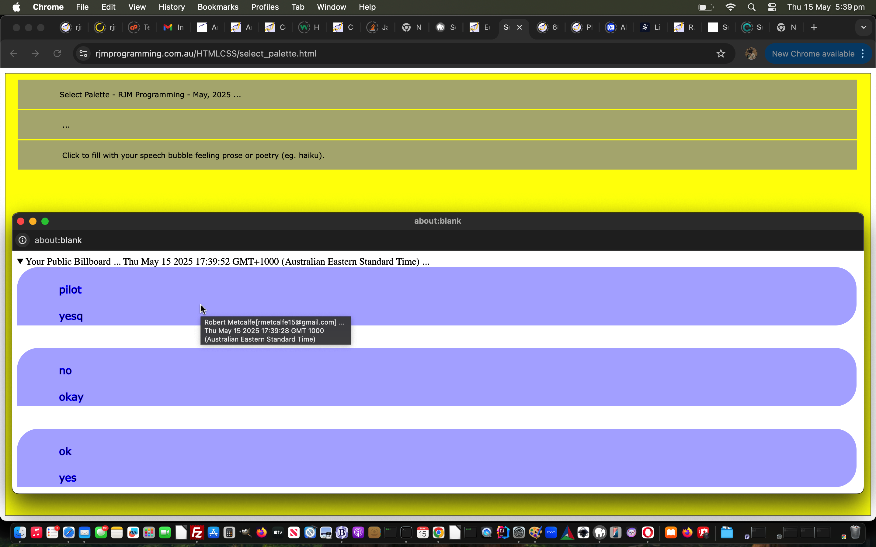

If this was interesting you may be interested in this too.
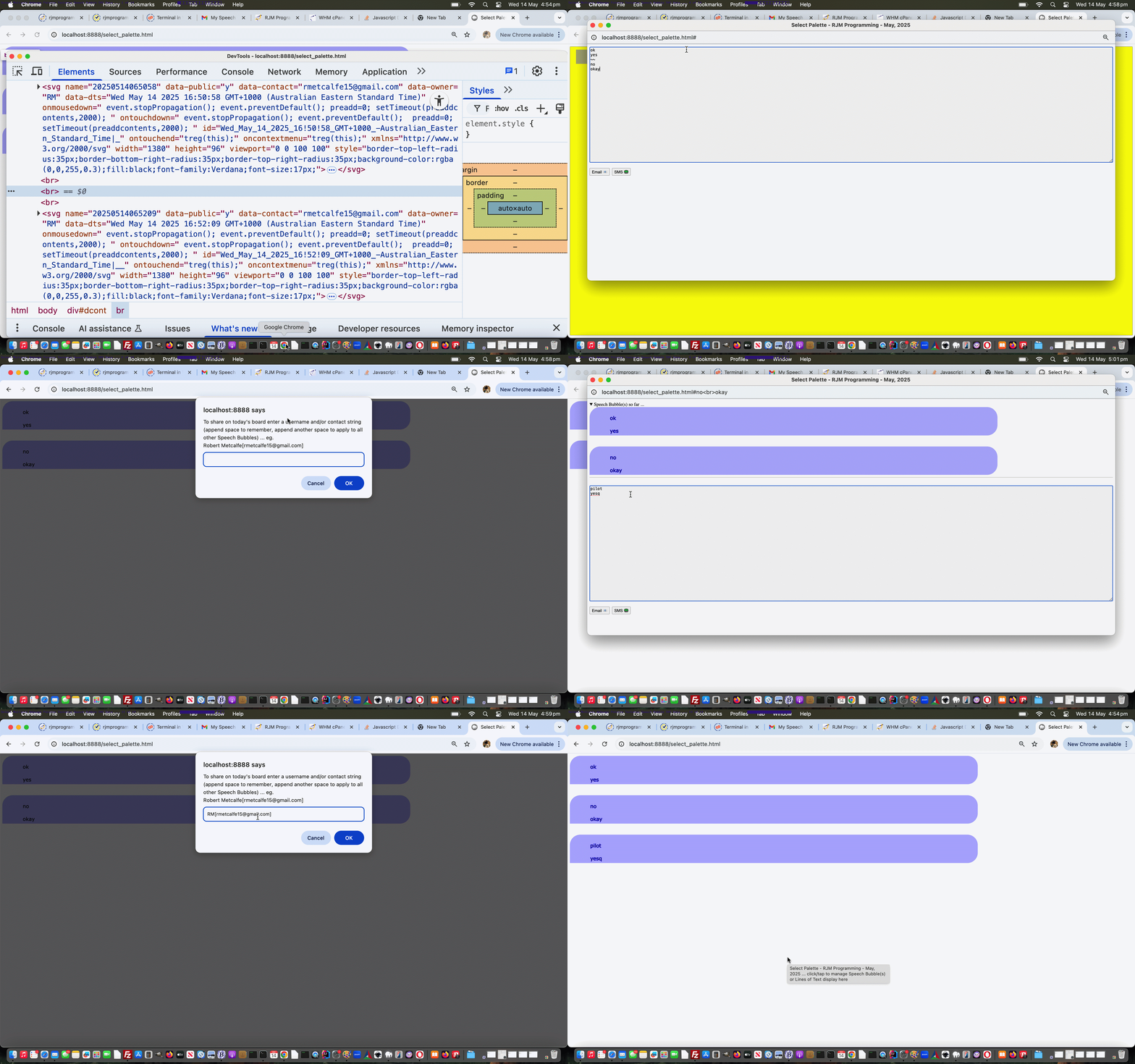

If this was interesting you may be interested in this too.
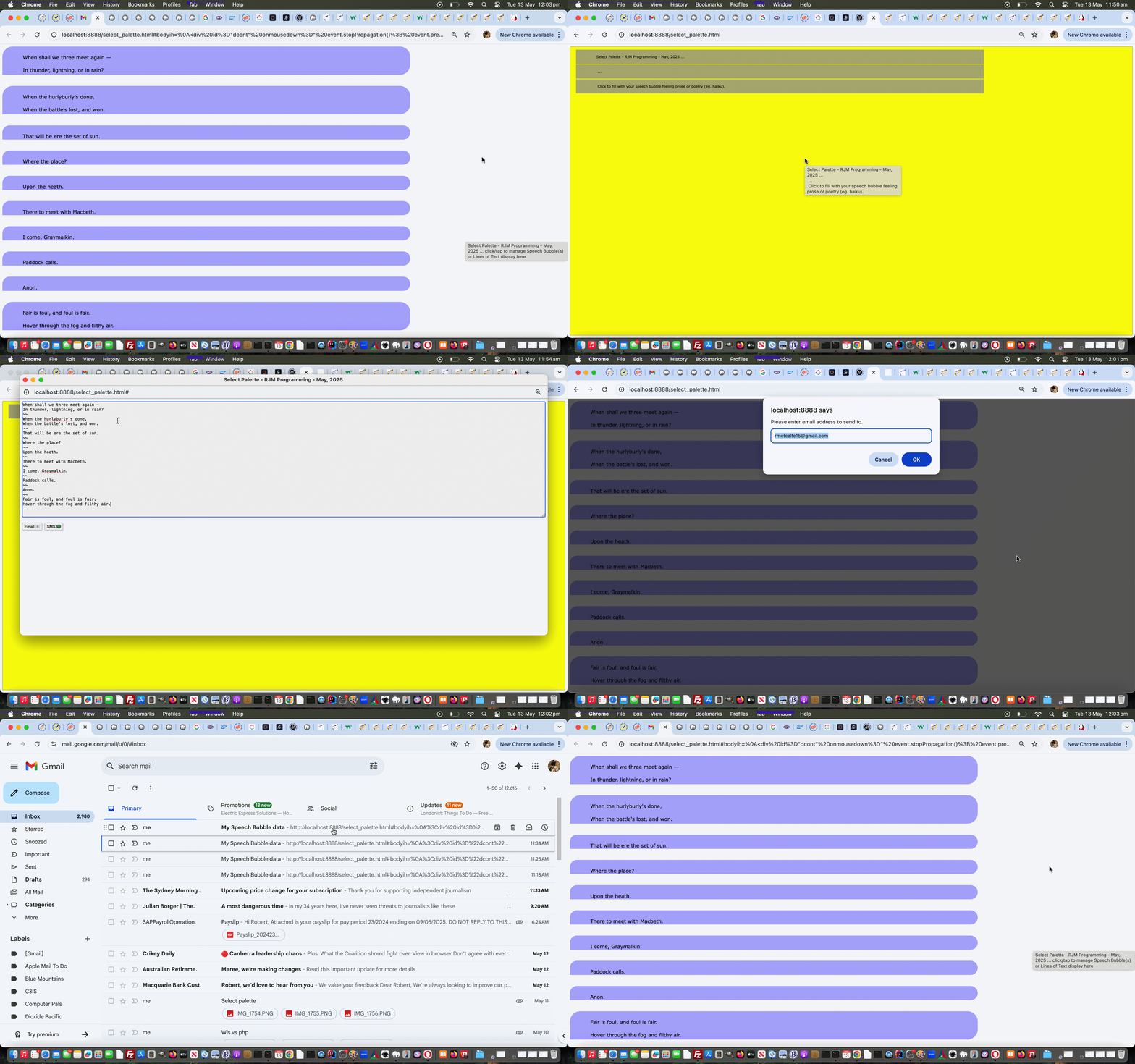
Posted in eLearning, Event-Driven Programming, OOP, Tutorials | Tagged , , , , , , , , , , , , , , , , , , , , , , , , , , , , , , , , , , , , , , , , , , , , , , , , , , , , , , , , , , , , , , , , , , , , , , , , , , , , , , , , , , , , , , , , , , , , , , , , , , , , , , , , , , , , , , , , , , , , , , , , , , , , , , , , , , , , , , , , , , , , , , , , , , , , , , , , , , , , , , , , , , , , , , , , , | Leave a comment

Earth Scanner Lines Tutorial

Earth Scanner Lines Tutorial

Earth Scanner Lines Tutorial

Not everybody is a geography buff. But I’d say more people attended primary school than are geography buffs. And those people may have seen World Maps on the wall, and they were often Mercator Projection maps featuring the usual country and sea boundaries, as well as useful reference lines …

  • lines of latitude, including, in between top “North Pole” 90° N and “South Pole” 90° S bottom …
    1. Arctic Circle 66° 34′ N
    2. Tropic of Cancer 23° 26′ N
    3. Equator 0°
    4. Tropic of Capricorn 23° 26′ S
    5. Antarctic Circle 66° 34′ S
  • meridians of longitude (only the Equator above, is as long as … and in the “Go Figure, Mercator” realms, the North Pole and South Pole are each of zero length, in “non-projection land”), including …
    1. Greenwich Meridian 0°
    2. International Date Line 180° (but in practice, broken up so as not to confuse regarding timezones for some Pacific island countries)

… that become useful as you scan your way around Earth, further to yesterday’s Earth Scanner Primer Tutorial, in our changed second draft Earth Scanner web application.

Stop Press

Couple of points to note …

  1. the linework is just hr (Horizontal rule) elements, which are not the challenge either horizontally or vertically, regarding linework, that any diagonality brings …

  2. the matter of screen width and screen height, which we need to know precisely for the work above, can be more involved to calculate on mobile platforms … we ended up, with great help from this useful link, with this Javascript code …

    var screenwidth=screen.width, screenheight=screen.height;

    var wasthisso='';
    if (navigator.userAgent.match(/Android|BlackBerry|iPhone|iPad|iPod|Opera Mini|IEMobile/i)) {
    try {
    wasthisso=('' + window.orientation).replace(/^0$/g, 'portrait'); //"portrait";
    } catch (ehgfg) {
    wasthisso='';
    }
    if (wasthisso == '') {
    try {
    wasthisso='' + screen.orientation.type; //"portrait";
    } catch (hgfg) {
    wasthisso=('' + window.orientation).replace(/^0$/g, 'portrait'); //"portrait";
    }
    }
    //alert(wasthisso);
    var hdone=false;
    if (wasthisso.indexOf('ortrait') != -1) { // thanks to https://stackoverflow.com/questions/50690191/window-innerheight-returning-wrong-value-in-ios-11
    if (eval('0' + document.documentElement.clientWidth) >= eval('0' + window.innerWidth)) {
    screenwidth=eval('' + document.documentElement.clientWidth);
    screenheight=eval('' + document.documentElement.clientHeight);
    hdone=true;
    } else {
    screenwidth=window.innerWidth;
    }
    if (!hdone) {
    if (eval('0' + document.documentElement.clientHeight) > eval('0' + window.innerHeight)) {
    screenheight=eval('' + document.documentElement.clientHeight);
    } else {
    screenheight=window.innerHeight;
    }
    }
    } else {
    if (eval('0' + document.documentElement.clientWidth) >= eval('0' + window.innerHeight)) {
    screenwidth=eval('' + document.documentElement.clientWidth);
    screenheight=eval('' + document.documentElement.clientHeight);
    hdone=true;
    } else {
    screenwidth=window.innerHeight;
    }
    if (!hdone) {
    if (eval('0' + document.documentElement.clientHeight) > eval('0' + window.innerWidth)) {
    screenheight=eval('' + document.documentElement.clientHeight);
    } else {
    screenheight=window.innerWidth;
    }
    }
    }
    // alert(wasthisso + ' ' + screenwidth + 'x' + screenheight);
    if (1 == 6) {
    documentURL=documentURL + '&nolines=y';
    if (documentURL.indexOf('.html') != -1) {
    location.href=document.URL.replace('.html','.htm');
    }
    }
    }

    … in Earth Scanner Primer Tutorial, in our changed third draft Earth Scanner web application


Previous relevant Earth Scanner Primer Tutorial is shown below.

Earth Scanner Primer Tutorial

Earth Scanner Primer Tutorial

Today we’ve got for you a tutorial that takes bits and pieces from …

… so as to create a new “Earth Scanner” web application in what we like to think of as “the where of life” realms.

In essence this Earth Scanner is pretty simple, so below you can see a first draft, “holus bolus” …


<html>
<head>
<title>Earth Scanner - RJM Programming - February, 2024 ... Thanks to https://github.com/nvkelso/natural-earth-raster/blob/master/50m_rasters/HYP_50M_SR_W/HYP_50M_SR_W.README.html</title>
<style>
#myimg {
clip-path: circle(2% at 800px 700px);
animation:mymove 5s infinite;
-webkit-animation:mymove 5s infinite; /* Safari and Chrome */
}

@keyframes mymove
{
0% { clip-path: circle(2% at 0px 0px) }
100% { clip-path: circle(16% at 140px 140px) }
}

@-webkit-keyframes mymove /* Safari and Chrome */
{
0% { clip-path: circle(2% at 0px 0px) }
100% { clip-path: circle(16% at 140px 140px) }
}
</style>
<script type=text/javascript>
// Deemed unnecessary is ...
// 7% { clip-path: circle(3% at 10px 10px) }
// 14% { clip-path: circle(4% at 20px 20px) }
// 21% { clip-path: circle(5% at 30px 30px) }
// 28% { clip-path: circle(6% at 40px 40px) }
// 35% { clip-path: circle(7% at 50px 50px) }
// 42% { clip-path: circle(8% at 60px 60px) }
// 50% { clip-path: circle(9% at 70px 70px) }
// 57% { clip-path: circle(10% at 80px 80px) }
// 64% { clip-path: circle(11% at 90px 90px) }
// 71% { clip-path: circle(12% at 100px 100px) }
// 78% { clip-path: circle(13% at 110px 110px) }
// 85% { clip-path: circle(14% at 120px 120px) }
// 93% { clip-path: circle(15% at 130px 130px) }

var xp=0, yp=0, num=0;
var fixkeys='<style> #myimg { animation:mymove 5s infinite; -webkit-animation:mymove 5s infinite; } @keyframes mymove' + document.head.innerHTML.split('@keyframes mymove')[1].split('</style>')[0] + ' </style>';
var screenlong=-9, screenlat=-9, askfor=null, enforcedlong=false, enforcedxp=-999;

function scmove() {
var longforce='-999', latforce='-999';
if (screenlong < 0) {
screenlong=eval(360 * screen.width / document.getElementById('myimg').width);
screenlat=eval(180 * screen.height / document.getElementById('myimg').height);
document.getElementById('myimg').onclick=function() { askfor=prompt('Earth Scanner - RJM Programming - February, 2024 ... ' + String.fromCharCode(10) + 'Thanks to https://github.com/nvkelso/natural-earth-raster/blob/master/50m_rasters/HYP_50M_SR_W/HYP_50M_SR_W.README.html ... ' + String.fromCharCode(10) + 'Currently top left of screen is (Longitude,Latitude) ' + '(' + eval(-180 + xp * 360 / 100) + ',' + eval(90 - yp * 180 / 100) + ') and bottom right is (' + eval(-180 + screenlong + xp * 360 / 100) + ',' + eval(90 - screenlat - yp * 180 / 100) + ') and in the middle is (' + eval(-180 + eval(screenlong / 2) + xp * 360 / 100) + ',' + eval(90 - eval(screenlat / 2) - yp * 180 / 100) + ').' + String.fromCharCode(10) + 'Where do you want middle of screen to be in terms of Longitude,Latitude?', ''); };
}
//document.title="window.scrollTo(" + eval(xp * eval('' + document.getElementById('myimg').width) / 100) + "," + eval(yp * eval('' + document.getElementById('myimg').height) / 100) + ")";
if (askfor != null) {
if (askfor.replace('(','').replace(')','').indexOf(',') != -1) {
longforce=askfor.replace('(','').replace(')','').split(',')[0];
latforce=askfor.replace('(','').replace(')','').split(',')[1];
} else if (askfor.replace('(','').replace(')','').indexOf(' ') != -1) {
longforce=askfor.replace('(','').replace(')','').split(' ')[0];
latforce=askfor.replace('(','').replace(')','').split(' ')[1];
}
//xp = eval(((eval(eval('' + longforce) + 180) / 360) * eval('' + document.getElementById('myimg').width) / 100) - 0 * eval(eval(screenlong / 720) * eval('' + document.getElementById('myimg').width) / 100));
//yp = eval(((eval(90 - eval('' + latforce)) / 180) * eval('' + document.getElementById('myimg').height) / 100) + 0 * eval(eval(screenlat / 360) * eval('' + document.getElementById('myimg').height) / 100));
xp = eval(eval(eval('' + longforce) - screenlong / 2 + 180) / 3.60); // * eval('' + document.getElementById('myimg').width) / 100) - 0 * eval(eval(screenlong / 720) * eval('' + document.getElementById('myimg').width) / 100));
yp = eval(eval(90 - eval('' + latforce) - screenlat / 2) / 1.80); // * eval('' + document.getElementById('myimg').height) / 100) + 0 * eval(eval(screenlat / 360) * eval('' + document.getElementById('myimg').height) / 100));
//alert('' + xp + ',' + yp + ' ... ' + "window.scrollTo(" + eval(xp * eval('' + document.getElementById('myimg').width) / 100) + "," + eval(yp * eval('' + document.getElementById('myimg').height) / 100) + ")");
askfor=null;
if (enforcedlong) {
enforcedlong=false;
enforcedxp=xp;
//alert(xp + ' or ' + enforcedxp);
}
}
eval("window.scrollTo(" + eval((enforcedxp > -990 ? enforcedxp : xp) * eval('' + document.getElementById('myimg').width) / 100) + "," + eval(yp * eval('' + document.getElementById('myimg').height) / 100) + ")");
document.getElementById('myimg').title='Earth Scanner - RJM Programming - February, 2024 ... ' + 'Thanks to https://github.com/nvkelso/natural-earth-raster/blob/master/50m_rasters/HYP_50M_SR_W/HYP_50M_SR_W.README.html ... ' + String.fromCharCode(10) + String.fromCharCode(10) + 'Top left of screen is (Longitude,Latitude) ' + '(' + eval(-180 + (enforcedxp > -990 ? enforcedxp : xp) * 360 / 100) + ',' + eval(90 - yp * 180 / 100) + ') and bottom right is (' + eval(-180 + screenlong + (enforcedxp > -990 ? enforcedxp : xp) * 360 / 100) + ',' + eval(90 - screenlat - yp * 180 / 100) + ') and in the middle is (' + eval(-180 + eval(screenlong / 2) + (enforcedxp > -990 ? enforcedxp : xp) * 360 / 100) + ',' + eval(90 - eval(screenlat / 2) - yp * 180 / 100) + ')';
document.title=document.getElementById('myimg').title; //'Top left of screen is (Longitude,Latitude) ' + '(' + eval(-180 + xp * 360 / 100) + ',' + eval(90 - yp * 180 / 100) + ') and bottom right is (' + eval(-180 + screenlong + (enforcedxp > -990 ? enforcedxp : xp) * 360 / 100) + ',' + eval(90 - screenlat - yp * 180 / 100) + ') and in the middle is (' + eval(-180 + eval(screenlong / 2) + (enforcedxp > -990 ? enforcedxp : xp) * 360 / 100) + ',' + eval(90 - eval(screenlat / 2) - yp * 180 / 100) + ')';
if (xp < 95) {
xp+=5;
} else if (yp >= 95 && xp >= 95) {
enforcedxp=-999;
xp=0;
yp=0;
} else {
yp+=5;
xp=0;
}
var xdiff=eval((enforcedxp > -990 ? enforcedxp : xp) * eval('' + document.getElementById('myimg').width) / 100);
var ydiff=eval(yp * eval('' + document.getElementById('myimg').height) / 100);
var startkeys=fixkeys;
var coords=fixkeys.split('px');
for (var ic=0; ic<coords.length; ic+=2) {
if (coords[ic].split(' ')[eval(-1 + coords[ic].split(' ').length)].indexOf('<') == -1) {
//alert('' + xdiff + ',' + ydiff+ ',' + coords[ic].split(' ')[eval(-1 + coords[ic].split(' ').length)]);
startkeys=startkeys.replace(' ' + coords[ic].split(' ')[eval(-1 + coords[ic].split(' ').length)] + 'px', ' ' + eval(xdiff + eval('' + coords[ic].split(' ')[eval(-1 + coords[ic].split(' ').length)])) + 'px');
startkeys=startkeys.replace(' ' + coords[eval(1 + ic)].split(' ')[eval(-1 + coords[eval(1 + ic)].split(' ').length)] + 'px', ' ' + eval(ydiff + eval('' + coords[eval(1 + ic)].split(' ')[eval(-1 + coords[eval(1 + ic)].split(' ').length)])) + 'px');
}
}
//alert(startkeys);
document.getElementById('dstyle').innerHTML=startkeys; //.replace(/mymove/g, 'mymove' + num);
num++;
}

setInterval(scmove, 5000);
document.write("<img src='/HTMLCSS/HYP_50M_SR_W.jpg' id=myimg></img><div id=dstyle></div>");
var latis=location.search.split('latitude=')[1] ? decodeURIComponent(location.search.split('latitude=')[1].split('&')[0]) : '';
var longis=location.search.split('longitude=')[1] ? decodeURIComponent(location.search.split('longitude=')[1].split('&')[0]) : '';
if (latis != '' && longis != '') {
askfor='' + longis + ',' + latis;
} else if (latis != '') {
askfor='-168,' + latis;
} else if (longis != '') {
enforcedlong=true;
askfor='' + longis + ',70';
}
</script>
</head>
<body>
</body>
</html>

… with great thanks to this great resource as the crucial image in our first draft Earth Scanner web application.

Please note using it, it does have onclick logic to specify …

Posted in Animation, eLearning, Event-Driven Programming, Tutorials | Tagged , , , , , , , , , , , , , , , , , , , , , , , , , , , , , , , , , , , , , , , , , , , , , , , , , | Leave a comment

Earth Scanner Primer Tutorial

Earth Scanner Primer Tutorial

Earth Scanner Primer Tutorial

Today we’ve got for you a tutorial that takes bits and pieces from …

… so as to create a new “Earth Scanner” web application in what we like to think of as “the where of life” realms.

In essence this Earth Scanner is pretty simple, so below you can see a first draft, “holus bolus” …


<html>
<head>
<title>Earth Scanner - RJM Programming - February, 2024 ... Thanks to https://github.com/nvkelso/natural-earth-raster/blob/master/50m_rasters/HYP_50M_SR_W/HYP_50M_SR_W.README.html</title>
<style>
#myimg {
clip-path: circle(2% at 800px 700px);
animation:mymove 5s infinite;
-webkit-animation:mymove 5s infinite; /* Safari and Chrome */
}

@keyframes mymove
{
0% { clip-path: circle(2% at 0px 0px) }
100% { clip-path: circle(16% at 140px 140px) }
}

@-webkit-keyframes mymove /* Safari and Chrome */
{
0% { clip-path: circle(2% at 0px 0px) }
100% { clip-path: circle(16% at 140px 140px) }
}
</style>
<script type=text/javascript>
// Deemed unnecessary is ...
// 7% { clip-path: circle(3% at 10px 10px) }
// 14% { clip-path: circle(4% at 20px 20px) }
// 21% { clip-path: circle(5% at 30px 30px) }
// 28% { clip-path: circle(6% at 40px 40px) }
// 35% { clip-path: circle(7% at 50px 50px) }
// 42% { clip-path: circle(8% at 60px 60px) }
// 50% { clip-path: circle(9% at 70px 70px) }
// 57% { clip-path: circle(10% at 80px 80px) }
// 64% { clip-path: circle(11% at 90px 90px) }
// 71% { clip-path: circle(12% at 100px 100px) }
// 78% { clip-path: circle(13% at 110px 110px) }
// 85% { clip-path: circle(14% at 120px 120px) }
// 93% { clip-path: circle(15% at 130px 130px) }

var xp=0, yp=0, num=0;
var fixkeys='<style> #myimg { animation:mymove 5s infinite; -webkit-animation:mymove 5s infinite; } @keyframes mymove' + document.head.innerHTML.split('@keyframes mymove')[1].split('</style>')[0] + ' </style>';
var screenlong=-9, screenlat=-9, askfor=null, enforcedlong=false, enforcedxp=-999;

function scmove() {
var longforce='-999', latforce='-999';
if (screenlong < 0) {
screenlong=eval(360 * screen.width / document.getElementById('myimg').width);
screenlat=eval(180 * screen.height / document.getElementById('myimg').height);
document.getElementById('myimg').onclick=function() { askfor=prompt('Earth Scanner - RJM Programming - February, 2024 ... ' + String.fromCharCode(10) + 'Thanks to https://github.com/nvkelso/natural-earth-raster/blob/master/50m_rasters/HYP_50M_SR_W/HYP_50M_SR_W.README.html ... ' + String.fromCharCode(10) + 'Currently top left of screen is (Longitude,Latitude) ' + '(' + eval(-180 + xp * 360 / 100) + ',' + eval(90 - yp * 180 / 100) + ') and bottom right is (' + eval(-180 + screenlong + xp * 360 / 100) + ',' + eval(90 - screenlat - yp * 180 / 100) + ') and in the middle is (' + eval(-180 + eval(screenlong / 2) + xp * 360 / 100) + ',' + eval(90 - eval(screenlat / 2) - yp * 180 / 100) + ').' + String.fromCharCode(10) + 'Where do you want middle of screen to be in terms of Longitude,Latitude?', ''); };
}
//document.title="window.scrollTo(" + eval(xp * eval('' + document.getElementById('myimg').width) / 100) + "," + eval(yp * eval('' + document.getElementById('myimg').height) / 100) + ")";
if (askfor != null) {
if (askfor.replace('(','').replace(')','').indexOf(',') != -1) {
longforce=askfor.replace('(','').replace(')','').split(',')[0];
latforce=askfor.replace('(','').replace(')','').split(',')[1];
} else if (askfor.replace('(','').replace(')','').indexOf(' ') != -1) {
longforce=askfor.replace('(','').replace(')','').split(' ')[0];
latforce=askfor.replace('(','').replace(')','').split(' ')[1];
}
//xp = eval(((eval(eval('' + longforce) + 180) / 360) * eval('' + document.getElementById('myimg').width) / 100) - 0 * eval(eval(screenlong / 720) * eval('' + document.getElementById('myimg').width) / 100));
//yp = eval(((eval(90 - eval('' + latforce)) / 180) * eval('' + document.getElementById('myimg').height) / 100) + 0 * eval(eval(screenlat / 360) * eval('' + document.getElementById('myimg').height) / 100));
xp = eval(eval(eval('' + longforce) - screenlong / 2 + 180) / 3.60); // * eval('' + document.getElementById('myimg').width) / 100) - 0 * eval(eval(screenlong / 720) * eval('' + document.getElementById('myimg').width) / 100));
yp = eval(eval(90 - eval('' + latforce) - screenlat / 2) / 1.80); // * eval('' + document.getElementById('myimg').height) / 100) + 0 * eval(eval(screenlat / 360) * eval('' + document.getElementById('myimg').height) / 100));
//alert('' + xp + ',' + yp + ' ... ' + "window.scrollTo(" + eval(xp * eval('' + document.getElementById('myimg').width) / 100) + "," + eval(yp * eval('' + document.getElementById('myimg').height) / 100) + ")");
askfor=null;
if (enforcedlong) {
enforcedlong=false;
enforcedxp=xp;
//alert(xp + ' or ' + enforcedxp);
}
}
eval("window.scrollTo(" + eval((enforcedxp > -990 ? enforcedxp : xp) * eval('' + document.getElementById('myimg').width) / 100) + "," + eval(yp * eval('' + document.getElementById('myimg').height) / 100) + ")");
document.getElementById('myimg').title='Earth Scanner - RJM Programming - February, 2024 ... ' + 'Thanks to https://github.com/nvkelso/natural-earth-raster/blob/master/50m_rasters/HYP_50M_SR_W/HYP_50M_SR_W.README.html ... ' + String.fromCharCode(10) + String.fromCharCode(10) + 'Top left of screen is (Longitude,Latitude) ' + '(' + eval(-180 + (enforcedxp > -990 ? enforcedxp : xp) * 360 / 100) + ',' + eval(90 - yp * 180 / 100) + ') and bottom right is (' + eval(-180 + screenlong + (enforcedxp > -990 ? enforcedxp : xp) * 360 / 100) + ',' + eval(90 - screenlat - yp * 180 / 100) + ') and in the middle is (' + eval(-180 + eval(screenlong / 2) + (enforcedxp > -990 ? enforcedxp : xp) * 360 / 100) + ',' + eval(90 - eval(screenlat / 2) - yp * 180 / 100) + ')';
document.title=document.getElementById('myimg').title; //'Top left of screen is (Longitude,Latitude) ' + '(' + eval(-180 + xp * 360 / 100) + ',' + eval(90 - yp * 180 / 100) + ') and bottom right is (' + eval(-180 + screenlong + (enforcedxp > -990 ? enforcedxp : xp) * 360 / 100) + ',' + eval(90 - screenlat - yp * 180 / 100) + ') and in the middle is (' + eval(-180 + eval(screenlong / 2) + (enforcedxp > -990 ? enforcedxp : xp) * 360 / 100) + ',' + eval(90 - eval(screenlat / 2) - yp * 180 / 100) + ')';
if (xp < 95) {
xp+=5;
} else if (yp >= 95 && xp >= 95) {
enforcedxp=-999;
xp=0;
yp=0;
} else {
yp+=5;
xp=0;
}
var xdiff=eval((enforcedxp > -990 ? enforcedxp : xp) * eval('' + document.getElementById('myimg').width) / 100);
var ydiff=eval(yp * eval('' + document.getElementById('myimg').height) / 100);
var startkeys=fixkeys;
var coords=fixkeys.split('px');
for (var ic=0; ic<coords.length; ic+=2) {
if (coords[ic].split(' ')[eval(-1 + coords[ic].split(' ').length)].indexOf('<') == -1) {
//alert('' + xdiff + ',' + ydiff+ ',' + coords[ic].split(' ')[eval(-1 + coords[ic].split(' ').length)]);
startkeys=startkeys.replace(' ' + coords[ic].split(' ')[eval(-1 + coords[ic].split(' ').length)] + 'px', ' ' + eval(xdiff + eval('' + coords[ic].split(' ')[eval(-1 + coords[ic].split(' ').length)])) + 'px');
startkeys=startkeys.replace(' ' + coords[eval(1 + ic)].split(' ')[eval(-1 + coords[eval(1 + ic)].split(' ').length)] + 'px', ' ' + eval(ydiff + eval('' + coords[eval(1 + ic)].split(' ')[eval(-1 + coords[eval(1 + ic)].split(' ').length)])) + 'px');
}
}
//alert(startkeys);
document.getElementById('dstyle').innerHTML=startkeys; //.replace(/mymove/g, 'mymove' + num);
num++;
}

setInterval(scmove, 5000);
document.write("<img src='/HTMLCSS/HYP_50M_SR_W.jpg' id=myimg></img><div id=dstyle></div>");
var latis=location.search.split('latitude=')[1] ? decodeURIComponent(location.search.split('latitude=')[1].split('&')[0]) : '';
var longis=location.search.split('longitude=')[1] ? decodeURIComponent(location.search.split('longitude=')[1].split('&')[0]) : '';
if (latis != '' && longis != '') {
askfor='' + longis + ',' + latis;
} else if (latis != '') {
askfor='-168,' + latis;
} else if (longis != '') {
enforcedlong=true;
askfor='' + longis + ',70';
}
</script>
</head>
<body>
</body>
</html>

… with great thanks to this great resource as the crucial image in our first draft Earth Scanner web application.

Please note using it, it does have onclick logic to specify …

Posted in Animation, eLearning, Tutorials | Tagged , , , , , , , , , , , , , , , , , , , , , , , | Leave a comment

Country Quizzes Mobile Makeover Tutorial

Country Quizzes Mobile Makeover Tutorial

Country Quizzes Mobile Makeover Tutorial

It’s interesting, when making a web application like the Country Quiz ones of yesterday’s Country Quizzes Makeover Tutorial how when making it better for mobile platforms, with their smaller device widths, you often end up wanting to increase font sizes. Go Figure!

Well, we figure … personally … it revolves around how the mobile platform keyboards take up about a third of a iPhone sized device screen.

You can fight it, or get flexible, and we’ve decided on the latter, and taken inspiration from this scene of Hitch … keep it small, keep it simple, and don’t think you can just programmatically scroll everywhere you might want to on any given webpage using mobile platforms.

And this thought pattern set us at our ease. Why have we fought these fundamentals, so often in the past? It pans out, due to keyboard usage, the crux of the quizzes in “mobile land” can be traced down to a very small area of the “starting out” onload event screen content, and we just need to enhance what is shown in that area which is the “tweeners area” in among where …

  • table header cells “th” (2x) meet … and also meet …
  • top part of where table data cells “td” (2x) meet

… because of that zooming in to focussed input type=text textboxes that goes on with mobile platforms. And in this scenario …


<table>
<tr><th>Country</th><th>X[Modes of Use Dropdown]</th></tr>
<tr><td>[Country Dropdown]</td><td>[Text Box]</td></tr>
</table>

X marks the spot where the score and wrong answer explanations could be temporarily (for 20 seconds at a time) copied to, to allow the most important information to the user regarding the quiz be “above the fold” for the user, perhaps doing away with any need for the mobile user to scroll anywhere, for the running of their basic quiz incarnation. This “zooming” replaces the need, we are often feeling, on mobile platforms, for larger font size usage.

Take a look at our external Javascript function to cover the checking of answers made at the Country Currency Quiz, and map into your mind X with <span id=container style=font-size:8px;></span> as you analyze


function currencycheck(inv) {
if (inv.value != '') {
var suffix='';
goes++;
if (ourcomp(inv.value,document.getElementById('country').value)) {
score++;
} else if (document.getElementById(countryids[choice]).outerHTML.indexOf('<p') == 0 || document.getElementById(countryids[choice]).outerHTML.indexOf('<span') == 0) {
suffix=' The country ' + document.getElementById(countryids[choice]).id.replace(/_/g,' ') + ' (' + countrycodes[choice] + ') <BR>represented by <span>' + document.getElementById(countryids[choice]).innerHTML + '</span> <BR>has the currency ' + document.getElementById(countryids[choice]).title;
} else {
suffix=' The country ' + document.getElementById(countryids[choice]).id.replace(/_/g,' ') + ' (' + countrycodes[choice] + ') <BR>represented by <img src=' + document.getElementById(countryids[choice]).src + '></img> <BR>has the currency ' + document.getElementById(countryids[choice]).title;
}
if (document.getElementById('ssuffix')) {
document.gteElementById('ssuffix').innerHTML=suffix; suffix='';
}
document.getElementById('score').innerHTML='Score: ' + score + ' Goes: ' + goes + suffix; choose();
if (suffix != '' && navigator.userAgent.match(/Android|BlackBerry|iPhone|iPad|iPod|Opera Mini|IEMobile/i)) {
//document.body.style.zoom='1';
//window.scrollTo(0,0);
if (document.getElementById('container')) {
document.getElementById('country').scrollIntoView();
if (document.getElementById('ssuffix')) {
document.getElementById('container').innerHTML=(document.getElementById('score').innerHTML + '&nbsp;&nbsp;').replace('The country ', '<br>The country ').replace('has the currency ', 'has the currency <br>');
} else {
document.getElementById('container').innerHTML=(document.getElementById('score').innerHTML + '&nbsp;&nbsp;').replace('The country ', '<br>The country ').replace('has the currency ', 'has the currency <br>');
}
if (document.getElementById('thleft')) {
document.getElementById('thleft').scrollIntoView();
} else {
document.getElementById('container').scrollIntoView();
}
setTimeout(nocontainer, 20000);
} else {
document.getElementById('myh1').scrollIntoView();
}
}

}
}

function nocontainer() {
document.getElementById('container').innerHTML='';
}

Again, with this “peer to peer” web application suite they share the use of …


Previous relevant Country Quizzes Makeover Tutorial is shown below.

Country Quizzes Makeover Tutorial

Country Quizzes Makeover Tutorial

It’s been more than a year since a visit to the Country Quiz web applications of Country Quizzes Wikipedia Image Integration Tutorial, involving “the we are fam-il-y” style

  • Country Capitals Quiz
  • Country Currency Quiz
  • Country Flags Quiz

… and some of us agree that it can be the sure case that

moss grows fat on a rolling stone

… and so, we’re back!

Since then, on a revisit, we thought the optional quiz “informing options” could be expanded upon from the existant …

  • YouTube Video
  • Wikipedia Images … to also include, as of today …
  • GeoJson World Map
  • TimeZone Places … and …
  • Google Image Chart Map Chart

Data wise we started collecting Country ISO-3166 2 character Codes …

<?php

$foundcc=''; // global

// later used ...

$postbits=explode("<", str_replace('<span>','',str_replace('</span>','',$ctysarr[$ihj])));
if (yourflag($postbits[0]) != '') {
// blah blah ...
$scriptis=str_replace("</scr" . "ipt>", " countries.push(\"" . str_replace("_", " ", $postbits[0]) . "\"); countryids.push(\"" . $idis . "\"); countryccs.push(\"" . $foundcc . "\"); num++; \n</scr" . "ipt>", $scriptis);
// blah blah ...
}

function yourflag($incn) {
global $iso_country_codes, $foundcc;
for ($jk=1; $jk<sizeof($iso_country_codes); $jk+=2) {
if (strtoupper($iso_country_codes[$jk]) == strtoupper($incn)) {
$foundcc=strtoupper($iso_country_codes[-1 + $jk]);
return orflag(strtoupper($iso_country_codes[-1 + $jk]));
}
}
return '';
}

function orflag($incc) {
global $foundcc;
$uretv='';
$lri=["A","B","C","D","E","F","G","H","I","J","K","L","M","N","O","P","Q","R","S","T","U","V","W","X","Y","Z"];
$dri=["127462","127463","127464","127465","127466","127467","127468","127469","127470","127471","127472","127473","127474","127475","127476","127477","127478","127479","127480","127481","127482","127483","127484","127485","127486","127487"];
for ($jjm=0; $jjm<strlen($incc); $jjm++) {
for ($jm=0; $jm<sizeof($lri); $jm++) {
if (strtoupper(substr(substr($incc,$jjm),0,1)) == $lri[$jm]) {
$uretv.='&#' . $dri[$jm] . ";";
$foundcc=$incc;
}
}
}
return $uretv;
}


?>

… and found this to be a wise move, not just to do with linking to some of these new “informational helpers” above, but also with ideas into the future, we reckon, the main reason being that you can rely on the ISO-3166 2 character codes, while there are a wide and varied set of Country Names out there.

With this “peer to peer” web application suite they share the use of …


Previous relevant Country Quizzes Wikipedia Image Integration Tutorial is shown below.

Country Quizzes Wikipedia Image Integration Tutorial

Country Quizzes Wikipedia Image Integration Tutorial

We wanted to offer some optional Wikipedia Image lookup functionality as an alternative to the optional existent YouTube Video lookup functionality in the …

… peer to peer linked (via dropdown selection) web applications we’ve talked about in the past with Country via Capital Placeholder Quiz Game Tutorial.

Before this idea came to us, the way functionality was optional led us to use an input type=checkbox to represent this idea. Even with the new Wikipedia Image choice, to us, this does not change, as it’s optional.

But the choice between the two optionals is a choice, and so … we have to choose among …

… usage for this second-tier user choice. Well, the checkbox buttons are definitely inferior to the others in that we only want to present one optional lookup type of content, as well as the awkwardness of two checkboxes, horizontally, in a row, presentation and UX-wise. Now that leaves dropdowns versus radio buttons. Most of the time we prefer the former by a long way, but because there are only two choices and we’d prefer a horizontal display that is “all seen” (even on mobile), today, we’ve plumped for radio buttons, but not used, perhaps, the way you might be more familiar with, within a form and using a shared name attribute passed along with a value through to the “called”. No, we use the onclick event of each radio button to glean the choice without any HTML form help. See relevant changed code from the peer to peer shared and modified country_quiz.js external Javascript …

<script type=’text/javascript’>

function check(inv) {
var ourcis="";
if (inv.value != "") {
if (document.URL.indexOf('_flag_') != -1) {
if (document.getElementById('fav_opt').value == 'wi') {
ourcis="//www.rjmprogramming.com.au/PHP/fgc/?tzexact=" + encodeURIComponent(document.getElementById(countryids[choice]).title.replace(/\ /g,'_')) + "&tznickname=" + encodeURIComponent(document.getElementById(countryids[choice]).title.replace(/\ /g,'_'));
} else {

ourcis="//www.rjmprogramming.com.au/HTMLCSS/karaoke_youtube_api.htm?emoji=on&nokaraoke=y&youtubeid=" + encodeURIComponent(" flag of " + document.getElementById(countryids[choice]).title);
}
flagcheck(inv);
} else if (document.URL.indexOf('_capital_') != -1) {
if (document.getElementById('fav_opt').value == 'wi') {
ourcis="//www.rjmprogramming.com.au/PHP/fgc/?tzexact=" + encodeURIComponent(document.getElementById(countryids[choice]).id.replace(/\ /g,'_')) + "&tznickname=" + encodeURIComponent(document.getElementById(countryids[choice]).id.replace(/\ /g,'_'));
} else {

ourcis="//www.rjmprogramming.com.au/HTMLCSS/karaoke_youtube_api.htm?emoji=on&nokaraoke=y&youtubeid=" + encodeURIComponent(" capital of " + document.getElementById(countryids[choice]).id.replace(/_/g,' '));
}
capitalcheck(inv);
} else if (document.URL.indexOf('_currency_') != -1) {
if (document.getElementById('fav_opt').value == 'wi') {
ourcis="//www.rjmprogramming.com.au/PHP/fgc/?tzexact=" + encodeURIComponent(document.getElementById(countryids[choice]).id.replace(/\ /g,'_')) + "&tznickname=" + encodeURIComponent(document.getElementById(countryids[choice]).id.replace(/\ /g,'_'));
} else {

ourcis="//www.rjmprogramming.com.au/HTMLCSS/karaoke_youtube_api.htm?emoji=on&nokaraoke=y&youtubeid=" + encodeURIComponent(" currency of " + document.getElementById(countryids[choice]).id.replace(/_/g,' '));
}
currencycheck(inv);
}
if (trjm != null) {
document.getElementById('iback').src=ourcis;
document.getElementById('iback').style.display='block';
}
}
}

function ronclk(cv) {
var wasv=document.getElementById('fav_opt').value;
if (wasv == 'yv' && cv != 'yv') {
document.getElementById('fav_opt').value='wi';
} else if (wasv == 'wi' && cv != 'wi') {
document.getElementById('fav_opt').value='yv';
}
}


function andquizthen() {
// xpreandquizthen();
if (trjm == null) {
trjm=document.getElementsByTagName('h3')[0];
if (trjm != null) {
trjm.innerHTML+=' <input onchange=" if (trjm == null) { trjm=this; } else { trjm=null; } ifon(); " type="checkbox" name="youtube" id="youtube" value="Optional YouTube Video lookups" checked>Optional <input type=hidden id=fav_opt value=yv></input><input onclick=ronclk("yv"); type="radio" id="yv" name="fav_opt" value="YouTube Video" checked><label for="yv">YouTube <font size=1>Video</font></label><!--br--><input onclick=ronclk("wi"); type="radio" id="wi" name="fav_opt" value="Wikipedia Images"><label for="wi">Wikipedia <font size=1>Images</font></label>';
document.body.innerHTML+="<div id=ourcanvas><iframe id='iback' style='height:700px;width:100%;display:none;background-color:transparent;border:7px solid lightblue;' src='//www.rjmprogramming.com.au'></iframe></div><div id=dstyle style=display:none;></div><div id=stz style=display:none;></div><input id=addthis type=hidden value=''></input>";
choose();
}
}
}

</script>


Previous relevant Country via Capital Placeholder Quiz Game Tutorial is shown below.

Country via Capital Placeholder Quiz Game Tutorial

Country via Capital Placeholder Quiz Game Tutorial

Our latest favourite HTML styling feature is the HTML placeholder attribute. We like its …

  • ability to be a replacement for a label or caption, especially when designing an HTML form, and hence, saving space
  • similar ability to be able to direct a user via a default suggestion
  • use that we apply with it today, is to dynamically reveal an input type=text box value, and gradually, with an effect a bit like an HTML marquee element

… its transparency a great advantage that we are just starting out on a quest to realize how using it can help.

Today, we add a “Country via (a placeholder revealed) Capital” block of functionality onto what we’d already coded for when we presented Country Quiz Game Suite Google Geo Chart Javascript Tutorial.

There’s no rocket science here, and no need for anything new with content, just a rearrangement of display features, but we do quite like this slightly typewriterish effect that may remind you of when we presented HTML/Javascript Multiple Choice Quiz Reveal Tutorial. In practical terms, imagine (some of) the (relevant) innards of a Javascript function fit


var anal=0, capis='';
function fit() {
if (eval(-1 + anal) < capis.length) {
document.getElementById('icapital').placeholder+=capis.substring(anal,eval(1 + anal)).replace('_',' ');
anal++;
setTimeout(fit,1500);
}
}

If you want to try this new bit of functionality, try this live run with underlying PHP country_capital_quiz.php code that changed in this way.


Previous relevant Country Quiz Game Suite Google Geo Chart Javascript Tutorial is shown below.

Country Quiz Game Suite Google Geo Chart Javascript Tutorial

Country Quiz Game Suite Google Geo Chart Javascript Tutorial

Our blog posting titles lately (most recently Country Quiz Game Suite Google Geo Chart Post Tutorial) have used the word “suite” for describing some “peer to peer” web applications that can navigate from one to the other with our Country Quiz game regarding …

  • Capitals
  • Flags
  • Currencies

… and we used that first “Capitals” web application of the “suite” (as the guinea pig) to iron out issues related to our additional contextual Google Chart Geo Chart HTML iframe “helper”. We had it in our mind, in order of preference, we’d like to present this last “bringing it all together” blog posting showing the whole “suite” with this new functionality, that we would …

  • change the common country_quiz.js featuring these changes external Javascript that is shared throughout the suite of web applications, taking what was involved with changes to country_capital_quiz.php as the basis for this (to the point where country_capital_quiz.php could look “pared back” almost to the way it looked a long time ago) … or …
  • for each of the other two web applications piece equivalent bits of code into those two country_flag_quiz.php and country_currency_quiz.php to make them work along with the original country_capital_quiz.php

Alas, trying that first option, we believe we ran into timing issues related to when the external Javascript is “pulled in” and we couldn’t get that method to work, and so … boo, hoo … we settled for the second solution. Not bad, but not as aesthetically pleasing or generic as the way some generic external Javascript could be modelled to do, like, 95% of what is needed to make that Google Chart Geo Chart functionality work. Anyway, we may end up revisiting that external Javascript which has the intended code (but prefixed by an “x” and/or commented out) still there for a future “Eureka” moment, we’re hoping. Perhaps it relates to the defer method of calling this external Javascript.

So, less generic, but instructive, in any case, crystallizing commonalities (or not … eg. the flags web application should not have an active onchange event Geo Chart bit of logic attached) and so that leaves us with our changed live run link, featuring these changes inspired by making …

… fit into this similar “suite” mode of thinking regarding Country Quiz additional (contextual) Google Chart Geo Chart functionality.

Recapping (why we’ve been referring to “suite”), these “peer to peer” web applications navigate to each other by the changing value to an HTML select element “dropdown” (and kicking off the onchange event navigation logic) the look of which, they all share.


Previous relevant Country Quiz Game Suite Google Geo Chart Post Tutorial is shown below.

Country Quiz Game Suite Google Geo Chart Post Tutorial

Country Quiz Game Suite Google Geo Chart Post Tutorial

If you read yesterday’s Country Quiz Game Suite Google Geo Chart Tutorial as shown below, why, right there and then, didn’t we apply these changes (to the “Capital” web application) onto the whole suite of Country Quizzes, those being …

  • Capital
  • Flag
  • Currency

? Well, there’s another matter to attend to. What do you think would happen if you quizzed away for, say, ten minutes? We think our additional Google Chart Geo Chart bit would “fall over” … that’s what programmer’s say when there is a weakness (and/or a bug) to do with “not catering for” untoward scenarios. The reason it would “fall over”, we believe, is that, eventually, the number of countries you string along adding to the length of the URL you push into that Google Chart Geo Chart’s HTML iframe element would push it over the length limit for (form method=) “GET” URLs, and then this, albeit optional, functionality would become unstable. Even though the functionality is optional, if you keep ignoring such issues at the sidelines of your plans, you are likely to get lazy and produce results that disappoint your more adventurous users.

So here is what we are going to do. You see how we said ‘(form method=) “GET” URLs’ above?

  1. we don’t have an HTML form … but you could … and to simulate the stringing together of a URL and placing it, Javascript DOM-wise, into the src property of the HTML iframe, is to have an HTML form with input elements whose name properties point at the ?/&[name]=[value] and value properties … doh … point at ?/&[name]=[value] and have a method=”GET” action=http://www.rjmprogramming.com.au/PHP/GeoChart/geo_chart.php target=[nameOfRelevantIframe] … or …
  2. do everything the same as above except that method=”POST” and in this way there are much less stringent data length restrictions … you’ll be quizzing until dinner time … hey, why aren’t you making dinner?!

We’re going to go from the stringing a URL together to passing that “stringed together URL” as a parameter into a pretty generic Javascript function as per …


function checkforpost(insg, owhere) {
var outs=insg, fbits='<form style=display:none; target=\"myipost\" method=\"POST\" action=\"http://www.rjmprogramming.com.au/PHP/GeoChart/geo_chart.php\"><input type=submit id=myspost value=Submit></input><input name=wellinever value=y type=hidden></input></form>';
if (insg.length > 950) {
var outarr=insg.split('#')[0].split('?');
if (outarr.length > 1) {
var outarrtwo=outarr[1].split('&'), oath;
for (var im=0; im<outarrtwo.length; im++) {
oath=outarrtwo[im].split('=');
fbits=fbits.replace('</form>','<input type=hidden name=' + oath[0] + ' value=\"' + (oath[1]) + '\"></input></form>');
}
}
if (owhere == null) {
owhere=document.getElementById('mydpost');
if (owhere == null) {
if (document.getElementById('mydpost')) {
document.getElementById('mydpost').innerHTML=fbits;
setTimeout(andlater,1500);
outs=\"#\";
} else {
document.body.innerHTML+='<div id=mydpost>' + fbits + '</div>';
setTimeout(andlater,1500);
outs=\"#\";
}
} else {
owhere.innerHTML=fbits;
setTimeout(andlater,1500);
outs=\"#\";
}
} else {
owhere.innerHTML=fbits;
setTimeout(andlater,1500);
outs=\"#\";
}
}
return outs;
}
function andlater() {
document.getElementById('myspost').click();
}

… to cater for lots of quizzing.

And so that leaves us with our changed country_capital_quiz.php (with this live run link), featuring these changes.


Previous relevant Country Quiz Game Suite Google Geo Chart Tutorial is shown below.

Country Quiz Game Suite Google Geo Chart Tutorial

Country Quiz Game Suite Google Geo Chart Tutorial

We think there are several interesting thing about Charts …

  • they are a way to visualise mathematical ideas, which is not always easy
  • they interface really well with spreadsheets
  • in the case of Google Charts, especially with their Geo Chart and Map Chart, there is a great link to geography
  • they can simplify complex data
  • they can put trends into an easily digestible graphical form
  • they can show the distribution of data

… and we want to use that third point above today to make use of the brilliant Google Chart Geo Chart to add context to our Flags and Currency and Capital Country Quiz game we created when we last presented Country Quiz Game Suite Google Geo Chart Tutorial, as shown below.

The point here is that many of us struggle to locate all the countries of the world you can think of, but isn’t it of interest for us all to get better at this, if the dream of the Internet as the “Superhighway” of Knowledge and Information can improve as a force for good. Can we all get back that idea from those earlier times, and get back to tackling problems in an International framework, where every good idea has a chance to be expressed, and heard?

Anyway, that last change to Geo Chart interfacing got us to this point where we can highlight one or several countries (or regions), and not display that (default) legend, as we set up when we presented Country Quiz Game Suite Google Geo Chart Tutorial. We’ll buy into that today with our changed country_capital_quiz.php (with this live run link), featuring these changes.


Previous relevant Country Quiz Game Suite Google Geo Chart Tutorial is shown below.

Country Quiz Game Suite YouTube Tutorial

Country Quiz Game Suite YouTube Tutorial

Today we are adding optional functionality to our previous web application from Country Quiz Game Suite Tutorial as shown below, and so it seems apt that we add one word for the title of today’s tutorial called “Country Quiz Game Suite YouTube Tutorial”, and that added word is “YouTube”, the biggest repository of videos in the online world.

So we are trying to spice up the “dry” look of the “Country Quiz Game Suite” of web applications by adding optional lookups of YouTube so that the user can choose to watch a video about the last question that was asked about in the quiz. Is there a reason to use a “YouTube” search for this, rather than a search engine search? For us, yes, and this can be put down to the wonders of the YouTube API designed for embedding in HTML iframe elements, which you can read a thread of blog posts about from Karaoke via YouTube API in Iframe Email Tutorial down. This ability is a huge UX positive for use of these web applications, on mobile platforms in particular, because the YouTube video “interface” parts of the webpage can be placed on the webpage the user is currently using, rather than having to open any new windows, and have the user be in danger of “losing the plot”.

Added to that advantage is the way the user can do research and development on topics that may interest them. To us, the most important point here.

So far we’ve talked about what the changes involve, and now we’ll turn our attention to how these changes were achieved. In broad brush terms …

  • we introduce new external Javascript you could call country_quiz.js called by the parent …

    … using a call like …

  • <script type='text/javascript' src='country_quiz.js' defer='defer'></script>
  • the defer HTML script tag attribute used to delay its loading to the end of loading, and also placed so that …
  • the call of the external Javascript is placed after local Javascript script tag client logic, because …
  • we “overload” the local Javascript “function check()” with a version from the external Javascript country_quiz.js, and we’ve discussed this Javascript style of overloading, before, when we presented Javascript Function Overload Primer Tutorial (where we overloaded the “encodeURIComponent” method) … and in that …
  • external Javascript country_quiz.js “function check()” potentially loads YouTube API functionality to an HTML iframe element which was first created via …
  • a one off setTimeout piece of logic is called by the external Javascript country_quiz.js to …
    • append the HTML for that YouTube API HTML iframe “container” element to document.body
    • append to the first HTML h3 element an HTML input type=checkbox, initially checked, toggling the use of that option YouTube API (to HTML iframe element) functionality

    … this setTimeout methodology remaining as independent from any potential logic clashes with parent HTML Javascript onload event logic

    Nothing changes about the peer to peer nature of this “Country Quiz Game Suite” of web applications, so we encourage you to try any/all of them … let’s try … flags.


    Previous relevant Country Quiz Game Suite Tutorial is shown below.

    Country Quiz Game Suite Tutorial

    Country Quiz Game Suite Tutorial

    Think we may have done a (web application software) set before, but honestly cannot locate it, but in any case we are here today to tell you about one of the joys of server side programming, in our case PHP.

    That joy, for us, is when you get into a pattern of completely peer to peer software components, in our case PHP serverside web applications. What do we mean by peer to peer in the way we feel about the thought? It means that several, usually small, completely independent web applications can …

    • as such, be easily unit tested within themselves … but …
    • they each have a similar, and really easy, approach to, just right at the end of coding … ie. when they are all individually coded … link them to be pointable at each other “peer to peer” … guess the difference here, unlike our penchant for “parent/child” (which we are also very fond of), each web application component is independent and of “equal” status in our tiny little woooorrrrrrlllld!

    … and this really appeals to us. Sometimes such an arrangement can be thought of as a “suite” of web applications (or programs).

    So what is that really simple mechanism of linking …

    ? We just have a rearranged HTML select (dropdown) element as below (exemplified below for the “Country Capital Quiz”) …


    <select onchange=' location.href="http://www.rjmprogramming.com.au/PHP/country_" + this.value.toLowerCase() + "_quiz.php"; '><option value=Capital>Capital</option><option value=Currency>Currency</option><option value=Flag>Flag</option></select>

    … but just arrange for the “home” top HTML option element to point at the quiz theme of interest for that piece of web application PHP software.

    And the placement of such a dropdown? Well, we often annoy our HTML h1 elements with such dropdowns, but we’ve been a little more UXy today, by replacing an otherwise less dynamic (HTML (table) th element) heading (single word), with something dynamic, and perhaps useful, to some quizzer users out there in “net” land!

    And this is what we like to think of as “clobbering” (but we encourage you to think of a less aggressive word perhaps) something not very dynamic with something dynamic, but optionally so, in that it is up to the user whether they make use of the added functionality, or not, is another way “some of us we like to roll”.

    Now, perhaps you are thinking it rather cheeky to say that this is so peer to peer with the quiz concepts being so different, and yes, that is so, but what does bring things together is the generosity of the “net” and its data resources to find out information, so, we’d like to thank …

    • Country Flag Quiz … thanks to Tiki Wiki CMS … effectively giving up a country list to work with … and …
    • Country Currency Quiz … thanks to this link links countries to currencies (and (3 letter) country codes and (3 letter) currency codes) … and …
    • Country Capital Quiz … thanks to this link links countries to capitals

    If you don’t have an interest in a server side language like PHP to glean such information, please consider Ajax programming techniques to be able to (just) stick with HTML and Javascript and CSS (client side) coding. But if you do … your PHP homework for today is to read about the file_get_contents method.


    Previous relevant Country Flag Quiz Game Primer Tutorial is shown below.

    Country Flag Quiz Game Primer Tutorial

    Country Flag Quiz Game Primer Tutorial

    Often, the simpler you make the working of a web application, the more appealing it is. Not always, but often. Lots of us like to test our knowledge with a quiz, and lots of us have our specialty subjects. So, today’s “Country Flag Quiz” web application, that we also talk about at WordPress 4.1.1’s Country Flag Quiz Game Primer Tutorial, will be right up the alley of some people. Got to say that it felt like a huge challenge to get a decent score in this game, speaking personally, and found myself resorting to … but we digress … to come up with a pass mark for the game.

    Today’s game we wrote in PHP (that you could call country_flag_quiz.php and which you can try with today’s live run link) and used its Supercalifragilisticexpialidocious glob method … we’ve spoken about (quite a bit) here.

    We need to thank the excellent Tiki Wiki CMS product (which you can try for yourself at this test website) for the help with the country flag imagery, as well, today.

    If this was interesting you may be interested in this too.


    If this was interesting you may be interested in this too.


    If this was interesting you may be interested in this too.
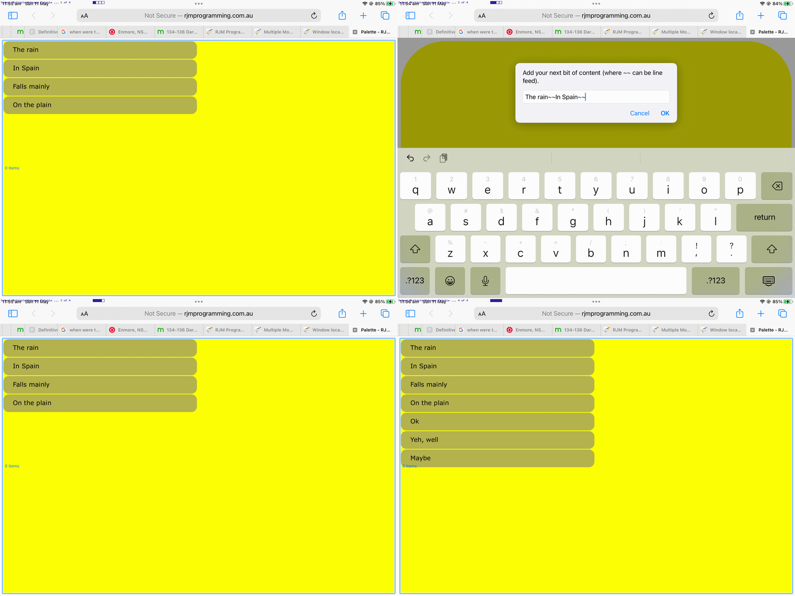

    If this was interesting you may be interested in this too.

    If this was interesting you may be interested in this too.

    If this was interesting you may be interested in this too.

    If this was interesting you may be interested in this too.

    If this was interesting you may be interested in this too.
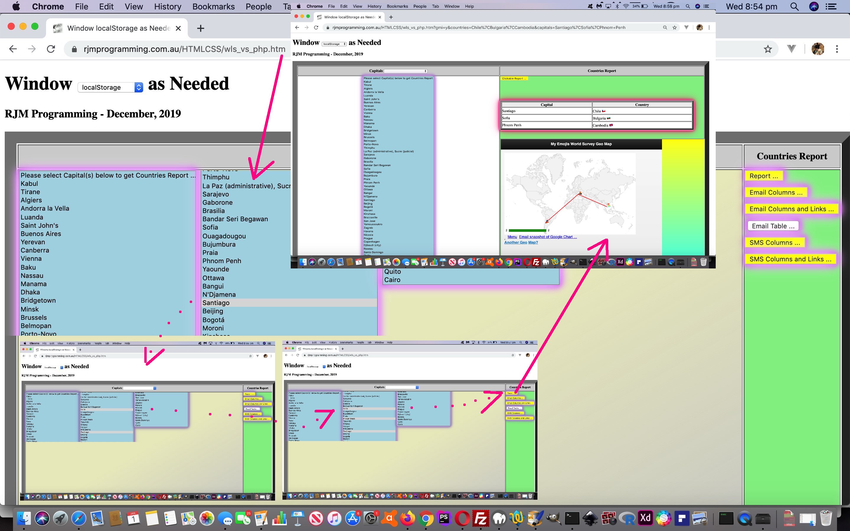

    If this was interesting you may be interested in this too.

    If this was interesting you may be interested in this too.
Posted in eLearning, Event-Driven Programming, Games, Tutorials | Tagged , , , , , , , , , , , , , , , , , , , , , , , , , , , , , | Leave a comment